Country:

 City:


Coming from Perpignan via the D117 to Caudiès-de-Fenouillèdes, at the entrance to the village, turn left onto the D9 towards Notre-Dame de Laval, crossing the railway line of the Fenouillèdes Tourist Train. At thefirst major right-hand bend on the D9, you’ll find a large car park. To begin with, look out for the red and white markings of theGR®367ACathar Trail.
The red and white markings ofthe GR®367A have replaced those of theGRP® Tour des Fenouillèdes.
(S/E) From the car park, continue on level ground along the right-hand verge of the D9 for 400 m until you reach a left-hand bend just before a road bridge over the Ruisseau de Saint-Jaume.
(1) Without crossing the bridge, look for the entrance to the Gorges de Saint-Jaume on the right. There are information and directional signs.
Please note: after rain, or in icy or wet conditions, put your walking poles away so that you can use the handrails provided at the numerous bridges and footbridges. You will eventually reach the bottom of the gorge, near the water intake.
Go down a few steps and cross the bridge over the Ruisseau de Saint-Jaume/le Noir. Then head back up into the hamlet. At the end of the path, turn left onto the tarmac road for a few metres and carry on straight ahead to rejoin the D9e. Follow it slightly to the left until you reach a road junction.
(2) Without crossing the road bridge, head up to the right, due south, on theGR®67AandGRP® trails, passing between two beautiful houses in the charming hamlet of Les Nautes. Continue along the small road until you reach Les Andrigotes. Look out on the right for a wide path leading up to a house on the hillside, before the left-hand bend in the small road.
There is no right-hand bend and no signposting (as of October 2024).
(3) Head up to the right and then immediately left along a wide, very steep path. Follow the red and white markings closely and you’ll come out onto another dead-end road leading to the hamlet of Les Bordes.
Please note: this is where theGR®367Aand theGRP® Tour des Fenouillèdes routes split.
Yellow and red markings for theGRP® Tour des Fenouillèdes.
(4) Continue left, heading south, on theGRP®. Climb up a small road through lovely, wooded countryside. Once the tarmac ends, you’ll reach a junction with three tracks.
(5) Turn left, pass under two power lines and reach another junction where three tracks meet.
(6) Continue climbing straight ahead along theGRP®, with the rock face on your right. The track climbs south-west.
(7) Continue climbing along theGRP®, ignoring the track that descends to the left. Pass through a scree slope.
Note that the route mapped on site is accurate = matches the OSM base map. The IGN base map is incorrect.
Caution: you will need to leave the track. There is a signpost, but no direction is indicated (observed in October 2024).
(8) At elevation 642, head up to the right along a very pretty forest path. Same comment regarding the track.
Much higher up, the path widens and, in a sweeping bend, turns right then left before emerging into a clearing. Continue uphill and pass the old stopover lodge, which is occupied all year round.
Please respect the peace and quiet of the area. This is not a picnic spot. Thank you.
Continue climbing along the track suitable for vehicles until you reach a junction where three tracks meet.
(9) Head up to the right towards the Col de Tulla at an elevation of 930, where there is a large open area.
(10) After a well-deserved break, turn back to the previous junction.
There are no further signposts from this point.
(9) Ignore the Yellow Cross and Red Cross on the tree to the left and continue straight ahead along the partly grass-covered track for 2.54 km. Enjoy the views that open up from time to time.
(11) At the 824-metre mark, if necessary, a track to the left leads back to the 642-metre mark on the outward journey.
Otherwise, carry on straight ahead, due south, past a few bends until you reach a sharp left-hand bend, with a 30 m³ cubic concrete DFCI water tank on your right. Continue for approximately 100 m.
Please note: you will need to leave the track. Look out for a very old Yellow Cross on a tree on the left-hand side of the track, marking the start of the path.
Very old and scattered yellow markings along the ascent.
(12) Descend to the left along a very steep path, heading into the Ravin de la Bène. As soon as the path becomes less steep, follow the Torrent de la Bène all the way. The path is sometimes in poor condition but always clearly visible (as observed in October 2024).
(13) The old markings and two state boundary markers confirm you are on the right path.
(14) You will eventually emerge onto a grassy track, neatly mown and in very good condition (as of October 2024). After following this grassy track, continue along the valley floor, through some very beautiful countryside. Cross the Ravin de la Bène, turn right and reach a junction where three tracks meet.
No signposting observed (October 2024)
(15) Turn right onto the track running alongside the Torrent Le Noir. Pass the Chemin de La Martine on your right. Continue along the track, following the torrent, and return to the hamlet of Les Andrigotes, which you passed on the way out.
Red and white markings forthe GR®367A, which takes precedence over theGRP® Tour des Fenouillèdes.
(3) Follow the same route back as on the way there to reach another junction you passed on the way there.
Red and white markings forthe GR®36
(2) Turn right onto theGR®36, crossing the road bridge over the Ruisseau Saint-Jaume/le Noir, then turn right at the recycling bins. Follow this small road (Chemin de Las Bordes) uphill until you reach a junction of roads and tracks.
=> Please note: if you’re afraid of heights, return the way you came via the gorges.
(16) Continue climbing steeply to the left along the Chemin de Las Bordes (GR®36). There is a lovely view of the hamlet of Les Nautes. Note a cross planted by the roadside on the right. Further up, join the D9e at a bend where there is a small water intake on the right (well).
(17) Continue along the right-hand branch of this small road and reach the charming hamlet of Fenouillet (La Vilasse). You can have a picnic in the small square.
No running water from the taps (as of October 2024). Bus shelter for cover, car park, freely accessible library.
Scattered yellow markings.
(18) Head up to the left towards the castle.
At the end of this street, there is a drinking water tap (as of October 2024). Turn right towards the castle and continue for 40 metres.
Please note: look out for a yellow ‘turn right’ sign on the right at the start of the small grassy path running parallel to the street.
(19) Head down this charming path. Much further down, you’ll come to a wooden footbridge over the dry stream (as of October 2024). Cross it and head up to the left along a steep path to emerge onto the D9.
(20) Cross this road, where visibility is very good. Climb the three steel steps opposite and continue to the left along this very stony path, where you’ll need to take extra care.
There is a brand-new warning sign: ‘Tricky section ’. Numerous guardrails and various safety barriers ensure you can proceed in complete safety (observed in October 2024).
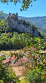
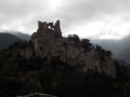
A beautiful view of the castle and the hamlet of La Villasse on the cliff edge.
Further on, the path enters a wooded area and descends to a restored farmhouse, which appears to be abandoned. Continue, following the yellow markings. You will eventually join a wider, cross-country path.
(21) Turn left onto this wide path, which becomes a track, whilst enjoying the beautiful scenery. You’ll reach a fork just before the D9. There’s a signpost here.
(22) Head down to the right, towards Notre-Dame de Laval, along a gullied path. At the D9, continue to the right along a path. Cross a ford, turn left along the stream and reach a track.
(23) Follow it to the left, cross two bridges and rejoin the tarmac road for 80 metres. Look out for the start of a path on the left.
(24) Turn left onto this path. After 100 m, at the fork, you have the option of heading up to the road.
Otherwise, follow the small track which descends alongside a fence on your left. Cross a ford, then follow another fence on your left along a narrow path. You’ll emerge into an orchard with a small farmhouse. Turn right and continue along another small track to return to the car park (S/E).

 Visorando Member
 Moderate

 Extremely difficult