Walk around the Desix

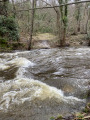
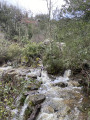
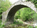
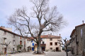
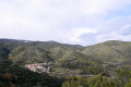
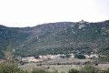
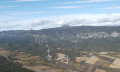
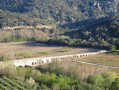
The ancient Gallo-Celtic oppidum of Sournia and Campoussy enjoy a remarkable mid-mountain setting. In this contrasting landscape of the Desix Valley, the land preserves Roman (bridge), Roman-Mozarabic and Templar remains. The route alternates between footpaths (GR®36,PR®) and forest tracks.

Details

53492560
Creation:
Last update:
Last review:
  • Walking
    Activity: Walking
  • ↔
    Distance: 7.50 mi
  • ◔
    Average duration: 4h 35 
  • ▲
    Difficulty: Moderate

  • ⚐
    Back to start: Yes
  • ↗
    Ascent: + 1,322 ft
  • ↘
    Descent: - 1,322 ft

  • ▲
    Highest point: 2,178 ft
  • ▼
    Lowest point: 1,224 ft

Photos

Description of the walk

Reach Sournia via the Route de l’Ariège (D117) or the Route de l’Andorre (N116). Park in the car park at the Sournia holiday village.

Red and white markings (GR®36).

(S/E) At the start, go down the steps next to the building towards the small lake and cross the bridge over the Desix.

(1) Follow the path. At the next fork, leave theGRP® on your right, turn left to stay on theGR®36, cross the Pomeins (a tributary of the Desix) and join the road.

(2) Follow theGR®36to the right as it climbs through the forest and joins the D619.

(3) Cross it and continue along theGR®36until you reach the D67, before arriving at Campoussy. Turn left and follow the road for about a hundred metres, then turn onto the path on the right, which rejoins the D67 further on. Continue towards the village centre.

End of the red and white markings

(4) Leave theGR®36and take a small road to the left. Turn right about a hundred metres further on towards Roc Blanc and arrive at the junction with a track.

(5) Follow the track to the right until it ends.

(6) Take the path continuing from there to the Roman bridge (D619). If necessary, you can reach Sournia by turning left onto the track and rejoining the PR®.

(7) Cross the road carefully and take the path opposite which crosses the Desix. Return to the D619.

(8) Follow it to the left for 50 m, then turn sharply right onto a track and follow it for about 400 m.

(9) Option to visit the Sainte-Félicité Chapel on a round trip. Otherwise, continue straight on along the track and rejoin the tarmac road at the entrance to Sournia.

(10) Turn left, join the Route des Prades (D619) and follow it to the left for about 250 m, passing the Emergency Services Centre. Then turn right to return to the car park (S/E).

Waypoints

  1. S/E : mi 0 - alt. 1,640 ft - Car park at the Sournia holiday village
  2. 1 : mi 0.13 - alt. 1,614 ft - Bridge. La Desix
  3. 2 : mi 0.35 - alt. 1,634 ft - GR36
  4. 3 : mi 1.77 - alt. 2,162 ft - D619
  5. 4 : mi 2.73 - alt. 2,172 ft - Campoussy
  6. 5 : mi 3.35 - alt. 1,962 ft - Junction
  7. 6 : mi 4.1 - alt. 1,667 ft - Trail entrance
  8. 7 : mi 4.64 - alt. 1,257 ft - Footbridge. Roman bridge at the - Desix (rivière) - Affluent de l'Agly
  9. 8 : mi 5.6 - alt. 1,473 ft - D619
  10. 9 : mi 5.83 - alt. 1,385 ft - Junction towards the - Chapelle Sainte-Félicité (Sournia)
  11. 10 : mi 7.2 - alt. 1,716 ft - Turn left at the fork
  12. S/E : mi 7.5 - alt. 1,640 ft - Car park at the Sournia holiday village

Notes

Don’t forget a fleece, a windbreaker, a water bottle and a 1:25,000 map.
Do not undertake this walk during a thunderstorm as streams may burst their banks.

Always be cautious and plan ahead when you're outdoors. Visorando and the author of this route cannot be held responsible for any accidents occurring on this route.

The GR® and PR® markings are the intellectual property of the Fédération Française de Randonnée Pédestre.

Reviews and comments

4.6 / 5
Based on 3 reviews

Reliability of the description
4.7 / 5
Ease of following the route
4 / 5
Route interest
5 / 5
User 29116739

Overall rating : 4.3 / 5

Date of your route : Apr 27, 2026
Reliability of the description : ★★★★★ Very good
Ease of following the route : ★★★☆☆ Average
Route interest : ★★★★★ Very good
Very busy route : No

Hello, on the hiking trail there is a lovely carved wooden sign saying "Sournia" which points to the right, but the route takes you straight ahead. Follow the Sournia sign, as the route is blocked further on. The path is closed to hikers: private property and live wires
Enjoy your walk.

Machine-translated

Philippe  Pagès
Philippe Pagès

Overall rating : 5 / 5

Date of your route : Mar 08, 2026
Reliability of the description : ★★★★★ Very good
Ease of following the route : ★★★★★ Very good
Route interest : ★★★★★ Very good
Very busy route : No

Hike completed after heavy rainfall in the winter of 2026. The first two footbridges are out of the water. It is very pleasant up to Campoussy.
Shortly before point 7, it is better to keep your shoes on and get your feet wet than to slip barefoot. This usually dry stream has swollen. Shortly after point 9, we rejoined the road after finding that the ford was submerged. All these remarks only apply to rare periods of flooding. I am attaching photos that will make walkers passing through in the summer smile. The "beach forecourt" in front of the Ste-Felicité chapel is a magnificent picnic spot. A very beautiful walk.

Machine-translated

bergpaden
bergpaden

Yes, taking off our shoes and walking across is an option, except that it was May, it was raining very heavily, and the water level was really very high with a strong current. We simply made the wiser decision to take the road instead.
Kind regards

Machine-translated

axurit66
axurit66

Hello
To cross the stream, you’ll need to take off your shoes and walk across
Kind regards

Machine-translated

bergpaden
bergpaden

Overall rating : 4.3 / 5

Date of your route : May 24, 2024
Reliability of the description : ★★★★☆ Good
Ease of following the route : ★★★★☆ Good
Route interest : ★★★★★ Very good
Very busy route : No

Hello,
The suggested walk is very interesting. We did this walk on 24 May 2024. We were unable to cross the Desix stream and had to take the road instead. Apparently, by June, crossing the stream was no longer a problem.
Enjoy the walk.
Bea

Machine-translated

Other walks in the area

For more walks, use our search engine .

The GPS track and description are the property of this route's author. Please do not copy them without permission.