Tirounère Crag (climbing routes) – round trip

This route describes the access path to the cliff at the Tirounère climbing site from the Gorges de Galamus car park. It is not a hike in itself but is intended to facilitate climbers’ access to this cliff nestled in the forest.

Details

88918008
Creation:
Last update:
Last review:
  • Walking
    Activity: Walking
  • ↔
    Distance: 1.68 mi
  • ◔
    Average duration: 1h 05 
  • ▲
    Difficulty: Easy

  • ⚐
    Back to start: Yes
  • ↗
    Ascent: + 404 ft
  • ↘
    Descent: - 404 ft

  • ▲
    Highest point: 1,286 ft
  • ▼
    Lowest point: 886 ft

Description of the walk

Coming from Saint-Paul-de-Fenouillet, park at Car Park No. 2 at the Belvédère des Gorges de Galamus, situated on the left-hand side of the D7 road before L’Ermitage.

(S/E) Walk down the road towards the south-east, towards Saint-Paul, for about 350 metres.

(1) After the wayside cross, take the GR®36 which descends to the right.

(2) Leave the GR® temporarily by taking the path on the right at the ‘Lodges Benjamin’ sign. Rejoin the GR® and follow it to the right.

(3) Cross the footbridge at La Tirounère, then take the road to the left.

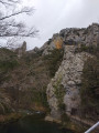
(4) About twenty metres past a guardrail, take the path on the right which starts in a clearing, just before the road begins to climb steeply. You’ll soon reach the foot of the climbing routes.

(5) Follow the same route in the opposite direction to return to the car park (S/E).

Waypoints

  1. S/E : mi 0 - alt. 1,270 ft - Car Park No. 2 at the Gorges de Galamus viewpoint
  2. 1 : mi 0.21 - alt. 1,270 ft - GR®36 trail
  3. 2 : mi 0.39 - alt. 1,093 ft - Sign for “Lodge Benjamin”
  4. 3 : mi 0.58 - alt. 889 ft - Footbridge - Agly (fleuve)
  5. 4 : mi 0.75 - alt. 899 ft - Guardrails
  6. 5 : mi 0.76 - alt. 902 ft - Start of the path on the right
  7. 6 : mi 0.84 - alt. 948 ft - Climbing routes
  8. 7 : mi 0.84 - alt. 942 ft - Cliff
  9. S/E : mi 1.68 - alt. 1,270 ft - Car Park No. 2 at the Gorges de Galamus viewpoint

Notes

On the way back, 150 m after the bridge (3), leave the GR® and continue along the path on the left (do not walk past the bench). You will rejoin the GR® at the sign for “Lodge Benjamin” (2).

The climb takes 35 to 40 minutes.

Always be cautious and plan ahead when you're outdoors. Visorando and the author of this route cannot be held responsible for any accidents occurring on this route.

The GR® and PR® markings are the intellectual property of the Fédération Française de Randonnée Pédestre.

Other walks in the area

For more walks, use our search engine .

The GPS track and description are the property of this route's author. Please do not copy them without permission.