


Refine your search for walks in Le Latet
Le Latet walks


 La Fresse State Forest
 Visorando Member
 8.44 mi
 +1,073 ft
 -1,043 ft
 4h 50
 Moderate
 Departure from Le Latet (Jura)
Walk in the Fresse State Forest along forest tracks, footpaths and tarmac roads.
Circular Nans route via the Angillon springs and the little crosses
6.37 mi
+1,270 ft
-1,276 ft
4h 00
 Difficult
Departure from Les Nans (Jura)
A lovely walk around the small village of Les Nans, taking you to the source of the Angillon and its superb waterfalls, the Grotte aux Ours, the Roche des Nans and its viewpoint. You can also enjoy the tranquillity of the Forêt de la Joux as you explore its very well-maintained paths. The route is entirely through woodland on forest paths and tracks.
Circular path in the Moidons Forest at Valempoulières
8.98 mi
+778 ft
-787 ft
4h 50
Moderate
Departure from Pont-d'Héry (Jura)
This easy walk, which takes place almost entirely in the forest, will take you through magnificent fir forests and beautiful deciduous woodlands. You’ll also enjoy lovely views of the iconic Mont Poupet, and, in the opposite direction, of Mont Rivel and the Haut Jura mountain range.
You’ll also pass through beautiful fields of sharp limestone pavement, typical of the region.
The Forest of La Joux, from the Maison du Chevreuil to the Belvédère de la Roche
 8.99 mi
+981 ft
-955 ft
5h 00
Moderate
Departure from Supt (Jura)
A hike entirely through the forest, alternating between forest roads and footpaths, traversing this vast forest massif. Several designated viewing points offer views of the Jura mountain range or, on the other side of the forest, the Poupet and the entire plateau. A superb site at the start with an arboretum and historical information about the area.
In the footsteps of the dinosaurs
 8.94 mi
+1,001 ft
-991 ft
5h 00
Moderate
Departure from Jura
The Loulle dinosaur trail,the third largest site of footprints in France, was discovered by J.F. Richard in 2001. More than 1,500 footprints, corresponding to 21 tracks of peaceful herbivorous sauropod dinosaurs and six less friendly carnivorous "bouffozaura", were studied. Along the way, there are no fewer than five viewpoints, the last and most beautiful of which is the Surmont viewpoint over the upper Ain valley, the Loulle sharp limestone pavement and, finally, on the way back, beautiful paths crossing karstic sinkholes.
Source of the Ain
 6.19 mi
+820 ft
-840 ft
3h 35
Moderate
Departure from Conte (Jura)
A splendid hike between the plateau and the steep-sided valley of the Ain. This circuit offers an opportunity to discover the upper Ain valley and its unique geology, with its Vaucluse spring, waterfalls (Le Moulinet, Saut des Maillys, Moulin-du-Saut) and ruined mills, evidence of how humans once harnessed the power of water. In fact, an EDF hydroelectric plant has replaced the old Moulin-du-Saut.
The Pertes de l’Ain gorges
 3.59 mi
+548 ft
-548 ft
2h 10
 Easy
Departure from Bourg-de-Sirod (Jura)
Pleasure in cascades.
This extraordinary walk around the Pertes de l’Ain gorges sets out from the remarkable site of the old forges and is a delight for all the senses.
Along the way: The Pertes de l’Ain, gorges, cascades, the ruins of Villain castle, and the relics of an old village.
Circular walk in Lemuy: the sources of the Roche and the Montorge stream
9.01 mi
+607 ft
-600 ft
4h 40
Moderate
Departure from Lemuy (Jura)
A lovely forest walk in the Joux State Forest, taking you through part of one of France’s most beautiful spruce forests. From the outskirts of Lemuy, you’ll reach the meadows of Villers-sous-Chalamont, then the source of the Roche at the foot of the viewpoint, followed by the source of the Ruisseau de Montorge and its picturesque setting with a waterfall emerging from an imposing cirque. Beautiful forest tracks and a lovely path will take you back to your car park.
To make the most of the rocky and rugged landscapes around both springs, it’s best to do this walk after a spell of rain so you can admire the waterfalls. In winter, when temperatures drop below freezing, ice will glisten all over the rocks and form magnificent stalactites along the cliff face, making this site even more spectacular.
Circular route of Bourg de Sirod via the Rocher des Commères and the Côte Poire
8.70 mi
+1,818 ft
-1,824 ft
5h 35
Moderate
Departure from Bourg-de-Sirod (Jura)
A circular loop around Bourg de Sirod offering a rich variety of landscapes, forests, terrain and paths.
From the ruins of Chateauvillain to the Rochers des Commères, from dry grasslands to mossy thickets and bare scree slopes, from quiet forest tracks to the deafening, bubbling waterfalls of the Ain’s underground watercourses, and from cliff edges to dense forests – there’s something for everyone.
Pertes de l’Ain
 1.22 mi
+190 ft
-200 ft
0h 45
Easy
Departure from Bourg-de-Sirod (Jura)
A short walk that allows you to explore a magnificent site via a well-maintained path. The River Ain plunges into a very narrow gorge and disappears beneath a jumble of rocks. After a few metres, the river re-emerges and, following a large waterfall, reaches the site of some old forges.
The Val de Sirod and the Pertes de l’Ain
10.13 mi
+1,627 ft
-1,617 ft
6h 05
Moderate
Departure from Bourg-de-Sirod (Jura)
Ten minutes from Champagnole, the most powerful of the medieval fortresses still stood not so long ago... A nature and heritage walk awaits you through the Val de Sirod around the site of the Perte de l'Ain, which is at the end of this route. You will pass by the Château Villain fortress, viewpoints, the Rocher des Commères, the castle chapel, the Fontaine des Tufs, the Roche des Sarrasins, the village of Syam, and more.
The Rocher des Commères and the Perte de l'Ain
 4.65 mi
+1,050 ft
-1,079 ft
3h 05
Moderate
Departure from Bourg-de-Sirod (Jura)
A lord had three daughters of marriageable age. Capricious, they found all suitors unworthy. Annoyed, the fairy Melusine turned them into stone statues. Erosion has destroyed two of these gossips. Time will get the better of the last one, so don't delay in paying her a visit. On the way, you will see the ruins of a castle perched on the cliffs, views of the Val de Sirod, and picturesque stony paths winding through beautiful rocks. Return via the Perte de l'Ain and its superb gorges.
La Reculée des Planches: the Cirque du Fer à Cheval
 8.32 mi
+1,486 ft
-1,503 ft
5h 05
Moderate
Departure from Les Planches-près-Arbois (Jura)
Shaped by limestone erosion, the Reculée des Planches has a relief characteristic of the Jura karstic plateau. At the foot of the vertically rising cliffs, you'll discover the cascades and cascatelles of the Cuisance. At a leisurely pace, through bright, cool forests, you'll climb up to the ledges where no fewer than five lookouts, not forgetting the ruins of a feudal castle, offer superb views over the whole of the reculée.
La Châtelaine and Cirque du Fer à Cheval
 7.51 mi
+1,434 ft
-1,427 ft
4h 40
Moderate
Departure from Les Planches-près-Arbois (Jura)
La Reculée des Planches, shaped by limestone erosion, has a relief characteristic of the Jura karst plateau. From the foot of the cliffs, climbing gently through the beautiful Arbois Forest towards the Belvédère du Fer à Cheval, you will climb up to the cornices where no fewer than four viewpoints, not to mention the ruins of a feudal castle, offer superb views of the entire reculée.
The Great Chimney
 5.39 mi
+1,306 ft
-1,280 ft
3h 35
Moderate
Departure from Syam (Jura)
Forest walk in the hills above Syam to discover the Grande Cheminée, an open-air cave that was visited in the Bronze Age. An axe made of this metal was found there. According to some, you may be walking on the lost site of Alesia as you make your way to two viewpoints over the wild Saine valley.
Around the Chaux-des-Crotenay plateau
 10.47 mi
+1,713 ft
-1,693 ft
6h 20
Difficult
Departure from Syam (Jura)
I’d like to suggest a lovely walk in the heart of the Jura, between Syam and the Chaux-des-Crotenay plateau, through an area of interest to some archaeologists.
There are two points of difficulty to note: access to the Belvédère du Rachet and the short walk through the Grotte de la Grande Cheminée. The rest of the route presents no difficulty.
Memorial to the Mirage crash and pond at the start of Froidefontaine
 9.45 mi
+436 ft
-440 ft
4h 45
Moderate
Departure from Mignovillard (Jura)
A peaceful walk in the Mignovillard area. You will be on the Haute Joux GRP® trail until Essart Bassand. Head towards the Seigne des Barbouillons Regional Nature Reserve, where you will pass the memorial to the crash on 9 January 2019. This memorial was erected here following the crash of a Mirage aircraft from Nancy-Ochey Air Base 133, near the site of the accident in which two soldiers were killed.Take a break at the Fontaine Carrée pond, then return via the hamlet of Petit Villard and the Moulin du Martinet.
Billaude Waterfall or Saut Claude Roy
 0.43 mi
+243 ft
-253 ft
0h 25
Easy
Departure from Le Vaudioux (Jura)
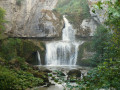
A short walk offering easy access to two viewing points providing views, from above and below, of the magnificent Billaude Waterfall. A footpath and metal staircases lead to these points.
Trois Vallées Viewpoint
 3.41 mi
+358 ft
-358 ft
1h 55
Easy
Departure from Le Vaudioux (Jura)
Access to a viewpoint offering a view of the confluence of three valleys: the Lemme, the Saine and the Ain. Along the way, you’ll notice the remarkable work carried out to build the ‘Ligne des Hirondelles’ railway line and a somewhat mystical section through the forest, between boulders covered in moss.
Circular route around the Cascade de la Billaude via the Grande Cheminée
 9.29 mi
+1,670 ft
-1,670 ft
5h 45
Difficult
Departure from Le Vaudioux (Jura)
A beautiful walk around the famous Cascade de la Billaude, which you can admire on the way there or back. The route runs alongside the picturesque Étang des Pêchettes and takes you to a surprising and fairly challenging section, the Grande Cheminée. It also passes by viewing points, including those at Prés Grillet and Taiclet.Those who wish can climb up to the drystone shelter at the Ours (cave) and take advantage of a gap in the vegetation to catch a glimpse of Champagnole and its surroundings. You’ll enjoy the coolness of the banks of the Saine and, at the confluence with the Lemme, you’ll head back up towards the waterfall.
Circular walk from Dournon to Sainte-Anne and the Pont du Diable
7.83 mi
+840 ft
-830 ft
4h 20
Moderate
Departure from Dournon (Jura)
This short, easy circular walk will take you from the hamlet of l’Entrepôt (Dournon) to Sainte-Anne and the famous Pont du Diable, which you can even admire from the bank of the Ruisseau de Château Renaud – the stream it spans – whilst following the small path leading to it. Before that, you’ll have passed through the quaint little village of Sainte-Anne with its street signs written in two languages: French and Arpitan, the local dialect. The return journey takes you through the lovely Chalème Forest with its beautiful forest lanes.
The ancient pass of Chalamont
 3.80 mi
+594 ft
-594 ft
2h 15
Easy
Departure from Villers-sous-Chalamont (Doubs)
This circular route around Chalamont takes you on a journey of discovery to a remarkable historical site: the ancient Chalamont Passage, where the ruts carved into the rock are a reminder of the carts of yesteryear. The route alternates between forest paths, wilder trails and clearings offering beautiful views of Mont Poupet, the valley and the Boujailles plateau.
Chalamont Ancient Trail
 1.17 mi
+171 ft
-161 ft
0h 40
Easy
Departure from Boujailles (Doubs)
Straddling the municipalities of Boujailles and Villers-sous-Chalamont, this trail will take you to the Chalamont Pass, a former toll station on the ancient road leading from northern Italy to Flanders.
Fort Saint-André
 2.72 mi
+823 ft
-846 ft
2h 00
Easy
Departure from Salins-les-Bains (Jura)
A short walk on the heights of Fort Saint-André to discover the exceptional natural site of Salins-les-Bains, protected by its two old forts.
Arbois - Pupillin
 13.31 mi
+2,579 ft
-2,028 ft
8h 20
Difficult
Departure from Arbois (Jura)
Fifth stage of the Échappée Jurassienne. This stage allows you to discover the remote valleys, particularly that of Planches-Près-Arbois, and to understand the geological phenomenon, with views from the Belvédère de la Roche du Feu. You will then descend to the bottom of the valley to reach the village of Planches-Près-Arbois and its tufa waterfall. Next, you will head towards the wine-growing village of Pupillin, the "World Capital of Ploussard", where you can explore its viewpoint, 19th-century church, Saint-Léger oratory and beautiful fountains.
Chamole wind farm from Pupillin
 8.45 mi
+650 ft
-623 ft
4h 25
Moderate
Departure from Pupillin (Jura)
Half of the route is through forest and half through pastureland.
Croix Bagier and Foyard Président in Pupillin
3.66 mi
+476 ft
-476 ft
2h 05
Easy
Departure from Pupillin (Jura)
Starting from Les Prunelles in Pupillin, this is an easy hike, mostly through forest on well-marked paths. The arboretum and the Foyard Président are attractions for children.
The Bioulets Trail starting from Pupillin
4.90 mi
+627 ft
-630 ft
2h 50
Easy
Departure from Pupillin (Jura)
A circular walk in the Bois de Buvilly, starting from Les Prunelles in Pupillin.
Allée du Roi de Rome from Pupillin
 4.91 mi
+633 ft
-640 ft
2h 50
Easy
Departure from Pupillin (Jura)
Mostly in the forest, the route combines small paths, wide forest tracks and a few sections over scree.
The two estates in Pupillin
 4.88 mi
+623 ft
-617 ft
2h 45
Easy
Departure from Pupillin (Jura)
A moderate-difficulty walk in the heart of the Pupillin vineyards.
Reculée des Planches starting from the Belvédère de Pupillin
 10.44 mi
+1,716 ft
-1,749 ft
6h 20
Moderate
Departure from Pupillin (Jura)
A circular route starting from Pupillin that allows you to discover this Jura valley, its viewpoint, its Cascade des Tufs waterfall and the small village of Les Planches-près-Arbois. This route follows the Chemin du Facteur and the Allée de Rome with its Foyard Président.
Pupillin- Miéry
 13.72 mi
+2,218 ft
-2,608 ft
8h 15
Difficult
Departure from Pupillin (Jura)
Sixth stage of the Échappée Jurassienne. This rugged stage starts in Pupillin and crosses forests and vineyards to Poligny, a former fortified town and religious capital of the Dukes of Burgundy. Poligny, looking to the future thanks to the Comté cheese industry, is home to the Maison du Comté and the headquarters of the Comité Interprofessionnel de Gestion du Comté. After a climb to the Croix du Dan, offering superb views of Poligny and the Culée de Vaux, the hike continues through the pastures and villages of the first plateau, where Montbéliard cows graze, before arriving in Miéry.
From Chaux-des-Crotenay to Foncine-le-Haut
 12.62 mi
+1,998 ft
-1,765 ft
7h 35
Difficult
Departure from Chaux-des-Crotenay (Jura)
Twelfth stage of the Échappée Jurassienne. For this stage,prepare to be amazed by the wild and authentic beauty of the Jura as you let yourself be carried away by the water for a peaceful break, out of time.
Follow the tumultuous course of the Saine River through theLangouette Gorges, then discover the village of Les Planches-en-Montagne and the spectacular Malvaux Gorges, where the Saine has formed the Cascade du Bief de la Ruine, the largest waterfall in the department with a drop of 110 metres. The river then winds its way under the viaduct of the old tramway towards Foncine-le-Bas, offering breathtaking natural landscapes.
Finally, cross the Mont Bayard at an altitude of over 1,000 metres for a remarkable view of the surrounding mid-mountain landscape. End your day with a descent to the village of Foncine-le-Haut, ideal for a restful and rejuvenating night.
The forts of Salins and the Roman Way
 7.96 mi
+2,490 ft
-2,461 ft
5h 50
Moderate
Departure from Salins-les-Bains (Jura)
This circular route allows you to see both forts and the town of Salins from two different angles. The Roman Way is an excuse to get closer to Mont Poupet and increase the elevation. However, the great advantage of this walk is that it is shaded by trees, which is very practical in summer.
Fort Belin and the village of Clucy
 5.96 mi
+1,286 ft
-1,263 ft
3h 50
Moderate
Departure from Salins-les-Bains (Jura)
This circular loop climbs up to Fort Belin, where you can enjoy a majestic view of Salins-les-Bains to the north and the green hills of the Jura to the south, before crossing the charming village of Clucy and descending via the Roman road at the foot of Mont Poupet.
The Cross of Pretin
 5.87 mi
+1,785 ft
-1,762 ft
4h 15
Moderate
Departure from Pretin (Jura)
Discover the small village of Pretin on the heights of Salins and its beautiful old houses nestled in the valley. No fewer than six viewpoints over the Val de Marnoz, Mont Poupet and the Monts de Cernans dot the route to the imposing Fort Saint-André, a stern sentinel overlooking Salins-les-Bains.
The Reculée des Planches
 10.56 mi
+1,545 ft
-1,512 ft
6h 10
Easy
Departure from Arbois (Jura)
A lovely circular walk starting from Arbois. The suggested route forms part of the “Échappée Jurassienne” trail. At the end of the walk, you’ll find yourself close to the vineyards. There’s another, shorter route via the bottom of the Reculée. This is an old route which does not necessarily follow the on-site signposting. See reviews
Mont Poupet from Salins-les-Bains
 9.15 mi
+1,991 ft
-1,985 ft
5h 55
Moderate
Departure from Salins-les-Bains (Jura)
Climb to the highest point of the extreme Jura at 851 m, with 360° views of the plains and mountains of the Jura and, on a clear day, even Mont Blanc.
Set off from Salins-les-Bains on the banks of the Furieuse, long known for its salt mining.
A scenic and slightly challenging hike without any major difficulties.
Salins-les-Bains – Arbois
 12.48 mi
+2,365 ft
-2,457 ft
7h 50
Difficult
Departure from Salins-les-Bains (Jura)
Fourth stage of the Échappée Jurassienne. Right from the start of this stage, things get serious with a demanding route punctuated by steep ascents and descents in the limestone massif of Revermont. Then, through undergrowth, pastures and picturesque viewpoints, the second part of the route reveals itself to be full of charm and tranquillity, offering a perfect transition before reaching Montigny-les-Arsures, a superb wine-growing village where the vineyards come into view. A few more kilometres will take you to Arbois, the capital of Jura wines. Louis Pasteur had his family home here, which is still open to visitors. This colourful town is full of Jura wine tasting cellars and great places to eat for food lovers.
From Arbois to Pupillin through the vineyards and back via the Ermitage chapel
 Association / Club / Walk leader
 5.86 mi
+1,001 ft
-994 ft
3h 35
Moderate
Departure from Arbois (Jura)
This is a pleasant walk through the rolling vineyards and the charming wine-growing village of Pupillin. The return route through the forest and the Ermitage viewpoint offers magnificent views of the town of Arbois. A few short climbs add a little spice to the route.
A taste of Arbois
 2.18 mi
+295 ft
-302 ft
1h 15
Easy
Departure from Arbois (Jura)
The Arbois circuit for an easy family walk to discover Arbois and its vineyards in the footsteps of Pasteur. It’s also a walk perfect for an aperitif:
- for other more challenging but equally impressive outings such as the Reculée des Planches or the Cascade des Tufs;
- for gourmet stops, in the heart of the Comté and Vin Jaune region, to discover the local cuisine.
This walk can be done as a post-lunch stroll, in which case it may prove longer and more challenging.
Circular Geraise route via the viewpoints and Grange de Vaux
8.39 mi
+1,132 ft
-1,119 ft
4h 50
Moderate
Departure from Geraise (Jura)
A lovely walk starting from Geraise that will take you through the Vaux valley, from the ridges on the way out and along the valley floor on the way back. The viewpoints along the route offer beautiful views of Nans-sous-Sainte-Anne and the head of the Lison valley.
The Devil's Bridge, the Lison spring and waterfall and the Sarrazine Cave
 10.18 mi
+2,254 ft
-2,228 ft
6h 40
Difficult
Departure from Crouzet-Migette (Doubs)
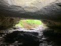
A lovely loop along beautiful paths, discovering the Pont du Diable, the Creux Billard, the Grotte Sarrazine, the Source and the Cascade du Lison. At the start of this beautiful walk, you'll cross the protected natural area of the marl pits and the Bois de Château-Renaud stream. Then head for Crouzet-Migette to reach the Source du Lison site, with a steep descent into the Combe Fagot. Before arriving at the site, you'll passthe Gros Chêne, presumed to be 300 years old, with a circumference of 5.5 m, an imposing sight. On arrival at the site: a return trip to the Creux Billard (unfortunately the Source path is off-limits), then a break at the Cascade du Lison, and a return trip to the Grotte Sarrazine (headlamp required). Then back along the Lison, a nice rest before a steep climb to Crouzet-Migette.
Circular walk around the Langouette Gorges via the Col du Gyps
6.52 mi
+689 ft
-663 ft
3h 35
Moderate
Departure from Les Planches-en-Montagne (Jura)
A lovely walk with no major difficulties, offering a chance to discover the Langouette Gorges and its magnificent waterfalls via a well-maintained and safe path. After passing through the village of Les Planches-en-Montagne, you’ll reach Chaux des Crotenay via forest paths and the route over the Col du Gyps.
Waterfalls and Gorges of the Langouette from Les Planches-en-Montagne
 1.00 mi
+108 ft
-112 ft
0h 35
Easy
Departure from Les Planches-en-Montagne (Jura)
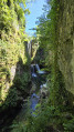
The village of Les Planches-en-Montagne has a picturesque gem at its heart: gorges carved into the limestone and well hidden under the trees. The Saine rushes through them with gusto. Force, turmoil and noise coexist here with calm, serenity and gentleness.
The River Saine along the Langouette and Malvaux gorges
 6.91 mi
+892 ft
-886 ft
3h 55
Moderate
Departure from Les Planches-en-Montagne (Jura)
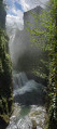
The Malvaux and Langouette Gorges offer cool respite on hot summer days as well as magnificent scenery. This hiking route is suitable for families, with a shorter alternative (9.5 km) that does not go around Lac à la Dame. Part of the route follows the old tramway, so a head torch or torch is required to cross the 180 m tunnel.
The vineyards of Montigny
 5.34 mi
+541 ft
-558 ft
2h 55
Easy
Departure from Montigny-lès-Arsures (Jura)
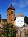
This walk in Montigny-lès-Arsures invites you to discover the soul of a wine-growing village in the Revermont region. Between the rows of vines that shape the Jura landscape, the beautiful winegrowers' houses with their vaulted cellars and the picturesque Tour du Zouave Coco, the route reveals a rich and living heritage. All along the way, superb views open up over the Arbois vineyards, providing an ideal setting for a walk combining nature, culture and local history.
Walk around Lake Chalain
 8.89 mi
+650 ft
-646 ft
4h 40
Moderate
Departure from Marigny (Jura) (Jura)
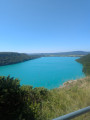
A pleasant walk to do in a day. The trail runs either along the lake, overlooking it or along the edge of the rocks, with numerous viewpoints.
Lake Chalain
8.01 mi
+574 ft
-571 ft
4h 10
Moderate
Departure from Marigny (Jura) (Jura)
A pleasant walk to do in a day. The trail runs either along the lake, overlooking it or along the edge of the rocks with viewpoints.
The balconies of Lake Chalain
 7.87 mi
+666 ft
-666 ft
4h 10
Moderate
Departure from Marigny (Jura) (Jura)
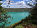
This balcony trail offers breathtaking views of the turquoise waters of the largest natural lake in the Jura.
Surrounded by mountains, forests and rivers, the lake is an invitation to linger and discover the secrets of the woods...
Fort Saint-André and Croix de Pretin
 10.34 mi
+1,860 ft
-1,864 ft
6h 20
Moderate
Departure from Aiglepierre (Jura)
A hike for experienced walkers, with the chance to discover the village of Pretin, nestled in a valley, and magnificent views of Salins-les-Bains and its surroundings (Mont Poupet and Fort Belin in particular).
Route de Foncine-le-Haut
 11.49 mi
+2,428 ft
-2,431 ft
7h 25
Difficult
Departure from Foncine-le-Haut (Jura)
A walk in the Jura, in Foncine-le-Haut and Les Planches-en-Montagne. This walk will take you to the source of the Saine, the Bayard botanical trail and the tree-lined ‘Path of Remembrance’, which traces the history of the two world wars. You will then climb up to the Belvédère du Bulay before descending again to follow the Ruisseau d’Entre Côtes, passing by the Mine d’Or and the Saut de la Pisse. You will also pass the Waterfall du Leat de la Ruine and its source, then on to the Belvédères du Couillou and de la Roche Fendue.
From the Source of the Saine to the Belvédère de la Roche Fendue
 4.80 mi
+810 ft
-801 ft
2h 55
Easy
Departure from Foncine-le-Haut (Jura)
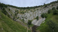
The Saine river has its source in the shelter of this limestone amphitheatre. Admire this magnificent resurgence with its wild but accessible character, climb up high, follow the Bayard botanical trail and contemplate a grandiose and unusual landscape from the Belvédère de la Roche Fendue.
Les Arsures in Arbois
 9.75 mi
+1,158 ft
-1,135 ft
5h 30
Moderate
Departure from Les Arsures (Jura)
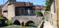
Discover the varied landscape typical of the Lower Jura: meadows, forests, villages, towns and vineyards. Take a break in Arbois, on the banks of the Cuisance, and watch the ducks dance on the water. It's a great place to catch your breath before, perhaps, a wine tasting and then the return trip to Les Arsures through the vineyards.
Les Arsures in Montigny
5.47 mi
+663 ft
-659 ft
3h 05
Easy
Departure from Les Arsures (Jura)
A short afternoon stroll through vineyards and forests, not forgetting to visit the pretty village of Montigny-lès-Arsures and perhaps taste the wines of the Jura. There are a few small climbs, however.
The source of the Saine
 9.22 mi
+1,467 ft
-1,483 ft
5h 30
Moderate
Departure from Foncine-le-Haut (Jura)
A trail starting out from Foncine le Haut that will take you to the source of the Saine and various viewpoints. A themed trail and a botanical trail...
From Foncine-le-Haut to Bellefontaine
 12.87 mi
+1,575 ft
-994 ft
7h 15
Difficult
Departure from Foncine-le-Haut (Jura)
Thirteenth stage of the Échappée Jurassienne: discover the Jura Mountains on this stage between Haut-Jura and Haut-Doubs. Explore the cross-country ski trails of the Mont Noir massif, which are transformed into superb hiking trails in summer. Immerse yourself in a peaceful, unspoilt environment, where alpine flowers bloom alongside the woody scents of fir and spruce trees. Between the woods, valleys and ridges, enjoy the fresh air while admiring the picturesque landscapes.
This stage will also take you along the Bellefontaine and Mortes lakes, known for their peat bogs, which are home to remarkable flora and fauna.
Between the lakes of Chambly and Chalain
 6.60 mi
+679 ft
-679 ft
3h 40
Moderate
Departure from Doucier (Jura)
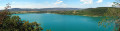
Lake Chalain, nestled in a valley flanked by high cliffs, is the largest in the Jura. After a walk through rural valleys offering beautiful views of Lake Chambly and the Jura mountains, you will walk along the cliffs overlooking its turquoise waters.