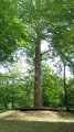
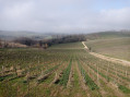
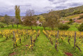
The Bioulets Trail starting from Pupillin

A circular walk in the Bois de Buvilly, starting from Les Prunelles in Pupillin.

Details

n°3153035
Creation:
Last update:
Last review:
  • Walking
    Activity: Walking
  • ↔
    Distance: 4.90 mi
  • ◔
    Average duration: 2h 50 
  • ▲
    Difficulty: Easy

  • ⚐
    Back to start: Yes
  • ↗
    Ascent: + 627 ft
  • ↘
    Descent: - 630 ft

  • ▲
    Highest point: 2,005 ft
  • ▼
    Lowest point: 1,499 ft
  • ⚐ Country: France
  • ⚐ City: Pupillin (39600)
  • ⚑
    Start/End: N 46.882879° / E 5.75858°
  • ❏
    IGN map(s): Ref. 3225E, 3226ET, 3325OT
  • Hour-by-hour weather

Description of the walk

Park in the small car park on Rue du Chardonnay.

(S/E) On leaving the car park, turn left, then left again onto Rue des Chenevières. At the end of the street, turn left, join Rue du Ploussard and follow it to the right for about 300 metres.

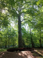
(1) Take the path on the left towards “Arboretum”.

(2) At a place called Les Sept Sergents, turn right onto the path towards “Fanum”. Continue straight on until you reach a junction.

(3) Take the forest track that climbs to the left and reach another junction in the Bois de Buvilly.

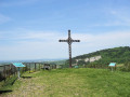
(4) Take the path on the left towards Les Clavières. Further on, turn right at a 90° angle along the path and you will reach the Croix du Bioulet.

(5) Carry on straight ahead.

(6) Turn left and walk straight on until you reach the crossroads near the Arboretum.

(7) Take the Allée de l’Europe on the left and head back down to Pupillin.

(2) Carry on straight ahead.

(1) Follow Rue du Ploussard to the right until you reach the junction with Rue du Chardonnay, passing the Pupillin wine shop on the way, where there are plenty of lovely things to sample. Turn left to return to the starting car park (S/E).

Waypoints

  1. S/E : mi 0 - alt. 1,503 ft - Rue du Chardonnay
  2. 1 : mi 0.36 - alt. 1,568 ft - Junction: A/ left – R/ right
  3. 2 : mi 0.84 - alt. 1,798 ft - Crossroads at the end of the circular loop
  4. 3 : mi 2.15 - alt. 1,811 ft - Junction, on the left
  5. 4 : mi 2.44 - alt. 2,005 ft - Junction, turn left
  6. 5 : mi 2.99 - alt. 2,001 ft - Bioulet Cross
  7. 6 : mi 3.12 - alt. 1,952 ft - Junction, turn left
  8. 7 : mi 3.63 - alt. 1,959 ft - Arboretum, on the left
  9. S/E : mi 4.9 - alt. 1,506 ft - Rue du Chardonnay

Reviews and comments

4.3 / 5
Based on 2 reviews

Reliability of the description
4.5 / 5
Ease of following the route
4.5 / 5
Route interest
4 / 5
jacquard
jacquard

Overall rating : 4 / 5

Date of your route : Oct 21, 2024
Reliability of the description : ★★★★☆ Good
Ease of following the route : ★★★★☆ Good
Route interest : ★★★★☆ Good
Very busy route : No

A lovely walk with a moderate elevation gain.

Machine-translated

TITINE39
TITINE39

Overall rating : 4.7 / 5

Date of your route : Feb 28, 2023
Reliability of the description : ★★★★★ Very good
Ease of following the route : ★★★★★ Very good
Route interest : ★★★★☆ Good
Very busy route : No

A lovely walk, with a bit of a climb at the start of the route. Most of it’s almost entirely under the trees, so it must be very pleasant in summer.
Unfortunately, construction work in the woods has left the paths badly damaged by the machinery.

Machine-translated

Other walks in the area

For more walks, use our search engine .

The GPS track and description are the property of this route's author. Please do not copy them without permission.