Country:

 City:
City:


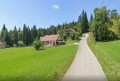
Park in the small car park at Chez Vallet in Foncine-le-Haut.
(S/E) Turn right onto the street known as Sur le Leat and continue along the path that follows it.
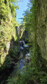
(1) Look out for the path on the left which you will take later, and carry on straight ahead to discover the large limestone cirque where the Saine has its source.
(2) Turn round and head back to the junction you spotted earlier.
(1) Take the path on the right uphill, following the sign for “Sous le Bayard”, and emerge onto a pasture. Continue straight on until you reach a large farm building, then turn right at the sign for “Le Bayard”, following theGR®509. Turn left about a hundred metres further on and reach a crossroads.
(3) Leave theGR®509and follow the discovery trail on the right, which forms part of the Bayard botanical trail. Return to theGR®509and, at the gate, turn right: you’ll reach the tree-lined ‘Souvenir des conflits ayant marqué le XXe siècle’ trail. After this, rejoin the road.
(4) Head uphill to the right, following the signs for “Belvédère du Balay”. When you reach the junction with the car park, leave the road and follow the path diagonally to the right: there is a signpost. You’ll come out onto a road.
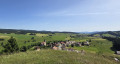
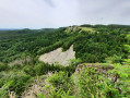
(5) Turn right, head uphill and walk for about 250 m. Then follow the path on the left leading to the Belvédère du Balay (alt. 1139 m).
(6) Enjoy the view of the Jura Mountains, continue to follow theGR® trail which runs along the cliff, then take the steps down to the road at the Col du Bulay. Turn right, walk 100 m and turn off onto the path on the left, continuing to follow theGR® markings. You’ll reach a junction at the Ruisseau d’entre Côtes.
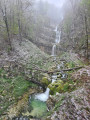
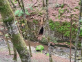
(7) Turn left and follow the path for 1.2 km through woodland and pasture. Cross the bridge over the stream to reach the left bank and continue along the same path: at one point, look out for a waterfall on your right, and you’ll see the entrance to the Mine d’Or cave.
(8) At the “Mine d’Or” signpost, follow the signs for “Paradis” and continue downhill, keeping the stream on your right. You’ll reach a track near the Refuge du Paradis.
(9) Turn right, cross the Ruisseau d’entre Côtes and continue to the left, following the sign for “Saut de la Pisse”. Further on, pass the turn-off for Le Sauget on your left and walk for about 300 metres.
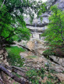
(10) Take the path on the left to reach the Saut de la Pisse.
(11) Turn back.
(10) Continue left along the road leading down towards Les Planches-en-Montagne. Keep an eye out for the start of the small path on the left: there are no signposts.
(12) Leave the road here and follow this small path downwards until it joins theGR® 559A. Turn left towards Foncine-le-Bas and carry on to the bridge.
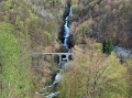
(13) On your left, admire the Cascade du Bief de la Ruine waterfall. Continue along the path for 600 m, go through a tunnel and you’ll reach the “Tram’Jurassienne” signpost.
(14) Take a small path that climbs to the left towards “Leat de la Ruine”.
(15) Follow a path that branches off to the left and quickly leads to the top of the Bief de la Ruine waterfall.
(16) Then continue along the path which climbs straight ahead to the Source du Leat de la Ruine.
(17) Turn back for about a hundred metres.
(16) Take the path that climbs to the left towards Les Ruines. At the T-junction, turn right.
(18) At the signpost marked ‘les Ruines’, turn left onto a road and head for the Col du Renvers des Ruines.
(19) Take the path on the left to reach the Belvédère du Couillou.
(20) Retrace your steps back to the pass.
(19) Take the path opposite towards Côte du Bayard, following theGR® 559A. Walk for about 2 km.
(21) At the “Côte du Bayard” signpost, take the path on the left to reach the Belvédère de la Roche Fendue viewpoint.
(22) Return to the signpost.
(21) Carry on straight ahead to reach Rue du Bois des Caches. Go down the steps opposite and cross Rue du Bois des Caches again to go down another flight of steps leading to Impasse du Rutillet. Cross this to take a final flight of steps leading to Impasse Combernoz.
(23) Turn left towards Sous le Bayard. Keep right at the junction, then carry on straight ahead to the hamlet, which you must cross to reach a junction just after a left-hand bend.
(24) Carry on straight ahead to the starting car park at Chez Vallet (S/E).

 Visorando Member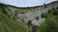
 Easy
Easy 
 Association / Club / Walk leader
 Moderate