


Refine your search for walks in Giraumont
Giraumont walks
 Walk through the Lorraine Regional Park
 Visorando Member
 14.79 mi
 +427 ft
 -446 ft
 7h 10
7h 10
 Moderate
 Departure from Jarny (Meurthe-et-Moselle)
A walk in Jarnisy, in the land of the iron mines. You’ll walk through fields, woods and alongside marshes, and discover the eco-village of Ville-sur-Yron. You’ll be able to admire the village architecture, traditional Lorraine-style dwellings, the building materials used, and the history reflected in the landscape and the symbolic sites still visible today: the church, the mill, the wash house and the labourers’ cottage.
 From Conflans-Jarny (station) to the Metz conurbation (Lorry-lès-Metz)
17.20 mi
+1,099 ft
-915 ft
2 hrs
Moderate
Departure from Jarny (Meurthe-et-Moselle)
The second part of the stage from Conflans-Jarny station is a route along small country roads back to Metz. The grounds of Moncel Castle near Jarny are an ideal spot for a break. From the Montvaux Valley, which we pass through, it is easy to reach the southern part of the Metz conurbation.
Bois Joeuf
 4.00 mi
+341 ft
-351 ft
2h 10
4.00 mi
+341 ft
-351 ft
2h 10
 Easy
Departure from Jœuf (Meurthe-et-Moselle)
Easy
Departure from Jœuf (Meurthe-et-Moselle)
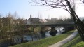
A family route suitable for all weathers, with or without your dog, fun with children, an easy and enjoyable short walk.
Orchid walk in Châtel-Saint-Germain
 Local authority5.36 mi
+994 ft
-1,119 ft
3h 20
Moderate
Departure from Châtel-Saint-Germain (Moselle)
Local authority5.36 mi
+994 ft
-1,119 ft
3h 20
Moderate
Departure from Châtel-Saint-Germain (Moselle)
From Square du Tagnon, the route climbs towards the historic site of Mont Saint-Germain, then joins the Route de Guerre and the Route de Vernéville. It passes through the Bois des Bannaires, goes past the 1870 monument and the Ferme Saint-Hubert, then continues towards the Ferme de Moscou and the Hêtre des Batailles. The descent towards Châtel follows the Chemin de Gravelotte, before returning to Square du Tagnon via Rue Bonne-Fontaine.
The Perdrix Walk in Châtel-Saint-Germain
 4.44 mi
+472 ft
-797 ft
2h 25
Easy
Departure from Châtel-Saint-Germain (Moselle)
4.44 mi
+472 ft
-797 ft
2h 25
Easy
Departure from Châtel-Saint-Germain (Moselle)
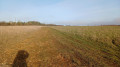
From the Square du Tagnon, the route climbs towards the schools then joins the Route de Guerre and the ancient Roman road, formerly known as the Chaussée de France. It passes close to Fort Jeanne-d’Arc, skirts the site, then offers an unobstructed view of Metz before crossing the Bois du Reposoir. The descent is via the Chemin de Gravelotte, where you can see a remarkable service tree. The return route follows Rue de Cléry and Rue de Bonne-Fontaine back to the starting point.
The Buse Walk in Châtel-Saint-Germain
6.33 mi
+1,083 ft
-1,217 ft
3h 50
Moderate
Departure from Châtel-Saint-Germain (Moselle)
From Square du Tagnon, the route climbs towards the historic site of Mont Saint-Germain, then joins the Haie des Échevins and the Fort de Guise military road. After passing through Montvaux, the route follows the Route de Guerre through the forests of Forey and Flutôt, then descends along the edge of the woods towards Châtel. The final stretch takes you past the railway line, the Chemin des Fourrières and Place Bompard, before following the stream back to Square du Tagnon.
Nature and heritage around Châtel-Saint-Germain
 8.47 mi
+853 ft
-850 ft
4h 40
Moderate
Departure from Châtel-Saint-Germain (Moselle)
8.47 mi
+853 ft
-850 ft
4h 40
Moderate
Departure from Châtel-Saint-Germain (Moselle)
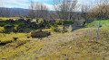
A superb walk in the woods of Châtel-Saint-Germain and Rozérieulles.
Walk through the enchanting ruins on the heights of Châtel, pass by the Jeanne d'Arc and François de Guise Fortified Groups built by the Germans, and admire the magnificent Hêtre des Batailles (Battle Beech) and a few graves from the 1870 war.
The Pheasant Walk in Châtel-Saint-Germain
4.41 mi
+525 ft
-495 ft
2h 30
Easy
Departure from Châtel-Saint-Germain (Moselle)
From the town hall, the walk leads to the Square du Saulcy and then to the Promenade de Montvaux, a former railway line. The botanical trail then leads to the Route de Guerre and passes through the forests of Forey and Flutôt, where there is a remarkable service tree. At the edge of the woods, a path leads back down towards the Chemin de Lorry. Passing by the Saint-Georges farm, the descent along the Chemin de Vazelle offers a view of an old lime kiln before returning to the town hall via the Rue de Lorry.
Hêtre des Batailles, starting from Châtel-Saint-Germain
5.57 mi
+479 ft
-479 ft
3h 00
Easy
Departure from Châtel-Saint-Germain (Moselle)
A circular walk starting from Châtel-Saint-Germain, taking in the ruins of the abbey, the castle ruins and the protohistoric fortification, then the Leipzig farm on the plateau, and finally the Hêtre des Batailles, a remarkable tree (over 170 years old!).
The Fox Walk in Châtel-Saint-Germain
5.21 mi
+702 ft
-873 ft
3h 00
Easy
Departure from Châtel-Saint-Germain (Moselle)
From the town hall, the route follows Rue du Ruisseau then climbs via Rue Jean d’Apremont, Rue de Cléry and Rue du Rebénot before joining Chemin des Goules and Route de Guerre. The route crosses the woods, passes near Captain Apchié’s grave, runs alongside Fort Jeanne-d’Arc and the old graves linked to the fighting of 1870. It continues towards the Moscou farm and the hamlet of Le Reposoir, then descends towards Châtel via the Square du Tagnon, Rue de Bonne-Fontaine and Ruelle de Gravelotte to return to the town hall.
The Lièvre Walk in Châtel-Saint-Germain
5.22 mi
+600 ft
-577 ft
2h 55
Moderate
Departure from Châtel-Saint-Germain (Moselle)
From the town hall, the route follows the stream then climbs towards Rue Jean d’Apremont and the footpath linking Châtel to Rozérieulles. It joins the Route de Guerre, crosses the Bois du Reposoir and passes close to the Mont Saint-Germain site before descending towards the Montvaux valley. The return route takes you via the Pas d’Âne, then through the village and along the Chemin des Fourrières.
The 360 steps of Châtel-Saint-Germain
5.89 mi
+928 ft
-928 ft
3h 30
Moderate
Departure from Châtel-Saint-Germain (Moselle)
A walk around Châtel-Saint-Germain, exploring the remains of the fortifications surrounding the city of Metz, including the famous 360 steps of a gigantic staircase! The highlight is the archaeological site at Châtel and its sarcophagi. And, as always, the forest, with a stretch exposed to the wind on the plateau.
The ‘Hêtre des Batailles’ walk in Châtel-Saint-Germain
3.92 mi
+463 ft
-600 ft
2h 10
Easy
Departure from Châtel-Saint-Germain (Moselle)
The route forms a circular path starting from the town hall: it passes by the wash house on the Ruisseau de Montvaux, climbs towards the archaeological site of Mont Saint-Germain, crosses the Bois du Reposoir to the Moscou farm, reaches the Hêtre des Batailles, then descends back towards the village, passing a remarkable service tree and rejoining the large wash house before returning to the starting point.
Route des fermes in Châtel-Saint-Germain
11.73 mi
+1,893 ft
-1,916 ft
7h 05
Moderate
Departure from Châtel-Saint-Germain (Moselle)
From the town hall, the route follows Rue de Lorry then the old railway line before joining the Botanical Trail. It then takes Route de Guerre down towards the Ruisseau de Montvaux. The path crosses the RD643 and heads back up towards Amanvillers, continuing on to the Montigny-la-Grange farm, then runs alongside the farms on the plateau and the Leipzig industrial estate. It then joins the Haie des Échevins, the Mont Saint-Germain site, and descends back towards the village via the Chemin de la Taye, the wash house and the Chemin des Fourrières, before returning to the town hall.
The Deer Walk in Châtel-Saint-Germain
6.52 mi
+781 ft
-758 ft
3h 40
Moderate
Departure from Châtel-Saint-Germain (Moselle)
From the town hall, the route heads towards Lessy then climbs towards the Saint-Georges farm, offering a view over the Moselle valley. It continues along the edge of the woods to the Route de Guerre and the small viaduct, then follows the Ruisseau de Montvaux before crossing the RD643 and climbing the 360-step staircase. The path then passes by the Leipzig farm and the Mont Saint-Germain site before heading back down towards Châtel via the wash house, the Chemin des Fourrières and the Rue de Lorry.
The Drince Tower from Fond-Saint-Martin
 4.75 mi
+846 ft
-843 ft
2h 55
Easy
Departure from Rombas (Moselle)
4.75 mi
+846 ft
-843 ft
2h 55
Easy
Departure from Rombas (Moselle)
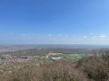
Hilly hike on the Côte de Drince with the Drince Tower and its spectacular view as the main attraction.
Circular walk around Fond Saint-Martin
2.24 mi
+358 ft
-361 ft
1h 20
Easy
Departure from Rombas (Moselle)
An easy, short walk, suitable for children aged 6 and over or as a gentle stroll, through the woodland around Fond Saint-Martin in Rombas.
History and prehistory above Rombas
 5.56 mi
+722 ft
-732 ft
3h 10
Easy
Departure from Rombas (Moselle)
5.56 mi
+722 ft
-732 ft
3h 10
Easy
Departure from Rombas (Moselle)
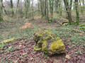
A circular route starting from Fond Saint-Martin, passing a geological site, a grave from the 1870 war, a viewpoint and sites linked to prehistory. There is a slight elevation gain on this route.
The Tivoli Pond and the Mal au Ventre and Oubli springs.
 9.05 mi
+597 ft
-627 ft
4h 40
Moderate
Departure from Moyeuvre-Grande (Moselle)
9.05 mi
+597 ft
-627 ft
4h 40
Moderate
Departure from Moyeuvre-Grande (Moselle)
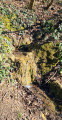
Forest hike from the Tréhémont farm and stables, following part ofthe GR®®5F trail, the Justemont trench to the Tivoli Pond, the Mal au Ventre spring and the Oubli spring, then returning via bridle paths through the Moyeuvre-Grande national forest.
Long walk in the Moyeuvre-Grande State Forest
5.06 mi
+413 ft
-417 ft
2h 40
Easy
Departure from Moyeuvre-Grande (Moselle)
A circular route mainly through woodland, following an old forest road (closed to traffic) in the Moyeuvre-Grande State Forest, starting from the Tréhémont farm and passing through Moyeuvre-Petite. The final climb up to the plateau and the Tréhémont farm is quite a challenge: fairly steep and long.
 Vaux - Les Sept Nains (fortifications)
 7.43 mi
+463 ft
-459 ft
2 hrs
Moderate
Departure from Vaux (Moselle) (Moselle)
7.43 mi
+463 ft
-459 ft
2 hrs
Moderate
Departure from Vaux (Moselle) (Moselle)
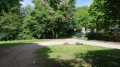
A mountain bike ride between Vaux and Gravelotte through an area fortified by the Germans between 1912 and 1916 to protect Metz. Remember that at that time (from 1870 until 1918), Alsace and Moselle were part of the German Empire.
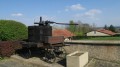
The battle beech tree
 7.56 mi
+581 ft
-568 ft
4h 00
Easy
Departure from Rozérieulles (Moselle)
7.56 mi
+581 ft
-568 ft
4h 00
Easy
Departure from Rozérieulles (Moselle)
A walk with varied landscapes. A gentle route through forest, grassland and cultivated areas. This route is strongly imbued with a former military presence.
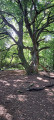
The Battle Beech (1870)
 6.19 mi
+479 ft
-479 ft
3h 15
Moderate
Departure from Rozérieulles (Moselle)
6.19 mi
+479 ft
-479 ft
3h 15
Moderate
Departure from Rozérieulles (Moselle)
Head up through the woodland along the Route de Guerre to the battlefields of 1870, then walk round the Moscou farm to see the ‘Hêtre des Batailles’ (Battle Beech), which is around 200 years old and has naturally propagated by layering. Head back down via the Route du Fort Jeanne d’Arc.
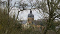
Gorze Abbey and the Rocher de la Pucelle
 5.82 mi
+919 ft
-896 ft
3h 30
Moderate
Departure from Gorze (Moselle)
5.82 mi
+919 ft
-896 ft
3h 30
Moderate
Departure from Gorze (Moselle)
A walk offering views of Gorze from various angles, including Gorzia, the statue of the Virgin of Saint-Blin, the cemetery, the Rocher de la Pucelle, Saint-Clément Chapel, the Altar of the Lepers, and Saint-Étienne Collegiate Church.
From the 1st century onwards, the springs of Gorze were harnessed by the Romans to supply Divodorum (now Metz) with water via an underground conduit and an aqueduct (one of the longest in Europe). Most of Gorze’s springs still supply the town.
Nature and heritage around Gorze
 4.87 mi
+676 ft
-686 ft
2h 50
Moderate
Departure from Gorze (Moselle)
4.87 mi
+676 ft
-686 ft
2h 50
Moderate
Departure from Gorze (Moselle)
Between nature and heritage, cross the Graoully Forest, descend into the "Fond de la Gueule", discover the mysterious Saint-Clément Chapel and its altar, small cliffs, the Rocher de la Pucelle, and end your walk at the Benedictine abbey of Gorze and its abbey palace.
On the hills above Ancy in Ars-sur-Moselle
4.95 mi
+577 ft
-577 ft
2h 45
Easy
Departure from Ars-sur-Moselle (Moselle)
The walk takes you mainly through woodland and orchards.
On the heights of Ars-sur-Moselle
6.04 mi
+489 ft
-499 ft
3h 10
Moderate
Departure from Ars-sur-Moselle (Moselle)
A walk on the hills above Ars-sur-Moselle with stunning views of the Mance Valley.
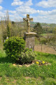
Villages of the Moselle Valley and 2nd-century Roman aqueduct
 7.02 mi
+584 ft
-577 ft
3h 45
Moderate
Departure from Ars-sur-Moselle (Moselle)
7.02 mi
+584 ft
-577 ft
3h 45
Moderate
Departure from Ars-sur-Moselle (Moselle)
Part of the hike takes place in the forest, offering beautiful views of the Moselle valley.
Lachaussée Pond and its satellite lakes
 8.99 mi
+30 ft
-30 ft
4h 10
Moderate
Departure from Lachaussée (Meuse)
8.99 mi
+30 ft
-30 ft
4h 10
Moderate
Departure from Lachaussée (Meuse)
Listed as a Regional Nature Reserve, the Lachaussée pond has remained in its natural state. Many birds have made their home there or stop off during their migration. It is a haven of peace for flora and fauna.Please note: it is forbidden to stray from the existing paths, particularly around the ponds, otherwise you may be liable for a hefty fine.
Harmanfontaine: between Dornot and Novéant
 2.38 mi
+144 ft
-141 ft
1h 15
Easy
Departure from Dornot (Moselle)
2.38 mi
+144 ft
-141 ft
1h 15
Easy
Departure from Dornot (Moselle)
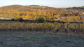
A short walk through the vineyards with numerous views of the Moselle and the Fraze rocks.
Rochers de la Fraze and Croix Saint-Clément
 5.54 mi
+535 ft
-531 ft
3h 00
Easy
Departure from Dornot (Moselle)
5.54 mi
+535 ft
-531 ft
3h 00
Easy
Departure from Dornot (Moselle)
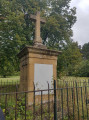
A lovely walk in the hills above Metz. Discover an old limestone quarry and enjoy panoramic views of the Moselle valley and the Croix Saint Clément.
The banks of the Moselle to the south of Metz
 10.46 mi
+669 ft
-669 ft
5h 25
Easy
Departure from Jouy-aux-Arches (Moselle)
10.46 mi
+669 ft
-669 ft
5h 25
Easy
Departure from Jouy-aux-Arches (Moselle)
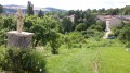
A beautiful circuit along the Mosel through the charming villages bordering it, namely:
Jouy-aux-Arches, Corny-sur-Moselle, Novéant-sur-Moselle, Dornot and Ancy-sur-Moselle.
On the right bank of the Moselle, the villages of Jouy, Féy, Corny through the woods
 10.62 mi
+1,227 ft
-1,234 ft
5h 55
Moderate
Departure from Jouy-aux-Arches (Moselle)
10.62 mi
+1,227 ft
-1,234 ft
5h 55
Moderate
Departure from Jouy-aux-Arches (Moselle)
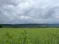
Most of this beautiful loop takes place in woodland. It will take you through the villages of Jouy-aux-Arches, Féy and Corny-sur-Moselle, passing through the main woods of these villages and offering beautiful views over the Moselle valley.Good waterproof footwear recommended.
Corny Jouy on foot
 5.31 mi
+112 ft
-98 ft
2h 30
Easy
Departure from Corny-sur-Moselle (Moselle)
5.31 mi
+112 ft
-98 ft
2h 30
Easy
Departure from Corny-sur-Moselle (Moselle)
A pleasant and easy walk along the Moselle and then through the woods on a well-maintained path.
Corny – Metz by bike
 16.73 mi
+23 ft
-23 ft
3 hrs
Moderate
Departure from Corny-sur-Moselle (Moselle)
16.73 mi
+23 ft
-23 ft
3 hrs
Moderate
Departure from Corny-sur-Moselle (Moselle)
This lovely cycle ride (suitable for all types of bikes, except after a spell of rain) takes you round the southern suburbs of Metz and allows you to discover the area from a very different perspective to the usual road routes.
1940-1944 Smugglers' Walk between Novéant and Arnaville
4.82 mi
+105 ft
-138 ft
2h 20
Easy
Departure from Novéant-sur-Moselle (Moselle)
A route commemorating the contemporary history of these places between Novéant and Arnaville. Between 1940 and 1944, volunteer smugglers helped men hunted by the invaders to regain their freedom and resume the fight for the liberation of their battered homeland.
Circular route around Novéant-sur-Moselle
 8.16 mi
+640 ft
-643 ft
4h 20
Easy
Departure from Novéant-sur-Moselle (Moselle)
8.16 mi
+640 ft
-643 ft
4h 20
Easy
Departure from Novéant-sur-Moselle (Moselle)
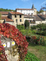
Circular route running alongside the Moselle, the old canal and the Rupt du Mad, passing through the villages of Novéant, Arnaville and Dornot, with a walk through the Dornot woods via La Fraze and La Croix Saint-Clément