


Refine your search for walks in Fresnes-en-Saulnois
Fresnes-en-Saulnois walks

 Discovering the Gallo-Roman villa at Grémecey
 Visorando Member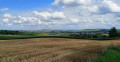
 6.96 mi
 +545 ft
 -512 ft
 3h 40
3h 40
 Moderate
 Departure from Château-Salins (Moselle)
Back in the 1970s, like many schoolchildren from the Saulnois region, I visited the Gallo-Roman villa at Grémecey. It was subsequently buried and somewhat forgotten. For a long time, I believed that no remains of it existed. It has indeed become difficult to find, as it is surrounded by dense vegetation. This route takes you there, allowing you to see the remains of this building steeped in history. The route presents no significant difficulty.
Grémecey Circular, in honour of Paul Beugnette
 5.92 mi
+262 ft
-243 ft
2h 55
5.92 mi
+262 ft
-243 ft
2h 55
 Easy
Departure from Grémecey (Moselle)
Easy
Departure from Grémecey (Moselle)
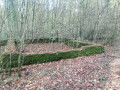
This route offers superb panoramic views and consists mainly of forest tracks. In the Saulnois region, the village of Grémecey is associated with the Gallo-Roman villa located in the communal forest. It was unearthed in 1960 and then reburied some thirty years later. This route pays tribute to Paul Beugnette, from Fresnes-en-Saulnois, who collected numerous artefacts. He set up a small museum which delighted many schoolchildren in the Saulnois region.
Between Grémecey and Vic-sur-Seille
 17.68 mi
+804 ft
-817 ft
8h 50
17.68 mi
+804 ft
-817 ft
8h 50
 Difficult
Departure from Grémecey (Moselle)
Difficult
Departure from Grémecey (Moselle)
A loop between Grémecey and Vic-sur-Seille, starting on the GR®5, mainly in the woods, returning on minor roads.
You'll need a GPS, as the signposting is poor in places and there are many false trails. By false trails, we mean beautiful, wide paths where you can walk happily, forgetting to turn off onto small paths where the start is hard to see.
The start through the woods is pleasant and shady, after the visit to Vic-sur-Seille, which is well worth the effort. You have to get back by the shortest route, and the small roads make this possible. An attempt to return via the old railway line proved impossible.
Before entering the Forêt Domaniale de Grémecey, there are some very fine views.
The Chemin de la Reine in Château-Salins
 7.65 mi
+584 ft
-581 ft
4h 00
Moderate
Departure from Château-Salins (Moselle)
7.65 mi
+584 ft
-581 ft
4h 00
Moderate
Departure from Château-Salins (Moselle)
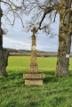
This walk around Château-Salins will offer you some superb panoramic views of the Saulnois region. Two-thirds of the route takes place in the forest. You’ll have the great honour of walking along the Chemin de la Reine, so named because it was trodden (after being restored) in 1725 by the new Queen of France, Marie Leszczynska. She was travelling with her entire entourage to join Louis XV. It’s worth noting that one section of this path is a particularly impressive tunnel of greenery.
The Majurin valley
 4.93 mi
+397 ft
-374 ft
2h 35
Easy
Departure from Château-Salins (Moselle)
4.93 mi
+397 ft
-374 ft
2h 35
Easy
Departure from Château-Salins (Moselle)
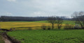
This route takes you to the Majurin valley from Château-Salins. The Majurin is a stream that flows through a plain surrounded by small woods. The valley is very close to Coutures and Château-Salins, yet you feel as though you are in the heart of the countryside, far from it all. The walk offers some beautiful panoramic views. It alternates pleasantly between sections deep in the forest and out in the open. As it presents no difficulties, this circular walk is ideal for a family outing.
Exploring Vic-sur-Seille from Château-Salins
 10.46 mi
+751 ft
-728 ft
5h 30
Moderate
Departure from Château-Salins (Moselle)
10.46 mi
+751 ft
-728 ft
5h 30
Moderate
Departure from Château-Salins (Moselle)
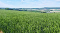
This walk will introduce you to one of the jewels of the Saulnois region: Vic-sur-Seille. The route offers a leisurely stroll through the village.
You’ll also be able to enjoy exceptional panoramic views, particularly from the Chemin du Haut de Phara.
From the old railway line to the longest tunnel in the Saulnois region
 11.47 mi
+1,109 ft
-1,086 ft
6h 15
Moderate
Departure from Delme (Moselle)
11.47 mi
+1,109 ft
-1,086 ft
6h 15
Moderate
Departure from Delme (Moselle)
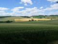
From Delme onwards, this route follows the old railway line. After the stunning panoramic views from the hill, it also offers another point of interest. Indeed, Xocourt has restored an old path which forms a truly extraordinary ‘tunnel of greenery’ stretching for over a kilometre. This marvel is, in fact, the focus of a shorter walk that is also suggested. Ideally, you should complete the route in a day, with the option of having a picnic at the second orientation table or in Juville.
The Delme Hill
 6.52 mi
+653 ft
-659 ft
3h 35
Moderate
Departure from Delme (Moselle)
6.52 mi
+653 ft
-659 ft
3h 35
Moderate
Departure from Delme (Moselle)
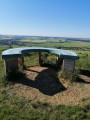
A route allowing you to discover one of the highest points in the Saulnois region, at the summit of the Côte de Delme, offering an unrivalled view of the Moselle hillsides.
Around Tincry via its "Roman Camp"
 5.64 mi
+443 ft
-443 ft
3h 00
Easy
Departure from Tincry (Moselle)
5.64 mi
+443 ft
-443 ft
3h 00
Easy
Departure from Tincry (Moselle)
This walk takes place on wide, often shaded paths. It plunges us into the heart of history as we traverse the hill crowned by a forest known as the ‘Camp des Romains’. This is a protohistoric oppidum. There are many traces of it to be seen. We owe much of the discovery of the cave to Régis, our fellow explorer. He is the great-nephew of Jacques Marsal, one of the three discoverers of the Lascaux cave. The apple doesn’t fall far from the tree...
Between Chambrey and Bezange-la-Grande
 10.06 mi
+676 ft
-696 ft
4h 55
Moderate
Departure from Chambrey (Moselle)
10.06 mi
+676 ft
-696 ft
4h 55
Moderate
Departure from Chambrey (Moselle)
A hike along small roads, stone tracks and wood paths between Chambrey and Bezange-la-Grande, starting in the Bezange-la-Grande national forest.Along the route: the Saint-Roch Chapel, the Imperial Station and the church of Chambrey, a German memorial monument in the national forest.
The “Gros Max” at Hampont
 2.30 mi
+121 ft
-118 ft
1h 10
Easy
Departure from Puttigny (Moselle)
2.30 mi
+121 ft
-118 ft
1h 10
Easy
Departure from Puttigny (Moselle)
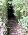
The “Gros Max” is an SK-LK/45-type gun installed by the Germans between 1916 and 1917 in the “Le Chaumont” woods, near Hampont. This site has been all but forgotten today. Finding a passable route was no easy task. The location is impressive. Please note that the surrounding area may be dangerous for children or pets. There are cavities in the vicinity caused by countless underground tunnels and other structures.
Around Moncel-sur-Seille
 9.65 mi
+423 ft
-427 ft
4h 50
Moderate
Departure from Moncel-sur-Seille (Meurthe-et-Moselle)
9.65 mi
+423 ft
-427 ft
4h 50
Moderate
Departure from Moncel-sur-Seille (Meurthe-et-Moselle)
A circular walk on the northern outskirts of Moncel-sur-Seille to visit the Bois de Rosebois, the Gare Impériale and the Chapelle Saint-Roch de Chambrey, the Bois Saint-Roch, the Moulin de Sainte-Marie and the Bois de Sainte-Marie.
As you enter the Bois de Rosebois and exit near the old railway line, you can see remnants of the First World War.
German remains from the First World War in the Bois Haut de Chaumont
 1.52 mi
+577 ft
-574 ft
1h 10
Easy
Departure from Moncel-sur-Seille (Meurthe-et-Moselle)
1.52 mi
+577 ft
-574 ft
1h 10
Easy
Departure from Moncel-sur-Seille (Meurthe-et-Moselle)
A circular route to visit the German remains from the 1914-1918 war in the Bois Haut de Chaumont in Moncel-sur-Seille. In the woods, it's a walk off the beaten track in search of remains. This hike is best done with a GPS or a good sense of direction. It is possible that there are still remains to be found: if you find any others, please post the photos and send me the GPS coordinates to complete this hike.
Xocourt circular loop via its splendid tunnel of greenery
 4.20 mi
+535 ft
-525 ft
2h 25
Easy
Departure from Xocourt (Moselle)
4.20 mi
+535 ft
-525 ft
2h 25
Easy
Departure from Xocourt (Moselle)
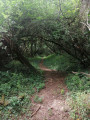
The main highlight of this route is the extraordinary tunnel of greenery, stretching for over a kilometre. This path has recently been restored thanks to the municipality of Xocourt. It was originally a narrow-gauge railway used to transport limes produced in the village of Tincry in the early 20th century. This tunnel offers some remarkable views. It is also worth noting that half of the route offers superb panoramic views towards Delme.
The circular loop through the woods of Château-Bréhain
 8.39 mi
+400 ft
-400 ft
4h 15
Moderate
Departure from Vannecourt (Moselle)
8.39 mi
+400 ft
-400 ft
4h 15
Moderate
Departure from Vannecourt (Moselle)
The woods of Château-Bréhain are criss-crossed with paths. You will therefore need to take care to follow the route and the description carefully. The paths (even those not shown on maps) are very wide and easily accessible. The forest is very beautiful and pleasant.
Via the Saint-Gengoult Fountain and the Brin Pond
 8.96 mi
+430 ft
-404 ft
4h 30
Moderate
Departure from Brin-sur-Seille (Meurthe-et-Moselle)
8.96 mi
+430 ft
-404 ft
4h 30
Moderate
Departure from Brin-sur-Seille (Meurthe-et-Moselle)
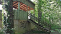
A lovely walk, partly in the shade and partly in the sun, which will take you to the edge of the Étang de Brin in its forest setting. A birdwatching hide will allow you to discover the wildlife that lives around the lake. A pair of binoculars may prove very useful.
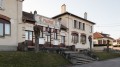
Brin-sur-Seille pond and forest
 7.14 mi
+302 ft
-299 ft
3h 35
Moderate
Departure from Brin-sur-Seille (Meurthe-et-Moselle)
7.14 mi
+302 ft
-299 ft
3h 35
Moderate
Departure from Brin-sur-Seille (Meurthe-et-Moselle)
Visit the Brin-sur-Seille pond and watch the birds.
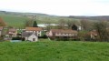
Forest and pond at Brin-sur-Seille
 10.53 mi
+413 ft
-413 ft
5h 10
Moderate
Departure from Brin-sur-Seille (Meurthe-et-Moselle)
10.53 mi
+413 ft
-413 ft
5h 10
Moderate
Departure from Brin-sur-Seille (Meurthe-et-Moselle)
A border village from 1870 to 1914, Brin-sur-Seille was completely razed to the ground at the start of the First World War. This walk will allow you to discover views of the Seille valley from the top of the village, its forest and its pond, which has long been used for restocking the region’s rivers and ponds.
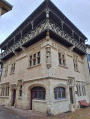
The Vic-sur-Seille, Salonnes and Château-Salins circular route
 9.31 mi
+633 ft
-659 ft
4h 50
Moderate
Departure from Vic-sur-Seille (Moselle)
9.31 mi
+633 ft
-659 ft
4h 50
Moderate
Departure from Vic-sur-Seille (Moselle)
This is a circular walk starting in one of the jewels of the Saulnois region: Vic-sur-Seille. This walk will take you past some superb panoramic views. It is ideal in fine weather, offering a variety of routes along paths, as well as sections of gravel or tarmac.
Loop between Vic-sur-Seille and Moyenvic through the Bezange-la-Grande Forest
 8.14 mi
+449 ft
-449 ft
4h 10
Moderate
Departure from Vic-sur-Seille (Moselle)
8.14 mi
+449 ft
-449 ft
4h 10
Moderate
Departure from Vic-sur-Seille (Moselle)
A loop in the Saulnois between Vic-sur-Seille and Moyenvic, passing through the Bezange la Grande National Forest. Walk along field paths and woodland trails with beautiful views from the highest points.
Bezange-la-Grande and its daffodils
 4.57 mi
+344 ft
-338 ft
2h 25
Easy
Departure from Bezange-la-Grande (Meurthe-et-Moselle)
4.57 mi
+344 ft
-338 ft
2h 25
Easy
Departure from Bezange-la-Grande (Meurthe-et-Moselle)
Mid-March is daffodil season, and there's no need to go into town to find them in abundance.
This route will allow you to find plenty of them without the crowds.
Around Bezange-la-Grande
 8.50 mi
+617 ft
-607 ft
4h 25
Moderate
Departure from Bezange-la-Grande (Meurthe-et-Moselle)
8.50 mi
+617 ft
-607 ft
4h 25
Moderate
Departure from Bezange-la-Grande (Meurthe-et-Moselle)
Hike around the village of Bezange-la-Grande along woodland paths, field tracks and small roads.
Between points (5) and (9), the paths are very quiet, so it is advisable to have a GPS.
Orientation tables on the Côte de Delme
 4.26 mi
+230 ft
-213 ft
2h 10
Easy
Departure from Juville (Moselle)
4.26 mi
+230 ft
-213 ft
2h 10
Easy
Departure from Juville (Moselle)
Walk on the limestone plateau of the Côte de Delme, between the north (Juville) and south (Puzieux) orientation tables, passing by the Juville quarry. You will discover many views of the Seille valley.
World War I structures in the Bois des Maires and Bois des Barres in the Amance Forest
 3.88 mi
+98 ft
-105 ft
1h 50
Moderate
Departure from Amance (Meurthe-et-Moselle) (Meurthe-et-Moselle)
3.88 mi
+98 ft
-105 ft
1h 50
Moderate
Departure from Amance (Meurthe-et-Moselle) (Meurthe-et-Moselle)
Forest walk in the Bois des Maires and Bois des Barres areas of the Amance National Forest, following the traces of trenches, concrete shelters and blockhouses from the Battle of Grand Couronné during the 1914–1918 war. Circular route that could be classified as difficult, as it involves walking deep in the forest, mostly off-trail, in search of military structures.
Please note that this walk presents navigation difficulties. See the recommendations in: practical information.
More walks in Fresnes-en-Saulnois
Select a point of interest below: