Vic-sur-Seille circular loop

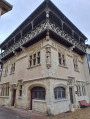
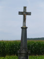
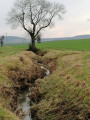
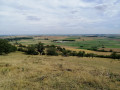
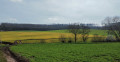
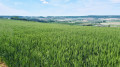
Apart from the inevitable stroll through Vic-sur-Seille, this walk offers plenty of variety. It includes sections across the Faluchamps plateau, forest paths and some very interesting viewpoints. It is not at all difficult and is perfectly suitable for families.

Details

n°19983816
Creation:
Last update:
Last review:
  • Walking
    Activity: Walking
  • ↔
    Distance: 4.16 mi
  • ◔
    Average duration: 2h 15 
  • ▲
    Difficulty: Easy

  • ⚐
    Back to start: Yes
  • ↗
    Ascent: + 377 ft
  • ↘
    Descent: - 394 ft

  • ▲
    Highest point: 1,030 ft
  • ▼
    Lowest point: 653 ft

Photos

Description of the walk

Park at Place Karl Flasche, near the Porte des Évêques in Vic-sur-Seille.

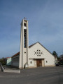
(S/E) Head towards the fortified gate, go through it and walk along Place Mesny. At the end of the square, continue straight on along Rue Vignon. Take the first left to begin the walk around the church.

(1) Before completing the full circuit, turn left into a small alleyway leading onto Place du Palais. Then turn right to continue along Rue du Palais. At the end of the street, turn left and carry on straight ahead until you reach the Seille.

(2) After crossing the bridge over the Seille, turn right onto Rue des Petites Salines, then take the first street on the left, Rue de l’Hôpital. Next, take the first street on the right (Rue Haute) for approximately 450 metres. Then turn onto the path leading uphill on your left, followed by the first path on your right.

(3) Turn right: the path isn’t shown on the map but does exist. In this section, these are paths that were originally designed for walking through the vineyards of yesteryear. After a few dozen metres, turn left and continue in the same direction. At the junction, carry on straight ahead along the path (which is now shown on the map again) and you’ll come out onto the RD155, which you follow to the left for a few hundred metres.

(4) As the road begins to bend to the right, leave the road and take the path leading uphill to your left (GR®5).

(5) After about 1 km of steep climbing, carry on, turning left.

(6) Head along the path on your left which descends and leads back to the entrance to Vic-sur-Seille. Turn right onto Rue des Hosties. At the end of this street, turn left onto Rue Liégeoise towards a bridge spanning the Seille.

(7) Just after crossing the bridge, turn right onto a path that takes you along the riverbank. After about 150 m, turn left onto a path that leads back to the starting point (S/E).

Waypoints

  1. S/E : mi 0 - alt. 689 ft - Place Karl Flashe, Vic-sur-Seille
  2. 1 : mi 0.26 - alt. 676 ft - Place du Palais
  3. 2 : mi 0.44 - alt. 666 ft - Bridge over the - Seille (Affluent de la Moselle)
  4. 3 : mi 0.95 - alt. 735 ft - Path to the left
  5. 4 : mi 1.76 - alt. 735 ft - Path to the left, junction GR°°®°°
  6. 5 : mi 2.44 - alt. 997 ft - Turn left
  7. 6 : mi 2.66 - alt. 1,030 ft - Entrance to Vic-sur-Seille
  8. 7 : mi 3.73 - alt. 666 ft - Riverbank path on the right
  9. S/E : mi 4.16 - alt. 689 ft - Porte des Évêques

Always be cautious and plan ahead when you're outdoors. Visorando and the author of this route cannot be held responsible for any accidents occurring on this route.

The GR® and PR® markings are the intellectual property of the Fédération Française de Randonnée Pédestre.

Reviews and comments

4.3 / 5
Based on 2 reviews

Reliability of the description
4.5 / 5
Ease of following the route
3.5 / 5
Route interest
5 / 5
cdmt
cdmt

Overall rating : 5 / 5

Date of your route : Nov 02, 2026
Reliability of the description : ★★★★★ Very good
Ease of following the route : ★★★★★ Very good
Route interest : ★★★★★ Very good
Very busy route : No

A lovely walk, a very pleasant trail, and we were able to enjoy Philippe Geluck’s cat exhibition… magnificent!

Machine-translated

logedu
logedu

Hello, thank you for your feedback. The path was used again for the 2024 RandoRipaille festival, but it has indeed become virtually impassable. I must say I’m surprised at how little regard is paid to these paths. It’s a real blow to the hiking options from Vic itself; otherwise, you have to head towards Les Faluchamps (Morville-les-Vic), but that will obviously make for a very long circular route.
Kind regards, P. Mercier

Machine-translated

RAZABETH
RAZABETH

Overall rating : 3 / 5

Date of your route : Jan 30, 2025
Reliability of the description : ★★★★☆ Good
Ease of following the route : ★★☆☆☆ Disappointing
Route interest : Not used / Not applicable
Very busy route : No

Hello;
We do not currently recommend this route.
We followed this route (on 24 January 2025) to prepare for a hike in early March using joëlettes (vehicles enabling people with reduced mobility to go hiking)
At present, the route is impassable due to major works being carried out on the hillside to clear the land for vine planting. The paths have been completely destroyed by the machinery being used.

Machine-translated

Other walks in the area

For more walks, use our search engine .

The GPS track and description are the property of this route's author. Please do not copy them without permission.