Country:
 City:
City:


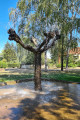
Large car park at Place du Général de Gaulle in Delme
(S/E) Cross Rue du Général Nassoy (D955) and take the small Ruelle des Pigeons directly opposite. At the first bend, a path has been created as a shortcut. At the junction (Rue du Maréchal Foch), continue straight ahead along the stream until you reach the right-hand bend.
(1) Before the sewage treatment works, level with a building (a former railway bridge pier), take the path leading uphill to the right to reach the first section of the old railway line. After a long left-hand bend, you’ll come to a small road.
(2) Cross over, leaving the first section behind to reach the second section on the opposite side.
Carry on for 3 km until you reach a junction where the old Puzieux railway station is located.
(3) Turn right towards the village of Puzieux. When you reach the junction with the D955 (take care, as there is a lot of traffic), cross the road and head towards the village centre until you reach thefirst street on the left (Rue de la Côte).
(4) The road climbs steeply, heading north-east, and joins a junction (signposted ‘Réserve Naturelle Régionale’).
(5) Leave the return path on your right and turn left. About 150 m further on, you’ll reach a car park at the foot of the Côte de Delme. Take the path on the right; at the following left-hand bend, leave the path and take a track on the right-hand side which leads to the first orientation table (signposted).
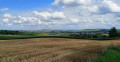
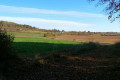
(6) With your back to the orientation board, continue along the path and turn right (signposted), walking towards the huge aerial visible in the distance for about 1.2 km. Then continue straight on to follow the path opposite through the stubble fields and enter the Côte de Delme Nature Reserve. At the end of the path, you’ll come out onto a small tarmac road.
(7) Turn left until you reach the edge of a wood, then turn right onto a path and continue to the top of the hill (signposted). Carry on straight ahead until you reach the second orientation table.
(8) When you reach the orientation board, carry on straight ahead towards the picnic area. Then head for the small tarmac road to Juville. Take this road on the right to reach the village.
(9) At the entrance to the village, take the first street on the right (Grande Rue). Then turn right into thefirst street and turn left to reach Rue Saint-Bernard. At the end of this street, the road becomes a path. Follow it to the bank of the Ruisseau de l’Étang, turn right and walk along the bank for about 1.2 km. At the end of the path, you’ll come to a large open space.
(10) Turn left onto the path to enter the forest. After a bend to the right and then a left-hand bend uphill, you’ll reach the start of a path on the right.
(11) Take this path on the right (be careful not to miss it, as there are many paths in this woodland, some of which are blocked or disused). After a good hundred metres, at a small Fork in the road, keep to the right. At thesecond Fork in the road, after about 300 m, do the same and continue for a few dozen metres until you come out onto a wider path.
(12) Turn right and walk for about fifty metres, then take thefirst path on the left. At the end of the path, after more than 200 m, you’ll reach a junction.
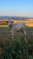
(13) Take the wide path on the right, leave the forest and begin the descent towards Xocourt. After several hundred metres, as you approach the village, the path becomes a road. You’ll come to a goat farm
(14) Turn right to walk past it and enter the long, leafy tunnel, nearly 1.2 km long, which has recently been restored by the municipality of Xocourt. At the end of the tunnel, turn left onto a wide path through the fields. This will take you to the road to Xocourt.
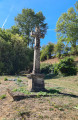
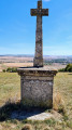
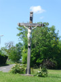
(15) Turn right, pass the Croix Saint-Martin and return to the crossroads you encountered on the way there.
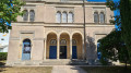
(5) At the crossroads, turn left onto the path leading down towards Delme (Roman road). At the end of this path, carry on straight ahead along Rue Raymond Poincaré (D955). Continue to Place de la République and then to the Church of Saint-Germain in Delme.
(16) Immediately afterwards, look for a small path on the left which leads onto Impasse Saint-Germain. Follow it up to the right. Then take thefirst path on the left. This leads onto Ruelle de la Fontaine. Follow it to the right to return to the starting point (S/E)


 Visorando Member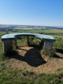

 Easy
Easy 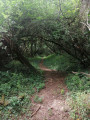
 Difficult