The Vic-sur-Seille, Salonnes and Château-Salins circular route

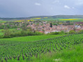
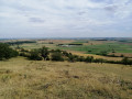
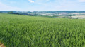
This is a circular walk starting in one of the jewels of the Saulnois region: Vic-sur-Seille. This walk will take you past some superb panoramic views. It is ideal in fine weather, offering a variety of routes along paths, as well as sections of gravel or tarmac.

Details

18986625
Creation:
Last update:
Last review:
  • Walking
    Activity: Walking
  • ↔
    Distance: 9.31 mi
  • ◔
    Average duration: 4h 50 
  • ▲
    Difficulty: Moderate

  • ⚐
    Back to start: Yes
  • ↗
    Ascent: + 633 ft
  • ↘
    Descent: - 659 ft

  • ▲
    Highest point: 1,033 ft
  • ▼
    Lowest point: 666 ft

Photos

Description of the walk

Park in Vic-sur-Seille, on Rue de la Gare near the Porte des Évêques.

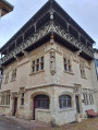
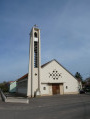
(S/E) Take thefirst street on the right along Place Mesny. Continue along Rue Vignon, then turn left just before the church. Walk round the church and, three-quarters of the way round, take a small alleyway on the left leading out onto Place du Palais. At the far end of the square, by the town hall, turn left into Rue des Carmes, then immediately right into Rue des Prisons. Head towards the banks of the Seille.

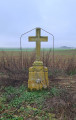
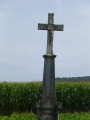
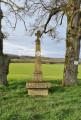
(1) Turn left into Rue de l’Abattoir, then right into Rue du Pont Neuf. Cross the Seille and continue along Rue Liégeoise, then Rue de Metz. Here, near a large wayside cross, you’ll reach the junction withthe GR®5

(2) Turn left onto it and follow the red and white markings; at the Y-junction, stay on theGR® to the right. You’ll then come to a path running along the edge of woodland and vineyards.

(3) Turn left and walk alongside the woodland and vineyards. You will then enter a tunnel of greenery before reaching the tarmac road, Chemin de la Haute Borne. You will arrive at the entrance to Salonnes.

(4) Leave theGR® here and turn right onto a small tarmac road, the Chemin de Dessous les Côtes. Then veer left to reach the area near two ponds.

(5) Continue due north until you reach Rue des Tilleuls. Turn left onto this road and you’ll come to a path junction just before the D955.

(6) Take a small path signposted and marked with a yellow line. Please note, it is not shown on the map. You’ll soon reach the D955; cross it, taking great care of the traffic, which can be heavy. Head across to the Route de Morvilles-lès-Vic. Follow the Ruisseau de Morville. Pass through the hamlet of Le Moulin, then you’ll come to a crossroads just before the D955.

(7) Take the road on the left, continue on to enter Morville-lès-Vic, and go to the end of the Grand Rue.

(8) Turn right onto the Rue Principale, then take the path on the left just as you leave the village. Walk through the fields, ignoring the turnings to the left, until you come out onto the D955 again. Cross it carefully, then turn right and follow it for about a hundred metres, taking the parallel path.

(9) Turn 90° to the left. Then make two changes of direction, first left and then right. Continue along this path until you reach theGR®5at the edge of the woodland. Please note that part of the route taken is not shown on maps.

(10) Follow theGR®5to the left for about 100 metres, then leave it to the right to enter the woods. When you reach a Fork in the road, continue to the right and you’ll arrive at the Croix aux Prés crossroads.

(11) Take Rue Haute, then Rue Saint-Étienne. Continue along thefirst street on the right, Rue des Petites Salines, then carry on via Place Jeanne d’Arc and Rue Meynier; finally, turn right onto Rue de la Gare to return to the Porte des Évêques car park (S/E).


Waypoints

  1. S/E : mi 0 - alt. 692 ft - Porte des Évêques car park
  2. 1 : mi 0.39 - alt. 673 ft - Bank of the - Seille (Affluent de la Moselle)
  3. 2 : mi 0.64 - alt. 709 ft - Calvary crossroads
  4. 3 : mi 1.33 - alt. 846 ft - Edge of the vineyard hedge
  5. 4 : mi 2.16 - alt. 666 ft - Salonnes
  6. 5 : mi 3.55 - alt. 682 ft - 2 ponds
  7. 6 : mi 4.3 - alt. 699 ft - Signposted junction near the - Petite Seille (rivière)
  8. 7 : mi 5.45 - alt. 840 ft - Crossroads near the D955
  9. 8 : mi 5.96 - alt. 853 ft - Morville-lès-Vic - Église Saint-Gorgon (Morville-lès-Vic)
  10. 9 : mi 6.92 - alt. 928 ft - Path running alongside the D955
  11. 10 : mi 8.06 - alt. 1,027 ft - GR5 junction
  12. 11 : mi 8.78 - alt. 676 ft - Croix aux Prés
  13. S/E : mi 9.31 - alt. 692 ft - Porte des Évêques car park

Always be cautious and plan ahead when you're outdoors. Visorando and the author of this route cannot be held responsible for any accidents occurring on this route.

The GR® and PR® markings are the intellectual property of the Fédération Française de Randonnée Pédestre.

Reviews and comments

4.3 / 5
Based on 3 reviews

Reliability of the description
4 / 5
Ease of following the route
4.7 / 5
Route interest
4.3 / 5
User 20340585

Overall rating : 5 / 5

Date of your route : Jun 16, 2026
Reliability of the description : ★★★★★ Very good
Ease of following the route : ★★★★★ Very good
Route interest : ★★★★★ Very good
Very busy route : No

A lovely walk.

Machine-translated

noelle martin
noelle martin

Overall rating : 3.7 / 5

Date of your route : Apr 28, 2023
Reliability of the description : ★★★☆☆ Average
Ease of following the route : ★★★★☆ Good
Route interest : ★★★★☆ Good
Very busy route : No

A lovely, easy walk, a bit slippery in places due to the rain. A few lovely views.
The route description includes road names, but be aware that these aren’t actually signposted on the ground (the path below the hills, the Haute Borne, the Morvilles road, etc.)
The route is marked in yellow but crosses over with others. You need to follow the route carefully on the map (not in the app).
The narrow path before the Route de Morville was very overgrown and hard to spot, so we turned off too early and took the road opposite – but it was the wrong one. (We had to turn back.)
We followed the walk for the first time using the smartphone app, but it’s still better to print out the map as it’s more accurate and helps avoid mistakes.
We had a lovely walk, though it was just a few kilometres longer than planned.
Thank you for this lovely walk.

Machine-translated

Christecol
Christecol
• Edited:

Overall rating : 4.5 / 5

Date of your route : Dec 07, 2022
Reliability of the description : Not used / Not applicable
Ease of following the route : ★★★★★ Very good
Route interest : ★★★★☆ Good
Very busy route : No

It was lovely grey weather with a bit of rain. The paths were extremely muddy, but that didn’t stop me from enjoying this lovely walk, which alternated between fields, woods and a bit of tarmac. I didn’t get to take in the view – I’ll have to do this walk again in the spring. I parked in a large car park on Avenue de la Gare on the outskirts of town, which meant I could return via a forest track that circles the ruins from the Porte des Évêques.

Machine-translated

Other walks in the area

For more walks, use our search engine .

The GPS track and description are the property of this route's author. Please do not copy them without permission.