Discovering the Gallo-Roman villa at Grémecey

Back in the 1970s, like many schoolchildren from the Saulnois region, I visited the Gallo-Roman villa at Grémecey. It was subsequently buried and somewhat forgotten. For a long time, I believed that no remains of it existed. It has indeed become difficult to find, as it is surrounded by dense vegetation. This route takes you there, allowing you to see the remains of this building steeped in history. The route presents no significant difficulty.

Details

12193312
Creation:
Last update:
Last review:
  • Walking
    Activity: Walking
  • ↔
    Distance: 6.96 mi
  • ◔
    Average duration: 3h 40 
  • ▲
    Difficulty: Moderate

  • ⚐
    Back to start: Yes
  • ↗
    Ascent: + 545 ft
  • ↘
    Descent: - 512 ft

  • ▲
    Highest point: 1,017 ft
  • ▼
    Lowest point: 761 ft

Photos

Description of the walk

Park in the car park near the fountain at the end of the village of Coutures.

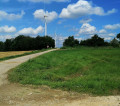
(S/E) Opposite the church, turn left onto the small tarmac road to Grémecey and follow it for 2 km until you reach the wind turbines.

(1) When you reach a crossroads at the foot of the first wind turbine, carry on straight ahead along the Route Forestière du Milieu until you come under a power line.

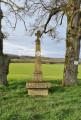
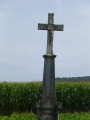
(2) After 1.7 km, opposite a granite memorial marking the site of a German cemetery from the First World War, take the Route Forestière de la Belle Fille as far as the first junction.

(3) At the Fork in the road, turn left onto the Route Forestière de Merlinsol, passing under a power line once more.

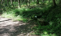
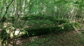
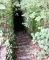
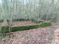
(4) Turn left onto a path where you can see a picnic table. Follow this path for 140 metres and turn left onto a small track, which you follow for just 30 metres. You have now arrived at the villa. You can make out the ruins amongst the vegetation.

(5) Then turn back to reach the forest track, which you follow until you reach a crossroads. You are now at the Vassieux spring.

(6) Turn left onto theGR®5long-distance footpath (marked in red and white) heading north-east.

(7) Continue along theGR®5, turning right for 100 m and then left at the Fork in the road (signposted). Carry on to the Croix de l’Homme.

(8) Carry on to the right along theGR®5until you reach the Chemin de la Reine.

(9) Turn left, heading due north, until you reach the first wind turbine.

(1) Turn right onto the small road towards Coutures – the same one you took on the way out – and return to the car park (S/E).

Waypoints

  1. S/E : mi 0 - alt. 761 ft - Car park near the fountain in Coutures. Towards the - Ruisseau du Majurin (ruisseau) - Affluent de la Seille
  2. 1 : mi 1.36 - alt. 994 ft - Route Forestière du Milieu
  3. 2 : mi 2.42 - alt. 932 ft - Merlinsol Forest Track
  4. 3 : mi 2.81 - alt. 925 ft - Route Forestière de la Belle Fille
  5. 4 : mi 3.11 - alt. 961 ft - Turn left at the fork in the path
  6. 5 : mi 3.24 - alt. 971 ft - Villa gallo-romaine de Grémecey
  7. 6 : mi 3.52 - alt. 958 ft - Vassieux Spring
  8. 7 : mi 3.96 - alt. 1,007 ft - Continuation of the GR5
  9. 8 : mi 4.39 - alt. 1,017 ft - Croix de l’Homme
  10. 9 : mi 4.91 - alt. 833 ft - Junction with Chemin de la Reine
  11. S/E : mi 6.96 - alt. 764 ft - Car park near the fountain in Coutures

Notes

- Two-thirds of the route follows gravel paths or a small tarmac road.
- In wet weather, take care in the forest as the paths can be particularly slippery due to the nature of the soil in the Saulnois region.
- Coutures is a village associated with Château-Salins. On some sat-navs, you will need to enter ‘Coutures Château-Salins’ to set it as your destination.

Worth a visit

Gallo-Roman villa at Grémecey
In the heart of the Gremecey State Forest, at a place called Grand Sareu, you’d be hard-pressed to guess that two thousand years ago, Gallo-Romans lived and worked here. The remains of a farm are, in fact, buried under a few dozen centimetres of earth. Discovered in 1960, excavated and restored over a period of some thirty years, the site was suddenly covered up following a decision by the DRAC (Regional Directorate for Cultural Affairs). Yet, spurred on by Paul Beugnette, a restaurant owner in Fresnes-en-Saulnois and an archaeology enthusiast, there was a flurry of activity at this site. Dozens of excavation projects, bringing together experienced archaeologists, students and residents of Gremecey, were organised every summer, gradually revealing the farm buildings, tools, coins, jewellery and utensils.An increasingly accurate map of the entire site was drawn up. It revealed that, between the 1st and 3rd centuries, there had been a farmstead comprising a large building (20 m x 12 m) with five rooms, a cellar, a front gallery and an enclosure wall.
Guided tours and exhibitions enabled these exceptional discoveries to be shared with as many people as possible. Restoration work was begun to prevent the uncovered structures from deteriorating.
The disastrous decision by the DRAC has, unfortunately, wiped out thirty years of work by Paul Beugnette and his friends, but we are still left with the numerous artefacts, exhibition panels, texts, drawings and a model of the site, which Paul Beugnette’s daughter, Maryse Ciaramella, shows with passion and kindness to curious visitors, teachers and school pupils who wish to see them.

Always be cautious and plan ahead when you're outdoors. Visorando and the author of this route cannot be held responsible for any accidents occurring on this route.

The GR® and PR® markings are the intellectual property of the Fédération Française de Randonnée Pédestre.

Reviews and comments

4.8 / 5
Based on 2 reviews

Reliability of the description
5 / 5
Ease of following the route
5 / 5
Route interest
4.5 / 5
Delf
Delf

Overall rating : 5 / 5

Date of your route : Jul 18, 2022
Reliability of the description : ★★★★★ Very good
Ease of following the route : ★★★★★ Very good
Route interest : ★★★★★ Very good
Very busy route : No

The villa was found without any problems

Machine-translated

Waltoo
Waltoo

Overall rating : 4.7 / 5

Date of your route : Aug 12, 2021
Reliability of the description : ★★★★★ Very good
Ease of following the route : ★★★★★ Very good
Route interest : ★★★★☆ Good
Very busy route : No

A lovely walk, a bit muddy about halfway through, but we’d been warned.

Machine-translated

Other walks in the area

For more walks, use our search engine .

The GPS track and description are the property of this route's author. Please do not copy them without permission.