Bois Pétard Circular Loop

This short walk has been designed to allow you to go for a stroll in the Château-Salins area even in very hot weather. Only 50 metres of the route are in the open, and you can park your car in the shade at the starting point. Please note that Coutures is a village associated with Château-Salins (it lies just beyond it). You will only find it on a sat-nav by entering: Coutures, Château-Salins.

Details

n°7815326
Creation:
Last update:
Last review:
  • Walking
    Activity: Walking
  • ↔
    Distance: 5.62 mi
  • ◔
    Average duration: 3h 05 
  • ▲
    Difficulty: Moderate

  • ⚐
    Back to start: Yes
  • ↗
    Ascent: + 561 ft
  • ↘
    Descent: - 558 ft

  • ▲
    Highest point: 1,020 ft
  • ▼
    Lowest point: 741 ft

Photos

Description of the walk

At the end of the village of Coutures, coming from Château-Salins, turn right and follow the small road to Gremecey. You can park in the shade at the end of this road, just before the first wind turbine.

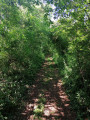
(S/E) Head towards the junction and turn left onto the path (green tunnel). You’ll be following a section of the Chemin de la Reine.

(1) At the exit of the ‘tunnel de verdure’, after 25 m, turn right onto theGR®5(Tranchée de l’Étoile).

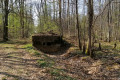
(2) After about 150 m, before the bunker, leave theGR®5and take the path on your left.

(3) At the end of this path, at the Fork in the road, turn right and follow theGR®5again for about 100 metres.

(4) At the fork in the road, continue to follow theGR®5by turning left. At the end of the path, you’ll reach a Fork in the road at Source Vassieux.

(5) Turn left onto the Route Forestière de Merlinsol, leaving the GR®.

(6) After 1 km, you’ll emerge from the forest. Take the path marked in yellow (via Randomoselle) to the left, where you’ll be in open country for 150 m. Please note that this section isn’t shown on IGN maps, but simply follow the markings. At the end of this path, you’ll come back to the Fork in the road you passed on the way there.

(3) Turn right, staying on theGR®5and continuing straight on. You’ll reach a crossroads at the Croix de l’Homme.

(7) Turn right onto theGR®5.

(2) Continue along the path you took on the way out, in the opposite direction, until you reach the starting point (S/E).


Waypoints

  1. S/E : mi 0 - alt. 994 ft - First wind turbine
  2. 1 : mi 0.75 - alt. 833 ft - Junction
  3. 2 : mi 1.09 - alt. 1,007 ft - Junction of the short circular loop
  4. 3 : mi 1.54 - alt. 1,010 ft - Crossroads of the Grand Boucle
  5. 4 : mi 1.61 - alt. 1,007 ft - T-junction – GR5
  6. 5 : mi 2.04 - alt. 958 ft - Vassieux Spring
  7. 6 : mi 2.95 - alt. 741 ft - Path starts on the left
  8. 7 : mi 4.34 - alt. 1,017 ft - Croix de l’Homme
  9. S/E : mi 5.62 - alt. 994 ft - First wind turbine

Worth a visit

(5) Vassieux Spring
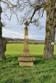
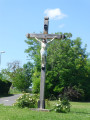
(7) Croix de l’Homme
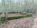
Bois Pétard

Always be cautious and plan ahead when you're outdoors. Visorando and the author of this route cannot be held responsible for any accidents occurring on this route.

The GR® and PR® markings are the intellectual property of the Fédération Française de Randonnée Pédestre.

Reviews and comments

3.8 / 5
Based on 2 reviews

Reliability of the description
3.5 / 5
Ease of following the route
4 / 5
Route interest
4 / 5
fanfan
fanfan

Hello
We took a chance on this route and it turned out badly for us.
It wasn't the fault of the route planner, but we were victims of excessive water.
The descent under the green tunnel was very difficult, and we almost stopped there, but we continued.
We had a bit of a respite at the tunnel exit, but when we reached point 1, the state of the path made us hesitate again.
However, we continued on a broken and very slippery path where it was impossible to walk properly.
We ignored point 2 and pushed straight on to point 7, where we lost our nerve and continued straight on to the small tarmac road that allowed us to reach the wind turbine safely (after carefully cleaning our shoes) and thus avoid returning through the green tunnel!
It will be quite some time before these paths dry out.
As for the car park, we couldn't find a place to park at your return point, so we parked at the foot of the wind turbine. I think you need to be a little more specific about this, as the roads are bumpy and difficult to drive on.

Thank you to the author of this route and see you soon when the weather is dry.

Machine-translated

User 25289441
• Edited:

Overall rating : 3.5 / 5

Date of your route : Jun 22, 2025
Reliability of the description : ★★★☆☆ Average
Ease of following the route : Not used / Not applicable
Route interest : ★★★★☆ Good
Very busy route : No

Hello.
I'm disappointed...
One thing's for sure, I was sheltered from the sun. From the heat too, but during a heatwave, it was still stifling.
I couldn't continue the hike because at checkpoint 5, I turned left, as explained. But apparently, I turned too far left... and got lost.
I had to turn back... and, to be on the safe side, stop the hike.
I find that the GR5 markings are not clear enough.
I might try again another time...
But I did discover three bunkers, tadpoles, frogs... a computer chair (well, what was left of it... and what was it doing there?) and, instead of signposts, beer cans and jerry cans!

Machine-translated

isa55
isa55

Overall rating : 4 / 5

Date of your route : May 01, 2022
Reliability of the description : ★★★★☆ Good
Ease of following the route : ★★★★☆ Good
Route interest : ★★★★☆ Good
Very busy route : No

I did this route on 1 May, so the forest was quite busy with people picking lily of the valley!
The directions to the starting point are spot on. Then the first section – a tunnel of greenery – was very pleasant.
I missed the start of the yellow-marked path, but that meant I got to see the remains of the German cemetery a little further on. After that, no problems. It’s a shame that, in the forest, the GR trail is ‘rutted’ in places due to heavy machinery. There were also quite a few motorbikes and quads – you can tell you’re in a suburban area. But I enjoyed my walk – thank you!

Machine-translated

Other walks in the area

For more walks, use our search engine .

The GPS track and description are the property of this route's author. Please do not copy them without permission.