Around Mesnival

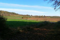
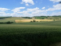
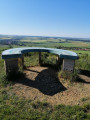
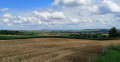
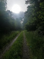
Mesnival is a charming little valley bordered by woodland. In the middle of this large clearing stands a farm. The route forms a circular route around this wonderful spot. Half the route runs along the edge of the woodland, offering views of the farm and its surroundings. On the open sections, you can enjoy stunning panoramic views towards the Moselle hillsides.

Details

n°22217880
Creation:
Last update:
Last review:
  • Walking
    Activity: Walking
  • ↔
    Distance: 6.58 mi
  • ◔
    Average duration: 3h 20 
  • ▲
    Difficulty: Moderate

  • ⚐
    Back to start: Yes
  • ↗
    Ascent: + 358 ft
  • ↘
    Descent: - 351 ft

  • ▲
    Highest point: 1,129 ft
  • ▼
    Lowest point: 817 ft
  • ⚐ Country: France
  • ⚐ City: Fonteny (57590)
  • ⚑
    Start/End: N 48.881003° / E 6.464061°
  • ❏
    IGN map(s): Ref. 3414E, 3514O
  • Hour-by-hour weather

Photos

Description of the walk

Car park in front of Fonteny Church.

(S/E) With your back to the church, walk to the crossroads and turn right onto Rue de Laneuveville. After 250 m, on leaving the village, take the path on the left and follow it straight on until you reach the woodland.

(1) Turn right to continue along the path at the edge of the forest.

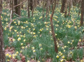
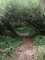
(2) After about a hundred metres, enter the forest by crossing a small ditch to reach a path through the woods (you can enter the forest at any point along this 300-metre stretch). Follow this path for about 1 km.

(3) The path widens and becomes partly gravelled. Continue for 700 metres until you reach a crossroads.

(4) Turn right and carry on until you reach a crossroads.

(5) At the Fork in the road, turn right and join a wider track. This is Chemin Frahaut.

(6) Carry on straight ahead until you reach the Route Forestière de Laneuville, almost at the foot of a wind turbine.

(7) Turn right onto the Route Forestière de Laneuville (signposted). After about 500 m, the road turns into a track and you’ll emerge from the forest. Keep going straight on.

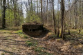
(8) On your right, you’ll find an interesting spot with a wayside cross and a fountain. For a short round trip, take the path on the right for a few metres as it leads into the forest.

(8) On your return, rejoin the route by turning onto the path on the right at the bend. Continue for about 1 km.

(9) At the fork in the road, keep to the right to continue along the edge of the forest. You’ll come out onto a tarmac road (D77). Cross the road and continue along the path opposite (slightly to the left).

(10) After 550 m, take the path on the right which leads back to Fonteny. Carry on straight ahead to return to the car park at Fonteny church (S/E).

Waypoints

  1. S/E : mi 0 - alt. 820 ft - Fonteny church car park
  2. 1 : mi 0.84 - alt. 892 ft - At the edge of the forest.
  3. 2 : mi 0.94 - alt. 902 ft - Forest path
  4. 3 : mi 1.54 - alt. 919 ft - Crossroads
  5. 4 : mi 1.99 - alt. 915 ft - Junction
  6. 5 : mi 2.34 - alt. 1,056 ft - junction
  7. 6 : mi 2.83 - alt. 1,050 ft - Chemin Frahaut
  8. 7 : mi 3.41 - alt. 1,129 ft - Laneuveville forest track
  9. 8 : mi 4.31 - alt. 1,043 ft - Calvary and fountain
  10. 9 : mi 5.04 - alt. 1,040 ft - Departmental Road 77
  11. 10 : mi 6.09 - alt. 1,004 ft - Path to Fonteny
  12. S/E : mi 6.58 - alt. 820 ft - Fonteny church car park

Notes

Watch out for tall grass on some sections of the path through the woods.

Reviews and comments

5 / 5
Based on 1 review

Reliability of the description
Not used
Ease of following the route
5 / 5
Route interest
5 / 5
lucraucy
lucraucy

Overall rating : 5 / 5

Date of your route : Feb 21, 2025
Reliability of the description : Not used / Not applicable
Ease of following the route : ★★★★★ Very good
Route interest : ★★★★★ Very good
Very busy route : No

A lovely walk, but there was a lot of mud

Machine-translated

Other walks in the area

For more walks, use our search engine .

The GPS track and description are the property of this route's author. Please do not copy them without permission.