The “Gros Max” at Hampont

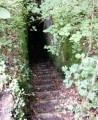
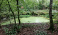
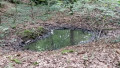
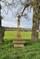
The “Gros Max” is an SK-LK/45-type gun installed by the Germans between 1916 and 1917 in the “Le Chaumont” woods, near Hampont. This site has been all but forgotten today. Finding a passable route was no easy task. The location is impressive. Please note that the surrounding area may be dangerous for children or pets. There are cavities in the vicinity caused by countless underground tunnels and other structures.

Details

12669691
Creation:
Last update:
Last review:
  • Walking
    Activity: Walking
  • ↔
    Distance: 2.30 mi
  • ◔
    Average duration: 1h 10 
  • ▲
    Difficulty: Easy

  • ⚐
    Back to start: Yes
  • ↗
    Ascent: + 121 ft
  • ↘
    Descent: - 118 ft

  • ▲
    Highest point: 840 ft
  • ▼
    Lowest point: 719 ft
  • ⚐ Country: France
  • ⚐ City: Puttigny (57170)
  • ⚑
    Start/End: N 48.83874° / E 6.55173°
  • ❏
    IGN map(s): Ref. 3514O
  • Hour-by-hour weather

Photos

Description of the walk

Starting point on the D28, near Hédival Farm, situated 2 km from Puttigny. Parking is available at the side of the stretch of road leading to the farm.

The area around the Gros Max site is dangerous and finding your way there is not always easy. Follow the instructions in this guide carefully; a GPS or the Visorando app is recommended.

(S/E) With your back to the farm, take the path directly opposite and follow it for about 1 km. At the Fork in the road, take the path on your left, at the edge of the forest.

(1) After 300 m, directly opposite a railway sleeper lying in a field, take the path on the right which leads into the forest. Keep heading south-east for about 300 m.

(2) This is the tricky bit of the route. The cannon is situated about 300 m away, almost in a straight line ahead of you, still heading south-east. At a fork in the road, take the path on your right.

(3) 30 metres further on, stay on the path to your left. Follow the track for about a hundred metres.

(4) This is where Gros Max is located.
Return to the starting point via the same route, in the opposite direction (S/E).


Waypoints

  1. S/E : mi 0 - alt. 719 ft - Hédival. Near the - Petite Seille (rivière)
  2. 1 : mi 0.9 - alt. 830 ft - Railway crossing
  3. 2 : mi 1.03 - alt. 830 ft - Fork in the road – Forest edge
  4. 3 : mi 1.04 - alt. 837 ft - Path on the left
  5. 4 : mi 1.09 - alt. 837 ft - Le Gros Max
  6. S/E : mi 2.3 - alt. 722 ft - Hédival

Notes

- The route, which is very short through the forest, is not shown on the IGN map. Please follow the path and signposts carefully.

- The area around the site is dangerous. Do not leave children unattended.

Worth a visit

Watch the video here.

Big Max

  • From 1915 to 1917, the 400 inhabitants of the village of Hampont lived alongside 180 German sailors. A presence that may seem incongruous 500 kilometres from the sea, but which is explained by the installation of an impressive piece of artillery: the ‘Big Max’. At the start of the 20th century, the major maritime powers embarked on an arms race. To catch up with Britain, Germany decided to produce 38-cm guns for its battleships. The first guns rolled off the Krupp production lines just as war broke out. The German army then required long-range guns. These guns were to be positioned along the front line to bombard French towns. Nancy was one of these targets. It was decided to install a gun at Hampont, 30 km away. First, a concrete caisson (400 m³) had to be built, and the construction work took five months. 1,000 men dug out tunnels, laid railway tracks and constructed all the structures necessary for the operation of ‘Max’. The first shells were fired at Nancy on 1 January 1916, causing widespread shock.
  • The naval gunners fired 150 of these enormous shells, causing significant material damage and killing 28 people. But the French located the gun and bombarded it in turn, silencing it for good in early 1917. A 260-tonne behemoth requiring extensive logistical support, ‘Big Max’ was only used for eighteen days, but its psychological impact was significant. Trapped within its concrete casemate, it proved to be highly vulnerable. The war demonstrated that long-range artillery has a strategic role to play… provided it is mobile.

Reviews and comments

5 / 5
Based on 1 review

Reliability of the description
5 / 5
Ease of following the route
5 / 5
Route interest
5 / 5
logedu
logedu

Thank you for your feedback!

Machine-translated

Monts&Forts
Monts&Forts

Overall rating : 5 / 5

Date of your route : Feb 21, 2024
Reliability of the description : ★★★★★ Very good
Ease of following the route : ★★★★★ Very good
Route interest : ★★★★★ Very good
Very busy route : No

Right, the explanations make it very easy to find the canon – many thanks!

Machine-translated

Other walks in the area

For more walks, use our search engine .

The GPS track and description are the property of this route's author. Please do not copy them without permission.