The Chemin de la Reine in Château-Salins

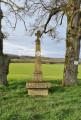
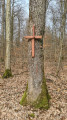
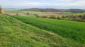
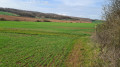
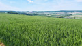
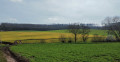
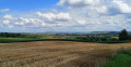
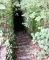
This walk around Château-Salins will offer you some superb panoramic views of the Saulnois region. Two-thirds of the route takes place in the forest. You’ll have the great honour of walking along the Chemin de la Reine, so named because it was trodden (after being restored) in 1725 by the new Queen of France, Marie Leszczynska. She was travelling with her entire entourage to join Louis XV. It’s worth noting that one section of this path is a particularly impressive tunnel of greenery.

Details

3457266
Creation:
Last update:
Last review:
  • Walking
    Activity: Walking
  • ↔
    Distance: 7.65 mi
  • ◔
    Average duration: 4h 00 
  • ▲
    Difficulty: Moderate

  • ⚐
    Back to start: Yes
  • ↗
    Ascent: + 584 ft
  • ↘
    Descent: - 581 ft

  • ▲
    Highest point: 1,001 ft
  • ▼
    Lowest point: 676 ft

Photos

Description of the walk

(S/E) Start from the car park at Place de la Saline in Château-Salins. Follow Rue de la Verrerie in the opposite direction to the town centre. You are heading towards the village of Coutures.

(1) After 500 m, turn left onto Rue du Stade. After 300 m, take the path on the right, directly opposite a small bridge over the salt stream, and continue for about 1 km.

(2) Turn right onto the track through the fields. Follow this track for about 200 m until you reach the outskirts of the village of Coutures. Then turn left onto a footpath for 300 m until you reach a Fork in the road.

(3) Then turn left onto a stony track leading up towards the ridge.

(4) When you reach a Fork in the road, turn right onto the forest track known as ‘la Marchande’. The forest track is gravelled for about 1.5 km and turns southwards.

(5) At the fork in the road, take the path on the right for 50 m until you reach the next junction.

(6) Follow the path to the right. After 20 m, take care to stay on this path as it veers to the left. Continue due south until you reach the junction with theGR®5.

(7) Take this signposted path by turning right. Walk along the edge of the forest through the undergrowth for about 800 m.

(8) Turn left as you leave the forest, cross a stream and continue along theGR®5, which leads, after 500 m, to the Chemin de la Reine.

(9) Turn right. You are now on the Chemin de la Reine. Continue due north to the Fresnes-en-Saulsnois wind farm. Towards the end, the path becomes a tunnel of greenery.

(10) At the end of the Chemin de la Reine, beneath the first wind turbine, take the tarmac road on the right towards Coutures. Just before entering the village, level with the first farm, take the path on the left and follow it straight on until you reach a crossroads.

(11) At the crossroads, carry on straight ahead along the Route de Château-Salins Coutures until you reach the crossroads from the outward journey.

(1) Follow this road straight on until you reach the Place de la Saline in Château-Salins (S/E).

.

Waypoints

  1. S/E : mi 0 - alt. 679 ft - Place de la Saline, Château-Salins
  2. 1 : mi 0.17 - alt. 679 ft - Crossroads at the end of the circular loop
  3. 2 : mi 0.99 - alt. 751 ft - Path across the fields towards Coutures
  4. 3 : mi 1.34 - alt. 833 ft - Gravel path towards the ridge
  5. 4 : mi 1.56 - alt. 945 ft - La Marchande forest track
  6. 5 : mi 2.5 - alt. 974 ft - Path on the right
  7. 6 : mi 2.6 - alt. 955 ft - Fork in the path
  8. 7 : mi 3.21 - alt. 797 ft - Junction with the GR5 long-distance walking trail
  9. 8 : mi 3.78 - alt. 741 ft - Junction, towards the - Ruisseau du Majurin (ruisseau) - Affluent de la Seille
  10. 9 : mi 4.1 - alt. 774 ft - Chemin de la Reine
  11. 10 : mi 5.39 - alt. 994 ft - Route de Coutures
  12. 11 : mi 6.93 - alt. 725 ft - Crossroads
  13. S/E : mi 7.65 - alt. 679 ft - Place de la Saline, Château-Salins

Notes

Please wear walking shoes, particularly for the section through the forest.
In wet weather, some paths outside the forest may be very slippery due to the nature of the ground.

Worth a visit

Always be cautious and plan ahead when you're outdoors. Visorando and the author of this route cannot be held responsible for any accidents occurring on this route.

The GR® and PR® markings are the intellectual property of the Fédération Française de Randonnée Pédestre.

Reviews and comments

4.2 / 5
Based on 3 reviews

Reliability of the description
4.5 / 5
Ease of following the route
4.7 / 5
Route interest
3.3 / 5
SM BISCHE
SM BISCHE

Overall rating : 4.3 / 5

Date of your route : Aug 09, 2023
Reliability of the description : ★★★★★ Very good
Ease of following the route : ★★★★★ Very good
Route interest : ★★★☆☆ Average
Very busy route : No

An easy walk (with little elevation gain); no problems with the route.
However, I wouldn’t recommend this walk in bright sunshine, as you’re very often in ‘direct sunlight’ (that wasn’t the case for us – 9 August 2023 was very cloudy.....).
Furthermore, apart from a few scenic spots and the chance to enjoy the natural surroundings, this route has little else to offer.

Machine-translated

Christecol
Christecol

Overall rating : 4 / 5

Date of your route : Mar 20, 2023
Reliability of the description : Not used / Not applicable
Ease of following the route : ★★★★★ Very good
Route interest : ★★★☆☆ Average
Very busy route : No

My first spring walk! I didn’t encounter any particular difficulties along the route, apart from a few large fallen trees blocking the paths. The forest has been badly damaged by logging in a few places. After the (9), I turned off towards the Bois de Chambrey to go and admire the Croix de l’Homme!
There were some lovely views along the route. There’s still a bit too much tarmac, though, but I realise it’s difficult to do otherwise on such a short route.

Machine-translated

Milor54
Milor54

Overall rating : 4 / 5

Date of your route : Jul 29, 2020
Reliability of the description : ★★★★☆ Good
Ease of following the route : ★★★★☆ Good
Route interest : ★★★★☆ Good
Very busy route : No

A lovely route that I had to alter as some sections were blocked. However, the author must have made a mistake, as I completed it in glorious weather, under a blazing sun, and I think the proportion of the route covered by woodland is actually around one-third (two-thirds according to the description). :jap(jap)jap:

Machine-translated

Other walks in the area

For more walks, use our search engine .

The GPS track and description are the property of this route's author. Please do not copy them without permission.