A stroll through the Amelécourt woods

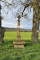
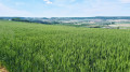
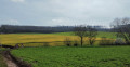
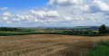
This walk presents no particular difficulty and offers superb panoramic views. It follows almost exclusively forest tracks or tarmac roads and is ideal in wet weather when the ground is muddy.

Details

n°12933067
Creation:
Last update:
Last review:
  • Walking
    Activity: Walking
  • ↔
    Distance: 6.94 mi
  • ◔
    Average duration: 3h 35 
  • ▲
    Difficulty: Moderate

  • ⚐
    Back to start: Yes
  • ↗
    Ascent: + 486 ft
  • ↘
    Descent: - 486 ft

  • ▲
    Highest point: 1,171 ft
  • ▼
    Lowest point: 679 ft

Photos

Description of the walk

Large car park at Place du Général de Gaulle in Château-Salins, very close to the sports hall.

(S/E) Walk past the sports hall on the left, turn left onto Rue Bel Air, then turn right onto the D174b towards Coutures until you reach a Fork in the road.

(1) At the fork in the road, take the small tarmac road on your right which joins the D955.

(2) Cross the road carefully and continue straight on towards Amelécourt.

(3) At the entrance to the village, turn left towards the cemetery and take the first path on your right. At the end of the path, at the Fork in the road, take the path on the right leading onto a tarmac road, which you follow to the left until the next junction.

(4) Turn right onto the Route Forestière Lavaux until you reach the Maison Forestière Lorois.

(5) Take the forest track on the right. After 300 metres, take the first track on the right, which leads onto a tarmac road; follow this until you reach the D674 main road.

(6) Cross with care and continue along the Route de Lubécourt.

(7) At the fork, turn right onto Rue Principale (D174D), leaving the village behind you. Continue to the main road, cross it and head left for 100 metres (watch out for traffic).

(8) Turn right to enter the village of Amelécourt. Then take the first street on the left (Rue de l’Église), go round the town hall and then turn left into Rue Principale to return to the cemetery.

(3) Turn left onto the road you took on the way there, continuing until you reach the D955.

(2) After crossing the departmental road with care – unlike on the way there – take the path on the left running alongside the road. At the end of this path, continue along Rue des Églantines to the right, then take the first street on the left (Rue des Aubépines).

(9) After 200 m, at the second bend in this street, take the path on the left. At the end of the path, continue straight on along Rue Bel Air and return to the car park at Place du Général de Gaulle (S/E).

Waypoints

  1. S/E : mi 0 - alt. 686 ft - Place du Général de Gaulle
  2. 1 : mi 0.57 - alt. 725 ft - Junction on a small road
  3. 2 : mi 1.1 - alt. 725 ft - D955 road
  4. 3 : mi 1.74 - alt. 728 ft - Amelécourt entrance
  5. 4 : mi 3.07 - alt. 1,161 ft - Lavaux Forest Track
  6. 5 : mi 3.68 - alt. 1,165 ft - Lorois Forest House
  7. 6 : mi 4.66 - alt. 801 ft - D674 road
  8. 7 : mi 4.88 - alt. 755 ft - D174d road
  9. 8 : mi 5.28 - alt. 705 ft - Amelécourt entrance
  10. 9 : mi 6.71 - alt. 692 ft - Château-Salins housing estate
  11. S/E : mi 6.94 - alt. 686 ft - Place du Général de Gaulle

Notes

No special equipment required. All the paths taken are very easy to walk on.

Reviews and comments

4.7 / 5
Based on 1 review

Reliability of the description
5 / 5
Ease of following the route
5 / 5
Route interest
4 / 5
logedu
logedu

Thank you for your feedback. We are currently experiencing a period where logging operations are shamelessly destroying footpaths. This is happening in several areas, which is a real shame.
I look forward to seeing you out on the trails,
Kind regards, P. Mercier

Machine-translated

patptout
patptout

Overall rating : 4.7 / 5

Date of your route : Mar 18, 2024
Reliability of the description : ★★★★★ Very good
Ease of following the route : ★★★★★ Very good
Route interest : ★★★★☆ Good
Very busy route : No

An interesting walk thanks to the lovely view from the heights of Amelécourt. On the downside, one path was impassable as it had been damaged by forestry work, so we had to walk along the side of the B-road for 300 metres before rejoining the original route. A few hundred metres through very damp terrain.

Machine-translated

Other walks in the area

For more walks, use our search engine .

The GPS track and description are the property of this route's author. Please do not copy them without permission.