Country:
 City:
City:


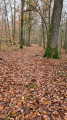
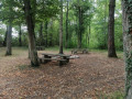
The route starts from the car park just at the entrance to the Route Forestière de la Bellevue.
(S/E) Follow the tarmac road for just under a kilometre until you reach a track on the right, which will be your return route.
(1) Continue along the forest road until you reach a wide track on the right.
(2) Follow this for 1.5 km, leaving the forest road, until you come out onto a larger, stony forest track. Turn left and continue towards the Route Forestière de l’Épine.
(3) Just before this, turn right onto a track that heads due north.
(4) Turn left onto the track between forest plots 4 and 5 (markings on the trees). After about 200 m, take the track on the right which continues to the left and carry on, leaving the forest until you pass under a power line.
(5) Turn right onto a wide path, then turn right again to make a detour, passing under a power line twice, to join a wide cross-path.
(6) Turn right onto Chemin le Pré Prêtre and follow it to the next fork after passing under the same power line.
(7) Turn left and carry on to the village of Château-Bréhain. At the junction, turn right onto the Route de Château-Salins for 200 m.
(8) Turn right at the junction onto the path and follow it for about 700 m.
(9) Turn left onto a track and follow it for 900 m through a wooded area. Please note that the tracks in this section are not shown on the map but do indeed exist. Follow the track carefully.
(10) At the Fork in the road, take the path on the right for 750 m. At the junction where several paths meet, do not go straight on but take the path on the left, which will lead you to the Route Forestière de la Bellevue.
(1) Turn left and return to the starting point (S/E).

 ).
).
 Visorando Member
 Easy
Easy