Grémecey Circular, in honour of Paul Beugnette

This route offers superb panoramic views and consists mainly of forest tracks. In the Saulnois region, the village of Grémecey is associated with the Gallo-Roman villa located in the communal forest. It was unearthed in 1960 and then reburied some thirty years later. This route pays tribute to Paul Beugnette, from Fresnes-en-Saulnois, who collected numerous artefacts. He set up a small museum which delighted many schoolchildren in the Saulnois region.

Details

28574394
Creation:
Last update:
Last review:
  • Walking
    Activity: Walking
  • ↔
    Distance: 5.92 mi
  • ◔
    Average duration: 2h 55 
  • ▲
    Difficulty: Easy

  • ⚐
    Back to start: Yes
  • ↗
    Ascent: + 262 ft
  • ↘
    Descent: - 243 ft

  • ▲
    Highest point: 971 ft
  • ▼
    Lowest point: 715 ft
  • ⚐ Country: France
  • ⚐ City: Grémecey (57170)
  • ⚑
    Start/End: N 48.800117° / E 6.406221°
  • ❏
    IGN map(s): Ref. 3414E
  • Hour-by-hour weather

Photos

Description of the walk

Car park at the foot of Grémecey Church

(S/E) Leave the Rue Principale and take the narrow lane leading down to Place Saint-Vith. This continues as the Chemin de Veau. On leaving the village, the path climbs steeply for nearly 500 m.

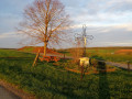
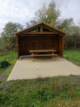
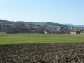
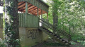
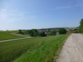
(1) At the top, turn left onto the Route Forestière de la Belle Fille. Take in the panoramic view. A small shelter has been set up 200 m further on. After 1.5 km, enter the forest.

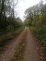
(2) Continue your walk by keeping to the left, staying on the forest track for about 900 metres.

(3) At the junction, take the path on the right (Route Forestière de Merlinsol; there is a sign). After 500 m, you will see a bench and a table, as well as a sign indicating the location of the villa.

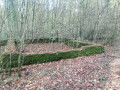
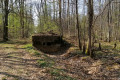
(4) Turn left and follow the path for about 150 m to see the ruins of the villa on your left. Please note that it is difficult to spot due to the vegetation.

(5) Turn back.

(4) Turn right to return to the Route forestière de la Belle Fille.

(3) Turn right and, after 600 m, you’ll come out onto the Route Forestière du Milieu. In front of you are the remains of a German military cemetery from the First World War.

(6) Turn left and continue along the forest track, which is now tarmac. After 1.5 km, you’ll reach a junction (marked by a ‘meeting point’ sign).

(7) Leave the forest road by turning left onto the road leading towards Grémecey. After 2.5 km, you’ll reach a junction by a wayside cross (with a table and bench for picnics).

(8) Continue along the road towards Grémecey to return to the church car park (S/E).

Waypoints

  1. S/E : mi 0 - alt. 787 ft - Car park at Grémecey church
  2. 1 : mi 0.51 - alt. 879 ft - La Belle Fille forest track
  3. 2 : mi 1.46 - alt. 945 ft - Enter the forest.
  4. 3 : mi 2.03 - alt. 925 ft - Merlinsol forest track
  5. 4 : mi 2.34 - alt. 961 ft - Turn left towards the villa.
  6. 5 : mi 2.44 - alt. 971 ft - Ruins of the Gallo-Roman villa.
  7. 6 : mi 3.21 - alt. 932 ft - Remains of the old German cemetery (1914–1918)
  8. 7 : mi 4.18 - alt. 883 ft - ‘Meeting point’ sign
  9. 8 : mi 5.7 - alt. 876 ft - Way of the Cross with a table and bench.
  10. S/E : mi 5.92 - alt. 787 ft - Car park at Grémecey church

Reviews and comments

4.4 / 5
Based on 3 reviews

Reliability of the description
4.7 / 5
Ease of following the route
4.7 / 5
Route interest
4 / 5
nicger
nicger

Overall rating : 4.7 / 5

Date of your route : May 13, 2026
Reliability of the description : ★★★★★ Very good
Ease of following the route : ★★★★★ Very good
Route interest : ★★★★☆ Good
Very busy route : No

A lovely little walk! We really enjoyed the ruins of the Gallo-Roman villa. The second part is a bit monotonous, but in wet weather, the forest tracks are no problem at all!

Machine-translated

Katrando
Katrando

Overall rating : 4 / 5

Date of your route : Apr 27, 2025
Reliability of the description : ★★★★☆ Good
Ease of following the route : ★★★★☆ Good
Route interest : ★★★★☆ Good
Very busy route : No

A lovely walk throughout the first half, with stunning panoramic views and lovely forest paths.
At point 3, the table and bench are completely covered in moss and unusable as they are.
We really enjoyed exploring the remains of the Gallo-Roman villa.
Between points 3 and 6: a wide path runs alongside the high-voltage power lines, and from point 6 onwards, it’s a road –
tiring in the sun. We’ll do this walk again, but turn back.

Machine-translated

Pierre GUILMIN
Pierre GUILMIN

Overall rating : 4.7 / 5

Date of your route : Dec 11, 2022
Reliability of the description : ★★★★★ Very good
Ease of following the route : ★★★★★ Very good
Route interest : ★★★★☆ Good
Very busy route : No

A leisurely walk, mostly along forest tracks, so no problems even in slightly damp weather. The ruins of the Gallo-Roman villa are well signposted (Yellow Circle from point 4), but it’s a shame they aren’t more clearly cleared of the trees and shrubs that are gradually burying them.

Machine-translated

Other walks in the area

For more walks, use our search engine .

The GPS track and description are the property of this route's author. Please do not copy them without permission.