Country:
 City:
City:


Place de la Saline in Château-Salins (next to the church).
(S/E) Walk 30 m up Rue de la Verrerie (church forecourt) and turn left onto Rue Maréchal Joffre for 20 m. Turn right onto Rue Solvay.
(1) Cross the Petite Seille and follow Avenue Napoléon1er as it continues. Go round a roundabout and carry on straight ahead (Rue des Bouleaux).
(2) At the junction, turn right onto Rue des Tilleuls (take a moment to enjoy the little path running alongside the road).
(3) At the very end of Rue des Tilleuls, turn right onto a track for 20 metres. Leave the track and turn left onto the footpath (signposted) which takes you towards the village of Salonnes.
(4) When you reach the entrance to the village, at the first fork, take the Chemin de la Haute Borne on the left. Then turn onto the footpath on the right (signposted) which will take you to the foothills of Vic-sur-Seille.
(5) At the end of the path, at the fork, turn right to join the Salonnes–Vic-sur-Seille road, which you’ll follow to the left, i.e. towards Vic-sur-Seille.
An interesting stroll through Vic-sur-Seille:
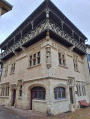
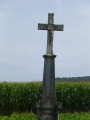
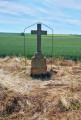
(6) When you reach a large wayside cross, turn right towards the village (Rue de Metz). Turn right at the Fork in the road (Rue Liegoise). Continue straight on. Thethird street on your left is Rue de l’Abattoir; follow it for 20 metres. Turn right onto Rue des Prisons. At the end of this street, turn left onto Place du Palais. At the end of the square, turn right towards the church and walk round it by taking the first street on the left. After completing the circuit, continue to the right (Rue Vignon).
(7) At the junction, take the second street on the left (Rue Jules Wolff). At the end of the street, turn left and then cross Place Jeanne d’Arc. Pass a car park on your right and continue along Rue Georges de La Tour. At the end, cross the bridge over the Seille.
(8) As you come off the bridge, turn right onto Rue des Petites Saline and follow it for 40 metres. Take the first street on the left (Rue de l’Hôpital) and then the first street on the right (Rue Haute).
(9) Turn left onto Rue des Hosties. Continue for about thirty metres along the path, following its course whilst ignoring a path on your right. When you reach a fork, continue along the path on the left.
(10) At the end of the path, turn left for a few metres, then turn right onto a path recently signposted by Rando Moselle (this section is not shown on IGN maps).
(11) Turn left at the fork and follow the path for 50 metres, then take the first path on the right (signposted).
(12) When you reach the D955 (caution: dangerous crossing due to traffic), walk alongside it on the right for 25 m. Then cross over to join the path on the other side, which will take you to Morville-lès-Vic.
(13) When you can see Morville, turn left at the Fork in the road.
(14) Follow Rue Principale to the right and turn into the first street on the left (Rue de l’Église).
(15) At the fork, turn right onto Grand Rue and, at the junction immediately ahead, turn left onto Rue Principale.
(16) Take thefirst left, Rue des Cachettes, and continue straight on along the track (Chemin du Haut de Phara), which will take you to Château-Salins.
(17) Turn right onto Rue de Strasbourg (watch out for traffic). After about 70 metres, take thefirst left (Rue des Tilleuls).
(2) Turn right towards the roundabout and follow the route back in the opposite direction to return to Place de la Saline (S/E).


 Visorando Member

 Easy
Easy