


Refine your search for walks in Châtel-Saint-Germain
Châtel-Saint-Germain walks


 The Pheasant Walk in Châtel-Saint-Germain
 Local authority
 4.41 mi
 +525 ft
 -495 ft
 2h 30
2h 30
 Easy
Easy
 Departure from Châtel-Saint-Germain (Moselle)
From the town hall, the walk leads to the Square du Saulcy and then to the Promenade de Montvaux, a former railway line. The botanical trail then leads to the Route de Guerre and passes through the forests of Forey and Flutôt, where there is a remarkable service tree. At the edge of the woods, a path leads back down towards the Chemin de Lorry. Passing by the Saint-Georges farm, the descent along the Chemin de Vazelle offers a view of an old lime kiln before returning to the town hall via the Rue de Lorry.
Hêtre des Batailles, starting from Châtel-Saint-Germain
 Visorando Member5.57 mi
+479 ft
-479 ft
3h 00
Easy
Departure from Châtel-Saint-Germain (Moselle)
Visorando Member5.57 mi
+479 ft
-479 ft
3h 00
Easy
Departure from Châtel-Saint-Germain (Moselle)
A circular walk starting from Châtel-Saint-Germain, taking in the ruins of the abbey, the castle ruins and the protohistoric fortification, then the Leipzig farm on the plateau, and finally the Hêtre des Batailles, a remarkable tree (over 170 years old!).
The Fox Walk in Châtel-Saint-Germain
5.21 mi
+702 ft
-873 ft
3h 00
Easy
Departure from Châtel-Saint-Germain (Moselle)
From the town hall, the route follows Rue du Ruisseau then climbs via Rue Jean d’Apremont, Rue de Cléry and Rue du Rebénot before joining Chemin des Goules and Route de Guerre. The route crosses the woods, passes near Captain Apchié’s grave, runs alongside Fort Jeanne-d’Arc and the old graves linked to the fighting of 1870. It continues towards the Moscou farm and the hamlet of Le Reposoir, then descends towards Châtel via the Square du Tagnon, Rue de Bonne-Fontaine and Ruelle de Gravelotte to return to the town hall.
The Lièvre Walk in Châtel-Saint-Germain
5.22 mi
+600 ft
-577 ft
2h 55
 Moderate
Departure from Châtel-Saint-Germain (Moselle)
Moderate
Departure from Châtel-Saint-Germain (Moselle)
From the town hall, the route follows the stream then climbs towards Rue Jean d’Apremont and the footpath linking Châtel to Rozérieulles. It joins the Route de Guerre, crosses the Bois du Reposoir and passes close to the Mont Saint-Germain site before descending towards the Montvaux valley. The return route takes you via the Pas d’Âne, then through the village and along the Chemin des Fourrières.
Route des fermes in Châtel-Saint-Germain
11.73 mi
+1,893 ft
-1,916 ft
7h 05
Moderate
Departure from Châtel-Saint-Germain (Moselle)
From the town hall, the route follows Rue de Lorry then the old railway line before joining the Botanical Trail. It then takes Route de Guerre down towards the Ruisseau de Montvaux. The path crosses the RD643 and heads back up towards Amanvillers, continuing on to the Montigny-la-Grange farm, then runs alongside the farms on the plateau and the Leipzig industrial estate. It then joins the Haie des Échevins, the Mont Saint-Germain site, and descends back towards the village via the Chemin de la Taye, the wash house and the Chemin des Fourrières, before returning to the town hall.
The 360 steps of Châtel-Saint-Germain
5.89 mi
+928 ft
-928 ft
3h 30
Moderate
Departure from Châtel-Saint-Germain (Moselle)
A walk around Châtel-Saint-Germain, exploring the remains of the fortifications surrounding the city of Metz, including the famous 360 steps of a gigantic staircase! The highlight is the archaeological site at Châtel and its sarcophagi. And, as always, the forest, with a stretch exposed to the wind on the plateau.
The ‘Hêtre des Batailles’ walk in Châtel-Saint-Germain
3.92 mi
+463 ft
-600 ft
2h 10
Easy
Departure from Châtel-Saint-Germain (Moselle)
The route forms a circular path starting from the town hall: it passes by the wash house on the Ruisseau de Montvaux, climbs towards the archaeological site of Mont Saint-Germain, crosses the Bois du Reposoir to the Moscou farm, reaches the Hêtre des Batailles, then descends back towards the village, passing a remarkable service tree and rejoining the large wash house before returning to the starting point.
The Deer Walk in Châtel-Saint-Germain
6.52 mi
+781 ft
-758 ft
3h 40
Moderate
Departure from Châtel-Saint-Germain (Moselle)
From the town hall, the route heads towards Lessy then climbs towards the Saint-Georges farm, offering a view over the Moselle valley. It continues along the edge of the woods to the Route de Guerre and the small viaduct, then follows the Ruisseau de Montvaux before crossing the RD643 and climbing the 360-step staircase. The path then passes by the Leipzig farm and the Mont Saint-Germain site before heading back down towards Châtel via the wash house, the Chemin des Fourrières and the Rue de Lorry.
Nature and heritage around Châtel-Saint-Germain
 8.47 mi
+853 ft
-850 ft
4h 40
Moderate
Departure from Châtel-Saint-Germain (Moselle)
8.47 mi
+853 ft
-850 ft
4h 40
Moderate
Departure from Châtel-Saint-Germain (Moselle)
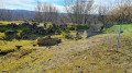
A superb walk in the woods of Châtel-Saint-Germain and Rozérieulles.
Walk through the enchanting ruins on the heights of Châtel, pass by the Jeanne d'Arc and François de Guise Fortified Groups built by the Germans, and admire the magnificent Hêtre des Batailles (Battle Beech) and a few graves from the 1870 war.
The Buse Walk in Châtel-Saint-Germain
6.33 mi
+1,083 ft
-1,217 ft
3h 50
Moderate
Departure from Châtel-Saint-Germain (Moselle)
From Square du Tagnon, the route climbs towards the historic site of Mont Saint-Germain, then joins the Haie des Échevins and the Fort de Guise military road. After passing through Montvaux, the route follows the Route de Guerre through the forests of Forey and Flutôt, then descends along the edge of the woods towards Châtel. The final stretch takes you past the railway line, the Chemin des Fourrières and Place Bompard, before following the stream back to Square du Tagnon.
The Perdrix Walk in Châtel-Saint-Germain
 4.44 mi
+472 ft
-797 ft
2h 25
Easy
Departure from Châtel-Saint-Germain (Moselle)
4.44 mi
+472 ft
-797 ft
2h 25
Easy
Departure from Châtel-Saint-Germain (Moselle)
From the Square du Tagnon, the route climbs towards the schools then joins the Route de Guerre and the ancient Roman road, formerly known as the Chaussée de France. It passes close to Fort Jeanne-d’Arc, skirts the site, then offers an unobstructed view of Metz before crossing the Bois du Reposoir. The descent is via the Chemin de Gravelotte, where you can see a remarkable service tree. The return route follows Rue de Cléry and Rue de Bonne-Fontaine back to the starting point.
Orchid walk in Châtel-Saint-Germain
5.36 mi
+994 ft
-1,119 ft
3h 20
Moderate
Departure from Châtel-Saint-Germain (Moselle)
From Square du Tagnon, the route climbs towards the historic site of Mont Saint-Germain, then joins the Route de Guerre and the Route de Vernéville. It passes through the Bois des Bannaires, goes past the 1870 monument and the Ferme Saint-Hubert, then continues towards the Ferme de Moscou and the Hêtre des Batailles. The descent towards Châtel follows the Chemin de Gravelotte, before returning to Square du Tagnon via Rue Bonne-Fontaine.
The battle beech tree
 7.56 mi
+581 ft
-568 ft
4h 00
Easy
Departure from Rozérieulles (Moselle)
7.56 mi
+581 ft
-568 ft
4h 00
Easy
Departure from Rozérieulles (Moselle)
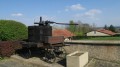
A walk with varied landscapes. A gentle route through forest, grassland and cultivated areas. This route is strongly imbued with a former military presence.
The Battle Beech (1870)
 6.19 mi
+479 ft
-479 ft
3h 15
Moderate
Departure from Rozérieulles (Moselle)
6.19 mi
+479 ft
-479 ft
3h 15
Moderate
Departure from Rozérieulles (Moselle)
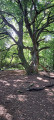
Head up through the woodland along the Route de Guerre to the battlefields of 1870, then walk round the Moscou farm to see the ‘Hêtre des Batailles’ (Battle Beech), which is around 200 years old and has naturally propagated by layering. Head back down via the Route du Fort Jeanne d’Arc.
Mont Saint-Quentin - The little loop
 5.88 mi
+499 ft
-502 ft
3h 10
Easy
Departure from Scy-Chazelles (Moselle)
5.88 mi
+499 ft
-502 ft
3h 10
Easy
Departure from Scy-Chazelles (Moselle)
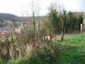
Enjoy a breath of fresh air on the heights of Mont Saint-Quentin, starting from the Col de Lessy. Cross the plateau to the Saint-Georges farm, then Vazelle, and return via Lessy
Mont Saint-Quentin - The big loop
 10.27 mi
+1,106 ft
-1,109 ft
5h 40
Moderate
Departure from Scy-Chazelles (Moselle)
10.27 mi
+1,106 ft
-1,109 ft
5h 40
Moderate
Departure from Scy-Chazelles (Moselle)
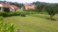
Loop around Mont Saint-Quentin, starting from Col de Lessy, through the villages of Lorry and Vigneules, via Ferme Saint-Maurice, Notre-Dame du Gros Chêne and Châtel-Saint-Germain.
Nature and heritage around Mont Saint-Quentin
 4.26 mi
+486 ft
-489 ft
2h 25
Easy
Departure from Plappeville (Moselle)
4.26 mi
+486 ft
-489 ft
2h 25
Easy
Departure from Plappeville (Moselle)
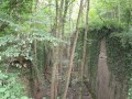
A short historical and wooded walk on Mont Saint-Quentin.
 Vaux - Les Sept Nains (fortifications)
 7.43 mi
+463 ft
-459 ft
2 hrs
Moderate
Departure from Vaux (Moselle) (Moselle)
7.43 mi
+463 ft
-459 ft
2 hrs
Moderate
Departure from Vaux (Moselle) (Moselle)
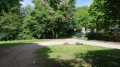
A mountain bike ride between Vaux and Gravelotte through an area fortified by the Germans between 1912 and 1916 to protect Metz. Remember that at that time (from 1870 until 1918), Alsace and Moselle were part of the German Empire.
Sainte-Brigide Church and the Lovers’ Path
3.72 mi
+397 ft
-410 ft
2h 05
Easy
Departure from Plappeville (Moselle)
A short walk of one hour and thirty minutes, accessible to all and suitable for all seasons. It will take you on a tour of part of the village of Plappeville, its church (dating from the 11th to the 15th century) and some of its most beautiful narrow streets.
 From Lorry-lès-Metz to the Vieille Hage farm (Tintigny – Belgium)
58.52 mi
+3,251 ft
-2,963 ft
8 hrs
 Difficult
Departure from Lorry-lès-Metz (Moselle)
Difficult
Departure from Lorry-lès-Metz (Moselle)
For this first stage, the route seems very direct but stays well away from the main roads. It follows country lanes, tracks reserved for farm machinery, forest paths and cycle paths!
Metz–Chassepierre circular cycle tour (+ return train journey from Pétange)
123.85 mi
+5,968 ft
-5,820 ft
3 days
Difficult
Departure from Lorry-lès-Metz (Moselle)
The village of Chassepierre is a little paradise on the banks of the Semois, very close to the French and Luxembourg borders, just 120 km from Metz.Our route takes place over 3 or 4 days: one and a half days to reach Chassepierre, half a day or one and a half days there to enjoy the surroundings, and one day for the return journey, part of which is by train. It is also possible, as the author of this route did, to attend the performances at the street arts festival, which takes place in the afternoons and evenings on the Saturday and Sunday following 15 August.
The first long stage (over 90 km) takes us beyond the Chiers and the Ton via a very direct route through France. The following morning, it’s just a 30-km cycle, plus an optional visit to Orval Abbey. The return journey to Metz follows the Semois upstream before heading into Luxembourg to catch the train.
Lorraine, Gaume and Guttland Route (Metz – Chassepierre – Luxembourg)
248.55 mi
+8,120 ft
-8,127 ft
5 days
Difficult
Departure from Lorry-lès-Metz (Moselle)
Two borders, three countries, several castles, a river and winding streams punctuate this short cycling trip. The route often follows valleys, so the elevation gain is not very significant. It almost always runs along dedicated routes, including smooth cycle paths, footpaths or shared roads with very little motor traffic. If all the cultural attractions appeal to you, you’ll need to allow an extra day or two, which is possible by camping, for example, in Inor (Meuse) and Hesperange (Luxembourg).
From the Metz conurbation (Lorry-lès-Metz) to Moirey (Ferme du Vallon)
53.94 mi
+1,706 ft
-1,745 ft
8 hrs
Difficult
Departure from Lorry-lès-Metz (Moselle)
This first stage of the route takes us into the Meuse department via footpaths, tracks reserved for farm machinery or small country lanes. The detour into Meurthe-et-Moselle offers the chance to visit several castles. There are several spots along the route ideal for a picnic, including the Étang d’Amel within a nature reserve, provided you set off early to reach it before lunchtime.
From the north of the Metz conurbation (Lorry-lès-Metz) to Hagondange station
11.10 mi
+394 ft
-669 ft
1.5 hrs
Easy
Departure from Lorry-lès-Metz (Moselle)
On the first day, you’ll need to cycle to the nearest or most suitable station to catch the train to Bettembourg. In this guide, we’ve chosen Hagondange station for the reasons explained in the practical information section. It’s easy to adapt this section to suit your starting point, choosing another station on the line between Nancy and Luxembourg.
From the Messine conurbation to Toul station
49.83 mi
+676 ft
-758 ft
8 hrs
Difficult
Departure from Lorry-lès-Metz (Moselle)
The V50 cycle route (Luxembourg - Lyon) crosses the Messine conurbation, running alongside the Moselle from La Maxe to Augny. Like the author, who set off from Lorry-lès-Metz, it is easy to join the route and follow it to Blénod-lès-Pont-à-Mousson, between ponds and wetlands, riding mostly on dedicated cycle paths. Then you cross "Little Lorraine Switzerland" on quiet roads to rejoin the Moselle at Liverdun, nestled in one of its beautiful meanders. Following the river along the V533 greenway, you soon come into view of Toul Cathedral, the first stop on the journey.
Destination Chassepierre: return journey by bike and train
168.45 mi
+6,309 ft
-6,309 ft
3 days
Difficult
Departure from Lorry-lès-Metz (Moselle)
To reach the village of Chassepierre, a little paradise on the banks of the Semois, here is a three-day itinerary. By using the train for part of the journey, both there and back, you can enjoy paths free from motor traffic and even visit several remarkable places in Belgium and France.
The banks of the Moselle in Montigny-lès-Metz
6.64 mi
+23 ft
-23 ft
30 mins
Easy
Departure from Montigny-lès-Metz (Moselle)
Along the banks of the Moselle, starting from Montigny-lès-Metz.
Route de Saulny Bas in Saulny
2.58 mi
+164 ft
-164 ft
1h 20
Easy
Departure from Saulny (Moselle)
This easy route takes you through the streets and alleys of the village, allowing you to enjoy a pleasant, effortless walk with dry feet and get to know this village near Metz better.
Fort de Plappeville
6.82 mi
+682 ft
-679 ft
3h 45
Moderate
Departure from Saulny (Moselle)
Starting from Saulny, cross through Lorry-lès-Metz, walk around Fort de Plappeville, a fortified structure dating from the 1870 war, and return via the limestone plateau and the Bois des Prussiens.
Route panoramique de Saulny
 6.20 mi
+804 ft
-791 ft
3h 35
Easy
Departure from Saulny (Moselle)
6.20 mi
+804 ft
-791 ft
3h 35
Easy
Departure from Saulny (Moselle)
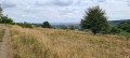
A fairly easy circular route which, starting from the village of Saulny, takes you up onto the limestone plateau, offering a panoramic view – in good weather – of the village of Lorry-lès-Metz and the city of Metz. This panoramic view also takes in Saint-Étienne Cathedral and the Centre Pompidou (museum) with its white sail. A walk through the limestone grasslands and the surrounding woods.
Route de Vigneulles à Saulny
2.92 mi
+243 ft
-236 ft
1h 35
Easy
Departure from Saulny (Moselle)
This circular route, through the paths and lanes of the village of Saulny, will give you a better understanding of this village, situated 7 km west of the city of Metz. A varied route through woods, farmland and urban streets.
Saulny Village route
2.42 mi
+207 ft
-200 ft
1h 20
Easy
Departure from Saulny (Moselle)
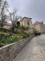
An easy route starting from the village centre, allowing you to see different aspects of this village of 1,500 inhabitants located about 10 km west of the city of Metz. Through narrow streets and paths, you can enjoy an unobstructed view of Saint-Brice Church, cross a market garden area and then walk along the Saulny Stream.
Around Saulny, Plesnois and Norroy-le-Veneur
 6.91 mi
+902 ft
-876 ft
4h 00
Moderate
Departure from Saulny (Moselle)
6.91 mi
+902 ft
-876 ft
4h 00
Moderate
Departure from Saulny (Moselle)
Ten kilometres from Metz, enjoy this walk along the banks of the Moselle through woods, orchards and vineyards.
On the hills above Ancy in Ars-sur-Moselle
4.95 mi
+577 ft
-577 ft
2h 45
Easy
Departure from Ars-sur-Moselle (Moselle)
The walk takes you mainly through woodland and orchards.
More walks in Châtel-Saint-Germain
Select a point of interest below: