Country:
 City:
City:





Park in the car park at the Saulny community centre.
(S/E) Turn left as you leave the car park, then, after 100 m, turn right up the steps next to the electricity substation. Follow a path along the fence of the EGO car park and join Rue de Vigneulles.
(1) Turn right and continue straight on along Rue de Mallemat to reach Chemin du Moulin, which runs alongside the municipal park on the right.
(2) Just before the old mill, turn left onto Chemin de la Grande Tuilerie and head straight up for about 300 m. As you come out of the woods, turn right onto a grassy path between two fields.
(3) At the entrance to the Bois de Vigneulles, turn right and follow the wide dirt track through the woods for 1.2 km. Pass two paths on the left and another on the right.
(4) Take a path on the right leading downhill to join the Chemin des Douars military road. Continue straight on along the Sentier des Gloriottes, crossing the Ruisseau de Saulny over a small stone bridge: the pond is on the left. After a 200-metre climb up a narrow path, you’ll emerge onto a stony track, the Chemin du Bois de la Chapelle.
(5) Turn left and follow this track. Pass a house on the left and some tennis courts on the right, and carry on straight ahead, passing two chalets on the right. You’ll come to a gate.
(6) Keep to the right, then continue straight on along the gently ascending track until you reach a T-junction shaped like an inverted Y.
(7) Take the sharp right-hand bend onto the stony, uphill track.
(8) Turn right onto the dirt track which, after 600 metres in a straight line, leads to a junction.
(9) Turn left onto a small dirt track and join the RD57.
(10) Cross this road with extreme caution and immediately turn right onto the Chemin de la Côte. Go through a gate and continue for about 400 m.
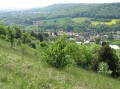
(11) Continue straight on along a grassy path that crosses the limestone grasslands, offering panoramic views. At the old football pitch, turn left and carry on to the junction with the Chemin de Moremont.
(12) Turn right onto this stony track which, after a long descent (barrier), leads to the entrance to the village of Saulny, on Rue de Plesnois.
(13) Cross this street, passing a wayside cross on your left. Go through a barrier and continue straight on along Chemin des Grands Journaux. Pass a telecoms mast on your left and, following a wire fence, you’ll reach the hamlet known as La Verrerie.
(14) Turn right and take the path, which is first stony and then tarmac-surfaced, downhill (Chemin de la Gentière). Pass through a barrier, leave the entrance to the housing estate via Rue Côte Vuillemin on your left, then turn left into Rue Saint-Clément.
(15) At the bend, turn right into Passage de Lambanie (a gravel lane) to reach Impasse Brunehaut. Turn left, continue on the left along Rue d’Austrasie, then turn right onto Rue de Lambanie to reach the roundabout on Rue de Metz (D7). Cross at the pedestrian crossing and return to the car park of the multi-purpose hall (S/E).


 Visorando Member
 Moderate