


 Country:
 City:
City:


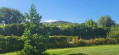
Head to the Parc de l’Archyre on Rue de la Passerine in Scy-Chazelles, via the Voie de la Liberté 1944.
Parking spaces are available nearby.
You can also get there by public transport using LE MET, LIANE L5 line, getting off at Scy-Bas or Scy-Chazelle.
(S/E) Walk through Parc de l’Archyre facing Mont Saint-Quentin, then take the Chemin de l’Archyre opposite.
(1) Cross the Esplanade de Scy-Chazelles with the town hall on your left and Saint-Rémi Church on your right; take a moment to admire the magnificent view over Metz (the cathedral, Stade Saint-Symphorien, the Centre Pompidou, etc.), then take the Chemin de la Frécotte as far as the Croix du Gibet. Leave this on your right and turn left onto the Chemin Croix de Rose.
(2) At the junction shortly afterwards, continue left along the Chemin Croix de Rose (a former military road) to the Crête du Saint-Quentin. Admire the beautiful panoramic view over the Moselle valley and the villages of Châtel, Lessy and Sainte-Ruffine.
(3) Take the path on the left which descends towards Scy-Chazelles, running alongside the vineyards.
(4) Turn left before reaching the road and continue along the path to Rue du Saint-Quentin.
(5) Walk down this street to the right until you reach the fountain on your left. Continue down the Chemin de Ronde.
(6) Turn right onto the Chemin des Noques, then left onto the path lined with gardens, until you reach a road. Follow the road to the right.
(7) Cross the Place de la Liberté, with the Robert Schuman House on your left, then turn right onto the Chemin du Corchu, veer left onto the Allée Saint-Rémi, then follow the Route de Lessy to the right until you reach the Gilbrin Chapel.
(8) Continue along the road to the left (Chemin des Brayes), then enter the forest and climb until you reach the plateau.
(9) Take the path on the left into the forest, which runs alongside the plateau on your right. You’ll come to a junction with the Chemin de la Croix de Bois. Turn left towards the Col de Lessy.
(10) Once past the arboretum, turn right alongside a military structure, then head uphill following the railway tracks. Pass through a tunnel and you’ll arrive at Fort Girardin, which will be on your right.
(11) Continue along this path to the radio tower.
(12) Walk round the tower, then, at the bend, go down the stairs on the right and carry on straight ahead to the Bismarck Tower.
(13) Turn round and retrace your steps (this time it’s quite a climb!) then, about 100 metres before the radio tower, take the path on the left which joins the tourist route.
(14) Follow it to the right.
(15) Once you reach the top of this road, head up the path on the right to find yourself between the fort’s trench and the tourist route. Continue along this path, admiring the beautiful panoramic views of the city of Metz and the Moselle valley on your left, until you rejoin the Chemin Croix de Rose, which you took on the way there.
(2) Walk down to the Croix du Gibet on the tourist road, then head back down via the same route as on the way there, but in the opposite direction, to the Parc de l’Archyre (S/E). Do feel free to stop and visit the Church of Saint-Rémi on the esplanade.


 Visorando Member

 Easy
Easy 
 Local authority
