


Refine your search for walks in Castelnau-de-Guers
Castelnau-de-Guers walks
 A stroll through the historic centre of Pézenas
 Visorando Member

 2.23 mi
 +49 ft
 -49 ft
 1h 05
 Easy
 Departure from Pézenas (Hérault)
Pézenas, with its historic centre, is well worth a visit – a short 3.5 km stroll that will allow you to wander and discover some magnificent spots. Molière’s town, with its picturesque alleyways and splendid architecture, will take you away on a dreamlike journey. Then there are its many museums, shops and restaurants – everything you need for a pleasant afternoon.
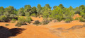
The Bois de Saint-Martin, the Étendoir des Fées and the Plateau des Paredaus
 9.41 mi
+443 ft
-449 ft
4h 45
Easy
Departure from Aumes (Hérault)
Vineyards, woodland, heathland and panoramic views punctuate this route. A beautiful walk to enjoy in spring when nature comes to life, or in autumn when it is ablaze with seasonal colours. Unfortunately, the severe wildfires of 2025 and 2026 destroyed large swathes of the flora and fauna. Nevertheless, the walk remains very enjoyable.
Around Tourbes
5.92 mi
+420 ft
-417 ft
3h 05
Easy
Departure from Tourbes (Hérault)
This circular route around Tourbes is not particularly difficult and offers varied landscapes, mostly in the undergrowth. Take care when crossing the D39. The entire hike is marked in yellow. The beautiful village of Tourbes is well worth a visit.
The Mademoiselle Florensac walk
 7.18 mi
+318 ft
-315 ft
3h 35
 Moderate
Departure from Florensac (Hérault)
An easy walk with beautiful views. Along the way, you can discover the fauna, flora and landscapes of the Florensac hinterland.
 Château de Laurens, Agde au départ de Montblanc
21.24 mi
+203 ft
-213 ft
2.5 hrs
Easy
Departure from Hérault
Itinéraire empruntant la nouvelle piste cyclable avec un retour par la rive droite de l'Hérault.
The Balconies of Alignan-du-Vent
7.33 mi
+374 ft
-384 ft
3h 40
Moderate
Departure from Alignan-du-Vent (Hérault)
"Lo qu'o bist Alignan-del-ben, toudo la bido sen souben", which means in Occitan "whoever has seen Alignan-du-Vent remembers it all their life". This route winds through the heart of the Alignan-du-Vent vineyards, passing through vineyards and among the vines. From Le Travers, you’ll enjoy a magnificent view of the valley and the wine-growing villages.
Travers viewpoint and fitness trail starting from Alignan-du-Vent
2.63 mi
+43 ft
-46 ft
1h 15
Easy
Departure from Alignan-du-Vent (Hérault)
Discover a superb panoramic view from the spot known as “Le Travers”.
Take the opportunity to get some exercise on the fitness trail.
Route from the Peyreficade menhir to Caux
 5.61 mi
+276 ft
-256 ft
2h 50
Moderate
Departure from Caux (Hérault)
Route on the Baumes volcano flow to see the Peyreficade menhir, without any particular difficulty.
Banastes route in Margon
 7.52 mi
+285 ft
-302 ft
3h 40
Moderate
Departure from Margon (Hérault) (Hérault)
An easy circular route around Margon, with several views of the beautiful 17th-century château. Pleasant in winter to enjoy an unobstructed view of the vineyard. This circular route includes many tarmac roads.
The entire route is marked in blue.
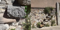
Vineyards and volcanoes of Fontès
 6.79 mi
+1,109 ft
-1,109 ft
4h 05
Moderate
Departure from Fontès (Hérault)
Part of the route takes you through vineyards and over the Céressou and Baumes volcanoes surrounding Fontès, offering views of the sea.
The Map of Ceressou in Fontès
3.83 mi
+551 ft
-535 ft
2h 15
Easy
Departure from Fontès (Hérault)
A modified version of aPR® of the same name with an easier start for parking and a crossing of the River Boyne via the bridge on the D174. ThePR® ford before Ceressou is very often impassable. Otherwise, the rest of the route is identical.
Le Plan du Ceressou is an ancient volcano. Curiously, its name has changed in recent years from Ceressou to Celessou on IGN maps.
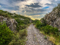
The Aven du Trou du Duc
 3.00 mi
+302 ft
-295 ft
1h 40
Easy
Departure from Saint-Pargoire (Hérault)
This is an easy hike that allows you to discover an old railway line and its tunnel, as well as a geological curiosity, while enjoying the natural heritage of the Hérault hinterland.
Moderator's warning: Please note that reviews of this hike indicate that a GPS or the Visorando app is useful
 From Mèze to Balaruc via the Crique de l’Angle
12.70 mi
+3 ft
-0 ft
4 hrs
Moderate
Departure from Mèze (Hérault)
A superb kayaking trip along the north-eastern part of the Thau lagoon between Mèze, Bouziques and Balaruc, taking in the oyster farms, the Crique de l’Angle, the River La Vène and the La Vise resurgence.
From the Canal du Midi to the mouth of the Hérault
7.93 mi
+13 ft
-13 ft
3h 40
Easy
Departure from Agde (Hérault)
A walk beneath the plane trees, amongst beaches, vineyards and locks, from the Canal du Midi to the Canal de l’Hérault. Explore La Tamarissière, where nature, oyster farming and culture come together – come and discover Agde, its historic monuments and its history.
The banks of the Hérault, from Agde to Grau d'Agde
 Local authority6.98 mi
+10 ft
-10 ft
3h 15
Moderate
Departure from Agde (Hérault)
It is along the banks of the Hérault, which rises in Mont Aigoual in the heart of the Cévennes, that the charm works its magic.. The murmur of the river, the contrasting colours of the river, the sky and the flamboyant Château Laurens, the Cathedral of Saint-Étienne built from lava stones from the ancient volcano of Mont Saint-Loup, the charm of the boats sailing on the river... nothing will leave you indifferent.You are here in Agde, "Agathé Tyché" or "Good Fortune". This ancient Greek city, founded in the 5th century BC and a thriving commercial port until the 18th century, will surprise you with its unusual houses built from black volcanic stone. To discover Le Grau d'Agde, a pretty fishing village, follow the Hérault river, which ends its course by joining the "beautiful blue sea" of the Mediterranean.
Circular Crozes in Neffiès
9.08 mi
+1,247 ft
-1,266 ft
5h 15
Moderate
Departure from Neffiès (Hérault)
An easy hike combining open areas with views of the Pyrenees and wooded areas.
Along the route, you will see a coal mine shaft and the ruins of Tibéret, behind which is a multi-level mill powered by gravity from a water basin (now abandoned).
Discover Agde walk
2.20 mi
+72 ft
-72 ft
1h 05
Easy
Departure from Agde (Hérault)
A walk to explore this small town on the banks of the Hérault. The start of the walk is on the other side of the river and is easily accessible. It’s worth combining this visit with another fairly short walk nearby: The beach, the Hérault and the marshes at La Tamarissière.
The Aspiran volcano
 6.52 mi
+384 ft
-384 ft
3h 20
Moderate
Departure from Aspiran (Hérault)
Starting from Aspiran, the route follows dirt tracks (mostly), tarmac sections and about a hundred metres on departmental roads. Up to (7), the route follows the signposting for cycle routes 14-17. Beautiful views over the Hérault plain, Pic Saint-Loup, Mont Saint-Baudille, Mont Liausson and Pic de Vissou.
Mont Saint-Loup in Agde
 Association / Club / Walk leader
 4.13 mi
+361 ft
-341 ft
2h 15
Easy
Departure from Agde (Hérault)
An ancient volcano situated between Agde and Cap d’Agde.Stunning 360° panoramic view.A wide path lined with pine trees.
This walk may be closed depending on the fire risk level. Remember to check the map.
Lake Olivet and the Roquemale Viaduct as seen from Villeveyrac
4.41 mi
+203 ft
-203 ft
2h 10
Easy
Departure from Villeveyrac (Hérault)
A very easy walk through orchards and vineyards, passing by Lake Olivet and the Roquemale Viaduct. The route starts in the village of Villeveyrac and continues through the heath.
On the Falgairas plateau
 7.63 mi
+817 ft
-833 ft
4h 15
Moderate
Departure from Neffiès (Hérault)
Hike in the hills between Neffies, Vailhan and Les Crozes (hamlet of Cabrières). Beautiful views at the start and end of the route over the plains of Languedoc Roussillon. We were lucky that day to have a wonderful view of the Mediterranean, Canigou and the Pyrenees.
The 50 km of Agde
 30.51 mi
+453 ft
-430 ft
14h 25
 Difficult
Departure from Agde (Hérault)
This route will allow you to discover or rediscover the riches of the Agde region (historic town centre, river, beaches, marinas, cliffs, Mont Saint Martin and Mont Saint Loup, Bagnas Nature Reserve, Canal du Midi, etc.).
It is not particularly difficult, apart from the distance, and can be covered in several days (see practical information).
The dolmen and the Fossé des Yeux from Tressan
5.06 mi
+436 ft
-433 ft
2h 40
Easy
Departure from Tressan (Hérault)
This route follows the Dolmen and Fossé des Yeux hike, but starts from Tressan. It is slightly shorter and parking is easier.
Walk to Mont Saint-Loup in Cap d’Agde
 1.84 mi
+249 ft
-269 ft
1h 05
Moderate
Departure from Agde (Hérault)
Climb to the summit of Mont Saint-Loup for a breathtaking view!
La Soureille d'Izarne
 8.06 mi
+1,348 ft
-1,319 ft
4h 55
Moderate
Departure from Cabrières (Hérault) (Hérault)
The path to the top of La Soureille d'Izarne is quite steep, but the effort is rewarded with a superb view of the Pyrenees on a clear day. Walking along the ridges requires a little care, but there are no vertiginous passages. The rest of the route is easy.
Cabrières Castle and Les Pitrous
3.93 mi
+2,680 ft
-2,507 ft
4h 10
Moderate
Departure from Cabrières (Hérault) (Hérault)
A short but interesting walk to Cabrières Castle (3rd to 1st century BC), with fine views of the Pic de Vissou, the village, Mount Tibéret and the Pitrous valley. The route passes through the beautiful and renowned vineyards of the Cabrières Estabel AOC.
The Crozes drovers' roads
 9.55 mi
+1,909 ft
-1,880 ft
6h 05
Moderate
Departure from Cabrières (Hérault) (Hérault)
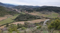
During this hike, you can discover the remains of the old village of Cabrières at the foot of the castle, the hamlet of Les Crozes, the Tiberet mills and the old paths, known as "drovers' roads" in Occitan.
The Vissou ridges and the Estabel terrace
 7.04 mi
+1,529 ft
-1,519 ft
4h 35
Moderate
Departure from Cabrières (Hérault) (Hérault)
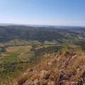
This trail winds through the heart of a listed site, rich in natural, geological and scenic discoveries. Leaving the village, the trail winds through the vineyards, climbs through the fragrant heath and reaches the impressive cliffs of the Pic de Vissou. This pleasant route offers many geological curiosities and, in particular, an amazing view of the Estabel terrace. In the background, the silhouette of Vissou serves as a landmark during this walk full of surprises.
This hike may be closed depending on the fire risk level. Be sure to check the map.
The seven peaks of Gabian, set amidst wild heath and historic heritage
12.50 mi
+1,821 ft
-1,808 ft
7h 20
Difficult
Departure from Gabian (Hérault)
A challenging circular walk in the heart of the Hérault, the Resclauze de Gabian walk alternates between heath, woodland, ridges, steep sections and more technical stretches. It offers beautiful views over the hills, vineyards and villages of the area. The route also passes through an area of remarkable heritage: the Font de l’Oli, a former natural oil spring, whose oil was extracted as early as the 17th century for medicinal use; the Château-Abbaye de Cassan, a former priory founded in the 11th century, with its 12th-century Romanesque church and 18th-century castle; as well as the Church of Saint-Julien-et-Sainte-Basilisse in Gabian, of medieval origin and remodelled in the 16th and 19th centuries. This long and varied hike is classified as difficult: some sections are steep, technical or slightly exposed, with a rope sometimes provided as a handrail. A GPX track is strongly recommended.
Around Gabian
5.49 mi
+719 ft
-738 ft
3h 10
Moderate
Departure from Gabian (Hérault)
Starting from Gabian, this 8 km hike takes you through the Hérault heath, amongst small hills, streams and the banks of the Thongue. An easy to moderate route, perfect for discovering an authentic, wild and peaceful corner of nature.
The beach, the Hérault and the marshes at La Tamarissière
5.32 mi
+13 ft
-13 ft
2h 30
Easy
Departure from Agde (Hérault)
A circular route to explore the (channelled) Hérault estuary, the marshes and polders with their canals, the beach and the Tamarissière bunker site. Best avoided in hot weather as there is no shade along the route.
Walk to Tamarissière Beach
1.76 mi
+10 ft
-10 ft
0h 50
Easy
Departure from Agde (Hérault)
Explore the Tamarissière area along the beach and the River Hérault!
A few pockets of nature in Cap d'Agde
6.52 mi
+427 ft
-430 ft
3h 20
Easy
Departure from Agde (Hérault)
A route winding through housing estates, roads, campsites, golf courses, car parks and other junctions in search of a bit of nature in this highly urbanised region. Viewpoint and orientation tables at the summit of Mont Saint-Loup.The Visorando app is recommended
Pioch Farrus mine, Church of Saint-Gély-d'Arques from Cabrières
 9.51 mi
+1,368 ft
-1,381 ft
5h 35
Moderate
Departure from Cabrières (Hérault) (Hérault)
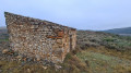
Hike with varied terrain and a beautiful view of the Pic de Vissou. The ruins of the Church of Saint-Gély d'Arques are a lovely spot for a picnic.Some sections are not marked and require the use of a GPS.
The different aspects of Cap d'Agde
 5.18 mi
+59 ft
-59 ft
2h 25
Easy
Departure from Agde (Hérault)
This walk allows you to discover the different facets of Cap d'Agde, with 95% of the route on foot (no cars). You start by walking through the pine forest before strolling along the quays. Then you come to the sea wall and cliffs before reaching the beach.
Starting from the Portiragnes lock
 7.86 mi
+13 ft
-13 ft
3h 35
Moderate
Departure from Portiragnes (Hérault)
A walk exploring the other side of the scenery, behind the beaches of Portiragnes. Along the Canal du Midi, meet the barges and discover the dedicated port on the edge of the marshes. A winter stopover for migratory birds, from the top of the small dunes, overlooking the beach. Walk along the dykes surrounded by salt marshes.
Tour of Cap d'Agde, taking in its beaches, harbours and pine forests
8.48 mi
+135 ft
-138 ft
4h 00
Moderate
Departure from Agde (Hérault)
A lovely walk to explore Cap d'Agde, with its beaches – Richelieu, Le Mole, La Roquille with its naturist campsite, the cliffs and La Pagette – its islands such as Marinas, Saint Martin etc., and via the Île des Loisirs. Its pedestrianised streets along the harbour, its magnificent harbour such as Richelieu, Malfato, etc. A walk through the pine forests with views of the international golf course.
Discover Cap d'Agde
 6.58 mi
+121 ft
-121 ft
3h 10
Moderate
Departure from Agde (Hérault)
Explore almost all of Cap d'Agde on this 10-kilometre route. You can enjoy landscapes such as the beaches of Rochelongue and Richelieu, the Palais des Congrès, the Aqualand water park, Mont Saint-Loup and the Cap d'Agde golf course.
Mont Saint-Loup, an ancient volcano
5.21 mi
+407 ft
-404 ft
2h 45
Easy
Departure from Agde (Hérault)
Set off to conquer Mont Saint-Loup! Like adventurers, discover the sumptuous panoramas and historical remains of this ancient volcano at the southern end of the Auvergne hills, 113 metres above sea level.As you pass through the fragrant pine forests, discover the different colours that stand out in these varied panoramas, like an artist's palette: the different shades of blue of the Mediterranean Sea, the green expanses of the Cap d'Agde golf course and the Bagnas reserve, the brilliance of the Étang de Thau, the black of the basalt lands and that of the Tour des Anglais. Enough to bring back wonderful memories!
Capagathoise outing, from port to beaches
4.33 mi
+26 ft
-26 ft
2h 00
Easy
Departure from Agde (Hérault)
Fancy strolling along the marina and sandy beaches? This tour is for you!During this walk, you'll have time to window shop, enjoy an ice cream, and stroll leisurely towards the Mail de Rochelongue. On foot, by bike, scooter, mini train or even a "rosalie" (four-seater bicycle), discover the unspoilt nature of this dune cordon, home to preserved flora and fauna. Enjoy the view of Richelieu and Rochelongue beaches, with the magnificent Fort Brescou standing out in the distance!
The Causse de Gely circular
 5.88 mi
+758 ft
-755 ft
3h 20
Easy
Departure from Vailhan (Hérault)
A circular loop on the left bank of the Peyne climbs along the dam's reservoir opposite Vailhan to follow the local hiking trail, which is dotted with picnic tables and offers beautiful views.
The Maraval Estate
4.76 mi
+30 ft
-30 ft
2h 15
Easy
Departure from Agde (Hérault)
Between vineyards, meadows and salt marshes, set off to explore the Bagnas Nature Reserve and the heritage of the Agde region.On foot from the Cap d'Agde Tourist Office reception area or by parking in the car park before the entrance to the naturist village, this route takes you to the Bagnas Nature Reserve, towards the former Maraval Estate with views of Mont Saint-Loup.Access to the Bagnas National Nature Reserve is regulated in order to preserve the environment and the tranquillity of the species. The reserve is managed by ADENA, an association dedicated to nature conservation and awareness, which specialises in Mediterranean coastal wetlands. As such, it invites you to discover this route, in and around the reserve, which you can explore on foot or by bike, to freely observe the natural and heritage riches of this area.
The viewpoint of the volcanic cliffs at Cap d'Agde
 4.32 mi
+43 ft
-43 ft
2h 00
Easy
Departure from Agde (Hérault)
Head to the "volcanic lands"! A complete change of scenery is guaranteed in the heart of the basalt coastline of Cap d'Agde.Discover the black sand beach of Grande Conque and the volcanic cliffs that overlook the blue and translucent waters of the Mediterranean Sea.Ready for a photo? From the breathtaking 360° view of the seafront, discover the richness of this coastline located in the heart of the Natura 2000 marine protected area. In your lens: the Mediterranean Sea, Sète, Fort Brescou, Port du Cap d'Agde, the Pyrenees mountain range, and the hinterland with the Monts de l'Espinouse, enough to make you fall in love!
Cabrières Castle and Pic de Vissou
 9.18 mi
+2,300 ft
-2,277 ft
6h 15
Moderate
Departure from Cabrières (Hérault) (Hérault)
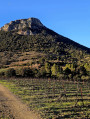
During this hike in the heart of a listed site, rich in natural, geological and scenic discoveries, you can explore the ruins of the old village of Cabrières at the foot of the castle, then climb the ridges of Vissou before ascending the peak to discover a breathtaking viewpoint.This hike follows twoPR®® trails, the “Drovers' Roads of Crozes” and then the “Pic de Vissou”. Not difficult, but still a bit of a workout.
Les Crozes - Vailhan loop via the ruins of Tibéret
 7.83 mi
+1,280 ft
-1,263 ft
4h 45
Moderate
Departure from Cabrières (Hérault) (Hérault)
A pleasant hike with remarkable views and beautiful 360° panoramas of Mont Saint-Clair and the Mediterranean, Caroux, Pic de Vissous and Mont Baudille Séranne. We were lucky enough to catch a glimpse of the Canigou massif.
Between the Canal du Midi and the vineyards, starting from Villeneuve-les-Béziers
 6.34 mi
+16 ft
-16 ft
2h 55
Moderate
Departure from Villeneuve-lès-Béziers (Hérault)
On the outskirts of Béziers, in the Villeneuve-lès-Béziers area, the vineyards stretch along the banks of the Canal du Midi. The Oenorando will take you on a journey of discovery through the landscapes and the mosaic of grape varieties, within the Pays d’Oc and Coteaux de Béziers PGI areas, which benefit from maritime influences on terroirs of rounded pebbles caressed by the local breeze.
From Villeneuves-lès-Béziers to Portiragnes via the Canal du Midi
6.13 mi
+3 ft
-13 ft
2h 50
Easy
Departure from Villeneuve-lès-Béziers (Hérault)
A short walk along the Canal du Midi and its locks, via the Voie Verte. A fairly shaded route, then a short stretch through the vineyards as you skirt around Portiragnes, following the banks of the Grande Maïre. At the end of the route, you pass through the Portiragnes Marshes and the Lac de la Grande Maïre.