Country:
 City:
City:


Set off from the town hall car park in Villeveyrac (bus stop for line 21 at the car park).
(S/E) Walk up into the village via Rue des Horts Viels (opposite the chemist’s) then along Rue des Amandiers. At the end, turn and you’ll arrive in front of the Chapelle des Pénitents Blancs.
(1) Continue left along Rue Saint-Antoine as far as the church. Turn left into Rue de l’Église, then right onto Rue du Peyrou and follow it to the left for 60 metres.
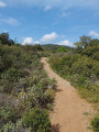
(2) Turn right and follow the Chemin de la Balloussieyre, which winds through the heath to the Croix de Canat, where two paths branch off opposite each other and rejoin further on.
(3) Continue straight ahead along the path to the Marcel Descamps Bridge.
(4) Cross this bridge over the D2 and continue along the tarmac road straight ahead.
(5) At a left-hand bend, turn right onto a wide, stony track. After 100 m, you can go round a waterhole on the right. Continue to the right until you reach a ruin.
(6) Turn right onto the wide track that runs alongside Lac de l’Olivet towards the east. A signposted path leads down to the lake from the track.
(7) Carry on to the hamlet of La Gare.
(8) In the hamlet, turn left then immediately right onto a tarmac road which continues as a track. The Roquemale Viaduct is visible on the right-hand side of the track (you can make out the railway line that was used to transport bauxite ore).
(9) At the foot of the viaduct, turn right onto a tarmac road and join the D2.
(10) Cross it carefully, then take the road opposite to return to the village via the main street.
(11) Turn right to reach the town hall car park (S/E).

 Visorando Member


 Association / Club / Walk leader
 Moderate