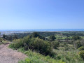
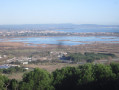
Walk to Tamarissière Beach

Explore the Tamarissière area along the beach and the River Hérault!

Details

n°68488667
Creation:
Last update:
Last review:
  • Walking
    Activity: Walking
  • ↔
    Distance: 1.76 mi
  • ◔
    Average duration: 0h 50 
  • ▲
    Difficulty: Easy

  • ⚐
    Back to start: Yes
  • ↗
    Ascent: + 10 ft
  • ↘
    Descent: - 10 ft

  • ▲
    Highest point: 13 ft
  • ▼
    Lowest point: 0 ft
  • ⚐ Country: France
  • ⚐ City: Agde (34300)
  • ⚑
    Start/End: N 43.2859° / E 3.441861°
  • ❏
    IGN map(s): Ref. 2645ET
  • Hour-by-hour weather

Description of the walk

The route starts at the Tamarissière car park.

(S/E) Walk along the car park to pass between the Second World War bunkers. Remember to walk along the beach as far as the last bunker.

(1) Go past the bunker, head up to your right and follow the stream. Pass one Fork in the road to reach a second one.

(2) Take the path on the right and follow it to Rue Commandant Malet (be sure to turn left here so as not to end up on a path that leads back towards the stream).

(3) Carry on straight ahead, then turn right at the quay running parallel to the Hérault until you reach the Quai car park.

(4) Turn right back onto the path to return to the car park where you started your walk (S/E).

Waypoints

  1. S/E : mi 0 - alt. 3 ft - Parking de la Tamarissière
  2. 1 : mi 0.44 - alt. 10 ft - Bunker
  3. 2 : mi 0.89 - alt. 3 ft - Watercourse separation
  4. 3 : mi 1.19 - alt. 3 ft - Rue Commandant Malet
  5. 4 : mi 1.56 - alt. 10 ft - Quai car park - Hérault (fleuve)
  6. S/E : mi 1.76 - alt. 3 ft - Parking de la Tamarissière

Notes

No special equipment is required (there are a few sandy sections).
If you’re planning to do this route in hot weather, make sure you bring a cap and a bottle of water.

Worth a visit

Reviews and comments

5 / 5
Based on 1 review

Reliability of the description
5 / 5
Ease of following the route
5 / 5
Route interest
5 / 5
jeanine terral
jeanine terral

Overall rating : 5 / 5

Date of your route : Mar 25, 2026
Reliability of the description : ★★★★★ Very good
Ease of following the route : ★★★★★ Very good
Route interest : ★★★★★ Very good
Very busy route : Yes

The route is clearly described but not signposted. The scenery is lovely. Not to be attempted in strong winds

Machine-translated

Other walks in the area

For more walks, use our search engine .

The GPS track and description are the property of this route's author. Please do not copy them without permission.