Country:
 City:


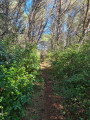
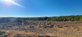
Important note: due to the numerous wildfires that affected the region in 2025 and 2026, the landscape has in some cases changed significantly along certain sections of the route, and it is not always easy to find your way. You are therefore strongly advised to check the route on the map regularly.
You can park at a place called La Grange de l’Air, at a lay-by situated at the junction of the D161 and the D161E4: space for three to four vehicles.
(S/E) With your back to the hamlet, continue for about a hundred metres along the D161, heading north-east, then turn right, heading south, onto the D161E4.
(1) Look out for the return path on the right and carry on straight ahead along the road.
(2) Take a dirt track on the left. Keep left at the junctions you come to, then veer right between a vineyard and a wooded area. Continue until you reach a crossroads.
(3) Head straight ahead onto a small footpath. You’ll come out onto a tarmac road; follow it to the right and then carry on straight ahead, ignoring any turn-offs to the right. Continue until you reach one of the entrances to the Madone vineyard on the left.
(4) Leave the tarmac road and take the path on the right into the woods towards the Château de Saint-Martin de la Garrigue. You’ll come out at a star-shaped junction. Situation as of September 2026: a fire has partially burnt this woodland near the Château de Saint-Martin de la Garrigue, so the paths may be difficult to make out.
(5) Turn right, then left, without crossing the bridge. Follow the path for a good hundred metres before turning right onto a very narrow track that descends into the Bois de Saint-Martin: there is often water just before the track starts to climb again. You’ll reach a junction once you’ve reached the highest point.
(6) Keep to the left and follow the path as it winds its way, generally heading south.
(7) Turn left again and you’ll come out onto a cross-path.
(8) Turn left and continue walking due south until you reach a crossroads.
(9) Take the path on the right, running alongside vineyard plots, and keep to the right at the next two junctions to pass between two wooded areas.
(10) Turn right once more, walk for about sixty metres, then turn left at a 90° angle to continue through the vineyards.
(11) Take the path on the right (north) to change direction completely. The path continues to alternate between wooded areas and vineyards.
(12) Turn left at a right angle, cross the beds of two streams and reach a junction at a place called Puech Redon.
(13) Head to the right.
(14) Ignore the path on the left and carry on straight ahead until you join a path marked PR® Yellow.
(15) Cross this path to head straight ahead and reach the Étendoir des Fées: take a moment to admire the panoramic view and the rocks hollowed out and eroded by the rain.
(16) Continue along the path as it descends, turn right and rejoin a PR® trail. Follow this for about 300 m.
(17) Leave the yellow markings by turning right, then turn right again towards the Plateau des Paredaus.
(18) Take a short detour to the right to see the bottle-shaped sculpture carved into the rock.
(19) Then retrace your steps back to the junction.
(18) Resume the route to the right, cross a tarmac road and continue straight ahead.
(20) Head left, then turn left again a few dozen metres further on. Pass under a power line and you’ll soon reach a junction.
(21) Turn right and rejoin the D161e4, which you took at the start.
(1) Follow it to the left to return directly to the car park at La Grange de l’Air (S/E).
 Visorando Member


 Moderate