


Refine your search for walks in Aouste-sur-Sye
Aouste-sur-Sye walks


 The Serre des Aigles in Aouste-sur-Sye
 Visorando Member
 9.39 mi
 +1,115 ft
 -1,142 ft
 5h 15
5h 15
 Average
 Departure from Aouste-sur-Sye (Drôme)
A lovely autumn hike offering numerous views of the Vercors, the peaks of the Saoû forest and the Baronnies. The route crosses rural farmland, where vineyards and fields give way to forest. There is a bit of road at the start.
 Crête de Saint-Alban
3.36 mi
+499 ft
-489 ft
45 mins
 Easy
Departure from Aouste-sur-Sye (Drôme)
Easy
Departure from Aouste-sur-Sye (Drôme)
Short mountain bike ride on the Balcons de la Drôme between Crest and Aouste-sur-Sye. Not too difficult climb and nice little descent on single track. Ideal for a short winter outing.
Perched village of Mirabel
 5.50 mi
+1,086 ft
-1,070 ft
3h 30
Easy
Departure from Mirabel-et-Blacons (Drôme)
5.50 mi
+1,086 ft
-1,070 ft
3h 30
Easy
Departure from Mirabel-et-Blacons (Drôme)
Explore the hilltop village of Mirabel, with views of Charsac Hill and the Col de l'Armurier.
Les Roches - Crestois
 Local authority
 2.79 mi
+591 ft
-591 ft
1h 50
Easy
Departure from Crest (Drôme)
2.79 mi
+591 ft
-591 ft
1h 50
Easy
Departure from Crest (Drôme)
Family walk behind the highest keep in France: you will walk along ridges and enjoy an unforgettable panorama of the Vercors mountains, the Trois Becs and the Ardèche plateau.
From the Crest ridges to the banks of the Drôme
 5.07 mi
+810 ft
-840 ft
3h 00
Easy
Departure from Crest (Drôme)
5.07 mi
+810 ft
-840 ft
3h 00
Easy
Departure from Crest (Drôme)
This discovery route is divided into three parts, with a passage along the ridges overlooking the town, offering superb panoramic views, followed by a pleasant walk along the banks of the Drôme. The circular ends with a short tourist route through the labyrinth of the old town.
The highlight of this discovery of Crest is a visit to its tower, the tallest keep in France: be sure to plan a visit.
The Crêtes de Crest
 4.00 mi
+981 ft
-958 ft
2h 40
Average
Departure from Crest (Drôme)
4.00 mi
+981 ft
-958 ft
2h 40
Average
Departure from Crest (Drôme)
A pleasant walk in the hills above Crest offering beautiful views of the southern Vercors, the peaks of the Saoû Forest, the Ardèche mountains and the Drôme valley. As a bonus, you can explore Crest and its heritage at the start and end of the walk.
Haut Divajeu
 3.38 mi
+381 ft
-407 ft
1h 55
Easy
Departure from Divajeu (Drôme)
3.38 mi
+381 ft
-407 ft
1h 55
Easy
Departure from Divajeu (Drôme)
A lovely walk starting from old Divajeu and its château, with views of Grand Veymont on one side and the Ardèche on the other. An easy, very pleasant hillside path through oak and pine trees.
Saint-Médard Chapel
 9.04 mi
+2,503 ft
-2,474 ft
6h 20
Average
Departure from Piégros-la-Clastre (Drôme)
9.04 mi
+2,503 ft
-2,474 ft
6h 20
Average
Departure from Piégros-la-Clastre (Drôme)
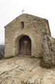
This chapel is on the ridge of the Forest of Saoû, above the ruins of an old priory. At the top of the climb from La Clastre, hikers have breathtaking views of the hanging valley of Saoû.
Tour of the Val de Charsac
 11.34 mi
+1,814 ft
-1,821 ft
6h 50
11.34 mi
+1,814 ft
-1,821 ft
6h 50
 Difficult
Departure from Mirabel-et-Blacons (Drôme)
Difficult
Departure from Mirabel-et-Blacons (Drôme)
A long walk with beautiful views, with no difficulty other than the length, on trails and paths through fairly sparse pine forests.
The Saint-Médard Chapel from Piégros
 3.68 mi
+1,663 ft
-1,660 ft
3h 10
Average
Departure from Piégros-la-Clastre (Drôme)
3.68 mi
+1,663 ft
-1,660 ft
3h 10
Average
Departure from Piégros-la-Clastre (Drôme)
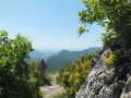
A short exploratory walk through the Saou Forest on the northern side of the syncline and through the woodland.Beautiful views during the ascent and, at the end of the descent, of Piegros Castle, the Drôme valley and the Vercors foothills. A stunning 360° panorama from the Chapel of Saint-Médard.
⚠️Between 1 July and 15 September,Prefectural Order DDT-SEF-2026-0176 of 4 June2026 concerning the temporary restriction of access to the Saou Forest and the Ambel Plateau in the event of afirerisk, assessed on a daily basis. A map is published every evening (around 5.30 pm) for the following day.
Roche Colombe
 6.10 mi
+1,332 ft
-1,332 ft
4h 00
Easy
Departure from Saou (Drôme)
6.10 mi
+1,332 ft
-1,332 ft
4h 00
Easy
Departure from Saou (Drôme)
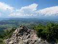
From the top of this cliff, you have a beautiful view of the Vercors, the foothills of the Ardèche, the Rhône valley and the entire Saoû forest with the Trois Becs at the other end.
Saint Pancras Cross from Suze
 3.59 mi
+873 ft
-873 ft
2h 25
Average
Departure from Suze (Drôme)
3.59 mi
+873 ft
-873 ft
2h 25
Average
Departure from Suze (Drôme)
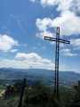
The massif is a perched syncline. This small mountain offers exceptional views of the Diois and southern Vercors regions.
On a clear day, there is a superb view of the Grand Veymont, the 3 Becs, Roche Colombe and the syncline of the Saou forest.
Chapel and viewpoint at the Croix de Saint-Pancrace.
Grand and Petit Pomerolle
 7.12 mi
+2,454 ft
-2,467 ft
5h 25
Difficult
Departure from Saou (Drôme)
7.12 mi
+2,454 ft
-2,467 ft
5h 25
Difficult
Departure from Saou (Drôme)
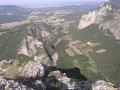
Climb up to the Grand and Petit Pomerolle from the Pas de Lestang, offering beautiful views of Saoû, its forest and its legendary three peaks.
Around Lake Eurre
 1.34 mi
+16 ft
-16 ft
0h 40
Easy
Departure from Eurre (Drôme)
1.34 mi
+16 ft
-16 ft
0h 40
Easy
Departure from Eurre (Drôme)
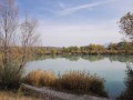
A post-lunch stroll around Lake Eurre, then into the Ramières du Val de Drôme Nature Reserve, where, depending on the season, you may spot migratory birds taking a break, or coypu and beavers.
Tour of the Ramières Reserve
 2.12 mi
+16 ft
-16 ft
1h 00
Easy
Departure from Eurre (Drôme)
2.12 mi
+16 ft
-16 ft
1h 00
Easy
Departure from Eurre (Drôme)
A walk, partly through woodland, around Lac d’Eurre and along the Drôme, followed by a visit to the reserve’s birdwatching point.
Saint-Michel - Pays de Saillans
 4.23 mi
+899 ft
-899 ft
2h 45
Average
Departure from Aubenasson (Drôme)
4.23 mi
+899 ft
-899 ft
2h 45
Average
Departure from Aubenasson (Drôme)
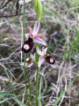
On the foothills of the perched syncline of the Saoû forest and through vineyards, forests and ridges, this route offers beautiful views of the Trois Becs.
Roche Colombe in the Saoû Forest region
5.65 mi
+1,962 ft
-1,942 ft
4h 20
Difficult
Departure from Saou (Drôme)
Roche Colombe is the stern of the great ship formed by the Saoû Forest, offering a remarkable view of the Vercors, the Drôme and the interior of the forest.
⚠️ Between 1 July and 15 September, Prefectural Order DDT-SEF-2026-0176 of 4 June 2026 concerning temporary restrictions on access to the Saoû Forest and the Ambel plateau in the event of a fire risk , assessed on a daily basis. A map is published every evening (around 5.30 pm) for the following day.
The cliffs of Roche Colombe
 5.82 mi
+1,988 ft
-1,969 ft
4h 25
Average
Departure from Saou (Drôme)
5.82 mi
+1,988 ft
-1,969 ft
4h 25
Average
Departure from Saou (Drôme)
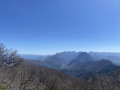
The west summit of Saou forest, which marks the beginning (or end) of this forest.
Grand tour of the Saou Forest
20.17 mi
+3,366 ft
-3,366 ft
4 hrs
Difficult
Departure from Saou (Drôme)
Head east to explore the tourist trail created by Maurice Burrus in 1930. The route passes at the foot of the Trois-Becs. To round off this walk, a descent along forest paths and tracks will make you forget the long climb.
The Saou Forest, acquired as part of the Sensitive Natural Areas policy, is the Department’s largest property. Listed as a protected site since 1942, it is managed in accordance with the principles of sustainable development, in consultation with local stakeholders.
⚠️ Between 1 July and 15 September, Prefectural Order DDT-SEF-2026-0176 of 4 June 2026 concerning the temporary restriction of access to the Saou Forest and the Ambel Plateau in the event of a fire risk, assessed on a daily basis. A map is published every evening (around 5.30 pm) for the following day.
Exploring the Saou Forest
9.15 mi
+791 ft
-787 ft
1.5 hrs
Easy
Departure from Saou (Drôme)
A discovery trail in the heart of the Saou Forest, along easy paths and tracks suitable for the whole family. In the heart of the forest, don’t miss the Auberge des Dauphins and its remarkable architecture.The Saou Forest, acquired as part of the Sensitive Natural Areas policy, is the Department’s largest property (2,500 ha). Listed as a protected site since 1942, it is now managed in accordance with the principles of sustainable development, in consultation with local stakeholders.
⚠️ Between 1 July and 15 September, Prefectural Order DDT-SEF-2026-0176 of 4 June 2026 concerning the temporary restriction of access to the Saou Forest and the Ambel Plateau in the event of a fire risk, assessed on a daily basis. A map is published every evening (around 5.30 pm) for the following day.
L'Échelette in the Saou Forest
13.55 mi
+1,745 ft
-1,742 ft
2.5 hrs
Difficult
Departure from Saou (Drôme)
A challenging route, with a short section where you’ll need to carry your bike on the climb up to the Pas de l’Échelette. Enjoy the panoramic views of Crest, the Drôme valley and the Trois Becs!
⚠️ Between 1 July and 15 September, Prefectural Order DDT-SEF-2026-0176 of 4 June 2026 concerning temporary restrictions on access to the Saoû Forest and the Ambel Plateau in the event of a fire risk, assessed on a daily basis. A map is published every evening (around 5.30 pm) for the following day.
Le Muletier in the Saou Forest
11.22 mi
+1,867 ft
-1,864 ft
2 hrs
Average
Departure from Saou (Drôme)
A route in the Saou forest, where you’ll follow the tourist trail before heading down the Sentier Muletier. Please note that this descent is technical; some stony sections require caution!
Rochecolombe in the Saou Forest
10.95 mi
+1,706 ft
-1,696 ft
2 hrs
Difficult
Departure from Saou (Drôme)
A beautiful route that will take you through the Saou Forest, then to the foot of Rochecolombe Mountain. The route follows fun and varied paths through the woods.
⚠️ Between 1 July and 15 September, Prefectural Order DDT-SEF-2026-0176 of 4 June 2026 concerning temporary restrictions on access to the Saou Forest and the Ambel Plateau in the event of a fire risk, assessed on a daily basis. A map is published every evening (around 5.30 pm) for the following day.
Between Roc and Estang - Saoû Forest
 3.32 mi
+469 ft
-456 ft
1h 55
Easy
Departure from Saou (Drôme)
3.32 mi
+469 ft
-456 ft
1h 55
Easy
Departure from Saou (Drôme)
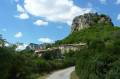
At the foot of the Aiguilles, you will pass through a wide variety of environments. Wetlands and arid areas alternate between the Vèbre and the Mediterranean slopes of the Pas de l'Estang and the Palloir.
The old farms - Forêt de Saoû
 2.45 mi
+233 ft
-233 ft
1h 20
Easy
Departure from Saou (Drôme)
2.45 mi
+233 ft
-233 ft
1h 20
Easy
Departure from Saou (Drôme)
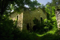
This walk will take you on a journey through the agricultural landscape of the Saoû Forest. The walk begins along the hay meadows at the foot of the forest. You will then pass close to the ruins of Raillon and Fuoc, remnants of the many farms that once stood at the foot of the forest. This walk is suitable for all-terrain pushchairs.Dogs must be kept on a lead.
⚠️ 1 July 2026: Between 1 July and 15 September,Prefectural Order DDT-SEF-2026-0176 of 4 June2026 concerning the temporary restriction of access to the Saoû Forest and the Ambel Plateau in the event of afirerisk, assessed on a daily basis. A map is published every evening (around 5.30 pm) for the following day.
In the footsteps of the mule drivers - Saoû Forest
 4.66 mi
+1,020 ft
-1,027 ft
3h 00
Average
Departure from Saou (Drôme)
4.66 mi
+1,020 ft
-1,027 ft
3h 00
Average
Departure from Saou (Drôme)
This walk takes you along various historic routes through the Saoû Forest.You can start this circular walk from the Écogardes Office, heading towards Le Chemin de la Grande Combe, then follow the directions in the text.Dogs must be kept on a lead.
⚠️ Between 1 July and 15 September, Prefectural Order DDT-SEF-2026-0176 of 4 June 2026 concerning temporary restrictions on access to the Saoû Forest and the Ambel Plateau in the event of a fire risk, assessed on a daily basis. A map is published every evening (around 5.30 pm) for the following day.
The Saint-Médard Chapel
 3.08 mi
+1,407 ft
-1,407 ft
2h 40
Difficult
Departure from Saou (Drôme)
3.08 mi
+1,407 ft
-1,407 ft
2h 40
Difficult
Departure from Saou (Drôme)
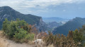
In the heart of the Diois region, the Saou Forest is home to some lovely treasures.The Saint-Médard Chapel is one of them: a viewpoint offering a unique vista of the Trois Becs. Although the path up is a bit steep, it makes for a lovely family walk.
⚠️ Between 1 July and 15 September, Prefectural Order DDT-SEF-2026-0176 of 4 June 2026 concerning temporary restrictions on access to the Saou Forest and the Ambel Plateau in the event of a fire risk, assessed on a daily basis. A map is published every evening (around 5.30 pm) for the following day.
Grand Pomerolle via Pas de Berlhe and Pas Jossaud
 9.21 mi
+2,602 ft
-2,575 ft
6h 30
Difficult
Departure from Saou (Drôme)
9.21 mi
+2,602 ft
-2,575 ft
6h 30
Difficult
Departure from Saou (Drôme)
A very beautiful walk for regular walkers which, in good weather, will allow you to discover the ridges of the Eyzahut rocks, Saint-Maurice, Mont Ventoux, the Lance massif, the Montagne d’Angèle, the Trois Becs and the Grand Delmas.
⚠️ 1 July 2026: Between 1 July and 15 September, Prefectural Order DDT-SEF-2026-0176 of 4 June 2026 concerning temporary restrictions on access to the Saoû Forest and the Ambel Plateau in the event of a fire risk , assessed on a daily basis. A map is published every evening (around 5.30 pm) for the following day.
Circular mountain bike loop in the Saou Forest
13.24 mi
+3,156 ft
-3,140 ft
3 hrs
Difficult
Departure from Saou (Drôme)
A long climb (800m elevation gain over 13km, taking just over 2 hours) but not particularly difficult to reach the Refuge des Girards by mountain bike. From there, it is advisable to continue on foot, for example to climb the Trois Becs. The return route is technical, following the path alongside the River Vèbre.
In the footsteps of mule drivers and old farms in the Forest of Saoû
 6.34 mi
+1,089 ft
-1,115 ft
3h 50
Average
Departure from Saou (Drôme)
6.34 mi
+1,089 ft
-1,115 ft
3h 50
Average
Departure from Saou (Drôme)
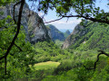
A 10 km circular route, the first part of which offers a pleasant walk in the shade through the beautiful Saoû Forest, whilst the second, sunnier part offers splendid panoramic views of the perched syncline.
⚠️ Between 1 July and 15 September, Prefectural Order DDT-SEF-2026-0176 of 4 June 2026 concerning the temporary restriction of access to the Saoû Forest and the Ambel Plateau in the event of a fire risk, assessed on a daily basis. A map is published every evening (around 5.30 pm) for the following day.
Les Trois Croix from Les Lombards
 2.07 mi
+469 ft
-469 ft
1h 20
Easy
Departure from La Répara-Auriples (Drôme)
2.07 mi
+469 ft
-469 ft
1h 20
Easy
Departure from La Répara-Auriples (Drôme)
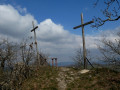
This walk allows you to discover the remains of an ancient fortified village on a hilltop, at the top of which are three crosses and a magnificent viewpoint with an orientation table.
270° panorama of the foothills of the Vercors and Diois, Roche Colombe, the Trois Becs, the Montagne de Couspeau, the northern Rhône valley and the Ardèche mountains.
Saint-Sauveur-en-Diois
 2.96 mi
+400 ft
-430 ft
1h 45
Easy
Departure from Saint-Sauveur-en-Diois (Drôme)
2.96 mi
+400 ft
-430 ft
1h 45
Easy
Departure from Saint-Sauveur-en-Diois (Drôme)
Walk through the Clairette de Die vineyards.
Views of the Trois Becs, the Glandasse, and the Drôme valley.
Saou Forest via the Pas de la Motte, the Quatrième Bec and the Pomerolle
16.52 mi
+5,686 ft
-5,689 ft
8 hrs
 Very difficult
Departure from Saou (Drôme)
Very difficult
Departure from Saou (Drôme)
A hike with a significant elevation gain but no particular difficulty apart from its length; a good part of the route is shaded in case of hot weather.See Practical Information regarding the section near the cliffs.Reserved for experienced hikers.
Please note: the route passes through a wildlife sanctuary. Certain sections are off-limits between 15 May and 15 July.Specific signage and a diversion from the GR®9 have been put in place to guide users; seehere.
Tour of the Rocher de Saint-Supière via Serre du Bois, Sagnol and Boussière
 9.72 mi
+2,192 ft
-2,172 ft
6h 25
Average
Departure from Gigors-et-Lozeron (Drôme)
9.72 mi
+2,192 ft
-2,172 ft
6h 25
Average
Departure from Gigors-et-Lozeron (Drôme)
A beautiful hike that will take you through pretty woodland and the Rocher de Saint-Supière massif. Some fairly steep climbs and descents. Beautiful views of the Crêtes de Suze, Rochecolombe and Les Trois Becs.
Les 3 Becs via the Grande Combe, then Pas de Picourère and Pas de la Laveuse
11.39 mi
+4,222 ft
-4,222 ft
8h 55
Difficult
Departure from Saou (Drôme)
A beautiful, long hike that alternates between forest, alpine meadows and ridge paths before returning through the forest.A gentle climb through the forest via the Grande Combe, which zigzags between two cliffs. Then the view opens up between the Pas de Siara and the Pas de la Laveuse, passing by the Veyou and close to the other peaks of the Trois Becs. Descent through the beech forest.The effort is richly rewarded by the variety of landscapes and superb views over the Vercors and the Saou Forest syncline.
Please note: the route passes through a wildlife sanctuary. Certain sections are closed to the public between 15 May and 15 July. Special signage and a diversion from the GR®9 have been put in place to guide walkers; seehere.
Saint-Supière Rock
 6.76 mi
+1,811 ft
-1,791 ft
4h 40
Difficult
Departure from Gigors-et-Lozeron (Drôme)
6.76 mi
+1,811 ft
-1,791 ft
4h 40
Difficult
Departure from Gigors-et-Lozeron (Drôme)
This trail crosses a property where Scottish Highland cows graze. The trail then climbs up to the Savel Plateau, where a panoramic view opens up before you.
Long circular in the Saou forest
12.97 mi
+3,937 ft
-3,934 ft
8 hrs
Very difficult
Departure from Saou (Drôme)
This route offers a good introduction to this hilltop forest, its tranquillity and the birdsong. You’ll come close to the Trois Becs without actually climbing them. Just enough to make you want to come back and tackle them.
⚠️ The route passes through a wildlife sanctuary. Certain sections are off-limits between 15 May and 15 July. Specific signage and a diversion from the GR®9 have been put in place to guide walkers; see here.
⚠️ Between 1 July and 15 September, Prefectural Order DDT-SEF-2026-0176 of 4 June 2026 concerning the temporary restriction of access to the Saoû forest and the Ambel plateau in the event of a fire risk, assessed on a daily basis. A map is published every evening (around 5.30 pm) for the following day.
Les Clos - Saoû Forest
3.05 mi
+630 ft
-620 ft
1h 55
Easy
Departure from Saou (Drôme)
A short circular path through the forest, perfect for enjoying the shade. You’ll walk through a splendid beech forest on a north-facing slope.Dogs must be kept on a lead.
Pré de l'Âne through the heart of the forest - Saoû Forest
 9.66 mi
+2,697 ft
-2,697 ft
6h 45
Difficult
Departure from Saou (Drôme)
9.66 mi
+2,697 ft
-2,697 ft
6h 45
Difficult
Departure from Saou (Drôme)
A lovely walk where ‘diversity’ is the watchword! This superb route, winding its way between two cliffs, takes you gradually uphill via the Grande Combe, amidst lush vegetation. The Pas de Siara offers a glimpse of the southern Alpine meadows of the Trois Becs, where sheep from neighbouring valleys graze during the summer grazing season. The descent is gentle through the beech forest, typical of the montane zone.
⚠️ Between 1 July and 15 September,Prefectural Order DDT-SEF-2026-0176 of 4 June2026 concerning the temporary restriction of access to the Saoû forest and the Ambel plateau in the event of afirerisk, which is assessed daily. A map is published every evening (around 5.30 pm) for the following day.
In the footsteps of the Huguenots in the Saoû Forest
2.27 mi
+381 ft
-381 ft
1h 25
Easy
Departure from Saou (Drôme)
A lovely, gentle round-trip walk that will take you in the footsteps of the Huguenots through the Saoû Forest. The walk is fully accessible to all-terrain pushchairs.
The Three Crosses at the start of Soyans (Talon)
 6.38 mi
+938 ft
-938 ft
3h 45
Average
Departure from Soyans (Drôme)
6.38 mi
+938 ft
-938 ft
3h 45
Average
Departure from Soyans (Drôme)
Following paths and small tracks, mostly through woodland, this walk offers some beautiful views and the remains of an ancient hilltop fortified village.
The top of the village, where three crosses stand, offers a magnificent viewpoint with an orientation table.
There is a 270° panorama of the foothills of the Vercors and Diois, Roche Colombe, the Trois Becs, the Montagne de Couspeau, the northern Rhône valley and the Ardèche mountains.
Les Pomerolle
 7.50 mi
+2,244 ft
-2,238 ft
5h 25
Average
Departure from Saou (Drôme)
7.50 mi
+2,244 ft
-2,238 ft
5h 25
Average
Departure from Saou (Drôme)
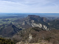
Explore the south-western ridge of the famous Saou Forest.
⚠️ Between 1 July and 15 September, Prefectural Order DDT-SEF-2026-0176 of 4 June 2026 concerning temporary restrictions on access to the Saou Forest and the Ambel Plateau in the event of a fire risk, assessed on a daily basis. A map is published every evening (around 5.30 pm) for the following day.
Col de la Croix, Chemin de Mars, Col de Gerbe and Col Chicotier
9.45 mi
+1,588 ft
-1,591 ft
5h 45
Average
Departure from Montclar-sur-Gervanne (Drôme)
Departure from Vaugelas. Car park in the centre of the village.
A pretty little village, fairly well restored, located at the bottom of a valley
Route via the Porte de Barry, the Pas de Siara and the Grande Combe
 10.94 mi
+2,841 ft
-2,815 ft
7h 30
Average
Departure from Saou (Drôme)
10.94 mi
+2,841 ft
-2,815 ft
7h 30
Average
Departure from Saou (Drôme)
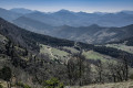
It’s a fairly long route but not particularly difficult, allowing you to discover all aspects of the Saoû Forest, starting with the Auberge des Dauphins and its grounds...
The Saou Forest, returning via the Pas de la Motte
10.19 mi
+3,297 ft
-3,278 ft
7h 35
Difficult
Departure from Saou (Drôme)
The heart of the Saou Forest has a very distinctive atmosphere for the region, with its dense vegetation, gorges and cliffs. You might feel as though you’re in another country. A few routes published on Visorando pass through this forest, but they all differ in terms of the return route. Here we suggest a relatively challenging route that will take you along the northern ridges and through its beautiful landscapes.
Please note that the route passes through a wildlife sanctuary. Certain sections are off-limits between 15 May and 15 July. Special signage and a diversion from the GR®9 have been put in place to guide walkers; seehere.
The Trois Becs via the Grande Combe
 13.30 mi
+4,911 ft
-4,898 ft
10h 25
Difficult
Departure from Saou (Drôme)
13.30 mi
+4,911 ft
-4,898 ft
10h 25
Difficult
Departure from Saou (Drôme)
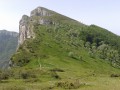
From the Auberge des Dauphins, a magnificent climb via the Grande Combe leads to the Rocher de la Laveuse and the Trois Becs – a legendary hike in the Saou Forest.
⚠️ The route passes through a wildlife sanctuary. Certain sections are off-limits between 15 May and 15 July. Specific signage and a diversion from the GR®9 have been put in place to guide walkers; see here.
⚠️ Between 1 July and 15 September, Prefectural Order DDT-SEF-2026-0176 of 4 June 2026 concerning the temporary restriction of access to the Saou Forest and the Ambel Plateau in the event of a fire risk, which is assessed daily. A map is published every evening (around 5.30 pm) for the following day.
Saoû Forest
 12.68 mi
+2,799 ft
-2,812 ft
8h 15
Difficult
Departure from Saou (Drôme)
12.68 mi
+2,799 ft
-2,812 ft
8h 15
Difficult
Departure from Saou (Drôme)
A superb hike in the Saoû Forest, ideal for nature lovers and sports enthusiasts – a challenge for us as novice hikers. Despite the fairly long route, we were delighted and, above all, pleasantly surprised by the untamed beauty of the landscape and the view of the Trois Becs.
⚠️ 1 July 2026: Between 1 July and 15 September, Prefectural Order DDT-SEF-2026-0176 of 4 June 2026 concerning temporary restrictions on access to the Saoû Forest and the Ambel Plateau in the event of a fire risk , assessed on a daily basis. A map is published every evening (around 5.30 pm) for the following day.
The Crêtes de Côte Belle and the Tour de Merly
 12.16 mi
+1,942 ft
-1,952 ft
7h 15
Difficult
Departure from Beaufort-sur-Gervanne (Drôme)
12.16 mi
+1,942 ft
-1,952 ft
7h 15
Difficult
Departure from Beaufort-sur-Gervanne (Drôme)
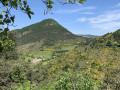
Côte Belle is a classic hike from Beaufort-Sur-Gervanne. Here we offer a longer and more complete version, covering almost all of the ridges and extending around Merly, a pointed mountain overlooking Eygluy. As a bonus, you can enjoy views not only of the Massif des Trois-Becs and the Drôme Valley, but also of the Montagne de Glandasse, the But Saint-Genix, Ansage, the Falaises d'Omblèze and the Rochers du Vellan. No difficulty except for the length.
The Croix du Vellan from Beaufort-sur-Gervanne
 10.62 mi
+2,178 ft
-2,139 ft
6h 45
Average
Departure from Beaufort-sur-Gervanne (Drôme)
10.62 mi
+2,178 ft
-2,139 ft
6h 45
Average
Departure from Beaufort-sur-Gervanne (Drôme)
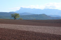
From Beaufort-sur-Gervanne, the gradual climb to Plan-de-Baix and then to the Croix du Vellan (a picturesque passage between rocks and cliffs) is on good paths. From there, you can enjoy a unique view of the Gervanne Valley and the Trois Becs Massif. The return journey takes you through the village of Lozeron and the Domaine des Arômes (Sanoflore organic cosmetics factory and botanical garden).
Chalamet Tower
 6.79 mi
+1,975 ft
-1,962 ft
4h 50
Average
Departure from Ourches (Drôme)
6.79 mi
+1,975 ft
-1,962 ft
4h 50
Average
Departure from Ourches (Drôme)
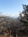
On this well-shaded hike, in addition to the various views of the Rhône valley, the Ardèche, the southern Vercors, the Trois Becs and the Saoû forest, we also encountered a young deer enjoying some foliage and a squirrel frightened by our presence. Unfortunately, we also saw the damage caused by the box tree moth.
The church and castle ruins in the Old Village of Soyans
 1.58 mi
+531 ft
-518 ft
1h 10
Easy
Departure from Soyans (Drôme)
1.58 mi
+531 ft
-518 ft
1h 10
Easy
Departure from Soyans (Drôme)
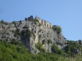
A family walk, starting from the Roubion valley, to discover the old village of Soyans, dominated by the Romanesque church of Saint-Marcel and the castle ruins.
Perched on the edge of the cliff, you can enjoy a magnificent panorama of the Roubion Valley, the Saoû Forest to the north and the Couspeau Mountain to the east.
Bois Sec and Vaire - Saoû Forest
2.78 mi
+354 ft
-354 ft
1h 35
Easy
Departure from Francillon-sur-Roubion (Drôme)
After swimming in the Roubion, you can finish the descent at nightfall: Vaire is a remarkable platform for stargazing, at the foot of the southern slope of the Saoû syncline.
Please note: the route is impassable when the Roubion is in flood.
Bois Sec and banks of the Roubion in Francillon
 3.07 mi
+384 ft
-400 ft
1h 45
Easy
Departure from Francillon-sur-Roubion (Drôme)
3.07 mi
+384 ft
-400 ft
1h 45
Easy
Departure from Francillon-sur-Roubion (Drôme)
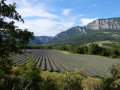
This is an easy walk to stretch your legs while enjoying a beautiful variety of landscapes: panoramic views of the majestic syncline of the Saou Forest, dry pine forests, the cool banks of the Roubion inviting you to take a dip, and even lavender fields to finish off before crossing the pretty village of Francillon.
Lozeron Mountain - Gervanne-Sye
7.48 mi
+1,545 ft
-1,539 ft
4h 45
Average
Departure from Gigors-et-Lozeron (Drôme)
From the famous Plateau des Chaux, a small agricultural plain still preserved by traditional practices, you will reach the heights of the Lozeron mountain and enjoy a 260° panorama.
Crête de Chevrière - La Pigne
 7.46 mi
+1,181 ft
-1,178 ft
4h 30
Average
Departure from Puy-Saint-Martin (Drôme)
7.46 mi
+1,181 ft
-1,178 ft
4h 30
Average
Departure from Puy-Saint-Martin (Drôme)
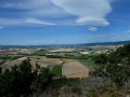
Alternating between small roads, narrow lanes and paths through the woods, this route offers beautiful views of the Marsanne plain, the foothills of the Vercors and the village of Puy-Saint-Martin.
The Chevrière - La Pigne viewpoints
 7.01 mi
+1,142 ft
-1,161 ft
4h 15
Average
Departure from Puy-Saint-Martin (Drôme)
7.01 mi
+1,142 ft
-1,161 ft
4h 15
Average
Departure from Puy-Saint-Martin (Drôme)
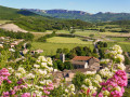
In addition to panoramic views of the Valdaine plain, Couspeau mountain and Saoû forest, this route will allow you to discover the natural and cultural heritage of Puy-Saint-Martin.
Around the Charivari starting from Puy-Saint-Martin
 4.37 mi
+837 ft
-837 ft
2h 45
Easy
Departure from Puy-Saint-Martin (Drôme)
4.37 mi
+837 ft
-837 ft
2h 45
Easy
Departure from Puy-Saint-Martin (Drôme)
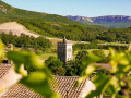
This short route is easily accessible in the hills above Puy-Saint-Martin. It offers new views of the old village and the Valdaine plain.
Serre Antoine - Saoû Forest
 7.33 mi
+1,417 ft
-1,421 ft
4h 35
Average
Departure from Mornans (Drôme)
7.33 mi
+1,417 ft
-1,421 ft
4h 35
Average
Departure from Mornans (Drôme)
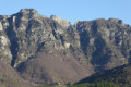
Sheltered by the imposing wall of the Saoû perched syncline, you will pass close to the ruins of Pradas and also enjoy unobstructed views over the Roubion valley.
⚠️ Between 1 July and 15 September, Prefectural Order DDT-SEF-2026-0176 of 4 June 2026 concerning temporary restrictions on access to the Saoû forest and the Ambel plateau in the event of a fire risk, assessed on a daily basis. A map is published every evening (around 5.30 pm) for the following day.
The Baron and the old village of Roynac
 6.57 mi
+1,138 ft
-1,119 ft
4h 00
Average
Departure from Roynac (Drôme)
6.57 mi
+1,138 ft
-1,119 ft
4h 00
Average
Departure from Roynac (Drôme)
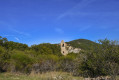
This very shady forest walk offers a new perspective on the Valdaine plain with a few glimpses of the Saoû massif, not to mention the discovery of the old ruined village of Roynac and its belvedere.
Le Baron and the Chevrière Balcony
 5.82 mi
+981 ft
-974 ft
3h 30
Average
Departure from Roynac (Drôme)
5.82 mi
+981 ft
-974 ft
3h 30
Average
Departure from Roynac (Drôme)
Discover the panoramic view from the east of Roynac: the Chevrière area is home to a remarkable natural site and offers a magnificent view of the Ardèche!
Le Pradou - Roche Rousse
9.05 mi
+2,907 ft
-2,897 ft
6h 40
Difficult
Departure from Mornans (Drôme)
This wild hike allows you to discover the south-eastern ridge of the Saoû Forest, passing by the peaks of Pradou and Roche Rousse with views of the southern Drôme mountains as far as Mont Ventoux.
Please note that the route passes through a quiet zone for wild animals. It is forbidden to use it between Pas de Floréal (6) and the bottom of Pré de l'Âne (8) between 15 May and 15 July.Specific signage and a diversion from the GR®9 have been put in place to guide users, seehere.
Loop of Rocher and Croix du Vellan from Plan-de-Baix
 2.89 mi
+974 ft
-965 ft
2h 10
Average
Departure from Plan-de-Baix (Drôme)
2.89 mi
+974 ft
-965 ft
2h 10
Average
Departure from Plan-de-Baix (Drôme)
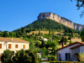
At the gateway to the Vercors, at the end of a long ridge at an altitude of 1,000 metres, this rocky promontory is visible for dozens of kilometres around. The site offers a remarkable panorama of the village, which it overlooks by nearly 200 metres, the Rieussec and Gervanne valleys and the high plateaus of the Vercors, the Diois, the Trois Becs and the Montagne Saint-Pancrace. The place is peaceful at sunrise and offers an interesting view of the plateau stretching around the village with its farms, temple, chapel and castle. The elevation gain is modest and the distance is short. The loop makes the climb less difficult. We chose to start from the Church of Notre-Dame, at the bottom of the village, to discover this well-renovated Romanesque heritage site.