Circular mountain bike loop in the Saou Forest

A long climb (800m elevation gain over 13km, taking just over 2 hours) but not particularly difficult to reach the Refuge des Girards by mountain bike. From there, it is advisable to continue on foot, for example to climb the Trois Becs. The return route is technical, following the path alongside the River Vèbre.

Details

859980
Creation:
Last update:
Last review:
  • Mountain biking
    Activity: Mountain biking
  • ↔
    Distance: 13.24 mi
  • ◔
    Duration according to the author: 3 hrs 
  • ▲
    Difficulty: Difficult

  • ⚐
    Back to start: Yes
  • ↗
    Ascent: + 3,156 ft
  • ↘
    Descent: - 3,140 ft

  • ▲
    Highest point: 4,045 ft
  • ▼
    Lowest point: 1,362 ft
  • ⚐ Country: France
  • ⚐
    Areas: Alps, Diois, Dauphiné
  • ⚐ City: Saou (26400)
  • ⚑
    Start/End: N 44.656705° / E 5.110243°
  • ❏
    IGN map(s): Ref. 3137OT, 3138OT

  • ◶
    Type of surface:
  •  
     
     
     33% Road  34% Byway  33% Path
  • ⇧
    Bike carrying: Not specified
  • ▲
    Difficulty: Not specified
  • Hour-by-hour weather

Description of the route

Park at the Sables Blancs car park (the first car park as you enter the Saou Forest).

(S/E) Take the path opposite on the southern slope. Pass the first, roughly level path on the left and turn immediately left uphill.

(1) Take a hairpin bend to the right. Stay on the stony but not unpleasant path (this is a former road suitable for vehicles) and ignore the side tracks.

(2) At the Girards mountain hut, continue along the stony path until you reach a junction.

(3) Take the second path on the right and continue uphill.

(4) At the Pas de l’Ane hairpin bend, take the first path on the right. Descend, keeping to the Vèbre stream.

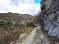
The descent is very technical on a mountain bike (especially at the start due to large boulders), but magnificent.

(5) Passages through narrow gorges, with lush vegetation.

(6) You’ll pass some traces of troglodyte settlements.

(7) At the former Auberge des Dauphins, carry straight on.

(8) Take the path to the left of the water tower. Then turn right and follow the river at a leisurely pace back to the car park where you started (S/E).

Waypoints

  1. S/E : mi 0 - alt. 1,378 ft - Sables Blancs car park
  2. 1 : mi 0.83 - alt. 1,542 ft - Raillon
  3. 2 : mi 6.96 - alt. 3,911 ft - Refuge des Girards
  4. 3 : mi 7.53 - alt. 3,911 ft - Junction – Elevation 1186
  5. 4 : mi 8.47 - alt. 3,973 ft - Virage du Pré de l’Ane
  6. 5 : mi 9.2 - alt. 3,281 ft - Narrow gorges
  7. 6 : mi 10.63 - alt. 2,005 ft - Traces of troglodytes
  8. 7 : mi 11.7 - alt. 1,581 ft - Auberge des Dauphins
  9. 8 : mi 11.99 - alt. 1,526 ft - Water tower. Follow the - Vèbre (rivière) - Affluent du Roubion
  10. S/E : mi 13.24 - alt. 1,378 ft - Sables Blancs car park

Notes

Please note that the descent follows a stream bed (usually dry); you must be properly equipped (full-suspension mountain bike + protective gear!). If not, follow the road down to the bottom via the other side of the hill.

In summer, the northern slope is preferable for the ascent, and if the descent through the stream bed worries you, you can always continue along the main road down to the inn.

Of course, it’s possible to do the same route on foot, but in that case, you might as well set off from the inn and head straight up towards the road via one of the footpaths.

This circular mountain bike route can be combined with a hike up the Trois Becs: see the route description on Visorando. Leave your bikes at the Refuge des Girards (2) and walk up to the Virage du Pied de l’Ane (4). From there, follow the other hike starting from its starting point (7). Once you reach the Pas de Siara, follow the other walk from its starting point (2) to the summit. Descend on the other side to the Col des Auberts. Continue along the other walk until you reach the junction with the track to the Refuge des Girards (elevation 1186, point (3) on this walk). Then head down to the right to reach the refuge and collect your bikes. Allow around 3 hours for the circular walk. It is not recommended to attempt this ascent by mountain bike as the paths are fragile and feature numerous steps.

Worth a visit

And what’s more, there’s a brasserie in Saou…

Reviews and comments

4.5 / 5
Based on 2 reviews

Reliability of the description
4.5 / 5
Ease of following the route
4.5 / 5
Route interest
4.5 / 5
Fredo6954
Fredo6954

Overall rating : 4.7 / 5

Date of your route : Aug 26, 2024
Reliability of the description : ★★★★★ Very good
Ease of following the route : ★★★★☆ Good
Route interest : ★★★★★ Very good
Very busy route : No

The descent from the ‘Virage de l’Âne’ towards the Auberge des Dauphins is incredibly tough (even on a full-suspension electric mountain bike)! We had to get off our bikes half the time.

Machine-translated

mooky51
mooky51

Overall rating : 4.3 / 5

Date of your route : Jul 21, 2018
Reliability of the description : ★★★★☆ Good
Ease of following the route : ★★★★★ Very good
Route interest : ★★★★☆ Good

A long climb of about 2 hours, with no flat sections or descents, leading into the forest and on to the Girard refuge. Take great care when you reach the Pas de l’Ane bend to make sure you take the small path on the right, as I personally missed it and so I can’t comment on the rest of the route…

As for the views along the route I took, I can’t say they were brilliant, as you’re in the forest the whole time with few clear views to the sides.

Machine-translated

Other walks in the area

For more walks, use our search engine .

The GPS track and description are the property of this route's author. Please do not copy them without permission.