


taboulechat

 Visorando Member
 Premium user
 Contributor 2024
- Location: Anglet (64600)
- Gender: man
Sign up:
Published route(s)
 The Ursuya from the Celhay district of Hasparren
 4.28 mi
 +1,293 ft
 -1,280 ft
 3h 05
 Moderate
 Departure from Hasparren (Pyrénées-Atlantiques)
Climb Ursuya via the easiest route. A circular loop at the summit will save you from having to descend the final steep climb, which is quite strenuous. Firstly, as you climb, you can admire the coastline and the wooded countryside of the Basque Country, as well as the plains of the Landes. Further on, you’ll see some typical thatched cottages and the surrounding secondary peaks. At the summit, there’s a magnificent view of the Baigura and all the peaks of the Basque Country.
The Zuhalmendi circular loop from Ibarrun to Saint-Pée-sur-Nivelle
7.49 mi
+1,289 ft
-1,286 ft
4h 35
Moderate
Departure from Saint-Pée-sur-Nivelle (Pyrénées-Atlantiques)
Another way to tackle all these little peaks between Sare and Ascain. A few fairly steep sections, but the return along the Uzkaingo Erreka is quite picturesque. After the descent from Zuhalmendi, you walk past herds of Basque pigs roaming freely.
Mont Errebi from Col de Pinodieta and return via Col des Trois Croix
4.73 mi
+1,270 ft
-1,270 ft
3h 20
Moderate
Departure from Souraïde (Pyrénées-Atlantiques)
This route will take you to the summit of Errebi more directly than via the Notre-Dame d'Arantza chapel. Two-thirds of the climb is on a gentle slope, ending with a slightly steeper section. The reward is at the summit with a 360° view. Horses and sheep will accompany you along the gentle descent to the Col des Trois Croix.
Lac dets Plagnous
4.59 mi
+577 ft
-564 ft
2h 35
 Easy
Departure from Beaucens (Hautes-Pyrénées)
Lac dets Plagnous is a tiny lake above Lac d'Isaby. A little more difficult to access than the latter, it is neglected by hikers. However, it is very pleasant and makes you want to stay on its banks for a while.
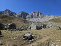
Cap de la Baitch hut as seen from the Refuge de l’Abèrouat
 4.78 mi
+1,089 ft
-1,076 ft
3h 10
Moderate
Departure from Lescun (Pyrénées-Atlantiques)
This short walk takes us easily to a shepherd’s hut. Left unoccupied during the off-season, it’s a lovely spot for a picnic break. The setting is idyllic. Take care during the summer months and follow the advice given to respect the herds and the Patou dogs.
Isaby Lake
3.37 mi
+387 ft
-387 ft
1h 55
Easy
Departure from Beaucens (Hautes-Pyrénées)
This is an easy, short hike, ideal for young children. The lake, nestled in lush greenery and surrounded by mountains, is truly magnificent. Calm and peaceful, it makes you want to stay there for a long time.
Ibardin–Manttale–Zigorriega circular, returning via the Spanish side
3.66 mi
+1,079 ft
-1,063 ft
2h 35
Easy
Departure from Urrugne (Pyrénées-Atlantiques)
A short walk, starting from the Ventas d’Ibardin, which nevertheless offers magnificent views. The first section follows the ridges of Manttale and Zigorriaga, with views of the ocean to the right and the Spanish mountains to the left. The second section involves returning to the ventas, following an easy track on the Spanish side. This fairly short walk can be completed in a morning, allowing you to enjoy a meal in one of the many restaurants.
Col de Pau and Col de Burcq
8.50 mi
+3,294 ft
-3,294 ft
6h 45
 Difficult
Departure from Lescun (Pyrénées-Atlantiques)
A magnificent hike from Lescun, yet relatively unknown. There are magnificent views all along the way. Herds of chamois are frequently seen between the Col de Pau and the Col de Burg.Although this hike is challenging due to the elevation gain, it is not overly difficult. You can stop at the Cabane de Bonaris or the Col de Pau if you start to feel tired. If you are very fit, you can extend the hike by climbing the surrounding peaks or even reaching the Refuge d'Arlet.
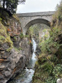
The Raillère waterfall trail to the Pont d'Espagne hotel
 5.89 mi
+1,749 ft
-1,732 ft
4h 15
Moderate
Departure from Cauterets (Hautes-Pyrénées)
The path begins in the undergrowth of the Pyrenees National Park. From waterfall to waterfall, we reach Pont d'Espagne and its hotel. The path passes through the forest, which is very pleasant in summer. We walk along the Gave du Marcadau or Cauterets. This hike is a classic in the region.
The foothills of La Rhune
5.69 mi
+1,762 ft
-1,755 ft
4h 10
Moderate
Departure from Ascain (Pyrénées-Atlantiques)
This walk takes you along very little-used paths. Throughout the walk, you’ll enjoy some beautiful scenery and views. A few climbs will prove quite strenuous but are not difficult. As this walk is not signposted, it would be wise to follow the GPS track to ensure you don’t go the wrong way, despite the directions, which should normally be sufficient.
Errebi Circuit: from farm to farm via the Col Pinodieta
6.10 mi
+1,257 ft
-1,260 ft
3h 55
Moderate
Departure from Souraïde (Pyrénées-Atlantiques)
This route to the Col des Trois Croix avoids the usual path to Errebi. You’ll be walking along small roads and idyllic paths used only by local farmers. As you climb along the path, you’ll enjoy magnificent views of the Mondarrain massif. The second section offers views of the Spanish peaks. A very pleasant walk with no difficulty at all.
Le Larla from Saint-Étienne-de-BaÏgorry
7.43 mi
+2,454 ft
-2,428 ft
5h 35
Moderate
Departure from Saint-Étienne-de-Baïgorry (Pyrénées-Atlantiques)
The Larla can be climbed from several points. This circular walk is slightly longer than the others and has a greater elevation gain. Despite this difficulty, the walk remains very pleasant and offers, as is often the case in the Basque Country, magnificent views.
Irubelakaskoa from the Otxondo Pass
8.41 mi
+2,149 ft
-2,129 ft
5h 45
Moderate
Departure from Baztan (Navarre)
For those familiar with the Irubelkaskoa route from the Basasagarra farm, this hike is much easier.
The road leading to the start from the Otxondo Pass already offers magnificent views.
The hike passes through a beautiful forest and continues along grassy paths, arriving – as is often the case in the Basque Country – at the summit with a 360° view. The return route follows a ridge line to Gorramakil and then Gorramendi for those wishing to extend the hike, with splendid views of all the peaks throughout. For this hike, I joined the track at the Otanarteko Pass.
Arlet Refuge and Lake Arlet from the Espélunguère car park
10.26 mi
+2,697 ft
-2,671 ft
7h 05
Moderate
Departure from Borce (Pyrénées-Atlantiques)
There are several routes to Lac d’Arlet and the Arlet Refuge. This is one of the most beautiful: varied scenery with a magnificent viewpoint at an elevation of 1909 metres on the map, followed by the arrival at Col de Lapachouaou. The first half of the hike is steady but fairly strenuous. The rest of the way to the lake follows the contour lines more or less. You’ll have plenty of time to admire the stunning scenery unfolding before you from the slopes of Montagne de Banasse.
The Atxuria circuit via the Col des Trois Bornes
 7.30 mi
+1,526 ft
-1,526 ft
4h 40
Moderate
Departure from Sare (Pyrénées-Atlantiques)
Another way to do a circular route around Atxuria. Easier than some of the other routes already published, with only 450 m of elevation gain. Magnificent views of the impressive cliffs of Atxuria.
Some difficult sections – see the reviews
Circular at Col d'Ispeguy via the Balcon sous Tranpeta
 6.70 mi
+2,201 ft
-2,195 ft
5h 00
Moderate
Departure from Saint-Étienne-de-Baïgorry (Pyrénées-Atlantiques)
A magnificent hike. The views are spectacular all along the way. You can stock up on snacks and drinks at Col d'Ispeguy, which will lighten your backpack. Please note: the path between (2) and (3) may be frightening for those who are afraid of heights. In any case, it should be avoided by everyone when the ground is frozen.
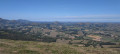
L'Hoxanandia
 6.52 mi
+1,142 ft
-1,115 ft
4h 00
Moderate
Departure from Lantabat (Pyrénées-Atlantiques)
A very pleasant hike, not very difficult but offering magnificent views all along the route and, of course, at the summit: a 360° panorama. To the north-west, the coast and its towns, with Baigura and Ursuya in the foreground.
To the west, Iparla. To the south-west, Jara with its antennas. To the south, Orhi and Bearn with the Pics d'Anie and Ossau.
Pombie Refuge
 5.84 mi
+1,581 ft
-1,578 ft
4h 05
Moderate
Departure from Laruns (Pyrénées-Atlantiques)
With only 8 km and 470 m of elevation gain, this hike is accessible to almost everyone. The paths are wide and easy to follow. The views are magnificent. A change of scenery without too much difficulty. From the refuge, the more adventurous can climb to the Col de Peyreget or the Col de Suzon. To do so, you will need to be very well equipped.
Lac du Puits d'Arious
5.58 mi
+2,365 ft
-2,365 ft
4h 40
Moderate
Departure from Accous (Pyrénées-Atlantiques)
A lovely walk offering magnificent views of the Pic d’Anie, the Orgues de Camplong and many other peaks throughout the ascent. Towards the end of the hike, the route isn’t always obvious but is straightforward in clear weather.
The lake comes into view at the very last moment. Small but beautiful, it makes you want to take a dip in the summer and stay there for a while to rest.
Larry's refuge
 4.07 mi
+2,067 ft
-2,067 ft
3h 40
Moderate
Departure from Urdos (Pyrénées-Atlantiques)
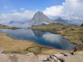
A very beautiful hike, accessible to all hikers in summer, and a really nice, unmanned refuge, well equipped for spending the night, with several beds, or for eating. Drinking water point outside.
An added bonus for fit hikers is the Col d'Ayous with its magnificent views of the lakes and the Pic du Midi d'Ossau.
La Rhune via the central ridge with return via Petite Rhune
6.03 mi
+2,694 ft
-2,687 ft
5h 05
Difficult
Departure from Urrugne (Pyrénées-Atlantiques)
La Rhune, the legendary mountain of the Basque Country, is never really easy to climb.This hike via the central ridge and the chimney is certainly one of the most difficult ways to reach the summit. The descent via Petite Rhune and Subizia is also difficult.Despite this, this hike is worth doing once because it takes you off the beaten track. You won't meet many people. The path is varied and the views are splendid.
Loop at Ursuya from the Xixtaberrri farm, known as the Blueberry Farm
6.67 mi
+1,654 ft
-1,654 ft
4h 30
Moderate
Departure from Cambo-les-Bains (Pyrénées-Atlantiques)
Here's another way to do a nice loop in Ursuya. This hike is always on open ground on wide paths with magnificent views from the start to the summit. The end of the return journey is via the Iramalda and Harrixuri ridges with Cambo-les-Bains in front of you and, further away, Bayonne and, of course, the coast. On the left, you can see La Rhune, Mondarrain, Artzamendi, etc.
Ursuya from the D152 in Mendionde
 6.59 mi
+1,745 ft
-1,739 ft
4h 35
Moderate
Departure from Mendionde (Pyrénées-Atlantiques)
This hike avoids the busiest routes (Chemin des Écoliers). It winds through meadows and fern fields on the northern slope and, still through meadows, skirts the summit on the southern slope. The final climb is steady. Magnificent 360° view from the summit of the coast, the Landes plain, the mountains of the Basque Country, Béarn and, further to the left, on a clear day, the Hautes Pyrénées. The return is via Gaineko Ordokia and the eastern slope.
The Larla circular from Bidarray
 7.28 mi
+2,201 ft
-2,201 ft
5h 15
Moderate
Departure from Bidarray (Pyrénées-Atlantiques)
A very beautiful hike with a variety of paths. Beautiful views of the Iparla mountain range throughout the climb.
At the summit, there is a magnificent 360° view, as is often the case in the Basque Country. You can see the beaches of the Basque Country and Landes, the Béarn Mountains and, on a clear day, even the Hautes-Pyrénées.
The climb to the summit is demanding and in places you will need to follow the description and GPS track carefully. There are no markings indicating this hike until (10), a nameless pass.
Le Jara from Saint-Martin-d'Arrossa
 7.76 mi
+2,175 ft
-2,172 ft
5h 30
Moderate
Departure from Saint-Martin-d'Arrossa (Pyrénées-Atlantiques)
Magnificent climb to Jara with breathtaking views of Larla, Iparla, Buztanzelai and Autza and, to the north, the ridges of Haltzamendi and Baigura.
A variety of paths, almost always in the open, ending with a cornice path overlooking the Landes plain. Arrival at the summit with a 360° view of the peaks of the Basque Country and Béarn. A pleasant picnic area awaits us there.
The Pic d'Iparla from the Basasagara farm
 6.20 mi
+2,549 ft
-2,549 ft
5h 05
Moderate
Departure from Bidarray (Pyrénées-Atlantiques)
This is an alternative route to the Pic d'Iparla. It starts a little higher up and avoids the additional detour that was recently put in place to avoid a farm and the degraded sections ofthe GR®10.
Be warned, this hike is not an easy one. The first 250 metres are challenging. The rest of the route along grassy tracks is very pleasant, with magnificent views of the ridges and Irubelakaskoa. The panorama from the ridges and the summit is spectacular.
La Rhune from the D406 road
 7.22 mi
+2,579 ft
-2,579 ft
5h 35
Moderate
Departure from Sare (Pyrénées-Atlantiques)
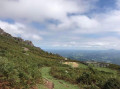
For those who want to climb La Rhune without encountering hardly anyone, this is the hike to do. The route starts in the forest. Once you’ve left the road behind, only birdsong accompanies you.
If you wander along the edges of the path during the season, you may come across a few mushrooms. The return route, alternating between open areas and forest sections, is most pleasant.
Lake Ansabère
 5.72 mi
+2,251 ft
-2,251 ft
4h 35
Moderate
Departure from Lescun (Pyrénées-Atlantiques)
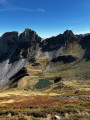
A beautiful little lake that is easily accessible. This hike is truly bucolic and the arrival at the lake is a wonder. You can stay there for a while to admire the scenery...
Étang de Peyregrand
 9.13 mi
+3,232 ft
-3,219 ft
7h 00
Moderate
Departure from Siguer (Ariège)
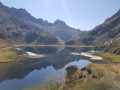
This hike in the Siguer valley is very varied. The climb along the Brouquenat stream is bucolic and feels easy despite the length and elevation gain.
Pique d'Endron
 5.00 mi
+3,238 ft
-3,238 ft
5h 05
Difficult
Departure from Goulier (Ariège)
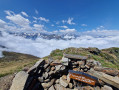
The Pique d'Endron, which can be seen majestically from Goulier, is located on a ridge separating the Siguer and Vicdessos valleys. Magnificent viewpoint with a 360° panorama of all the great peaks around, and below, the Étangs d'Izourt and Gnioure lakes.
The Pic de Tarbésou loop
 6.71 mi
+2,388 ft
-2,388 ft
5h 10
Moderate
Departure from Ascou (Ariège)
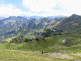
This summit is a magnificent viewpoint overlooking much of the Aude, the Pyrénées-Orientales and the Ariège. This ridge walk takes you to the Étang Noir and Étang Bleu lakes. These lakes are bordered by small pine groves where you can relax.
Refuge du Ruhle via the Étangs de Fortargente
 5.58 mi
+1,955 ft
-1,962 ft
4h 15
Moderate
Departure from Ariège
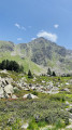
Another way to reach the Refuge du Ruhle is via the magnificent Fontargente lake and then the Estagnol lake, which is well worth a short detour to see. Once you reach the refuge, which is a crossroads for several hikes, the view from the terrace is splendid. The return to the starting point is now just a formality.
The tour of Atxuria via the Venta Loretxoa
6.95 mi
+1,929 ft
-1,929 ft
4h 50
Moderate
Departure from Sare (Pyrénées-Atlantiques)
Several hikers have reported that the path after the Zugarramurdi caves is now blocked. I have modified the route (July 2023). From the centre, take the road that leads to the cemetery.
A superb hike that avoids the climb to the summit, which can be exhausting and difficult to find.I have already posted this hike on Visorando.You will walk along the magnificent and impressive cliffs of Atxuria. On this southern side, the hike, with less elevation gain and a few hundred metres more, becomes bucolic.
Circular at Lac de Badet
 4.84 mi
+1,129 ft
-1,122 ft
3h 15
Moderate
Departure from Aragnouet (Hautes-Pyrénées)
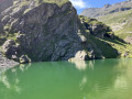
A short, easy walk for the whole family.
Bucolic landscapes and a beautiful little lake where you can relax and daydream.
Refuge de Bassiès via Port de Saleix
7.09 mi
+2,677 ft
-2,657 ft
5h 35
Moderate
Departure from Aulus-les-Bains (Ariège)
A magnificent hike through varied landscapes along the entire route. The climb to Port de Bassiès is steady and not too difficult. Unfortunately, there is a 280 m descent to the refuge, which you will have to climb back up.
Take advantage of the view of the lakes and the Pique Rouge cirque to rest for a while.
Tour of Ibanteli
 5.98 mi
+1,949 ft
-1,923 ft
4h 25
Moderate
Departure from Sare (Pyrénées-Atlantiques)
A lovely, easy hike. Beautiful view from the summit.
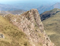
L'Autza from the Col d'Ispeguy and return via the Olhateko Kaskoa ridge
 5.70 mi
+2,451 ft
-2,428 ft
4h 45
Moderate
Departure from Saint-Étienne-de-Baïgorry (Pyrénées-Atlantiques)
This is a very beautiful hike that takes us to the first peak over 1,300 m from the ocean. It passes through very varied landscapes along the way. At the Col d'Elhorieta, there is an important megalithic site (cromlechs) that is worth a short detour. At the summit, there is a beautiful 360° view. The return trip along the ridges is truly magnificent in good weather.
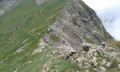
Port de Bielsa via Port and Pic de Bataillence, returning via the Port Vieux ridges
 5.73 mi
+3,202 ft
-3,205 ft
6 hrs
 Extremely difficult
Departure from Aragnouet (Hautes-Pyrénées)
The Port de Bielsa is reminiscent of a miniature version of the Brèche de Roland (in the Pyrenees). On the ridges of the Pic de Batalliance and all the way to the Col des Aiguillettes, the view of the valley and the Sierra Pelada is spectacular and the view along the ridges is splendid.Following the ridges requires a lot of experience in high mountains.Following the GPS track will prove essential. See Practical Information.I would classify this hike as very, very difficult
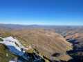
Iraukotuturu and return from the Errekaxaro pass via the Malbei ridges
 8.01 mi
+2,976 ft
-2,959 ft
6h 15
Difficult
Departure from Lecumberry (Pyrénées-Atlantiques)
The D'esternguibel valley is a wild site in Lower Navarre. Its steep sides are bristling with ridges and peaks. Iraukotuturu is the highest peak. To reach it, head for the Errékaxaro pass and from there follow a path carved into the rock in places, which was once used for transhumance of sheep.
Irubelakaskoa circular
 7.01 mi
+3,071 ft
-3,077 ft
5h 55
Difficult
Departure from Bidarray (Pyrénées-Atlantiques)
The ascent of Irubelakaskoa via the north-east ridge, with its peaks, is reminiscent of high mountain climbing. Some of the passages, although not dangerous, are quite vertiginous. The summit offers a 360° view.
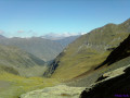
Port of Bielsa and return via the ridges of Port Vieux
 4.10 mi
+2,621 ft
-2,595 ft
4h 10
Difficult
Departure from Aragnouet (Hautes-Pyrénées)
The Port de Bielsa is reminiscent of a miniature version of the Brèche de Roland (in the Pyrenees). It can be seen from several places along the road leading to the start. Once you reach the other side, the view of the valley and the Sierra Pelada is spectacularThe return trip via Les Crête du Port Vieux offers splendid views, but requires some experience of high mountain terrain.Following the GPS track is essential as there are no signposts. See Practical Information.
L'Iramendy from Estérençuby
 7.98 mi
+2,290 ft
-2,287 ft
5h 40
Difficult
Departure from Estérençuby (Pyrénées-Atlantiques)
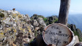
The Iramendy ridge is bristling with poudingue peaks (conglomerate of round pebbles). From Saint-Jean-Pied-de-Port, this gives it the appearance of a dinosaur. Climbing to the summit via this ridge from north to south requires a bit of scrambling (level 2 lower). The proposed hike climbs to the summit via the other ridge. No difficulties other than the total elevation gain and a few steep sections. Magnificent 360° view of the surrounding mountains.
Haltzamendi from the village of Ossès
6.61 mi
+2,369 ft
-2,346 ft
5h 05
Moderate
Departure from Ossès (Pyrénées-Atlantiques)
The climb to Haltzamendi is a truly enjoyable hike. Without any particular difficulties, it offers varied landscapes. From the summit, a splendid viewpoint, we have a bird's eye view of the eastern ridges of Baïgura.
Lake Caillauas
 10.57 mi
+3,517 ft
-3,497 ft
7 hrs
 Very difficult
Departure from Génos (Hautes-Pyrénées) (Hautes-Pyrénées)
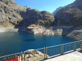
A very beautiful hike which, initially through the woods with explanatory panels, allows you to cover the elevation gain without even noticing. Then the Clarabide Gorges with the balcony path carved into the rock are magnificent. From the refuge to the lake, the landscape becomes more rocky. On arrival, there is a splendid view of the 3,000 m mountain range. I would say it is more difficult than very difficult, as recommended by Visorando
Lacs des Miares
 7.19 mi
+3,481 ft
-3,465 ft
7 hrs
Very difficult
Departure from Azet (Hautes-Pyrénées)
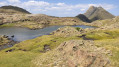
A very beautiful hike. The descent into the steep-sided Sarrouyes valley retains a wild aspect. The climb to Lac de Sarrouyes takes you through meadows, following the stream. You may see many marmots here. From the Lac de Sarrouyes junction, the climb to Lac des Miares becomes more challenging. Good physical condition is recommended. I would say it is difficult rather than very difficult, as recommended by Visorando.
The Oilarandoi loop from Saint-Étienne-de-Baïgorry
 7.73 mi
+2,559 ft
-2,559 ft
5h 45
Moderate
Departure from Saint-Étienne-de-Baïgorry (Pyrénées-Atlantiques)
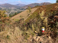
Oilarandoi is a magnificent viewpoint overlooking all the surrounding peaks. The nearby Munhoa and, further away, Iparla, Autza, Adarza and many others. At the summit, there was originally a hermitage, which was occupied from 1706 to 1792.
The ruins were rebuilt twice, in 1941 and 1985.
This hike includes sections with significant gradients of between 30 and 40%, but the reward is at the end and the view from the summit is well worth the effort.
Lac de Sarrouyes
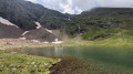 5.87 mi
+2,352 ft
-2,349 ft
4h 45
Moderate
Departure from Azet (Hautes-Pyrénées)
A very beautiful hike that is accessible to everyone. The descent into the steeply-sided Sarrouyes valley retains a wild appearance. The end of the climb is in the middle of a meadow, following the stream. You may see many marmots here.
Circular at the Cabane d'Auloueilh
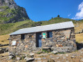 5.27 mi
+2,257 ft
-2,283 ft
4h 25
Moderate
Departure from Aulon (Hautes-Pyrénées) (Hautes-Pyrénées)
A very beautiful hike through the summer pastures of Aulon. Best done after the transhumance so you can enjoy the many herds of cows and sheep. You will pass by huts, walk along and cross streams, and walk through meadows full of flowers.
Lake Superior and Lake de l'Île from Lake Aubert
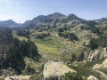 4.19 mi
+1,125 ft
-1,096 ft
2h 55
Moderate
Departure from Vielle-Aure (Hautes-Pyrénées)
Although less well known than their prestigious neighbours, the Néouvielle lakes are also magnificent. We can add Lac de l'Ours, which is accessible by footpaths.
This short hike with little elevation gain is an invitation to stroll from lake to lake, especially if you add Lac de l'Ours to the route, going from the small lake before Lac de l'Île and back. In this case, add an extra hour.
You are entering the Néouvielle National Nature Reserve, which is protected by regulations. Please respect these regulations (see practical information).
The Consaterre Lakes from the Pont Tisné
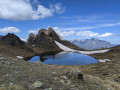 6.46 mi
+4,026 ft
-4,026 ft
6h 30
Difficult
Departure from Saint-Lary-Soulan (Hautes-Pyrénées)
The three Consaterre Lakes, dominated by the Pics de Berdalade, de Thou and de la Haille, are truly beautiful. The scenery is magnificent and wild. Silence reigns supreme here, and given the steep climb, you won’t be disturbed too much.