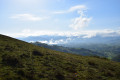
The foothills of La Rhune

This walk takes you along very little-used paths. Throughout the walk, you’ll enjoy some beautiful scenery and views. A few climbs will prove quite strenuous but are not difficult. As this walk is not signposted, it would be wise to follow the GPS track to ensure you don’t go the wrong way, despite the directions, which should normally be sufficient.

Details

47667604
Creation:
Last update:
Last review:
  • Walking
    Activity: Walking
  • ↔
    Distance: 5.69 mi
  • ◔
    Average duration: 4h 10 
  • ▲
    Difficulty: Moderate

  • ⚐
    Back to start: Yes
  • ↗
    Ascent: + 1,762 ft
  • ↘
    Descent: - 1,755 ft

  • ▲
    Highest point: 2,011 ft
  • ▼
    Lowest point: 427 ft

Description of the walk

Park at Ascain in the car park known as ‘des carrières’.

(S/E) Follow the wide traditional path to La Rhune until you reach a hairpin bend with a path on the right-hand side

(1) Leave this path (which leads back) and follow the wide main path on the left. Pass a renovated cattle shelter and, before the Ruisseau des Trois Fontaines, find a path on the left.

(2) Take this path downwards. Cross two fords: the second may be tricky to cross in heavy rain. The path continues over large stones, then veers sharply to the right. This first fairly steep climb will take you onto a grassy plateau. Pass to the right of a ruin, cross an easy ford just before some beech trees. Continue, leaving a wide grassy path on your right-hand side – which leads directly to the Trois Fontaines – and arrive at a hut.

(3) Leave the main path, which descends to the left, as well as the small earthen track that branches off opposite. Go round the hut to cross two or three metres of marshy ground and take the path that follows, leading onto a grassy slope. Follow this fairly steep grassy slope, finding your way along the easiest routes, to reach the Mouiz Entrenchment Camp (elevation 535).

(4) Turn right to join the path coming from the rack-and-pinion railway station. Follow this grassy path south-west, ignore the next path branching off to the right and continue straight up. A little further on, ignore another path on the right; you’ll rejoin it later. From here, you can see two passes: aim for the one on the right. There isn’t really a defined track, although it is marked on the map (OpenStreetMap World Hiking). The final stretch is quite strenuous, but a lovely viewpoint awaits just to the right of the Altsanga (624 m).

(5) The more experienced can follow the ridge line over the rocks. To ensure this walk remains accessible to everyone, it’s best to descend a few metres to rejoin the path you left behind further down. Follow it to the left, heading west. It crosses over to the southern slope and joins theGR®10coming from Sare.

(6) Turn right to follow theGR®10until you reach a junction with a signpost.

(7) Then take the grassy path opposite, which leads to the Cabane des Aigles.

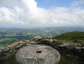
(8) Go round the hut on the left. The path leaves the southern slope, passes through the rocks and follows the northern ridge slightly below it. The track is clearly visible and, after a wide circular loop, leads to a viewpoint and a table carved into the rock.

(9) Continue north-east along the grassy path which joins the traditional path. Follow it to a renovated barn.

(10) Leave this main path and walk past the barn on the right. The path climbs gently amongst the gorse to a first cluster of rocks. Go round it and head towards the next rocky outcrop, slightly to the left. From there, look for the start of a path that descends alongside this outcrop on the left. After a bend, it descends quite steeply over stones, then gravel. After a flat section, join a track that climbs up from the right.

(11) Go straight on and, immediately afterwards, take the grassy path that climbs to the left towards a solitary birch tree. The path narrows to a track, winding its way through the gorse in places, and leads to a barn. Continue downhill to a wide path.

(12) Turn right and rejoin the path you took on the way up.

(1) Turn left, then head due east and follow the route back in the opposite direction to how you came, returning to the car park where you started (S/E).

Waypoints

  1. S/E : mi 0 - alt. 427 ft - Car park
  2. 1 : mi 0.5 - alt. 860 ft - Junction of the circular loop
  3. 2 : mi 1.05 - alt. 1,198 ft - Path on the left
  4. 3 : mi 1.56 - alt. 1,467 ft - Mountain hut
  5. 4 : mi 1.92 - alt. 1,768 ft - Mouiz Entrenchment Camp
  6. 5 : mi 2.22 - alt. 2,011 ft - Altsanga
  7. 6 : mi 2.61 - alt. 1,762 ft - GR°°®°°10
  8. 7 : mi 2.96 - alt. 1,804 ft - Junction
  9. 8 : mi 3.05 - alt. 1,873 ft - Cabane des Aigles
  10. 9 : mi 3.61 - alt. 1,781 ft - Carved table
  11. 10 : mi 4.32 - alt. 1,365 ft - Renovated barn
  12. 11 : mi 4.63 - alt. 1,165 ft - Path on the right
  13. 12 : mi 4.92 - alt. 1,033 ft - Wide path
  14. S/E : mi 5.69 - alt. 427 ft - Car park

Notes

This walk does not follow any specific signposting. Any yellow markings you encounter are not relevant to this route.
The route is entirely in the open. There is no shade or water source.

Always be cautious and plan ahead when you're outdoors. Visorando and the author of this route cannot be held responsible for any accidents occurring on this route.

The GR® and PR® markings are the intellectual property of the Fédération Française de Randonnée Pédestre.

Reviews and comments

4.6 / 5
Based on 3 reviews

Reliability of the description
4.3 / 5
Ease of following the route
4.3 / 5
Route interest
5 / 5
User 11421523

Overall rating : 4.3 / 5

Date of your route : Aug 17, 2026
Reliability of the description : ★★★★☆ Good
Ease of following the route : ★★★★☆ Good
Route interest : ★★★★★ Very good
Very busy route : No

We chose this route because it’s off the beaten track. We’d often been around the Rhune, but this walk is very pleasant and the views are superb. Its slightly wild, peaceful atmosphere is very enjoyable. The first part is a bit of a physical challenge but not unpleasant. The signposting is excellent, but without your phone to hand, you can easily stray from the route – that’s the price you pay for this tranquillity. A lovely discovery – thank you. Just a quick note on the duration: with quite a few stops, including for photos, it took us just under 3 hours and 45 minutes.

Machine-translated

pascalou81
pascalou81

Overall rating : 4.3 / 5

Date of your route : May 31, 2026
Reliability of the description : ★★★★☆ Good
Ease of following the route : ★★★★☆ Good
Route interest : ★★★★★ Very good
Very busy route : No

A very pleasant walk. As there are no signposts, you need to stay alert to stay on the right path and follow the description carefully, which, in hindsight, proves to be accurate. In the heat of the moment, I nearly missed point 2 and walked past (instead of behind) the Eagles’ Hut. Otherwise, it’s a hike well worth doing which, apart from the scenery, allows you to get off the beaten track and appreciate the landscape even more.

Machine-translated

taboulechat
taboulechat

Thanks again, lannemi, for this comment.
The first one since I posted this walk.

Machine-translated

Lannemi
Lannemi

Overall rating : 5 / 5

Date of your route : Oct 29, 2024
Reliability of the description : ★★★★★ Very good
Ease of following the route : ★★★★★ Very good
Route interest : ★★★★★ Very good
Very busy route : Yes

What a lovely surprise! I thought I knew most of the trails leading up to La Rhune, but this circular route, which follows mostly little-used paths, has been a wonderful discovery. There were few people on the ‘little-known’ trails, but plenty on the more traditional sections we took at times. We were also blessed with exceptional weather, with views stretching from Hendaye to the beaches of the Landes. After point 10, the descent is a bit steep; for those who aren’t keen on that, I’d suggest continuing along the traditional track and, a little further on, taking the path to the right of the next barn to rejoin the recommended route halfway up.

Machine-translated

Other walks in the area

For more walks, use our search engine .

The GPS track and description are the property of this route's author. Please do not copy them without permission.