Country:

 City:
City:


From Hasparren, take the D152 towards the Celhay district. Just past the pelota court, take a small road on the right. At a fork in the road, turn left towards Garatekoborda Farm: there is a small, staggered car park just before the farm or four spaces further on along the fence.
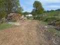
(S/E) Pass the cattle grating and follow the Route de Pitxaborda, heading south-west. The road quickly turns into a wide track. Follow it to a renovated barn at elevation 438.
(1) Take the track that climbs to the left and pass to the left of a barn below.
(2) Continue south-east and, after a wide left-hand bend, pass a picnic area on your left.
(3) Continue along the track towards a mast.
(4) Take a grassy path that climbs to the right, heading due south towards the first peak. It’s a steep climb with a high gradient.
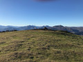
(5) Continue due south. The slope levels out as you reach the summit of Ursuya (Basque flag).
(6) Follow the ridge to the left, heading due east, until you come to a path that descends due south. After a bend, it turns left again, heading due east. You’ll reach a grassy clearing with a three-way junction.
(7) Take the grassy path on the left heading towards the ridges and follow it to a junction on the left.
(8) Turn left onto the path that leads back towards the mast.
(4) Turn left and, following the route back in the opposite direction to the way out, head back to the car park before Garatekoborda Farm (S/E).

 Visorando Member

 Easy
Easy 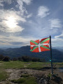
 Association / Club / Walk leader