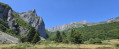
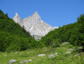
Cap de la Baitch hut as seen from the Refuge de l’Abèrouat

This short walk takes us easily to a shepherd’s hut. Left unoccupied during the off-season, it’s a lovely spot for a picnic break. The setting is idyllic. Take care during the summer months and follow the advice given to respect the herds and the Patou dogs.

Details

79434674
Creation:
Last update:
Last review:
  • Walking
    Activity: Walking
  • ↔
    Distance: 4.78 mi
  • ◔
    Average duration: 3h 10 
  • ▲
    Difficulty: Moderate

  • ⚐
    Back to start: Yes
  • ↗
    Ascent: + 1,089 ft
  • ↘
    Descent: - 1,076 ft

  • ▲
    Highest point: 5,499 ft
  • ▼
    Lowest point: 4,682 ft

Description of the walk

From Lescun, take the road leading to the Refuge de l’Abérouat. Park in the car park 50 metres before the refuge.

(S/E) From the car park, follow the road to the Refuge de l’Abérouat.

(1) Pass through an electric fence and follow the GR®10 path. There will be a series of ascents and descents. As you emerge from the woods, look out for the Cabane d’Ardinet perched on the right.

(2) Continue to the path leading up to the hut (sign for cheese for sale).

(3) You can already see the Cabane du Cap de Baitch. It appears to be at the same height, but in reality there are still 120 m to climb. Follow the GR®10, which climbs gently through the meadow to the hut.

(4) The current couple of shepherds are welcoming and sell cheese. It’s a picturesque spot. You can visit the hens and the Border Collies. The very brave can head left up to the Pic d’Anie (difficult). The GR®10 continues to the right to Arette-la-Pierre-Saint-Martin. For us, the return journey will follow the same route as the outward journey back to the refuge car park (S/E).

Waypoints

  1. S/E : mi 0 - alt. 4,688 ft - Car park at the - Refuge de l'Abérouat
  2. 1 : mi 0.11 - alt. 4,701 ft - Refuge de l'Abérouat
  3. 2 : mi 1.83 - alt. 5,072 ft - Ardinet Hut
  4. 3 : mi 1.9 - alt. 5,131 ft - Sign advertising cheese for sale
  5. 4 : mi 2.39 - alt. 5,499 ft - Cap de la Baitch Hut
  6. S/E : mi 4.78 - alt. 4,688 ft - Car park at the - Refuge de l'Abérouat

Always be cautious and plan ahead when you're outdoors. Visorando and the author of this route cannot be held responsible for any accidents occurring on this route.

The GR® and PR® markings are the intellectual property of the Fédération Française de Randonnée Pédestre.

Other walks in the area

For more walks, use our search engine .

The GPS track and description are the property of this route's author. Please do not copy them without permission.