Ibardin–Manttale–Zigorriega circular, returning via the Spanish side

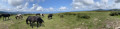
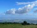
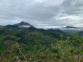
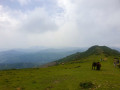
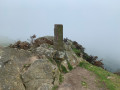
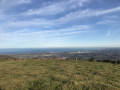
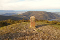
A short walk, starting from the Ventas d’Ibardin, which nevertheless offers magnificent views. The first section follows the ridges of Manttale and Zigorriaga, with views of the ocean to the right and the Spanish mountains to the left. The second section involves returning to the ventas, following an easy track on the Spanish side. This fairly short walk can be completed in a morning, allowing you to enjoy a meal in one of the many restaurants. 

Details

72247373
Creation:
Last update:
Last review:
  • Walking
    Activity: Walking
  • ↔
    Distance: 3.66 mi
  • ◔
    Average duration: 2h 35 
  • ▲
    Difficulty: Easy

  • ⚐
    Back to start: Yes
  • ↗
    Ascent: + 1,079 ft
  • ↘
    Descent: - 1,063 ft

  • ▲
    Highest point: 1,880 ft
  • ▼
    Lowest point: 1,175 ft

Description of the walk

Park in one of the car parks at Ibardin, preferably towards the top. 

(S/E) Do not follow the GR®10, but take the track that branches off to the right of the upper ventas. Go through a gate.

(1) Take a path on the left which makes a wide circular loop to rejoin the GR®10, which you left earlier. Follow it to the right until you reach a path climbing to the left, at the edge of the forest. 

(2) Take this path and head for the ridge. Follow the ridge to the right until you reach the first unnamed summit, at an altitude of 560 m. 

(3) Continue along the grassy ridge to the summit of Manttale (574 m).

(4) The path then descends to a plateau with the remains of redoubts, the remnants of Napoleonic fortifications. It climbs slightly again to Zigorriega (549 m).

(5)The path continues to follow the ridge as it descends, coming to a small peak which you will go round to the right. It then descends steeply over large boulders and reaches a grassy clearing. 

(6) Just past a marker post, a path marked with a cross descends to the left. Take this earthen path, which quickly leads to a three-way junction at a concrete-paved clearing.

(7) Continue along the path that climbs to the left. It runs alongside what used to be a larch forest, sadly destroyed by poorly controlled controlled burning;this allows you to see the landscape between the charred trunks, but what a shame. You make a wide circular route to the right, skirting the edge of the forest, before reaching a junction in a grassy clearing (480 m). 

(8) Take the path on the left, which starts off flat and then descends, leading to the car park at the two upper ‘ventas’. Follow the road back to the car park (S/E). 

Waypoints

  1. S/E : mi 0 - alt. 1,178 ft - Car park
  2. 1 : mi 0.29 - alt. 1,332 ft - Path on the left
  3. 2 : mi 0.66 - alt. 1,594 ft - Path on the left, towards the ridge
  4. 3 : mi 0.91 - alt. 1,864 ft - Unnamed peak
  5. 4 : mi 1.08 - alt. 1,880 ft - Manttale 573 m
  6. 5 : mi 1.46 - alt. 1,791 ft - Zigorriaga 549 m
  7. 6 : mi 1.78 - alt. 1,526 ft - Grassy clearing, marker post
  8. 7 : mi 1.89 - alt. 1,427 ft - Three-way junction, concrete-paved area
  9. 8 : mi 2.9 - alt. 1,578 ft - Crossroads
  10. S/E : mi 3.66 - alt. 1,175 ft - Car park

Notes

A short walk, ideal for getting back into the swing of things.

You can grab a bite to eat or a drink on arrival, or even do some shopping.

Always be cautious and plan ahead when you're outdoors. Visorando and the author of this route cannot be held responsible for any accidents occurring on this route.

The GR® and PR® markings are the intellectual property of the Fédération Française de Randonnée Pédestre.

Reviews and comments

4.8 / 5
Based on 2 reviews

Reliability of the description
5 / 5
Ease of following the route
5 / 5
Route interest
4.5 / 5
User 27628848

Overall rating : 4.7 / 5

Date of your route : Mar 24, 2026
Reliability of the description : ★★★★★ Very good
Ease of following the route : ★★★★★ Very good
Route interest : ★★★★☆ Good
Very busy route : Yes

A lovely little walk.
In my opinion, it’s better to do it the other way round: that way, on the way there you can enjoy the view of the Spanish mountains (despite the burnt-out forest...) and on the way back you’re faced with the magnificent French Basque coast.

Machine-translated

Anne-Valerie
Anne-Valerie

Overall rating : 5 / 5

Date of your route : Aug 10, 2025
Reliability of the description : ★★★★★ Very good
Ease of following the route : ★★★★★ Very good
Route interest : ★★★★★ Very good
Very busy route : No

A short hike, but one of the most beautiful I've done around here in the last three weeks, with a ridge and absolutely fantastic scenery and no difficulty at all! A must-do

Machine-translated

Other walks in the area

For more walks, use our search engine .

The GPS track and description are the property of this route's author. Please do not copy them without permission.