Errebi Circuit: from farm to farm via the Col Pinodieta

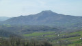
This route to the Col des Trois Croix avoids the usual path to Errebi. You’ll be walking along small roads and idyllic paths used only by local farmers. As you climb along the path, you’ll enjoy magnificent views of the Mondarrain massif. The second section offers views of the Spanish peaks. A very pleasant walk with no difficulty at all.

Details

46649008
Creation:
Last update:
Last review:
  • Walking
    Activity: Walking
  • ↔
    Distance: 6.10 mi
  • ◔
    Average duration: 3h 55 
  • ▲
    Difficulty: Moderate

  • ⚐
    Back to start: Yes
  • ↗
    Ascent: + 1,257 ft
  • ↘
    Descent: - 1,260 ft

  • ▲
    Highest point: 1,680 ft
  • ▼
    Lowest point: 495 ft

Description of the walk

From Espellete, head towards St-Pée-sur-Nivelle via the D918, then turn left onto the D20 towards Ainhoa. On reaching the Col Pinodieta, take the small road on the left and park, 200 m further on, alongside a dirt track.

(S/E) Do not take this dirt track, which is the traditional route, but take the road that descends towards the south-east. You will soon arrive above a path visible on the left.

(1) Turn left onto this track, which heads in the completely opposite direction. This track is signposted, but the signposts will only be relevant to us as far as Mehatsea. Before reaching Mehatsea, cross a ford.

(2) After the farm, turn right.

(3) Pass Beltzagitipia and continue along this road, soon passing a first road on your right and, a few metres further on, a second on your left. Continue along the one on the right. You’ll arrive at Haltia Farm, where the road ends.

(4) Just after the Canadian crossing, take the path on the left which heads uphill due south. You’ll come to a sharp bend to the right.

(5) Leave the track and go straight on, following the path which climbs, gently at first, to an altitude of 400 m. Over three hairpin bends, the gradient steepens to the Col des Trois Croix (513 m). A very beautiful viewpoint.

(6) Cross theGR®10and take the stony path that descends to the right to a signpost.

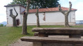
(7) Take the narrow, earthen path branching off to the right. It roughly follows a contour line, with occasional short ascents and descents. Join theGR®10. (You can take a few steps to the chapel on the left, an ideal spot for a picnic.)

(8) Follow theGR®10to the right and north-east. Pass a cave. A little further on, theGR® veers off and climbs at a right angle to the right.

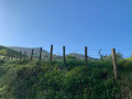
(9) Leave theGR® and continue along the first small path heading eastwards, which leads to a meadow. Walk along the edge of this meadow, following a fence, until you reach a track.

(10) Ignore the track and enter the meadow via a small gap in the fence. Walk down the meadow to the next fence. Cross to the other side via a zigzag path. Continue down this second meadow to the next fence.

(11) Cross the fence using the gap in it, and continue down between the trees until you reach a wide path; follow this to the left until you come to a very wide track.

(12) Follow this track to the right. Pass through a culvert and continue to the car park (S/E).

Waypoints

  1. S/E : mi 0 - alt. 640 ft - Car park
  2. 1 : mi 0.26 - alt. 610 ft - Path entirely to the left
  3. 2 : mi 0.95 - alt. 692 ft - Mehatsea
  4. 3 : mi 1.2 - alt. 804 ft - Belzagitpia
  5. 4 : mi 1.7 - alt. 886 ft - Fork in the road after Haltia
  6. 5 : mi 1.97 - alt. 1,079 ft - Turn right
  7. 6 : mi 2.82 - alt. 1,680 ft - Col des Trois Croix.
  8. 7 : mi 3.14 - alt. 1,417 ft - Signpost
  9. 8 : mi 4.05 - alt. 1,316 ft - GR 10
  10. 9 : mi 4.53 - alt. 1,371 ft - Right-hand bend
  11. 10 : mi 4.65 - alt. 1,375 ft - Track
  12. 11 : mi 4.98 - alt. 1,063 ft - Fence
  13. 12 : mi 5.17 - alt. 955 ft - Track
  14. S/E : mi 6.1 - alt. 636 ft - Car park

Always be cautious and plan ahead when you're outdoors. Visorando and the author of this route cannot be held responsible for any accidents occurring on this route.

The GR® and PR® markings are the intellectual property of the Fédération Française de Randonnée Pédestre.

Reviews and comments

4.6 / 5
Based on 3 reviews

Reliability of the description
4.7 / 5
Ease of following the route
4.7 / 5
Route interest
4.3 / 5
mayayi
mayayi

Overall rating : 4.7 / 5

Date of your route : May 04, 2026
Reliability of the description : ★★★★★ Very good
Ease of following the route : ★★★★★ Very good
Route interest : ★★★★☆ Good
Very busy route : Yes

A lovely little walk with some good climbs, well-marked paths and magnificent views of the surrounding mountains.

Machine-translated

PASCOUAU
PASCOUAU

Overall rating : 4.7 / 5

Date of your route : Feb 27, 2026
Reliability of the description : ★★★★★ Very good
Ease of following the route : ★★★★★ Very good
Route interest : ★★★★☆ Good
Very busy route : No

An interesting alternative is to go via the summit of Erebi. One minor drawback is that there are several "no parking" signs in the usual parking area.

Machine-translated

ANNE40
ANNE40

Overall rating : 4.3 / 5

Date of your route : Sep 01, 2025
Reliability of the description : ★★★★☆ Good
Ease of following the route : ★★★★☆ Good
Route interest : ★★★★★ Very good
Very busy route : No

gPS-only route: superb hike with beautiful panoramic views. Stop at the chapel and water source – highly recommended!

Machine-translated

Other walks in the area

For more walks, use our search engine .

The GPS track and description are the property of this route's author. Please do not copy them without permission.