The Atxuria circuit via the Col des Trois Bornes

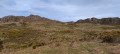
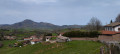
Another way to do a circular route around Atxuria. Easier than some of the other routes already published, with only 450 m of elevation gain. Magnificent views of the impressive cliffs of Atxuria.
Some difficult sections – see the reviews

Details

28564635
Creation:
Last update:
Last review:
  • Walking
    Activity: Walking
  • ↔
    Distance: 7.30 mi
  • ◔
    Average duration: 4h 40 
  • ▲
    Difficulty: Moderate

  • ⚐
    Back to start: Yes
  • ↗
    Ascent: + 1,526 ft
  • ↘
    Descent: - 1,526 ft

  • ▲
    Highest point: 1,762 ft
  • ▼
    Lowest point: 548 ft

Photos

Description of the walk

From Sare, follow the signs for the Sare Caves. Park just before the caves, in the small car park on the right.

(S/E) Go through a gate and take the stepped path on the right, marked with yellow signs. The start is quite steep. At the end of the steps, it becomes less steep and leads to a water intake and a fence. The path turns right onto a stony track. Take this track to the left, passing the first path on your right. Continue until you reach a junction.

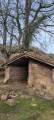
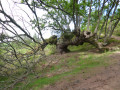
(1) Do not follow the yellow markings which head off to the left; instead, carry on straight ahead and pass to the left of a barn flanked by magnificent oak trees, several of which are over a hundred years old (information board). A little further on, pass to the right of some small cliffs and reach a stream: Urioko Erreka.

(2) Cross the stream for the first time. After heavy rain, the crossing may prove tricky. About twenty metres further on, you’ll reach a junction.

(3) Leave the path that goes straight on and cross Urioko Erreka again. The same warning applies as for the first crossing, except that you can go straight on and, after a wide circular loop, look out for a path on the left which allows you to cross the stream more easily and rejoin the path you left.

(3) The path climbs and reaches a junction.

(4) Ignore the path on the left, which climbs steeply towards the Venta Loretxoa. Turn right. The path approaches a woodland and runs alongside it through a vast meadow. After a while, it veers left away from the woodland. The path continues to climb, passing to the left of a paddock and a farmhouse, and joins a wide track.

(5) Take this track to the left and follow it to the Col des Trois Bornes.

(6) Turn onto the path that runs flat out to the left. It turns into a trail, skirting the copses to the left and roughly following a contour line to the Col Ibainetea.

(7) Take the grassy track that runs alongside the forest on the right. After passing through two fences – a cleared passageway – you’ll reach an enclosure with a barn.

(8) Go round it on the right and head down to the Urbiako Pass

(9) Take the road on the left and follow it to Zugarramurdi.

(10) Turn back and take the road which climbs to the right of the church and leads towards the cemetery. After the cemetery, continue along the road which is circular and leads to the right. Follow it to a sharp right-hand bend. Leave the road on your left which serves several farms.

(11) Turn right and you’ll come to another junction with a sign for Venta Halty.

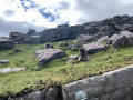
(12) Carry on to the left for 300 m and, when you reach a small meadow, take the paved path that descends towards the rock face. Follow this path to Venta Halty

(13) Do not head towards the venta but take a path branching off to the left. A point of interest along the way is a hole on the left, from which cool air rises from the depths of the earth. Very pleasant in hot weather. The path joins a road leading to Venta Anton. Cross the road and continue on the left-hand side along this path, which runs alongside the quarry and rejoins the road. At the entrance to the caves, turn right and head for the small car park (S/E).

Waypoints

  1. S/E : mi 0 - alt. 581 ft - Car park before the Caves of Sare
  2. 1 : mi 0.52 - alt. 1,086 ft - Crossroads
  3. 2 : mi 0.82 - alt. 1,270 ft - Urioko Erreka
  4. 3 : mi 0.83 - alt. 1,293 ft - Junction
  5. 4 : mi 0.94 - alt. 1,352 ft - Fork in the path
  6. 5 : mi 1.46 - alt. 1,699 ft - Wide track
  7. 6 : mi 1.84 - alt. 1,709 ft - Col des Trois Bornes
  8. 7 : mi 3.07 - alt. 1,686 ft - Ibaineta Pass
  9. 8 : mi 3.49 - alt. 1,647 ft - Enclos and its barn
  10. 9 : mi 3.79 - alt. 1,421 ft - Urbiako Lepoa - Col d'Urbia
  11. 10 : mi 5.12 - alt. 696 ft - Zugarramurdi
  12. 11 : mi 5.89 - alt. 696 ft - Turn right
  13. 12 : mi 6.29 - alt. 705 ft - Crossroads
  14. 13 : mi 6.66 - alt. 597 ft - Venta Halty route
  15. S/E : mi 7.3 - alt. 581 ft - Car park before the Caves of Sare

Notes

According to several Visorandone users at point (13), the path is blocked and you must continue along the road and follow the new ‘blue horses’ route. I will go and check this on site before updating the route description.
At waypoints (2) and (3), crossing the stream can be dangerous after heavy rain.
At point (8), the path follows a small stream which can become very wet in rainy weather.
Following feedback from walkers, a moderator asked me to review my route. After re-walking it twice following a spell of rain, I have kept the starting points (2) and (3) as they are, because whilst crossing the Urioko Erreka proved tricky for some – which I believe to be the case – this is likely to be after heavy rain. It should therefore be avoided when this is the case.
At point (7), following feedback, I have altered the route, which previously ran through a gully.
In Zugarramurdi, as the path is blocked off after the caves, the return route has also been altered.

Worth a visit

There are several restaurants in Zugarramurdi. The food is good and reasonably priced.
Places to see in the village include the Witches’ Museum and the caves.

Reviews and comments

4.1 / 5
Based on 4 reviews

Reliability of the description
4 / 5
Ease of following the route
4 / 5
Route interest
4.3 / 5
vivalamuerte
vivalamuerte
• Edited:

Overall rating : 4 / 5

Date of your route : Sep 15, 2023
Reliability of the description : ★★★★☆ Good
Ease of following the route : ★★★★☆ Good
Route interest : ★★★★☆ Good
Very busy route : Yes

I’ve done this (or rather, THESE) routes several times, the very first time back in… 1993!

You need to know the terrain and be able to use a compass, if only to work out whether you’re heading north or south-east!

Best avoided in foggy weather, which is what I experienced a month ago – not ideal… We headed south to reach the pass near the summit and came back down via a route we had to find ourselves, with no signposting >>> Zugarramurdi and back

P.S. Yes, you have to cross asecond stream – not easy when everything’s wet and slippery – or else wade through it, but the water comes right up to your ankles; you also need good high-top boots! Up to the ankles; you also need good high-top boots!

Machine-translated

lilian 64
lilian 64

Overall rating : 5 / 5

Date of your route : Aug 08, 2023
Reliability of the description : ★★★★★ Very good
Ease of following the route : ★★★★★ Very good
Route interest : ★★★★★ Very good
Very busy route : No

A very pleasant, easy circular walk. Crossing the stream at points 2 and 3 went without a hitch.
Apparently the route has been altered between points 7 and 9. Zugarramurdi was very busy on 8 August and it took a while to get a table in a restaurant.
Not a big deal, though, as the return journey takes you first along a small, shaded road and then along the cliffs amongst the trees, taking an hour and a quarter.

Machine-translated

THEAU
THEAU
• Edited:

Overall rating : 3 / 5

Date of your route : Jul 16, 2023
Reliability of the description : ★★★☆☆ Average
Ease of following the route : ★★★☆☆ Average
Route interest : ★★★☆☆ Average
Very busy route : No

A medium-length circular path with views into the distance on the way up, but none on the way down as the path is set in a steep valley. A stony path.
Lost the path on leaving Zugarramurdi (at landmark 10) due to incorrect signposting and a closed path.
After asking for directions, another path leads back to the starting point, but it is over a kilometre longer and involves nearly 100 metres of elevation gain and loss.

Machine-translated

VL2
VL2
• Edited:

Overall rating : 4.3 / 5

Date of your route : Nov 26, 2022
Reliability of the description : ★★★★☆ Good
Ease of following the route : ★★★★☆ Good
Route interest : ★★★★★ Very good
Very busy route : No

There are plenty of highlights on this walk, but avoid doing it after heavy rain. Right from the start, crossing the Urioka Erreka proves problematic. Swollen by the rain, the marked crossing is dangerous and even impossible; apart from the guide, no one dared to cross. A little further up, we found a more passable ford, yet one of the walkers still slipped in the water…!
There’s plenty of mud; in places, the path even serves as a stream bed.
These mishaps didn’t spoil our enjoyment, but it’s certainly better in dry weather!

Machine-translated

Other walks in the area

For more walks, use our search engine .

The GPS track and description are the property of this route's author. Please do not copy them without permission.