


Philippe COULOT

 Visorando Member
 Premium user
 - Gender: man
Sign up:
Published route(s)
 A walk in the Montsaugeonnais at the crossroads of three provinces
 11.02 mi
 +804 ft
 -814 ft
 5h 45
5h 45
 Moderate
 Departure from Vaux-sous-Aubigny (Haute-Marne)
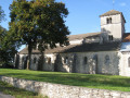
On the borders of Champagne, Burgundy and Franche-Comté, the Domaine du Muid Montsaugeonnais covers 13 hectares, spread across the territories of four communes: Chatoillenot, Montsaugeon, Rivière-les-Fosses and Vaux-sous-Aubigny.
Abandoned since the outbreak of phylloxera in the late 19th century, the vineyard was revived in 1988 thanks to the Chevaliers du Montsaugeonnais.
Around Pesmes, a town of character
 6.46 mi
+171 ft
-164 ft
3h 05
6.46 mi
+171 ft
-164 ft
3h 05
 Easy
Departure from Pesmes (Haute-Saône)
Easy
Departure from Pesmes (Haute-Saône)
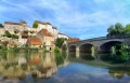
Pesmes is a French commune located in the Haute-Saône department, in the Bourgogne-Franche-Comté region.The commune holds the ‘Cité de Caractère de Bourgogne-Franche-Comté’ and ‘Most Beautiful Villages of France’ labels.
From Mirebeau-sur-Bèze to Noiron-sur-Bèze via the national forest
 10.46 mi
+92 ft
-92 ft
4h 55
Moderate
Departure from Mirebeau-sur-Bèze (Côte-d'Or)
10.46 mi
+92 ft
-92 ft
4h 55
Moderate
Departure from Mirebeau-sur-Bèze (Côte-d'Or)
This walk through the national forest will take you past the castle, Noiron and Blagny.
It follows a path once used by horses and pack animals to carry timber, charcoal and large game out of the forests, or to bring in woodcutters, charcoal burners and their equipment.
We will visit the villages of Mirebeau-sur-Bèze and Noiron-sur-Bèze, through which the River Béze flows.
A long circular route through the Clénay Forest
 9.90 mi
+164 ft
-164 ft
4h 40
Moderate
Departure from Clénay (Côte-d'Or)
9.90 mi
+164 ft
-164 ft
4h 40
Moderate
Departure from Clénay (Côte-d'Or)
Do you enjoy wide open spaces, nature and peace and quiet, away from the beaten route?
Then come and take a walk in the Clénay state-owned forest; we’ll walk along the River La Flacière to the village of Flacey, where we can admire the wash house, the castle and its church. Then we’ll return to Clénay through the forest.
The three communes of the Montsaugeonnais
 10.47 mi
+797 ft
-804 ft
5h 30
Moderate
Departure from Montsaugeon (Haute-Marne)
10.47 mi
+797 ft
-804 ft
5h 30
Moderate
Departure from Montsaugeon (Haute-Marne)
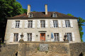
The Montsaugeonnais Community of Communes. Established by a prefectural decree of 19 November 2015, it was formed from the merger of the three communes of Montsaugeon, Prauthoy and Vaux-sous-Aubigny, which became delegated communes. Its administrative centre is in Prauthoy.
The route of the three municipalities will take you through the Montanson woods, which are very popular when the daffodils are in bloom from March to the end of April. You will also be able to explore the vineyards of the Montsaugeonnais.
From Poisot to Urcy through the forest
 5.52 mi
+472 ft
-479 ft
2h 55
Easy
Departure from Quemigny-Poisot (Côte-d'Or)
5.52 mi
+472 ft
-479 ft
2h 55
Easy
Departure from Quemigny-Poisot (Côte-d'Or)
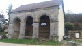
The commune of Urcy is best known for its famous hill climb motor race, which celebrated its60th edition in September 2018. This little corner of the Côte d'Or is also ideal for walks.
Exploring this area on foot is a real pleasure, surrounded by nature, far from the noise and hassle of everyday life. You may even encounter our forest friends along the way.
So put on your walking shoes and go for a stroll in the nearby forests.
The Creux Bleu walk in Villecomte
 5.69 mi
+699 ft
-699 ft
3h 15
Easy
Departure from Villecomte (Côte-d'Or)
5.69 mi
+699 ft
-699 ft
3h 15
Easy
Departure from Villecomte (Côte-d'Or)
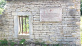
Le Creux Bleu is the resurgence (kastic massif) of the Francheville stream, which disappears a few kilometres upstream and is located 20 metres from the Ignon river in the centre of the village.
Around Couternon
 5.84 mi
+39 ft
-39 ft
2h 45
Easy
Departure from Couternon (Côte-d'Or)
5.84 mi
+39 ft
-39 ft
2h 45
Easy
Departure from Couternon (Côte-d'Or)
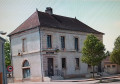
A leisurely walk around Courternon. This route will take you round the village and allow you to discover it in a different light.
The route is in open countryside with little shade. Make sure you bring suitable gear if the sun is strong.
Walk in the Saint-Léger State Forest
 7.04 mi
+115 ft
-108 ft
3h 20
Moderate
Departure from Lamarche-sur-Saône (Côte-d'Or)
7.04 mi
+115 ft
-108 ft
3h 20
Moderate
Departure from Lamarche-sur-Saône (Côte-d'Or)
The origins of Lamarche are unknown. Nevertheless, the discovery in 1887 of polished stone axes and flint knives by Viscount Raoul Legouz de Saint-Seine suggests that the area was inhabited as early as the Neolithic period, although it seems that these tools, found at the confluence of the Bèze and the Saône, were carried here by the floods of these rivers.
This peaceful stroll through the national forest is a truly relaxing experience.
Circular Arceau
 5.51 mi
+69 ft
-66 ft
2h 35
Moderate
Departure from Arceau (Côte-d'Or)
5.51 mi
+69 ft
-66 ft
2h 35
Moderate
Departure from Arceau (Côte-d'Or)
Arcelot, Arceau, Fouchanges; three villages that have always formed a single commune, crossed by the River Tille. Arceau is a rural commune situated 15 minutes from Dijon in a protected environment. Once situated on the Roman road linking Mirebeau to Dijon, the town was undoubtedly provided very early on with a single-arched bridge spanning the River Tille, which gave its name to the village. In the 17th century, General Gallas’s troops pillaged and burned the town.
Through the Bois des Francs via the Combe Pénevelle
 5.74 mi
+958 ft
-942 ft
3h 30
Moderate
Departure from Marsannay-la-Côte (Côte-d'Or)
5.74 mi
+958 ft
-942 ft
3h 30
Moderate
Departure from Marsannay-la-Côte (Côte-d'Or)
Fancy exploring the forest, the Bois des Francs and its paths, seeing Marsannay-la-Côte Castle and its church, and strolling along the vineyards? Then let’s go.
The vineyards of Marsannay-la-Côte are part of the Climats of the Burgundy vineyards, listed as a UNESCO World Heritage Site. Thanks to the combined effect of the geology, the exposure and human labour, these vineyards produce a wine distinct from those of the neighbouring Climats.
Circular loop around Mont de Vassange
 9.14 mi
+843 ft
-827 ft
4h 55
Moderate
Departure from Ougney (Jura)
9.14 mi
+843 ft
-827 ft
4h 55
Moderate
Departure from Ougney (Jura)
Hikers taking their time as they pass through the small village of Ougney will find their gaze drawn for a few seconds to an old, massive, cylindrical tower.
During this hike, we will walk from Ougney to Saligney, then head towards Gendrey and Taxenne before returning to Ougney.
The rolling, green countryside will give you a glimpse of part of the northern Jura (39).
Walk along the banks of the Ouche from Longvic
 7.19 mi
+39 ft
-36 ft
3h 20
Moderate
Departure from Longvic (Côte-d'Or)
7.19 mi
+39 ft
-36 ft
3h 20
Moderate
Departure from Longvic (Côte-d'Or)
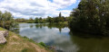
Étang Royal, a little corner of paradise.
Walkers, joggers and other nature lovers appreciate this site for its calm, beauty and balance.
An easy walk to enjoy the green charm of the ponds and banks of the Ouche.
Around Arcelot Castle
 5.17 mi
+46 ft
-49 ft
2h 25
Easy
Departure from Arceau (Côte-d'Or)
5.17 mi
+46 ft
-49 ft
2h 25
Easy
Departure from Arceau (Côte-d'Or)
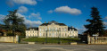
Arcelot Castle is situated in the commune of Arceau, in the Côte d’Or department, in the canton of Mirebeau-sur-Bèze. It has been listed as a Historic Monument since 22 September 1948, with the gardens listed on 30 April 1999. Behind the18th-century château lies one of Burgundy’s very first English-style parks.
A tour of Selongey’s chapels
 5.39 mi
+404 ft
-384 ft
2h 50
Easy
Departure from Selongey (Côte-d'Or)
5.39 mi
+404 ft
-384 ft
2h 50
Easy
Departure from Selongey (Côte-d'Or)
Selongey takes its name from a Roman estate once situated at the ‘Champ de Mars’. Centuries of history have left it with some remarkable monuments: a 13th-century church housing a carillon of 48 bells, listed as a historic monument, and a 19th-century organ, the Chapel of Saint Gertrude (1530) and the Chapel of Saint Anne (1637). There are also a few old houses dating from the 15th and 16th centuries.
In the forest of Crécey-sur-Tille via the Vornay valley
 4.41 mi
+417 ft
-410 ft
2h 25
Easy
Departure from Crécey-sur-Tille (Côte-d'Or)
4.41 mi
+417 ft
-410 ft
2h 25
Easy
Departure from Crécey-sur-Tille (Côte-d'Or)
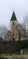
This route will take you to Crécey-sur-Tille Castle and its dovecote, wash houses, wayside crosses and the Church of Notre-Dame de la Nativité. This walk will also take you through the forest via the Combe Vornay to the north-east of the village.
The banks of the Oscara from Fauverney
 6.87 mi
+26 ft
-26 ft
3h 10
Moderate
Departure from Fauverney (Côte-d'Or)
6.87 mi
+26 ft
-26 ft
3h 10
Moderate
Departure from Fauverney (Côte-d'Or)
This walk takes place partly along the Ouche river (Oscara in Latin). It has its source in Lusigny-sur-Ouche. This commune is the guardian of the sources of the Ouche. The village is particularly charming with its stone houses.
The Bois du Vieux Dijon in Arçon
 5.86 mi
+98 ft
-98 ft
2h 45
Easy
Departure from Belleneuve (Côte-d'Or)
5.86 mi
+98 ft
-98 ft
2h 45
Easy
Departure from Belleneuve (Côte-d'Or)
An easy, family-friendly walk across the plain and through the woodland, partly shaded, partly sunny. On your way through Arçon, see the 12th-century Sainte-Anne Chapel, remodelled in the 17th century, located on Grande Rue. On leaving the woods, at a place called La Charme aux Loups, you’ll find the Sainte-Gertrude Chapel, which is not maintained.
From Beire-le-Châtel to Spoy and back
 5.56 mi
+72 ft
-79 ft
2h 35
Easy
Departure from Beire-le-Châtel (Côte-d'Or)
5.56 mi
+72 ft
-79 ft
2h 35
Easy
Departure from Beire-le-Châtel (Côte-d'Or)
Beire-le-Châtel: canton of Saint-Apollinaire (formerly canton of Mirebeau).
The village takes its name from the Gaulish word "Beire", meaning "plain". The discovery of a temple dedicated to Januaria recalls the position of Beire-le-Châtel in Gallo-Roman times, at the crossroads of ancient roads where the remains of two Roman roads can be found. In addition, six Gallo-Roman burials were found in 2019.
Fontaine-lès-Dijon Circular
 5.18 mi
+456 ft
-436 ft
2h 45
Easy
Departure from Fontaine-lès-Dijon (Côte-d'Or)
5.18 mi
+456 ft
-436 ft
2h 45
Easy
Departure from Fontaine-lès-Dijon (Côte-d'Or)
A short walk on the outskirts of Dijon. Lovely views of the villages along the route.
Circular route via the Sentiers des Roches starting from Orches
 9.72 mi
+1,732 ft
-1,732 ft
6h 00
Moderate
Departure from Baubigny (Côte-d'Or)
9.72 mi
+1,732 ft
-1,732 ft
6h 00
Moderate
Departure from Baubigny (Côte-d'Or)
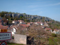
A lovely walk through the vineyards, orchards, hills and cliffs of the Hautes Côtes de Beaune. Numerous viewpoints to discover. Passing through the village of Orches, Saint-Romain, La Rochepot and its castle, and the medieval village of Dracy.
A short circular loop around Trochères
 4.58 mi
+36 ft
-36 ft
2h 10
Easy
Departure from Trochères (Côte-d'Or)
4.58 mi
+36 ft
-36 ft
2h 10
Easy
Departure from Trochères (Côte-d'Or)
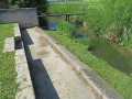
Taking a walk around Trochères isn’t easy; canals block our path in many places, particularly in the Bois de Mordesson, whilst the Albane and Motte streams dictate our route. Not to mention the private woods, where access is prohibited.
So I suggest this family walk, which is still enjoyable and allows us to explore the outskirts of this village.
Places to see:
A 19th-century open-air washhouse at the western exit; the village also boasts the small 13th-century Church of the Nativity, rebuilt in the 18th century and restored with ochre-coloured render.
The two mills, Haut and Bas.
Circular walk in the Forest of Saint-Léger starting from Cirey-lès-Pontailler
 5.64 mi
+203 ft
-184 ft
2h 45
Easy
Departure from Cirey-lès-Pontailler (Côte-d'Or)
5.64 mi
+203 ft
-184 ft
2h 45
Easy
Departure from Cirey-lès-Pontailler (Côte-d'Or)
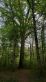
A family walk through the forest and a protected area, far from the hustle and bustle of the town and with little traffic.
Vaux-sur-Crosne circular
 4.99 mi
+95 ft
-95 ft
2h 25
Easy
Departure from Remilly-sur-Tille (Côte-d'Or)
4.99 mi
+95 ft
-95 ft
2h 25
Easy
Departure from Remilly-sur-Tille (Côte-d'Or)
A quiet family route in the heart of the countryside, between woodland and open countryside. 80% shaded Vaux-sur-Crosne has been part of the Norge and Tille Community of Communes since January 2017 and boasts a highly varied water system, partly due to the presence of the rivers Tille and Crosne, and partly due to the presence of a pond, the Lochère, and numerous former gravel pits now reserved for fishing.
Plains and woods around Orgeux
 5.16 mi
+46 ft
-46 ft
2h 25
Easy
Departure from Orgeux (Côte-d'Or)
5.16 mi
+46 ft
-46 ft
2h 25
Easy
Departure from Orgeux (Côte-d'Or)
Does the village of Orgeux owe its name to ancient barley fields (Hordeu)? The Church of the Assumption dates back to the 13th century and features beautiful stained-glass windows in the choir. In the cemetery, there is a 17th-century calvary with a stone plaque. Adjacent to a small stone bridge, the wash house is built straddling a stream. A needle weir on the Norges slows the flow of the water just a stone’s throw away. A Roman road once crossed the area and, in 1967, a hoard of Gallo-Roman coins was unearthed in a sand pit.
La Truchère-Ratenelle Nature Reserve and Site des Charmes
 7.26 mi
+69 ft
-66 ft
3h 25
Moderate
Departure from Sermoyer (Ain)
7.26 mi
+69 ft
-66 ft
3h 25
Moderate
Departure from Sermoyer (Ain)
It is undoubtedly the sand dunes that represent the most striking feature of the Nature Reserve. Shaped 5,000 years ago by the wind, these shifting sands are partially covered in mosses and lichens. Only species adapted to arid environments manage to colonise them. Just a few metres from this desert-like environment lies a waterlogged area stretching over 5 to 6 hectares: a wooded peat bog, the presence of which at an altitude of just 200 metres is surprising. A third, very different environment can be seen not far from there: Étang Fouget, whose surrounding marsh takes the form of a vegetative labyrinth and attracts numerous birds.
Brancion via Mont Prevers and the Bois de la Dame
 5.69 mi
+971 ft
-971 ft
3h 30
Moderate
Departure from Royer (Saône-et-Loire)
5.69 mi
+971 ft
-971 ft
3h 30
Moderate
Departure from Royer (Saône-et-Loire)
This walk will take you from Royer to Brancion via the Chemin des Moines, at the heart of the Romanesque route linking the abbeys of Tournus and Cluny. Perched on a rocky outcrop, the village of Brancion has been inhabited for 3,000 years. Brancion welcomes you and invites you to discover an idyllic medieval world: a fortified gate, a keep overlooking the village and the Romanesque church, exceptional views and leisurely strolls through a completely pedestrianised area. Nestled in lush greenery, the castle is a place where time seems to have stood still.
Around the Fontaine aux Ânes fountain at the start of Messigny-et-Vantoux
 5.11 mi
+558 ft
-535 ft
2h 50
Easy
Departure from Messigny-et-Vantoux (Côte-d'Or)
5.11 mi
+558 ft
-535 ft
2h 50
Easy
Departure from Messigny-et-Vantoux (Côte-d'Or)
A beautiful, undulating walk through the woods. Please note that the route may be slippery in wet or humid conditions.
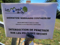
Bucey-lès-Gy circular route via the orientation table
 9.47 mi
+1,083 ft
-1,086 ft
5h 20
Moderate
Departure from Bucey-lès-Gy (Haute-Saône)
9.47 mi
+1,083 ft
-1,086 ft
5h 20
Moderate
Departure from Bucey-lès-Gy (Haute-Saône)
Bucey-les-Gy is a “Petite Cité Comtoise de Caractère” nestled in the Morthe valley, within the triangle formed by the towns of Gray, Vesoul and Besançon.
Ancient and Merovingian graves attest to a very long-standing presence in Bucey-les-Gy. Until 1091, the village belonged to the Counts of Burgundy, before being ceded to the Archbishops of Besançon.
The hamlet of Saint-Maurice, which you will pass through on your walk, was largely destroyed in 1944 in retaliation for acts of resistance.
Around Marnay, its lake and woods
 11.59 mi
+571 ft
-548 ft
5h 50
Moderate
Departure from Marnay (Haute-Saône)
11.59 mi
+571 ft
-548 ft
5h 50
Moderate
Departure from Marnay (Haute-Saône)
Remains of Gallo-Roman buildings have been found in Marnay. However, the commune was not mentioned until 1210. A gate and some remains of the old surrounding walls are still visible. A few elements of the feudal castle also remain, including the drawbridge and two turrets. The old town also has many houses dating from the 15th and 16th centuries. The current town hall dates from the Renaissance.The castle overlooking the Ognon valley was rebuilt in the 16th century but has been extensively remodelled since then.Finally, the Gothic church dates from the 14th and 17th centuries. The 20-hectare lake is home to many animal and plant species.
The plain, the Norges and the Longeault-Pluvault pond from Genlis
6.51 mi
+26 ft
-26 ft
3h 00
Easy
Departure from Genlis (Côte-d'Or)
An easy walk along the banks of the River Norges, crossing the plain south of Genlis and passing by the Longeault-Pluvault pond. The route has little shade and is mostly on stony paths.
Circular Chamblanc, via Pagny-la-Ville, the banks of the Saône and the plain
 12.70 mi
+20 ft
-20 ft
5h 40
Moderate
Departure from Chamblanc (Côte-d'Or)
12.70 mi
+20 ft
-20 ft
5h 40
Moderate
Departure from Chamblanc (Côte-d'Or)
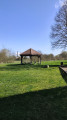
Fellow walkers, this walk starting from the village of Chamblanc will take you through the villages of Lechâtelet and then Pagny-la-Ville along the banks of the Saône. The return route follows the flatlands back to Chamblanc. Avoid this walk in hot weather as there is little shade along the route.
Circular walk along the Sans Fond starting from Corcelles-lès-Cîteaux
 5.84 mi
+115 ft
-125 ft
2h 45
Easy
Departure from Corcelles-lès-Cîteaux (Côte-d'Or)
5.84 mi
+115 ft
-125 ft
2h 45
Easy
Departure from Corcelles-lès-Cîteaux (Côte-d'Or)
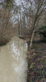
A short circular loop around the River Sans Fond, which winds through fields and the Izeure State Forest. The Sansfondis 16.3 km long, rising at Perrigny-les-Dijon at an altitude of 230 m and flowing into the Vouge at the Abbey of Cîteaux within the municipality of Saint-Nicolas-lès-Cîteaux at an altitude of 193 m.
A variation on the Corcelles-lès-Cîteaux circular route running alongside the Sansfond
 5.83 mi
+72 ft
-72 ft
2h 45
Easy
Departure from Corcelles-lès-Cîteaux (Côte-d'Or)
5.83 mi
+72 ft
-72 ft
2h 45
Easy
Departure from Corcelles-lès-Cîteaux (Côte-d'Or)
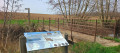
A circular walk around the River Sansfond, this walk takes place in the Izeure National Forest and across fields; it is not technically demanding and the terrain is fairly flat. This alternative route follows the Sansfond for longer towards Noiron-sous-Gevrey, now that a footbridge allows you to cross the river safely to reach Corcelles-lès-Cîteaux. Alovely walk, ideal for everyone.
Circular route in the Moloy National Forest starting from L'Abergement.
 6.49 mi
+643 ft
-656 ft
3h 35
Moderate
Departure from Moloy (Côte-d'Or)
6.49 mi
+643 ft
-656 ft
3h 35
Moderate
Departure from Moloy (Côte-d'Or)
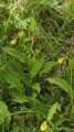
Walk in the Moloy National Forest. This walk will take you along the Bellefontaine Forest Road, past the summits and through numerous valleys. The Combe de Bellefontaine is home to a site famous for its wild orchids, the Lady’s Slipper orchids.
"Legend has it that, pursued by a satyr, Venus lost her clogs in the forest whilst running to escape him. Ever since that day, lady’s slippers have sprung up every spring."André Beuchot