Country:
 City:
City:


To get to Trochères: head via Dijon, Arc-sur-Tille and Binges; after the latter, on the D961 towards Étevaux, turn left onto the D25e towards Mitreuil, then Trochères. In the village, you can park on Rue de la Croix, near the Church of the Nativity and next to the Town Hall.
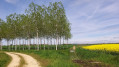
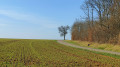
(S/E) Take Rue de la Croix to leave the village, passing the town hall. On leaving the village, continue straight on along Chemin de la Croix, a stony track that turns into a grassy path. At the end of this path, at an altitude of 205 (a T-junction), turn right onto the D25a
(1) Cross with care and follow the path opposite towards the hamlet of Saurois. When you reach the D104, turn left and continue for a few metres.
(2) Just after the hamlet, take the grassy path on the right and continue to the crossroads situated near the northern tip of a small copse. Turn right, ignore the first path on the left and carry on straight ahead. At the next crossroads at the top of a short climb, turn left to reach a T-junction at an altitude of 190 metres.
(3) Follow the white track to the right as far as the Moulin du Bas. Continue along the Chemin du Moulin, enter Trochères and reach the junction with Rue de Mirebeau.
(4) Turn left and continue carefully along the side of the D25a. Cross the bridge over the Albane and, at the next junction, turn right, still heading towards Mitreuil via the D25e. The road has little traffic, but do remain cautious until you reach the first path on the right.
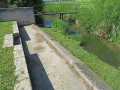
(5) Turn onto this unpaved track, which is grassy in the middle, and carry on until you reach the concrete bridge over the Ruisseau de la Motte.
(6) Turn right and stay on this road, keeping to the left until you reach the D104, which you’ll come to at Moulin du Haut.
(7) Turn right towards the village centre via Rue de Belleneuve. Use the pavements for your safety. Head towards the church and the car park (S/E).



 Visorando Member

 Moderate