Country:
 City:


In Champlitte, park at Place de la Mairie near Saint-Christophe Church.
(S/E) Take the alleyway leading to the church, situated to the right of the belfry, and head towards Rue de l’Église. Turn right and, at the crossroads, continue along Rue de la Bréche. On this street, after 100 metres, turn left into Rue des Jardins.
(1) Cross the iron bridge over the River Salon, keep to the left and continue until you reach Route de Champlitte-la-Ville.
(2) Continue to the right along this street for 200 m and turn left into Rue Saint-Jean, which forms part of the GR® 145 trail, marked in red and white. On this street, after 200 m, turn right and continue until you reach the wayside cross on the left. After the wayside cross, leave the GR® 145 and continue left along a track suitable for vehicles, going uphill until you reach a grassy path.
(3)Take thispath, cross a road and carry on straight ahead to reach the D17.
(4) Turn right onto it for 300 m and turn left onto a dirt track. Follow it until you reach a dirt track on the left.
(5) Turn onto it, heading towards Combe Marvelin. Continue along this track until you reach the Bois de Champlitte-la-Ville, at a place called La Coupotte.
(6) Carry on along the track which enters the woodland for 500 m and look out for a clearing on the left between the Bois de Ventoux and the Bois de Champlitte-la-Ville. Head for this clearing, slightly to the left, and walk along the edge of the Bois de Ventoux until you reach a track suitable for vehicles which enters the Bois de Ventoux.
- (7) Two options depending on the weather or the season:
– continue along the route on the path that leads into the woods and reach the track (which was in poor condition and wet when I was there).
– continue along the edge of the woods until you reach the track.
Once you reach the track, look out for a hunting lodge on the right-hand side of the track. Head uphill towards Pierrecourt until you reach the first track on the right.
(8) Turn onto this uphill track and, at the next junction, turn left to reach the Croix de Coulvot and the fountain. Then continue towards the village of Pierrecourt via Rue de l’Ormeau, where the old communal oven is located.
(9) Carry on to the right along Rue de Juchaud and continue to the right until you reach Saint-Martin’s Church. Turn left onto the Grande Rue until you reach Rue de Frette.
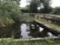
(10) You can turn right down this street to reach a picnic area, the Croix du Magny and its wash house.
(11) Retrace your steps back to the junction with the Grande Rue.
(10) Turn right, continue along the Grande Rue (D5) and cross the village towards Grenant or Frettes. On leaving the village, walk safely for 400 m on the left-hand side of the road; there is little traffic but do remain vigilant. Pass a wayside cross.
(12) Shortly afterwards, leave the departmental road and turn left. Stay on the track until you reach the Allée des Noyers on the left.
(13) Turn onto this stony track,pass through the hamlets of Les Champs Bois and Le Rhône, and join the D460.
(14) Cross it carefully and head towards Combe la Mort. Ignore the first track on the right, which is now blocked by a gate, and continue along the track until you reach the next gate.
(15) The second track on the right is now within an electrified enclosure with an access gate, but I couldn’t find a way out, so you’ll need to go off-track for 600 metres and follow the fence, staying outside the enclosure from the start of the track, to reach a track suitable for vehicles to the north, located at the hamlet of Creux des Boulaies. As this is an unmaintained route, there may be tall grass and some brambles, but the route does not present any major difficulties. I should point out that on my second visit with a walking group, I noticed that this route was apparently being used by walkers also seeking to return to the track.
(16) At this road, continue to the left until you reach the Croix de l’Échenot crossroads. At the crossroads, follow Rue de l’Échenoz to reach the village of Montarlot-lés-Champlitte.
(17) At the first junction, carry on straight ahead and cross the River Salon via the bridge to rejoin the GR®145. Continue along Grande Rue.
(18) At the first junction, you can make a detour to Saint-Martin’s Church in Montarlot-lés-Champlitte. Continue along Grande Rue and, on leaving the village, before the wayside cross, take the road on the left – Rue Pré et Martin Montarlot – to reach the ford across the Salon.
(19) Cross the ford and follow the stony path towards Champlitte until you reach the D460.
(20) On this departmental road, take due care. This road, which has a moderate volume of traffic, can be dangerous, so walk safely in single file at the side of the carriageway to reach the village of Champlitte, as the GR® 145 does
(21) On entering the built-up area of Champlitte, the grassy verge is passable. Approach via Rue des Casernes and you will see the former Augustinian convent on your left.
(2) At the junction with the Route de Champlitte-la-Ville, turn right into Rue Pasteur, cross the bridge over the Salon and carry on, ignoring Rue de la Haye Basse on the right.
(22) Immediately afterwards, turn right onto Rue de la Haye Haute and, a little further on, you’ll find some steps on the left leading to Saint-Christophe Church, which you should go round to the right. Turn right again to walk round the castle before returning to the car park (S/E).
 Visorando Member

 Moderate

 Easy