Vaux-sur-Crosne circular

A quiet family route in the heart of the countryside, between woodland and open countryside. 80% shaded Vaux-sur-Crosne has been part of the Norge and Tille Community of Communes since January 2017 and boasts a highly varied water system, partly due to the presence of the rivers Tille and Crosne, and partly due to the presence of a pond, the Lochère, and numerous former gravel pits now reserved for fishing.

Details

36009828
Creation:
Last update:
Last review:
  • Walking
    Activity: Walking
  • ↔
    Distance: 4.99 mi
  • ◔
    Average duration: 2h 25 
  • ▲
    Difficulty: Easy

  • ⚐
    Back to start: Yes
  • ↗
    Ascent: + 95 ft
  • ↘
    Descent: - 95 ft

  • ▲
    Highest point: 781 ft
  • ▼
    Lowest point: 676 ft

Photos

Description of the walk

To get to Vaux-sur-Crosne from Arc-sur-Tille, head towards Remilly-sur-Tille, then, once in the village, follow signs for Cessey-sur-Tille. Just before leaving Remilly-sur-Tille, turn left towards Vaux-sur-Crosne.
Park in the village on the left-hand side as you leave, on the verge along the road. Do not park in front of house entrances or on private property.

(S/E) Leave the village heading towards Tellecey and, after the stone bridge over the Crône stream, take the first path on the right after the wooden hut.
Walk a good hundred metres and take the grassy path on the left, lined with young trees. You’ll reach a crossroads at the edge of a copse.

(1) Turn left onto the grassy path. Continue to the edge of Les Bruyères Wood and take the first path on the right running along the edge of the wood. At the end of this path, turn right and continue until you reach the wood. Walk for about 150 metres until you reach a gully in the wood.

(2) Turn left into it. At the end of this woodland path, at the crossroads, turn right and carry on until you reach the next section of woodland on the left. Turn into it and follow it until you reach a T-junction. Turn left towards woodland section no. 33.

(3) Turn left onto it and carry on. At the first X-junction, turn right and you’ll immediately come to the junction for section no. 8.

(4) Turn left onto this path, then a few hundred metres further on, follow the edge of the woodland on the right. You’ll come to a wooden footbridge; cross it and carry on until you reach the white track. Turn right to reach the alpaca farm

(5) Head back the way you came for a few metres, then continue straight ahead along a completely straight path. Follow the edge of the woodland, then pass between the fields. Go round the Frétois farm and follow the road for a few metres, then leave it to walk alongside the Bois de Buisson à la Rose. Then enter the woodland and continue for a few hundred metres until you reach the junction for section no. 5.

(6) Turn right here, ignore the first three paths and, after a right-hand bend, you’ll reach the crossroads at the Bois des Batteux.

(7) Take the path on the left, which slopes gently downwards. At the end of this, turn left again – please note that the path is not shown on the map but is clearly there on the ground. Follow the edge of the woodland for a short distance, then enter the woodland and continue along a straight stretch to reach the junction with a wider track. Turn left onto this and you’ll reach a new section.

(8) Head up this track to the right until you reach the Crône stream.

(9) Keep to the left to follow the stream for 50 metres. Cross a small ditch – which is easy to cross in dry weather – and join the path on the right to cross the Crône stream. Continue to the tarmac road.

(10) Turn left onto it to return to the hamlet of Vaux-sur-Crosne. At the crossroads, turn left and head for the car park at Vaux-sur-Crosne (S/E).


Waypoints

  1. S/E : mi 0 - alt. 686 ft - Vaux-sur-Crosne car park
  2. 1 : mi 0.19 - alt. 676 ft - Crossroads at the edge of a copse
  3. 2 : mi 0.54 - alt. 686 ft - Bois des Bruyères crossroads
  4. 3 : mi 1.28 - alt. 745 ft - Wooded section no. 33
  5. 4 : mi 1.54 - alt. 745 ft - Wooded section no. 8
  6. 5 : mi 2.04 - alt. 751 ft - Alpaca Farm
  7. 6 : mi 2.9 - alt. 764 ft - Wooded section no. 5
  8. 7 : mi 3.14 - alt. 761 ft - Les Batteux
  9. 8 : mi 3.98 - alt. 722 ft - Junction options
  10. 9 : mi 4.27 - alt. 682 ft - Keep to the left, then cross the - Crôsne (ruisseau) - Affluent de la Tille
  11. 10 : mi 4.56 - alt. 696 ft - Tarmac road
  12. S/E : mi 4.99 - alt. 686 ft - Vaux-sur-Crosne car park

Notes

Alternative route:
(8) In wet weather, to avoid a small ditch that may be waterlogged, stay on the main path opposite and follow it to the road. Turn right to return directly to the car park at Vaux-sur-Crosne.

Worth a visit

(S/E) The wash house at Vaux-sur-Crosne was built in 1825 by Pierre Nicolardot, a local contractor.

Between (1) and (2) The Étang de la Lochère is situated alongside the Vaux-sur-Crosne road linking Cessey-sur-Tille and Vaux-sur-Crosne.

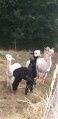
(5) Alpaca farm: take a few minutes to watch them grazing near the farm.

Reviews and comments

4.2 / 5
Based on 3 reviews

Reliability of the description
4.7 / 5
Ease of following the route
4.7 / 5
Route interest
3.3 / 5
Christian21
Christian21

Overall rating : 4.3 / 5

Date of your route : Nov 30, 2023
Reliability of the description : ★★★★★ Very good
Ease of following the route : ★★★★★ Very good
Route interest : ★★★☆☆ Average
Very busy route : No

We went on this walk as a group, parking next to the hut on the first path to the right of the road. The route and description are accurate and reliable. The main attraction, apart from the walk through the forest, is the alpaca farm. We’d phoned ahead and ended up staying there quite a while with the farmer, so we had to cut the walk short by returning via the road to Le Fretois.
It’s a shame, however, that this route wasn’t extended a little further south to include the remarkable tree known as ‘Les Six Filles’, situated south of point 3 and accessible via the correct path (see the ‘Les Six Filles’ route).

Machine-translated

Sosonounou21
Sosonounou21

Hello,
It wasn’t me who caused the trouble… but I witnessed the whole thing. The owners attacked the group and threatened to smash their vehicles with the tractor. I started by apologising for parking in their courtyard, but at the same time I told them that we couldn’t just assume it was a private courtyard. The following week, they’d put up signs stating that it was a private courtyard.
What’s more, two people saw us park; they could have told us.
It’s still a very pleasant ride.

Machine-translated

Philippe COULOT
Philippe COULOT

Hello
It’s true that the start was a bit overgrown. It’s good to hear the paths are clear now.
Reading your comment, I gather that the farm owner asked you to park somewhere other than on her property, and I think that’s only right.
I’d just like to add that, if – and only if – you were the one who caused the trouble with the lady at the farm, then:
This woman contacted me afterwards to ask if I was indeed the author of the walk and to request that I change the starting point, as you had the audacity to tell her that the description mentioned parking on her property. Not very nice.
I apologised to this lady for your behaviour and then updated the text of my walk to make it clear that people should not park on the farm, as it is, of course, private property.
We are respectful and well-mannered people, so let’s avoid these unpleasant situations. Let’s respect the peace and
other people’s property.
Kind regards

Machine-translated

Sosonounou21
Sosonounou21

Overall rating : 4.7 / 5

Date of your route : Sep 25, 2023
Reliability of the description : ★★★★★ Very good
Ease of following the route : ★★★★★ Very good
Route interest : ★★★★☆ Good
Very busy route : No

Be careful where you start from – it’s a private car park (which causes a lot of trouble with the villagers). It’s best to set off 100 metres further on (on the right as you leave the village); what’s more, there’s space for about twenty cars.
The paths have just been cleared – it’s a lovely walk 😉

Machine-translated

Philippe COULOT
Philippe COULOT

Hello
It’s true that the start is a bit overgrown – the local councils are maintaining the paths less and less. As for what I find appealing about the route, for me the main thing is just walking.
Kind regards

Machine-translated

Chabanis
Chabanis

Overall rating : 3.7 / 5

Date of your route : Aug 12, 2023
Reliability of the description : ★★★★☆ Good
Ease of following the route : ★★★★☆ Good
Route interest : ★★★☆☆ Average
Very busy route : No

A short, easy and pleasant walk in the woods (apart from the grassy paths at the start). Ideal for picking plenty of blackberries😋. Other than that, there’s not much to it.

Machine-translated

Other walks in the area

For more walks, use our search engine .

The GPS track and description are the property of this route's author. Please do not copy them without permission.