La Combe Grivot and the Bois de Comboyer, starting from Vantoux

An easy family walk on the outskirts of the Dijon conurbation. 80 per cent of the route is shaded. A good introduction to what remains to be discovered in the Val Suzon.

Details

n°55543093
Creation:
Last update:
Last review:
  • Walking
    Activity: Walking
  • ↔
    Distance: 5.72 mi
  • ◔
    Average duration: 3h 00 
  • ▲
    Difficulty: Easy

  • ⚐
    Back to start: Yes
  • ↗
    Ascent: + 394 ft
  • ↘
    Descent: - 384 ft

  • ▲
    Highest point: 1,342 ft
  • ▼
    Lowest point: 955 ft

Photos

Description of the walk

Getting to Vantoux, a village north of Dijon. From Dijon, take the D996. Just before Messigny-et-Vantoux, turn left onto the D104h. Drive through the whole of the village of Vantoux via Rue du Château and, on leaving the village, at the junction with the Chemin d’Hauteville, park at the side of the road, alongside a wall.

(S/E) Head west along a path leading towards a wood (do not take the Chemin d’Hauteville). Walk alongside the wood on your left. Stay on the edge of the wood, then enter it. Walk up the Combe Grivot, keeping a south-westerly direction.

(1) At the junction, keep to the left. Continue up the valley, still heading south-west.

(2) You’ll come out onto a small road; follow it to the left. Pass under two high-voltage power lines, then enter the village of Hauteville-lès-Dijon via Rue de Pied de Mont. Cross Rue des Herbues on the left-hand side and continue to the next junction (calvary).

(3) Then turn left into Rue de Messigny. Pass under the high-voltage power line again.

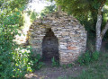
(4) Ignore the Chemin des Lavières on the right and pass a cadole on the right-hand side (la Cabiote Maurice). Continue northwards along a track, ignoring the side paths, and enter the Bois de Vantoux.

(5) At the crossroads, turn right (north-east) onto a wide, straight, stony track. Carry on straight ahead through the woods.

(6) At the crossroads, turn left (north-north-east) and walk along the right-hand side of the wall of the Château de Vantoux grounds.

(7) At the fork in the road, take the left-hand path. You’ll soon pass a path on your left. At the T-junction shortly afterwards, turn right.

(8) You’ll come to a small tarmac road, the Chemin d’Hauteville; follow it to the left. This will quickly take you back to the car park (S/E).


Waypoints

  1. S/E : mi 0 - alt. 958 ft - Vantoux – Alongside the D104h
  2. 1 : mi 1.21 - alt. 1,027 ft - Junction
  3. 2 : mi 2.23 - alt. 1,194 ft - Small road
  4. 3 : mi 3.11 - alt. 1,243 ft - Junction – Calvary
  5. 4 : mi 3.39 - alt. 1,240 ft - Junction – Cadole
  6. 5 : mi 4.12 - alt. 1,283 ft - Crossroads
  7. 6 : mi 5.04 - alt. 1,125 ft - Crossroads – Wall of the park at – Château de Vantoux
  8. 7 : mi 5.49 - alt. 1,050 ft - T-junction
  9. 8 : mi 5.6 - alt. 1,010 ft - Tarmac road
  10. S/E : mi 5.72 - alt. 958 ft - Vantoux – Alongside the D104h

Worth a visit

You can see Vantoux Castle from the village.

Reviews and comments

5 / 5
Based on 1 review

Reliability of the description
5 / 5
Ease of following the route
5 / 5
Route interest
5 / 5
Philippe COULOT
Philippe COULOT

Hello

Thank you for your comments.
Kind regards
Philippe

Machine-translated

Chabanis
Chabanis

Overall rating : 5 / 5

Date of your route : Aug 24, 2024
Reliability of the description : ★★★★★ Very good
Ease of following the route : ★★★★★ Very good
Route interest : ★★★★★ Very good
Very busy route : No

A really lovely walk, with no difficulties and mostly through the woods. We’ll definitely do it again!
Thank you

Machine-translated

Other walks in the area

For more walks, use our search engine .

The GPS track and description are the property of this route's author. Please do not copy them without permission.