The Creux Bleu walk in Villecomte

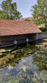
Le Creux Bleu is the resurgence (kastic massif) of the Francheville stream, which disappears a few kilometres upstream and is located 20 metres from the Ignon river in the centre of the village.

Details

2153507
Creation:
Last update:
Last review:
  • Walking
    Activity: Walking
  • ↔
    Distance: 5.69 mi
  • ◔
    Average duration: 3h 15 
  • ▲
    Difficulty: Easy

  • ⚐
    Back to start: Yes
  • ↗
    Ascent: + 699 ft
  • ↘
    Descent: - 699 ft

  • ▲
    Highest point: 1,663 ft
  • ▼
    Lowest point: 961 ft
  • ⚐ Country: France
  • ⚐ City: Villecomte (21120)
  • ⚑
    Start/End: N 47.510672° / E 5.036965°
  • ❏
    IGN map(s): Ref. 3021SB, 3022ET, 3121SB, 3122SB
  • Hour-by-hour weather

Photos

Description of the walk

Departure from the Creux Bleu car park in Villecomte.

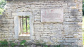
(S/E) From the car park, take a look at the wash house, then head to Rue du Moulin and turn left onto Rue de la Forge. At the crossroads with Chemin du Bois la Dame, turn right.

(1) At the village exit, the paved road ends. Continue on the dirt road uphill and keep going until the next crossroads.

(2) Turn right and continue straight ahead.

(3) Ignore the path that branches off to the right and continue straight ahead until you reach the road. At the road, turn left for 50 metres and take the dirt track on the right. At the first fork, keep to the right again and continue straight ahead until you leave the Villecomte communal forest.

(4) At the edge of the woods, continue straight ahead on the grassy path between the two cultivated fields and, after a small copse, you will come to a crossroads. Turn right.

(5) Mortière Farm, a place of resistance. Follow the track for 50 metres behind the building to see the pond, then continue along the path.

(6) Just before entering the woods, at the hunter's gatehouse, take the path opposite and continue, keeping to the right.

(7) At the crossroads, continue straight ahead then turn left towards Combe Vaudry.

(8) At the fork, turn left, pass between the two fields and at the next crossroads, follow the yellow sign to the right. (Villecomte Creux Bleu)
Enter the village via Chemin de la Mortière and continue to Grande Rue - D6c -

(9) At the junction of Grande Rue, Rue du Moulin and Rue Sophie Gancier, continue straight ahead towards Creux Bleu.

(10) Then head to the car park, walking between the Ignon and the Résurgence.
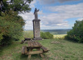
Tables and facilities are available for you to eat and enjoy yourself before setting off again (S/E).


Waypoints

  1. S/E : mi 0 - alt. 965 ft - Creux Bleu car park in Villecomte - Ignon (rivière)
  2. 1 : mi 0.26 - alt. 1,050 ft - Dirt track at the exit of the village
  3. 2 : mi 0.9 - alt. 1,342 ft - On the right, at the crossroads
  4. 3 : mi 1.36 - alt. 1,424 ft - Straight towards the road
  5. 4 : mi 2.57 - alt. 1,572 ft - Exit from the woods
  6. 5 : mi 3.03 - alt. 1,663 ft - Mortière Farm. Place of resistance.
  7. 6 : mi 3.15 - alt. 1,657 ft - Hunter's sentry box.
  8. 7 : mi 3.5 - alt. 1,598 ft - At the crossroads, go straight ahead.
  9. 8 : mi 4.47 - alt. 1,093 ft - Crossroads, on the left
  10. 9 : mi 5.54 - alt. 968 ft - Continue straight ahead towards Creux Bleu.
  11. 10 : mi 5.57 - alt. 965 ft - Le Creux Bleu. Resurgence
  12. S/E : mi 5.69 - alt. 965 ft - Creux Bleu car park in Villecomte

Worth a visit

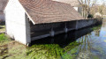
Le Creux Bleu follows the source of a fast-flowing river channelled over 200 metres to supply mills. Bright emerald green aquatic plants grow there. Ducks and large trout swim around at their leisure. This leat was used to supply the old mill located at the end of this canal. The resurgence is preceded by a large underground network that cannot be visited but has been explored.

During periods of high water, the bubbling of the resurgence is spectacular and, regardless of the flow, the water is always very clear. At the far right end of the leat, you can admire an old wash house with a mechanical lift.

Reviews and comments

4.6 / 5
Based on 19 reviews

Reliability of the description
4.7 / 5
Ease of following the route
4.7 / 5
Route interest
4.4 / 5
Philippe COULOT
Philippe COULOT

Thank you for your feedback.
Enjoy your upcoming walk.
Kind regards.

Machine-translated

User 30632030

Overall rating : 5 / 5

Date of your route : Aug 17, 2026
Reliability of the description : ★★★★★ Very good
Ease of following the route : ★★★★★ Very good
Route interest : ★★★★★ Very good
Very busy route : No

A brilliant walk – a first for us. The route is very well signposted and shaded for most of the way, with a particularly pleasant stretch through the woods. The initial climb, about 2 km long, requires a bit of effort but is still perfectly manageable.
It took us 2 hours 30 minutes as a pair of adult beginners.

Machine-translated

Philippe COULOT
Philippe COULOT

Thank you.
I hope you enjoy your future walks.
Kind regards

Machine-translated

User 25793603

Overall rating : 4.7 / 5

Date of your route : Aug 11, 2026
Reliability of the description : ★★★★☆ Good
Ease of following the route : ★★★★★ Very good
Route interest : ★★★★★ Very good
Very busy route : No

Hello,
A very pleasant route, suitable for walking at any time of day as it is very shaded.

Additional information: part of the route is closed between October and March by local by-law (roughly between points 3 and 8).
After point 8, don’t hesitate to turn left to avoid joining the road.
The estimated time is greatly overestimated; it’s more like 2½ hours.

Enjoy your walk

Machine-translated

User 29416805

Overall rating : 5 / 5

Date of your route : May 19, 2026
Reliability of the description : ★★★★★ Very good
Ease of following the route : ★★★★★ Very good
Route interest : ★★★★★ Very good
Very busy route : No

I’d like to let you know that I’ve taken a different route through the woods.
After point 3, on the road, turn left for 50 metres and take the dirt track on the right. At the first fork, keep to the right. In the woods, turn right again, complete the small circular loop and follow the footpath.
At the end, turn right, then ignore the paths on the right and follow the one on the left to the end.
At the junction, you’ll come to the path leading to Combe Vaudry by turning right.
A lovely walk through the woods. I spotted a magnificent 90-kg wild boar 50 metres away. He was more scared than I was.
The Creux Bleu in Villecomte is spectacular.

Machine-translated

User 19432839

Overall rating : 4.7 / 5

Date of your route : Mar 09, 2026
Reliability of the description : ★★★★★ Very good
Ease of following the route : ★★★★★ Very good
Route interest : ★★★★☆ Good
Very busy route : No

Very well marked route, without any major difficulties.

Machine-translated

Philippe COULOT
Philippe COULOT

Thank you.
Enjoy your future walks.
kind regards

Machine-translated

saint-apollinaire
saint-apollinaire
• Edited:

Overall rating : 4.7 / 5

Date of your route : May 09, 2025
Reliability of the description : ★★★★★ Very good
Ease of following the route : ★★★★★ Very good
Route interest : ★★★★☆ Good
Very busy route : Yes

le Creux Bleu is well promoted by the town hall.
The Mortière farm deserves greater recognition out of respect for the resistance fighters.
This is an easy route.
Good for birdwatching
Thank you for this route.

Machine-translated

Philippe COULOT
Philippe COULOT

Thank you.
Enjoy your future walks.
kind regards

Machine-translated

pailooe
pailooe

Overall rating : 4.7 / 5

Date of your route : Mar 31, 2025
Reliability of the description : ★★★★★ Very good
Ease of following the route : ★★★★★ Very good
Route interest : ★★★★☆ Good
Very busy route : No

A pleasant and easy walk.

Machine-translated

sunshine
sunshine
• Edited:

White road and highway, no footpaths, trails or wooded charm. Oh well; no interest except for the blue hollow itself, and even then...

Machine-translated

Philippe COULOT
Philippe COULOT

Hike created in 2019, so yes, the route may have changed.
Enjoy your walk
Kind regards.

Machine-translated

wiloucaramel
wiloucaramel

Overall rating : 3.7 / 5

Date of your route : Jun 18, 2023
Reliability of the description : ★★★★☆ Good
Ease of following the route : ★★★★☆ Good
Route interest : ★★★☆☆ Average
Very busy route : No

The blue hollow is ideal for a picnic, as it is quiet and shaded. However, the hike itself is not particularly interesting. There are sections with tall grass (watch out for ticks) and a path that has been widened by tree felling, making it less shaded than we had hoped. We did the hike in bright sunshine and 30-degree heat, so it was quite warm :-)

Machine-translated

Philippe COULOT
Philippe COULOT

Thank you for your appreciation.
Have a pleasant journey.
Kind regards.

Machine-translated

PATJO
PATJO

Overall rating : 4.7 / 5

Date of your route : Jul 04, 2022
Reliability of the description : ★★★★★ Very good
Ease of following the route : ★★★★★ Very good
Route interest : ★★★★☆ Good
Very busy route : No

Hello
A beautiful hike, well shaded, returning via the "Creux Bleue" and its picnic tables.
Best regards

Machine-translated

Other walks in the area

For more walks, use our search engine .

The GPS track and description are the property of this route's author. Please do not copy them without permission.