Walk between the Lonchamp and Saint-Léger State Forests

The route runs between the Lonchamp State Forest and the Saint-Léger State Forest.
Protected area; vehicle access prohibited unless authorised.
Road cycling route between the towns of Vaux-sur-Crosne and Lamarche-sur-Saône.

Details

n°2954390
Creation:
Last update:
Last review:
  • Walking
    Activity: Walking
  • ↔
    Distance: 5.38 mi
  • ◔
    Average duration: 2h 35 
  • ▲
    Difficulty: Easy

  • ⚐
    Back to start: Yes
  • ↗
    Ascent: + 164 ft
  • ↘
    Descent: - 164 ft

  • ▲
    Highest point: 781 ft
  • ▼
    Lowest point: 682 ft
  • ⚐ Country: France
  • ⚐ City: Tellecey (21270)
  • ⚑
    Start/End: N 47.293852° / E 5.281315°
  • ❏
    IGN map(s): Ref. 3123E
  • Hour-by-hour weather

Photos

Description of the walk

(S/E) Start from the car park behind the church. Head east along the Chemin de l’Arnizon.
Stay on this path until you enter the woods.

(1) Take the first path on the right, a dirt track with a grassy strip down the middle.

(2) Turn left onto a grassy track that climbs slightly. At the next junction, turn right.
At the next junction, turn right again.
At the next junction, take the path furthest to the left.

(3) At this junction, take a sharp left-hand bend, ignore section No. 41 and continue along the path that branches off to the left.

(4) Follow section No. 17 of the woodland to the left.
Carry on until you reach the cycle path. Just before you reach this path, veer slightly to the left and, without taking the cycle path, take the path that leads back into the woods on the left.

(5) Here, ignore the path (section No. 14/15) that branches off to the left and do not continue straight ahead.
Carry on to the right until you reach the road.
At the road, turn right until you reach the crossroads.
At the junction, turn left for a few metres, then take the first path on the right.

(6) Turn right onto section No. 39. At the end of this section, turn left and, after a few metres, take a narrow path on the right. After a slight descent, turn left at the next junction.
Stay on this track until you reach section No. 19.

(7) Take section No. 19 on the left until you reach the white track.
At the white track, turn left for 10 metres, then right after the gamekeeper’s lodge.
Continue to the next junction and turn right.
Stay on this path until you reach the sign (on the left) pointing towards Bois Charmant.
Carry on towards Bois Charmant until you reach the next junction.

(8) Turn left towards the transmitter.
At the junction by the transmitter, turn right to return to Tellecey (S/E) via the same path as on the way there.

Waypoints

  1. S/E : mi 0 - alt. 709 ft - Car park behind the church. Cross the - Arnisson (rivière)
  2. 1 : mi 0.99 - alt. 705 ft - Path on the right
  3. 2 : mi 1.42 - alt. 702 ft - Grassy path on the left.
  4. 3 : mi 1.86 - alt. 712 ft - Turn left onto the path
  5. 4 : mi 2.45 - alt. 748 ft - On the left, section 17
  6. 5 : mi 2.91 - alt. 755 ft - Turn right at the fork
  7. 6 : mi 3.22 - alt. 748 ft - Section 39
  8. 7 : mi 4.08 - alt. 722 ft - On the left is section 19. Dirt track.
  9. 8 : mi 4.77 - alt. 738 ft - Turn left towards the transmitter.
  10. S/E : mi 5.38 - alt. 709 ft - Car park behind the church

Notes

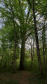
Most of the walk is through woodland.

Reviews and comments

3.2 / 5
Based on 3 reviews

Reliability of the description
3.7 / 5
Ease of following the route
3.7 / 5
Route interest
2.3 / 5
Xylo21
Xylo21

Overall rating : 3.3 / 5

Date of your route : Mar 28, 2021
Reliability of the description : ★★★☆☆ Average
Ease of following the route : ★★★★☆ Good
Route interest : ★★★☆☆ Average
Very busy route : No

A fairly average walk; the forest is quite rugged, the path is hard to make out, and we took the wrong route twice. So, to avoid making the walk any longer (with an 8-year-old, you can’t push it too far…), we took a shortcut to finish sooner – a shame.

Machine-translated

Christian Chauveau
Christian Chauveau

Overall rating : 2.3 / 5

Date of your route : Jan 11, 2021
Reliability of the description : ★★★☆☆ Average
Ease of following the route : ★★☆☆☆ Disappointing
Route interest : ★★☆☆☆ Disappointing
Very busy route : No

Logging everywhere, forest tracks everywhere – impossible to find the route, so we turned back at the 4

Machine-translated

chappard dominique
chappard dominique

Overall rating : 4 / 5

Date of your route : Jul 20, 2020
Reliability of the description : ★★★★★ Very good
Ease of following the route : ★★★★★ Very good
Route interest : ★★☆☆☆ Disappointing
Very busy route : No

An uninteresting route. Some sections are in need of maintenance.

Machine-translated

Other walks in the area

For more walks, use our search engine .

The GPS track and description are the property of this route's author. Please do not copy them without permission.