Circular walk in the Forest of Saint-Léger starting from Cirey-lès-Pontailler

A family walk through the forest and a protected area, far from the hustle and bustle of the town and with little traffic.

Details

33381458
Creation:
Last update:
Last review:
  • Walking
    Activity: Walking
  • ↔
    Distance: 5.64 mi
  • ◔
    Average duration: 2h 45 
  • ▲
    Difficulty: Easy

  • ⚐
    Back to start: Yes
  • ↗
    Ascent: + 203 ft
  • ↘
    Descent: - 184 ft

  • ▲
    Highest point: 778 ft
  • ▼
    Lowest point: 656 ft

Photos

Description of the walk

Head to Cirey-lès-Pontailler and park near the washhouse on Place des Lavandiers.

(S/E) Opposite the washhouse, head towards the street branching off to the right towards the junction of the Chemin des Moissons and Rue du Bois. At this junction, turn right onto Rue du Bois and continue along the road until you reach a Fork in the road.

(1) Stay on the main path, veering to the right. At the next junction, turn right again onto the grassy path. Once at the end, take the path on the left, almost directly opposite you, and follow it to a T-junction. Turn left, heading towards Le Bas des Combes, until you reach the junction before the ditch.

(2) Go straight on along the grassy path which descends towards a ditch (elevation 202), which you can cross in a single step with the help of a stake. Once you’ve crossed the ditch, head straight on for about twenty metres to rejoin the path; once on it, continue to your left through Le Bas des Combes: this path doesn’t appear on the map but it does exist. Follow it to the junction with a tarmac road.

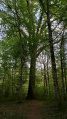
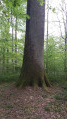
(3) Turn right and, at the first junction (elevation 206), carry on straight ahead towards Tellecey. A little further along this road, a sign will point you to a remarkable tree on the left. Take the time to go and see it, then return to the road and continue to a four-way junction (elevation 220).

(4) Turn right towards Tellecey and continue for about 1.5 km until you reach a Fork in the road.

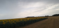
(5) Leave the road and turn right onto the white track with a grassy strip down the middle: there is a sign indicating “Route de la source”. Follow this route to the point with an altitude of 231, with a section of woodland numbered 19 and 31 on your right.

(6) Cross the small ditch to reach the entrance to the 19-31 section of woodland, then keep to the left and take the path on the left. At the next junction, continue straight on and carry on until you reach the crossroads at the edge of the woodland.

(7) Turn left onto a stony, unpaved track and follow it to the village of Cirey-lès-Pontailler, which you’ll reach via Rue du Tertre. Continue to Rue de la Liberté (D25) and turn right to reach Place des Lavandiers (S/E).


Waypoints

  1. S/E : mi 0 - alt. 682 ft - Place des Lavandiers
  2. 1 : mi 0.68 - alt. 741 ft - Fork in the road, turn right
  3. 2 : mi 1.52 - alt. 666 ft - Crossroads, go straight on
  4. 3 : mi 1.94 - alt. 659 ft - Tarmac road, on the right
  5. 4 : mi 2.98 - alt. 722 ft - Crossroads, turn right
  6. 5 : mi 3.81 - alt. 755 ft - Leave the road, turn right
  7. 6 : mi 4.34 - alt. 758 ft - On the right: sections 19 and 31
  8. 7 : mi 4.71 - alt. 679 ft - Crossroads at the edge of the woods
  9. S/E : mi 5.64 - alt. 682 ft - Place des Lavandiers

Worth a visit

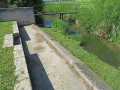
(S/E) Pump-fed washhouse. There is no natural spring, but the water that flowed in the washerwomen’s building was first pumped in from outside.

Reviews and comments

4.7 / 5
Based on 2 reviews

Reliability of the description
5 / 5
Ease of following the route
5 / 5
Route interest
4 / 5
Sissi21
Sissi21

Overall rating : 5 / 5

Date of your route : Mar 30, 2026
Reliability of the description : ★★★★★ Very good
Ease of following the route : ★★★★★ Very good
Route interest : ★★★★★ Very good
Very busy route : No

The satisfaction and joy of being able to wander through the woodland after the hunting season has ended. Enjoy your walk in the forest, and finally take the time to appreciate the awakening of nature: the first leaves unfolding in a beautiful spectrum of greens, the little flowers—anemones, cuckoo flowers, periwinkles, lily of the valley… and, with a bit of luck, perhaps spot a few hares or…

Machine-translated

Philippe COULOT
Philippe COULOT

Thank you for your comments.
Kind regards

Machine-translated

Chabanis
Chabanis

Overall rating : 4.3 / 5

Date of your route : Sep 01, 2024
Reliability of the description : ★★★★★ Very good
Ease of following the route : ★★★★★ Very good
Route interest : ★★★☆☆ Average
Very busy route : No

An easy walk, though best avoided in hot weather as the forest track is in full sun between 3 and 4; ideal in the morning or in spring
.

Machine-translated

Other walks in the area

For more walks, use our search engine .

The GPS track and description are the property of this route's author. Please do not copy them without permission.