A tour of Selongey’s chapels

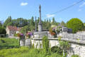
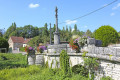
Selongey takes its name from a Roman estate once situated at the ‘Champ de Mars’. Centuries of history have left it with some remarkable monuments: a 13th-century church housing a carillon of 48 bells, listed as a historic monument, and a 19th-century organ, the Chapel of Saint Gertrude (1530) and the Chapel of Saint Anne (1637). There are also a few old houses dating from the 15th and 16th centuries.

Details

15127219
Creation:
Last update:
Last review:
  • Walking
    Activity: Walking
  • ↔
    Distance: 5.39 mi
  • ◔
    Average duration: 2h 50 
  • ▲
    Difficulty: Easy

  • ⚐
    Back to start: Yes
  • ↗
    Ascent: + 404 ft
  • ↘
    Descent: - 384 ft

  • ▲
    Highest point: 1,296 ft
  • ▼
    Lowest point: 961 ft
  • ⚐ Country: France
  • ⚐ City: Selongey (21260)
  • ⚑
    Start/End: N 47.58455° / E 5.189199°
  • ❏
    IGN map(s): Ref. 3121SB
  • Hour-by-hour weather

Photos

Description of the walk

Park on Chemin des Prés d’Orville or Rue des Champs, alongside the Venelle in Selongey

(S/E) Return to the Route des Buttes and turn right.
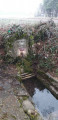
After crossing the bridge over the River Venelle, take the Quai Garnier turn-off on the left.

(1) Continue along Rue Basse, then turn right onto Rue de la Combe. At the end of the street, at the junction with Rue de Veroille, turn right and follow the D103 (Route de Boussenois).
As you go along, look out for the ‘Oratoire Dieu de Pitié’ on your right.

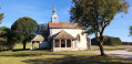
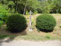
(2) On leaving the village, at an altitude of 329, leave the D103 and take the path that goes straight ahead. Ignore the path that veers sharply to the right and continue on to the Sainte-Gertrude Chapel (1530). Take a moment to admire the chapel and continue your walk.

(3) Take the stony track on the left after the chapel and follow it until you reach the D103.

(4) Turn right onto this road, pass the Fontaine Vaussel and continue to the motorway bridge. Turn onto the path on the left just before the bridge and continue alongside the motorway for about 900 metres.

(5) At an altitude of 394, turn left and, when you reach the road, continue left for about a hundred metres.

(6) Turn right onto the stony white track and stay on this route. Ignore the first two tracks branching off to the right; then, at the end of the long left-hand bend, take care not to miss the path leading into the woods.

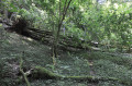
(7) Enter the woods (the track is marked by a small, weathered wooden sign). Take care on the descent for about ten metres; after that, the path is straightforward. Stay on the track.
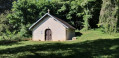
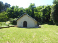
Stop for a moment at the Sainte-Anne Chapel (1637).
Continue along the Chemin de Sainte-Anne to return to the village of Selongey.

(8) At the road, turn right and, at the junction, continue along Rue Sainte-Anne. At the end of this street, take Rue Malpierre until you reach Rue Pastourelle. Turn left, then right into the street leading to Place des Halles. Head towards Rue de l’Église.

(9) At the junction of Rue de l’Église and Rue de la Roche, turn right. Walk round the church and head towards Rue du Rang Pastourelle. On this street, you’ll see the town hall on your left. Carry on and, after the bridge over the River Venelle, turn right onto Quai Charbonnel.

(1) Continue along Quai Garnier to reach Route des Buttes. At the road, cross at the pedestrian crossing and head right along the pavement to return to the car park (S/E).


Waypoints

  1. S/E : mi 0 - alt. 961 ft - Car park for visitors: Rue des Champs. Near the - Venelle (rivière) - Affluent de la Tille
  2. 1 : mi 0.11 - alt. 961 ft - Carrefour de la circular
  3. 2 : mi 0.94 - alt. 1,079 ft - Turn-off towards the chapel
  4. 3 : mi 1.23 - alt. 1,106 ft - A stony white track
  5. 4 : mi 1.91 - alt. 1,109 ft - D103
  6. 5 : mi 2.97 - alt. 1,289 ft - Turn left at the junction
  7. 6 : mi 3.3 - alt. 1,283 ft - Junction on a dirt track
  8. 7 : mi 3.94 - alt. 1,220 ft - Entrance to the woods
  9. 8 : mi 4.66 - alt. 1,079 ft - Carrefour
  10. 9 : mi 4.98 - alt. 968 ft - Church
  11. S/E : mi 5.39 - alt. 961 ft - Arrival and parking

Worth a visit

Places to visit:
A 13th-century church housing a carillon of 48 bells, listed as a historic monument, and a 19th-century organ.
St Gertrude’s Chapel (1530) and St Anne’s Chapel (1637).
There are also a few old houses dating from the 15th and 16th centuries in the town.

Selongey, the town where the SEB factory is located.

Reviews and comments

4.4 / 5
Based on 3 reviews

Reliability of the description
5 / 5
Ease of following the route
4.7 / 5
Route interest
3.7 / 5
Philippe pinto
Philippe pinto

Overall rating : 4 / 5

Date of your route : Oct 30, 2023
Reliability of the description : ★★★★★ Very good
Ease of following the route : ★★★★☆ Good
Route interest : ★★★☆☆ Average
Very busy route : No

In the second half of the route, at a certain point, it is no longer possible to follow the path; it has become private property. If you carry on along the road, there is indeed a small passage between two properties, but there is a ‘roadworks’ sign, so you must continue along the road until you reach the village.

Machine-translated

NanaDidi
NanaDidi

Overall rating : 4.7 / 5

Date of your route : Sep 25, 2023
Reliability of the description : ★★★★★ Very good
Ease of following the route : ★★★★★ Very good
Route interest : ★★★★☆ Good
Very busy route : No

There aren’t any lizards!
The route is exactly as described: the Way of the Cross, chapels and… the motorway! (As Didi loves lorries, walking alongside the motorway absolutely delighted him!!!!).
Whilst you can catch a glimpse of the interior of Sainte Gertrude through a cleverly placed opening, the same cannot, alas, be said for Sainte Anne.
One problem worth mentioning, however: the turn-off in the forest leading to La Chapelle Sainte Anne is no longer accessible, as the land is now private. Luckily, some local walkers pointed us towards a narrow path between a caravan site and a horse paddock... The route description really ought to be updated.

In any case, thank you to the author of this walk, who made our dream of visiting chapels come true (we’d love to do it again...).

Machine-translated

Philippe COULOT
Philippe COULOT

Hello
Thank you for your comments.
Kind regards.

Machine-translated

corinneb29
corinneb29

Overall rating : 4.7 / 5

Date of your route : Jan 28, 2022
Reliability of the description : ★★★★★ Very good
Ease of following the route : ★★★★★ Very good
Route interest : ★★★★☆ Good
Very busy route : No

A lovely walk, but the two sections running alongside the motorway are noisy... But that just makes the rest of the route all the more enjoyable....

Machine-translated

Other walks in the area

For more walks, use our search engine .

The GPS track and description are the property of this route's author. Please do not copy them without permission.