


More Outdoor

 Visorando Member
 Premium user
 - Gender: man
About
Well to be honest, it is in my blood, I've been walking since I was knee high to a grasshopper..
Brought up exploring Dartmoor. I have completed many challenge walks and ascended many of the peaks in Britain.
Britain, in my view, is taken for granted; it's where we live, but have we really seen all of its history and beauty?
There are many areas to explore and find, many paths to follow, or just "Coddiwomple" and see where it takes us.
Now retired to Cornwall, exploring the many trails here. Revisiting many of the routes completed and "Coddiwomped" to share.
“We Don’t Stop Walking Because We Grow Old, We Grow Old Because We Stop Walking”
Sign up:
Published route(s)
 Mount Hawke circular
 2.66 mi
 +256 ft
 -262 ft
 1h 25
1h 25
 Easy
Easy
 Departure from St. Agnes (Cornwall)
This walk takes you around, the Mount Hawke area. Take in some of the old mines worked areas, possibly walking along some of the many miner's tracks. Pass by some of the older parts of Mount Hawke and return down the valley passing the Cloutie Well.
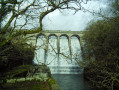
Burrator Reservoir
 7.02 mi
+810 ft
-814 ft
3h 55
7.02 mi
+810 ft
-814 ft
3h 55
 Average
Departure from Walkhampton (Devon)
Average
Departure from Walkhampton (Devon)
A circular walk around Burrator Reservoir, through woodland trails, and up to Sheepstor Tor, the high point of the area, through some "Bluebell woods" (when in season).
Stithians Cornwall
 5.41 mi
+289 ft
-272 ft
2h 45
Average
Departure from Stithians (Cornwall)
5.41 mi
+289 ft
-272 ft
2h 45
Average
Departure from Stithians (Cornwall)
This walk starts and finishes at Stithians Dam car park, Cornwall UK, taking in the countryside around the small Cornish village of Stithians. You will be walking on track and country lanes. However, as this is a circular route, could be started at any point, where access is permissible.
Codda to Brown Willy, Bodmin moors
 5.96 mi
+755 ft
-758 ft
3h 25
5.96 mi
+755 ft
-758 ft
3h 25
 Difficult
Departure from Altarnun (Cornwall)
Difficult
Departure from Altarnun (Cornwall)
This route takes the Southerly route to the Brown Willy Tor, you will be entering open moorland. An alternative route to the highest Tor in Cornwall UK. Not so much a circular walk but more like a there-and-back walk, although variations and or additions to the plotted route can be made, subject to competence in remote walking.
Shortly after the first waypoint, the route doesn't follow paths on the map.
It is strongly recommended that you follow the route using the GPX on the Visorando app.
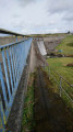
Stithians Reservoir Circular, Cornwall
 4.96 mi
+66 ft
-66 ft
2h 20
Easy
Departure from Wendron (Cornwall)
4.96 mi
+66 ft
-66 ft
2h 20
Easy
Departure from Wendron (Cornwall)
A circular route around Stithians Reservoir. For the purpose of this walk and description, the route is aligned in an anti-clockwise direction.
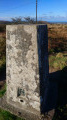
Heritage & Mining trail, Redruth, Cornwall
 7.10 mi
+554 ft
-581 ft
3h 45
Average
Departure from Carn Brea (Cornwall)
7.10 mi
+554 ft
-581 ft
3h 45
Average
Departure from Carn Brea (Cornwall)
A circular walk takes you to some of Cornwall's mining heritage. This route uses permissible cycle tracks and public highways.
Mawnan Smith to Maenporth
 3.12 mi
+341 ft
-331 ft
1h 45
Easy
Departure from Mawnan (Cornwall)
3.12 mi
+341 ft
-331 ft
1h 45
Easy
Departure from Mawnan (Cornwall)
A Circular walk starting in the small Cornish village of Mawnan Smith, through some woodland, and onto the South West Coast Path, taking in the coastal views before returning to Mawnan Smith.
Perranuthnoe Circular with a section of the South West Coast Path
 2.33 mi
+112 ft
-131 ft
1h 10
Easy
Departure from Perranuthnoe (Cornwall)
2.33 mi
+112 ft
-131 ft
1h 10
Easy
Departure from Perranuthnoe (Cornwall)
A short, summer walk from Perranuthnoe towards Marzion, Through the small village across designated footpaths. With views of St Micheal's Mount, and the South Cornish Coast. Returning along a section of the South West Coast Path (SWCP).
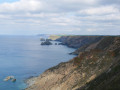
North Cliffs to Tehidy Country Park woods (Circular/Same way)
 2.86 mi
+98 ft
-72 ft
1h 25
Easy
Departure from Camborne (Cornwall)
2.86 mi
+98 ft
-72 ft
1h 25
Easy
Departure from Camborne (Cornwall)
A walk from a car park along the North Cliffs, walking along the North Cornish Coast Path, and into the Tehidy Country Park.
Maenporth - Budock Water Circular
7.50 mi
+554 ft
-554 ft
3h 45
Average
Departure from Budock (Cornwall)
A circular walk starting and finishing at Maenporth, the car park is now pay and display.
The walk will follow designated footpaths, cross some roads, and also along residential pavements.
I have suggested this walk to be a 'Moderate' walk as there are some stiles to negotiate, and the time is also dependent on personal pace.
St Erth to Trencrom Hill
4.48 mi
+551 ft
-554 ft
2h 30
Average
Departure from St. Erth (Cornwall)
A circular walk to Trencrom Hill, perhaps best taken on a clear day, to enjoy the views. But equally a nice walk any other time.
Boscawen Circular
2.40 mi
+262 ft
-253 ft
1h 20
Easy
Departure from Truro (Cornwall)
A short walk leading from Boscawen Park, following a designated footpath through field and wooded area, leading to a track and country road. Descending into the estuarial hamlet of Maplas, following the river upstream to the start
Penelewey Loop
 4.20 mi
+469 ft
-495 ft
2h 20
Easy
Departure from Feock (Cornwall)
4.20 mi
+469 ft
-495 ft
2h 20
Easy
Departure from Feock (Cornwall)
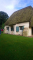
A loop walk around some interesting 'place names' like Come-to-Good, Playing Place, Porthkea, and Penelewey, with some interesting finds. The route is mainly on usually quiet country lanes, although walking along country lanes, there is still plenty to see.
From Stroxworthy to Bucks Mill, following country lanes
 8.63 mi
+988 ft
-978 ft
4h 50
Average
Departure from Torridge District (Devon)
8.63 mi
+988 ft
-978 ft
4h 50
Average
Departure from Torridge District (Devon)
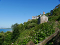
Staying at the small campsite, the walk follows a route through the narrow country lanes past the Parkham Farms Dairy, who produce cheese for the likes of Tesco. Passing many other features which individually may take one's interest. Arriving at Bucks Cross, and the main A39 Atlantic Highway. Care when crossing, then taking the lane downhill towards Bucks Mills.
As the lane winds a way downhill, passing a Church and many dwellings. Making the way downhill and following the stream, through the wooded valley has a lot to look out for.
Near the bottom is the old Mill House and onto the sea passing a National Trust cottage associated with two famous painters.
On the shingle/ pebble beach and NE there is a waterfall worth getting a closer look at.
SW direction is the adjacent town of Clovelly.
The return route follows the same way until Bucks Cross, whereby picking up the directions for Woolfardisworthy (Woolsery). Pass through Woolsery and then return following the markers/ directions
Sourton Tors Loop Dartmoor
 10.02 mi
+1,401 ft
-1,401 ft
5h 50
Average
Departure from Lydford (Devon)
10.02 mi
+1,401 ft
-1,401 ft
5h 50
Average
Departure from Lydford (Devon)
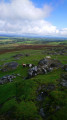
The walk starts at Lydford and makes its way up onto open moorland. It is a day walk. On a clear day, there will be far-reaching views, and on a not-so-clear day, refreshing navigation skills.
This walk will lead you into open moorland. From (4) to (7), the route doesn't follow paths on the map. It is strongly recommended that you follow the route using the GPX on the Visorando app, with the backup of a map and compass.
Do not attempt unless you are a competent 'remote' walker, with good navigation skills, and you are prepared for any eventualities.This walk leads into one of the Dartmoor Firing ranges. See Practical Information for information.This route can be used as a navigational exercise for competent walkers.
NOTE: Dartmoor's weather can change in an instant; one minute it's sunny, and the next, thick with fog, it can be dry, then heavy rain.
Princetown, North Hessary and King Tor
 7.11 mi
+883 ft
-883 ft
4h 00
Average
Departure from Dartmoor Forest (Devon)
7.11 mi
+883 ft
-883 ft
4h 00
Average
Departure from Dartmoor Forest (Devon)
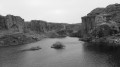
A walk that takes in the industrial past within this area. Climbing some Tors and seeing the panoramic views.
Shortly after the first waypoint, the route doesn't follow paths on the map, but can still be followed.
The paths on this route are not very visible/marked in places.
It is strongly recommended that you follow the route using the GPX on the Visorando app.
Wheal Francis, the Flat Lode and Carn Brea Loop
 4.76 mi
+456 ft
-489 ft
2h 45
Average
Departure from Carn Brea (Cornwall)
4.76 mi
+456 ft
-489 ft
2h 45
Average
Departure from Carn Brea (Cornwall)
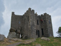
The walk starts in a free car park (with height restrictions) and follows some of the Great Flat Lode Trail, into Churchtown and Carn Brea Village. The route then leads back onto the Flat Lode Trail for a short period, then climbs up for the views on to the Carn, before descending down
As this is a circular route, the choice of which way to go is yours; however, in my view, the route plot offers the best way.
I have listed this route as Moderate purely due to the number of obstacles to overcome.
Stithians Dam Loop via Stithians Village
 4.75 mi
+322 ft
-164 ft
2h 30
Easy
Departure from Stithians (Cornwall)
4.75 mi
+322 ft
-164 ft
2h 30
Easy
Departure from Stithians (Cornwall)
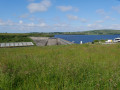
A loop walk, starting at the free car park by Stithians Dam. There is an option to start along the main road to Stithians, between (4) and (5), a bus route through Stithians.
The route follows made-up roads, country tracks, and designated footpaths, there are stiles, narrow gates and the need to climb over hedge steps.
Carnon Downs to Devoran Circular
4.57 mi
+302 ft
-302 ft
2h 20
Average
Departure from Feock (Cornwall)
The walk starts in a car park near the Travelodge, a small parking area nearest the main road, there are no parking restrictions (at the time of writing).
The walk follows designated footpaths, country roads, and crosses a main road.
The walk has been rated as 'Moderate' due to the walk back up the hill to finish. Timing is only a guide, and time should added for height gain, and exploring the area.
Lanner and Carn Marth Loop, Redruth
 2.54 mi
+951 ft
-781 ft
2h 00
Easy
Departure from Lanner (Cornwall)
2.54 mi
+951 ft
-781 ft
2h 00
Easy
Departure from Lanner (Cornwall)
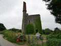
A loop walk, starting at the water tank on Lanner Hill, then walking past Carn Marth open-air theatre, Figgy Dowdy's Well, and up to Carn Marth with the far-reaching views of the North and South Coast of the County.
The route gives an option to shorten the route if required.
Lanner Bounds
 4.44 mi
+387 ft
-417 ft
2h 25
Average
Departure from Lanner (Cornwall)
4.44 mi
+387 ft
-417 ft
2h 25
Average
Departure from Lanner (Cornwall)
Starting at the water tank, on Lanner Hill, then walking past Carn Marth open-air theatre, Figgy Dowdy's Well, and up to Carn Marth with the far-reaching views of the North and South Coast of the county. The route then follows designated footpaths down to Carharrack, following a road back to Lanner and then climbing back up the valley to the disused rail track, returning to the start.
This walk could be completed in two sections (S) to (4), catch a convenient bus back towards Redruth, and the bus stop at the top of the hill. The second leg (E) on a reverse path to (4), again catching the bus, as above.
The time taken will depend on the pace and time spent exploring the area
This is a moderate walk due to the climb up from the Lanner valley, so late in the walk.
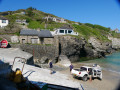
St Agnes, the Beacon, Trevaunance Cove, and Coastal Path Loop
 5.80 mi
+915 ft
-925 ft
3h 30
Average
Departure from St. Agnes (Cornwall)
5.80 mi
+915 ft
-925 ft
3h 30
Average
Departure from St. Agnes (Cornwall)
A loop walk around St Agnes, taking in the Beacon, the small town of St Agnes, and Trevaunance Cove, following a section of the South West Coast Path, many artifacts of the mining past, and St Agnes Head.
The walk offers a variety of tracks, roads, and coast paths with some impressive views (weather permitting). Along the route, there are many information boards to learn about the past. The time taken is dependent on pace and time exploring.
A Circular walk around, Illogan Highway, Carnkie, Piece & Tregajorran
 4.55 mi
+351 ft
-328 ft
2h 25
Easy
Departure from Carn Brea (Cornwall)
4.55 mi
+351 ft
-328 ft
2h 25
Easy
Departure from Carn Brea (Cornwall)
This walk starts just off a main public transport route, enabling walkers who use Public Transport the opportunity to discover new places. A walk from Illogan Highway along some old mining trails, passing some old mine workings. With many places to explore and see.
Alternative route options are possible. See the 'Description.'
Circular walk from Lanner Hill, around Carn Marth to Gwennap Pit
 2.77 mi
+164 ft
-171 ft
1h 25
Easy
Departure from Lanner (Cornwall)
2.77 mi
+164 ft
-171 ft
1h 25
Easy
Departure from Lanner (Cornwall)
Starting at the top of Lanner Hill by the water tank, and walking along an old miner's tracks towards Gwennap Pit, an open-air chapel. Before following a route back along country lane and tracks to Lanner.
Tencreek to Talland Bay
 2.30 mi
+381 ft
-381 ft
1h 25
Average
Departure from Looe (Cornwall)
2.30 mi
+381 ft
-381 ft
1h 25
Average
Departure from Looe (Cornwall)
With Looe and Polperro close by, Tencreek is a popular campsite for holiday-makers, and also access to many walks in the area. This is a short, there-and-back walk, but a walk that, after completing it, you will know it has been completed.
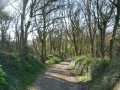
Connor Down, the Hydraulic Ram, and Angarrack
 2.68 mi
+161 ft
-161 ft
1h 20
Easy
Departure from Gwinear-Gwithian (Cornwall)
2.68 mi
+161 ft
-161 ft
1h 20
Easy
Departure from Gwinear-Gwithian (Cornwall)
This is a pleasant walk along country tracks and lanes, with the route passing over the main railway line, visiting the Hydraulic Ram, following some old tracks, and crossing under the viaduct at Angarrack. The route back is up the old main road, along 'Slug' Lane, returning to Connor Down
Circular route over Godolphin Hill and Tregonning Hill
 4.86 mi
+1,388 ft
-1,201 ft
3h 25
Easy
Departure from Breage (Cornwall)
4.86 mi
+1,388 ft
-1,201 ft
3h 25
Easy
Departure from Breage (Cornwall)
This walk leads to the top of Godolphin Hill, with far-reaching views over St Michael's Mount, and St Ives Bay. It follows a route leading to some disused mine workings and then to Tregonning, the birthplace of 'China Clay', and a war memorial and other artifacts.
Around Godrevy Headland
 0.67 mi
+52 ft
-75 ft
0h 20
Easy
Departure from Gwinear-Gwithian (Cornwall)
0.67 mi
+52 ft
-75 ft
0h 20
Easy
Departure from Gwinear-Gwithian (Cornwall)
This is a short walk around the Godrevy headland, with the hope of seeing seals in the cove. Following the path around the headland passing an old Iron Age settlement, the lighthouse, and then dropping down with views along St Ives Bay and the 3 miles of sandy beach.
Barripper Penponds Viaduct
 3.54 mi
+164 ft
-151 ft
1h 45
Easy
Departure from Camborne (Cornwall)
3.54 mi
+164 ft
-151 ft
1h 45
Easy
Departure from Camborne (Cornwall)
This walk leads through two old mining villages, passing near an Iron Age hilltop fort, and under both the old and new railway embankment/viaduct. Then passing thatched properties, one of which is now managed by the National Trust.
Bassett Cove to Portreath
 2.83 mi
+2,339 ft
-2,533 ft
3h 20
Average
Departure from Illogan (Cornwall)
2.83 mi
+2,339 ft
-2,533 ft
3h 20
Average
Departure from Illogan (Cornwall)
Of the 630 miles of the long-distance Southwest Coast Path (SWCP), this is a small section that offers both cliff-top walking and some of the undulations the SWCP has, especially in Cornwall. At Portreath, a small seaside town, the SWCP continues onwards. Bassett Cove also offers an option for a more sedate walk along North Cliff, Southwest of the parking area.
Branston, Historic Past and Farming
 2.84 mi
+75 ft
-79 ft
1h 20
Easy
Departure from Branston and Mere (Lincolnshire)
2.84 mi
+75 ft
-79 ft
1h 20
Easy
Departure from Branston and Mere (Lincolnshire)
Branston, a small town on the outskirts of Lincoln. This short circular walk takes in some of the many historic events and people. Also, walking out toward farmland, with the large, relatively flat, open fields. Along Hall Lane, views of the old manor house, now a hotel, Branston Hall.
North Cliff, Red River Nature Reserve, Hell's Mouth Circular
 4.65 mi
+390 ft
-420 ft
2h 30
Easy
Departure from Camborne (Cornwall)
4.65 mi
+390 ft
-420 ft
2h 30
Easy
Departure from Camborne (Cornwall)
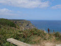
Starting at the most easterly National Trust (free) car park before Bassett Cove, walking down into Combe and following the Red River, which is now a Nature Reserve, then following the trail back to Hell's Mouth and then the South West Coast Path to the start.
Norsworthy Bridge, Older Bridge, Eylesbarrow Tin Mine (disused)
 8.60 mi
+751 ft
-761 ft
4h 35
Average
Departure from Walkhampton (Devon)
8.60 mi
+751 ft
-761 ft
4h 35
Average
Departure from Walkhampton (Devon)
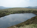
Burrator Reservoir, on the Western fringes of Dartmoor National Park, is a local beauty spot in itself, which has many guided routes through the trees and water line. This walk follows a well-defined track up onto the higher moors, then makes its way back on another well-defined path, through the village of Sheepstor, and finally follows the lane around the Reservoir, passing many interesting artifacts along the way to see and wonder.
Princetown, Nun's Cross, Tor Royal
 7.25 mi
+390 ft
-400 ft
3h 40
Average
Departure from Dartmoor Forest (Devon)
7.25 mi
+390 ft
-400 ft
3h 40
Average
Departure from Dartmoor Forest (Devon)
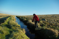
A walk out onto open moorland, with the reassurance of following clearly defined linear features. The walk follows the boundary of the Forest of Dartmoor, and continues along the Devonport Leat to Peat Cot, a remote moorland hamlet. Working the way back to Tor Royal, Bullpark and Bacholar's Hall, before returning to Princetown and views of the Prison.
Shaugh Bridge, Cadover, and The Old Pipe Track
 4.17 mi
+558 ft
-558 ft
2h 25
Average
Departure from Shaugh Prior (Devon)
4.17 mi
+558 ft
-558 ft
2h 25
Average
Departure from Shaugh Prior (Devon)
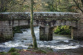
Crossing the River Plym and climbing up through the woods to the top. At the top of the rocky outcrop, see the far-reaching views of Plymouth Sound, passing through stone circle clusters, and a waymark cross. Crossing the river again at Cadover, then following the old 'Pipe Track' back down to Shaugh Bridge.
Wistman's Wood Nature Reserve, Dartmoor
 3.89 mi
+459 ft
-459 ft
2h 10
Easy
Departure from Dartmoor Forest (Devon)
3.89 mi
+459 ft
-459 ft
2h 10
Easy
Departure from Dartmoor Forest (Devon)
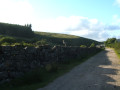
Wistman's Wood is a National Nature Reserve, an ancient dwarf oak woodland. It is one of Britain's ancient temperate rainforests. This route leads to the edge of the woods, and find the Buller Stone, an inscribed granite boulder. The route then climbs up to the ridge and some impressive moorland Tors, with panoramic views.
Barn Hill, Pew Tor & the Bullseye Stone at Windy Cross
 3.20 mi
+597 ft
-400 ft
2h 00
Easy
Departure from West Devon (Devon)
3.20 mi
+597 ft
-400 ft
2h 00
Easy
Departure from West Devon (Devon)
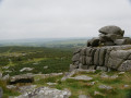
Dartmoor is known for its remote, rocky hilltops, known as tors. This short walk takes in three of the most easily accessible tors on the moor. The route gives walkers, new to the area, an example of open moorland and to 'bag' some tors. The route passes the popular Vixen Tor and the 'Windy Post Cross'.
Princetown, Childe's Tomb, Swincombe, Bull Park
 9.93 mi
+863 ft
-886 ft
5h 20
Average
Departure from Dartmoor Forest (Devon)
9.93 mi
+863 ft
-886 ft
5h 20
Average
Departure from Dartmoor Forest (Devon)
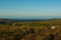
The route is on Dartmoor's south moor, and it follows some well-defined linear features, which will assist route finding. The route passes many interesting artifacts, including moorland Crosses, Fox Tor Mire, which inspired Conan Doyle's The Hounds of the Baskerville, and Grimpen Mire. The river Swincombe footbridge, and even walking on a part of what was once a road built by conscientious objectors.
The Great Flat Lode, Carn Arthen, Piece, and Carn Brea Monument
 5.14 mi
+1,972 ft
-1,952 ft
4h 05
Average
Departure from Carn Brea (Cornwall)
5.14 mi
+1,972 ft
-1,952 ft
4h 05
Average
Departure from Carn Brea (Cornwall)
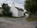
From the well-published Great Flat Lode Trail, with the whole area having a history of mining for tin and copper, it is perhaps no surprise that there are many routes across the whole area, where perhaps the miners used to get from their homes to the mines where they worked. It's when walking on such paths, one can only wonder about the hard work and hours they toiled. That is where we now see green fields where once was a patchwork of mining activities. This walk passes through some hamlets where perhaps the miners lived.
Barn Hill, Cox Tor, Roos, and Staple Tor then follow a leat to Windy Cross
 4.81 mi
+620 ft
-617 ft
2h 45
Average
Departure from West Devon (Devon)
4.81 mi
+620 ft
-617 ft
2h 45
Average
Departure from West Devon (Devon)
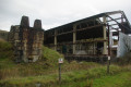
This walk, although relatively short, may play tricks with the mind. The first is seeing Cox Tor, the first objective, directly north of the car park. It appears higher than it is due to the open vista to the west. Once reaching the top, you are rewarded with panoramic views across much of the west and moorland. The route then leads through an old Stone Age, Stone Circle settlement to Roos and Staple Tor. With the perception of distance playing a trick, the Tors appear a long way away. Then dropping down to a leat, past Merrivale Quarry (disused), and making the way back following the leat to Windy Cross before reaching the start. With the start point being visible for much of the walk, the temptation to shorten a planned route becomes willpower.
The start of the Great Western Canal
 4.76 mi
+98 ft
-98 ft
2h 15
Easy
Departure from Stawley (Somerset)
4.76 mi
+98 ft
-98 ft
2h 15
Easy
Departure from Stawley (Somerset)
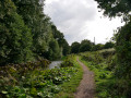
A walk starting at Gamlins Farm Campsite, which is very close to the start of the Great Western Canal, and has been designated a Country Park and Nature Reserve. The walk has been set at approximately 5 miles; however, the whole Devon section is 11 miles, with the choice to walk further. It is also part of the national cycle network, offering another option for exploring the area. There is an option to start the walk at a small parking area, see in 'Practical Information'.
Princetown, Stone Age Settlements and Old Moorland Quarries
 5.82 mi
+289 ft
-292 ft
2h 55
Easy
Departure from Dartmoor Forest (Devon)
5.82 mi
+289 ft
-292 ft
2h 55
Easy
Departure from Dartmoor Forest (Devon)
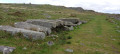
The old Princetown to Yelverton moorland railway line, now disused, is a well-defined linear feature high up on Dartmoor, a popular destination. The walk, starting in Princetown and 'walking out the track', offers options to explore Stone Age settlements and the disused granite quarries in the area, passing some Dartmoor tors, and on a clear day, provides some far-reaching views of West Devon.
Perranuthnoe, Rosudgeon, and the South West Coast Path passing Prussia Cove
 5.02 mi
+843 ft
-853 ft
3h 05
Average
Departure from Perranuthnoe (Cornwall)
5.02 mi
+843 ft
-853 ft
3h 05
Average
Departure from Perranuthnoe (Cornwall)
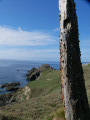
An interesting circular walk, starting in a small Cornish coastal village of Perranuthnoe, along designated footpaths, up to Rosudgeon, passing through farm fields and small, remote hamlets before descending to the coast and the South West Coast Path. The walk offers panoramic views across Mounts Bay and St Michael's Mount, where the rugged Cornish coastline passes Prussia Cove, a location steeped in history with smugglers and ship wrecks.
Long Rock, St Michael's Mount and the Bird Sanctuary
 4.33 mi
+151 ft
-157 ft
2h 05
Easy
Departure from Ludgvan (Cornwall)
4.33 mi
+151 ft
-157 ft
2h 05
Easy
Departure from Ludgvan (Cornwall)
This walk starts at the Long Rock car park, and follows a section of the St Michael's Way, South West Coast Path, and the coastal promenade towards Marazion and St Michael's Mount. A walk, where perhaps checking on the tides may be an advantage, with the possibility of crossing the causeway to the Mount. The route follows through the wetland bird sanctuary, before returning along the promenade.
Dartmoor's old rail line, Stone Age settlements and waterfall
 5.95 mi
+502 ft
-509 ft
3h 10
Average
Departure from Walkhampton (Devon)
5.95 mi
+502 ft
-509 ft
3h 10
Average
Departure from Walkhampton (Devon)
Retracing the old moorland railway line before passing many Stone Age hut circles, a stone row, and an old firing range. Passing an area where conservation work involving re-wetting of the moors is being done. Passing a small waterfall and then following a leat before returning to the parking area
Princetown, Hart Tor, Cramber Tor and South Hessary Tor
 4.23 mi
+253 ft
-256 ft
2h 10
Average
Departure from Dartmoor Forest (Devon)
4.23 mi
+253 ft
-256 ft
2h 10
Average
Departure from Dartmoor Forest (Devon)
A walk to explore some moorland tors, an open moorland walk, which offers the experience of the remoteness of the moor, yet is still relatively safe for the novice walker. The walk has several features that can act as a safety net for the walker to reference, to check the location. Should the walker wander, there are other natural stops to get back on track.
Mullion, the Poldhu Marconi Centre, and the Monument
 2.49 mi
+151 ft
-151 ft
1h 15
Easy
Departure from Mullion (Cornwall)
2.49 mi
+151 ft
-151 ft
1h 15
Easy
Departure from Mullion (Cornwall)
Walking from the small Cornish village of Mullion to the coast, and following the South West Coast path, along with the coastal views, passing the historic monument and museum of Marconi, where the first trans-Atlantic radio transmission was made from.
Mullion, Polurrian Cove, and the Chocolate Factory
 2.59 mi
+194 ft
-174 ft
1h 20
Easy
Departure from Mullion (Cornwall)
2.59 mi
+194 ft
-174 ft
1h 20
Easy
Departure from Mullion (Cornwall)
From the small village of Mullion on the south Cornish coast, the walk leads down through the valley to Polurrian Cove. As the South West Coast path winds its way back along the coastline to Mullion Cove, before heading back past the Chocolate factory, and back through the old village.
Woodland Walk Near Constantine, Helford
 2.18 mi
+262 ft
-289 ft
1h 15
Easy
Departure from Constantine (Cornwall)
2.18 mi
+262 ft
-289 ft
1h 15
Easy
Departure from Constantine (Cornwall)
A circular walk that follows a stream up through woodlands. From the small village, walking down the lane to the stream, then entering the woodland, discovering some of the mining past, which nature is claiming back.
Dunnabridge Pound, and the River West Dart Stepping Stones
 1.31 mi
+157 ft
-164 ft
0h 45
Easy
Departure from Dartmoor Forest (Devon)
1.31 mi
+157 ft
-164 ft
0h 45
Easy
Departure from Dartmoor Forest (Devon)
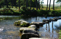
The River Dart, both the East and West Dart, rise high on Dartmoor, flowing down off the moors, to meet at Dartmeet. Each river has many must-see places; this short walk leads to one of the West Dart's attractions. The walk leading down to the river of the West Dart, stepping stones, a quiet spot to watch wildlife, or have a picnic.