henrigole

 Visorando Member
 Premium user
 - Location: Saint-Rémy-lès-Chevreuse (78470)
- Gender: man
- Website: http://dlrando.free.fr
Sign up:
Published route(s)
 Cime des Lacs

 11.53 mi
 +3,753 ft
 -3,737 ft
 8h 35
8h 35
 Difficult
 Departure from Tende (Alpes-Maritimes)
This summit, which rises just opposite the Refuge des Merveilles, lives up to its name. 360° panoramic view of a dozen lakes and the main peaks of the Vallée des Merveilles: Mont Bégo, Grand Capelet, Cime du Diable.
Circular: Lac de l'Agnel - small pass de la Charnassère - Lac Noir - Valmasque
 10.36 mi
+3,753 ft
-3,740 ft
8h 00
Difficult
Departure from Tende (Alpes-Maritimes)
10.36 mi
+3,753 ft
-3,740 ft
8h 00
Difficult
Departure from Tende (Alpes-Maritimes)
A beautiful circular hike that takes you from Lac de l'Agnel to the Lac Noir and Lac Vert de Valmasque.
Caution: tricky sections at (4) and (5).
Le Grand Capelet
 14.01 mi
+4,370 ft
-4,390 ft
8 hrs
14.01 mi
+4,370 ft
-4,390 ft
8 hrs
 Very difficult
Departure from Tende (Alpes-Maritimes)
Very difficult
Departure from Tende (Alpes-Maritimes)
Le Grand Capelet enjoys a privileged position, offering panoramic views over the Roya and Vésubie valleys.The hike is quite challenging, but once you reach your destination, you will be rewarded with a superb panorama.
Lake Sainte-Marie
 8.30 mi
+2,779 ft
-2,772 ft
6h 15
8.30 mi
+2,779 ft
-2,772 ft
6h 15
 Average
Departure from Tende (Alpes-Maritimes)
Average
Departure from Tende (Alpes-Maritimes)
Lac Sainte-Marie, situated 350 metres higher than the famous and much-visited Lac des Grenouilles, is well worth the slight extra effort. At the foot of Mont Sainte-Marie, peace and tranquillity await you.
Not to be confused with Lac de Sainte-Marie, situated to the south-west of Mont Sainte-Marie.
Mont Sainte-Marie
 11.32 mi
+3,504 ft
-3,474 ft
8h 15
Difficult
Departure from Tende (Alpes-Maritimes)
11.32 mi
+3,504 ft
-3,474 ft
8h 15
Difficult
Departure from Tende (Alpes-Maritimes)
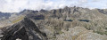
Mont Sainte-Marie overlooks the three large lakes of the Valmasque valley: Lac du Basto, Lac Noir and Lac Vert.From the summit, to the north, the view stretches from the Grand Capelet to the peak of Chanineye. To the west, the view is just as spectacular: from Mont Bégo to the Grand Capelet, including the Baisses de Fontanalbe and Valmasque.
Route through the Marguareis Nature Park
35.86 mi
+15,581 ft
-15,538 ft
5 days
Difficult
Departure from La Brigue (Alpes-Maritimes)
The two main access points to the Marguareis Nature Park are quite a distance from our French Alpes-Maritimes. The northern entrance is at Chiusa di Pesio (a 2-hour drive), the southern entrance is at Carnino (a 3-hour drive). Choosing Morignole is an alternative way to enter this magnificent park, which is rarely visited by French people despite being on the border. Pointe Marguareis lies on the French-Italian border.Five days to climb Pointe Marguareis and circumnavigate it.
Tour of Lake Bohinj and Savica Waterfall
 11.32 mi
+1,385 ft
-1,368 ft
6h 25
Average
Departure from Slovenia
11.32 mi
+1,385 ft
-1,368 ft
6h 25
Average
Departure from Slovenia
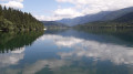
Lake Bohinj (Bohinjsko jezero) is Slovenia’s largest glacial lake. It is situated within Triglav National Park. Less crowded than Lake Bled, it is well worth a visit.Nearby, the Savica Waterfall is the perfect addition to this walk.
Morignole – Rifugio Don Barbera
 7.22 mi
+4,774 ft
-1,043 ft
7h 30
Difficult
Departure from La Brigue (Alpes-Maritimes)
7.22 mi
+4,774 ft
-1,043 ft
7h 30
Difficult
Departure from La Brigue (Alpes-Maritimes)
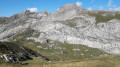
This first stage will take you into the Marguareis Nature Park from France.As soon as you enter the park, the karstic panoramas are enchanting and completely different from the crystalline landscapes of the nearby Mercantour. During the ascent, you’ll be far enough back to admire the Mercantour massif from the Authion to the Argentera.
Monte Stello
 9.16 mi
+3,553 ft
-3,566 ft
7h 20
Difficult
Departure from Brando (Haute-Corse)
9.16 mi
+3,553 ft
-3,566 ft
7h 20
Difficult
Departure from Brando (Haute-Corse)
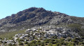
At an altitude of 1,307 metres, Monte Stello is the second highest peak in Cap Corse. This viewpoint on the central ridge of Cap Corse offers a magnificent panorama of the east and west coasts.
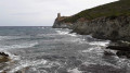
Round trip on the customs officers' path from Macinaggio to Barcaggio
 15.46 mi
+1,762 ft
-1,745 ft
8h 40
Difficult
Departure from Haute-Corse
15.46 mi
+1,762 ft
-1,745 ft
8h 40
Difficult
Departure from Haute-Corse
A superb coastal route where the path alternates between beaches and small climbs to Capandola Bay. The terrain changes completely as you now have to climb 130 metres to reach a small pass, with an exceptional view of the Finocchiarola Islands on one side and Barcaggio Bay on the other.
The path runs along the cliffs, descends to the Agnello Tower and then levels out to Barcaggio.
The only difficulty lies in the length of the route.
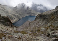
Circular route in the Mercantour starting from Castérino
 34.52 mi
+16,145 ft
-16,165 ft
5 days
Difficult
Departure from Tende (Alpes-Maritimes)
34.52 mi
+16,145 ft
-16,165 ft
5 days
Difficult
Departure from Tende (Alpes-Maritimes)
This challenging route will take you from the Roya Valley in the east to the Gordolasque Valley in the west. Over the course of these five days, you’ll have the chance to pass close to the highest peak in the Alpes-Maritimes, the Gélas. You’ll climb a legendary summit, Mont Bégo. You’ll make your way from valley to valley, crossing a series of mountain passes: the Pas de Pagari, the Pas du Mont Colomb, the Pas du Trem and the Baisse de Valmasque. Every day, chamois, ibex and marmots will keep you company.
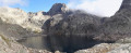
Nice Mountain Hut – Madone de Fenestre Mountain Hut
 4.88 mi
+2,523 ft
-3,527 ft
7 hrs
Very difficult
Departure from Belvédère (Alpes-Maritimes)
4.88 mi
+2,523 ft
-3,527 ft
7 hrs
Very difficult
Departure from Belvédère (Alpes-Maritimes)
This second day will take you to the foot of the Cime du Gélas (just 200 m below the summit); you’ll walk for a long time alongside Lac Long and the superb Malédie. You’ll then head into another small valley to admire the Cime Saint-Robert. The Lac Blanc, from which the stream flows, is none other than the Vésubie, and of course, the Gélas on its western face. The route will become more familiar and less strenuous once you rejoin the path coming from the Lac de la Fenestre.
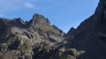
Madone de Fenestre Mountain Hut – Relais des Merveilles
 6.64 mi
+2,280 ft
-3,343 ft
5h 00
Difficult
Departure from Saint-Martin-Vésubie (Alpes-Maritimes)
6.64 mi
+2,280 ft
-3,343 ft
5h 00
Difficult
Departure from Saint-Martin-Vésubie (Alpes-Maritimes)
This third stage is less demanding than the previous two. The entire route follows a marked path.
Only the start of the descent from the Pas du Mont Colomb and the sections over scree require a little care. This is the classic route linking the Madone de Fenestre valley with the Gordolasque valley. The scenery along the way is magnificent, and the Pas du Mont Colomb offers two completely different views from its eastern and western sides.
Merveilles Rest House – Merveilles Mountain Hut
 5.68 mi
+3,688 ft
-1,909 ft
5h 50
Difficult
Departure from Belvédère (Alpes-Maritimes)
5.68 mi
+3,688 ft
-1,909 ft
5h 50
Difficult
Departure from Belvédère (Alpes-Maritimes)
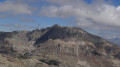
The aim of this fourth stage is to reach the Merveilles mountain refuge. The route is less well-travelled than the classic one via the Pas de l’Arpette. You’ll discover the Verrariers valley and the Pas du Trem. This small pass lies at the foot of the Cime du Diable, which you simply must climb. This magnificent viewpoint offers a 360° panorama of the Mercantour, as well as the Authion, the Col de Turini and all the way to the sea. You’ll then walk alongside the lakes of La Muta, Le Trem and Fourca.
Refuge des Merveilles – Castérino
 8.31 mi
+2,703 ft
-4,058 ft
8 hrs
Very difficult
Departure from Tende (Alpes-Maritimes)
8.31 mi
+2,703 ft
-4,058 ft
8 hrs
Very difficult
Departure from Tende (Alpes-Maritimes)
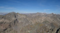
This final stage will take you back to Castérino via the ascent of Mont Bégo. From the summit, you’ll look out over the Vallée des Merveilles. You’ll catch sight of the neighbouring peak opposite, the Grand Capelet. You’ll enjoy a 360° panorama stretching from the Argentera to the Mediterranean.
You’ll need to be careful on the first part of the descent towards the Baisse de Valmasque (rated T3).
From the Baisse de Valmasque, the return journey follows the classic route that runs alongside the Lacs du Basto, Noir and Vert.
Castérino – Nice Mountain Hut
 8.98 mi
+4,928 ft
-3,258 ft
7 hrs
Very difficult
Departure from Tende (Alpes-Maritimes)
8.98 mi
+4,928 ft
-3,258 ft
7 hrs
Very difficult
Departure from Tende (Alpes-Maritimes)
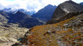
This first stage takes you from the bottom of the Roya Valley to the Nice Refuge. The proposed route is longer and more difficult than the one via the Baisse du Basto, but much less busy. On this demanding detour, you’ll enjoy the passage over the Pas de l’Agnel, the stretch into Italy as far as the Pas de Pagari, stopping off at the Rifugio Pagari, nestled against the summit of the Malédie. During the descent to the Refuge de Nice, you’ll enjoy the tranquillity of the Lacs Clapier.
Cime Viglino from Castérino
 10.73 mi
+4,049 ft
-4,068 ft
7 hrs
Very difficult
Departure from Tende (Alpes-Maritimes)
10.73 mi
+4,049 ft
-4,068 ft
7 hrs
Very difficult
Departure from Tende (Alpes-Maritimes)
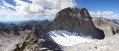
Cime Viglino enjoys a privileged location. At an altitude of 2,910 metres, it cannot compete with the nearby Mont Clapier (3,051 metres), which offers its most beautiful façade and an impressive view of its glacier. The view to the west is obscured by this superb neighbour, but there is still a breathtaking panorama to the north as far as Mont Viso and to the south as far as the sea. From this promontory, you can dream and meditate on the hikes to be made in the valleys below.
Rabuons Refuge – Vens Refuge
 9.54 mi
+3,383 ft
-3,875 ft
7 hrs
Very difficult
Departure from Saint-Étienne-de-Tinée (Alpes-Maritimes)
9.54 mi
+3,383 ft
-3,875 ft
7 hrs
Very difficult
Departure from Saint-Étienne-de-Tinée (Alpes-Maritimes)
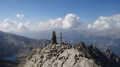
After a night at the Rabuons Mountain Hut, you’ll be ready to climb Mont Ténibre, the main highlight of this second stage. The route is challenging but you’ll be richly rewarded by the panoramic views that await you. To the south, you’ll recognise the Refuge de Rabuons and the lake; to the north and west, there are numerous lakes and the peaks on the border with Italy. After a more leisurely walk along the Chemin de l’Énergie, the scenery will become more pastoral as you approach the Lacs de Vens.
You are now in the Mercantour National Park; there are regulations to be observed, and failure to do so may result in a fine of up to €1,500 – please see the practical information.
Saint-Étienne-de-Tinée - Rabuons Refuge
 4.55 mi
+4,951 ft
-423 ft
6h 25
Difficult
Departure from Saint-Étienne-de-Tinée (Alpes-Maritimes)
4.55 mi
+4,951 ft
-423 ft
6h 25
Difficult
Departure from Saint-Étienne-de-Tinée (Alpes-Maritimes)
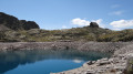
This first stage will take you to the Rabuons mountain hut, on the shores of the largest lake in the Alpes-Maritimes.The landscape is very rocky. You’ll come across plenty of Italians, as just across the border there are several mountain huts offering lovely routes via the nearby Pas de l’Ischiator.
⚠️ Allow around 4 hours for an average hiker in good physical condition to complete this walk.
Route of Occitan Piedmont
61.27 mi
+22,014 ft
-22,011 ft
7 days
Difficult
Departure from Macra (Cuneo)
This 7-stage route takes place in Val Maira, one of the four valleys of Occitan Piedmont. This mountainous valley, devoid of ski resorts, has successfully showcased its cultural heritage. Numerous stone hamlets with slate-roofed houses have been restored. In these valleys, every effort is made to give hikers a warm welcome.
Since 1992, a very well-signposted route has offered a wide choice of stopover lodges where Occitan cuisine is served.
Elva - Ussolo
 10.11 mi
+3,333 ft
-4,373 ft
7h 35
Difficult
Departure from Elva (Cuneo)
10.11 mi
+3,333 ft
-4,373 ft
7h 35
Difficult
Departure from Elva (Cuneo)
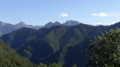
Before setting off on this third stage, take a moment to admire Monte Chersogno in the distance, which rises to over 3,000 metres. You’ll pass through more charming little villages in Chiosso before tackling the pleasant climb up Colle San Michele. After a long descent, you’ll pass through two more hamlets: Cesani and Castiglione. In Ussolo, you’ll be in for another culinary treat at the Locanda La Carlina. The vegetables come from the small vegetable patch adjoining the typically Occitan building.
Ussolo - Chialvetta
 8.68 mi
+3,747 ft
-3,199 ft
7h 15
Difficult
Departure from Prazzo (Cuneo)
8.68 mi
+3,747 ft
-3,199 ft
7h 15
Difficult
Departure from Prazzo (Cuneo)
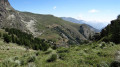
On this fourth day, you will continue along the left bank of the Maira. At Punta Culour, the highest point on this bank, a magnificent view to the west over the peaks on the border with France awaits you. You will then descend back down to the Maira river at Acceglio to cross over to the other bank. You will climb up the Unerzio valley to reach Chialvetta.
Gardetta Mountain Hut – Marmora
 11.77 mi
+1,906 ft
-5,551 ft
7h 05
Difficult
Departure from Canosio (Cuneo)
11.77 mi
+1,906 ft
-5,551 ft
7h 05
Difficult
Departure from Canosio (Cuneo)
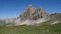
On this sixth day, you’ll walk alongside Rocca la Meja, then cross two magnificent passes (Ancoccia and del Mulo). Along the way, you’ll come across many more structures from the Vallo Alpino. The long descent into the valley offers a chance to relax by the shores of Lake Resile. You’ll then need to pass through the many small hamlets that make up Marmora before arriving at the Locanda Ceaglio.
Macra - Ruata Valle
 5.19 mi
+3,018 ft
-1,066 ft
5h 00
Difficult
Departure from Macra (Cuneo)
5.19 mi
+3,018 ft
-1,066 ft
5h 00
Difficult
Departure from Macra (Cuneo)
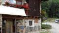
The village of Macra is ideally situated to start this route. A car park on the outskirts of the village, the Maira stream which is truly at the heart of these seven stages, and small, well-kept hamlets to help you get into the spirit of Occitania. Along the way, you’ll see votive pillars, religious frescoes on the façades of some houses and numerous chapels. At the end of the route, the hamlet of Ruata Valle is entirely dedicated to the Locanda Codirosso.
A circular walk to the Marinzenhütte starting from Castelrotto
 7.23 mi
+1,857 ft
-1,834 ft
4h 55
Average
Departure from Kastelruth - Castelrotto (South Tyrol)
7.23 mi
+1,857 ft
-1,834 ft
4h 55
Average
Departure from Kastelruth - Castelrotto (South Tyrol)
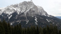
Castelrotto is a village situated at the foot of the Alpe di Siusi. This mountain pasture, the largest in Europe, offers breathtaking views of the Dolomites in the Italian South Tyrol.
A superb circular walk starting from this beautiful village. During this hike, you’ll be able to admire the majestic Punta di Santner at the far end of the Schlern massif. At Marinzen, you’ll look down over Castelrotto.
Saltria
 6.59 mi
+938 ft
-938 ft
3h 50
Average
Departure from Kastelruth - Castelrotto (South Tyrol)
6.59 mi
+938 ft
-938 ft
3h 50
Average
Departure from Kastelruth - Castelrotto (South Tyrol)
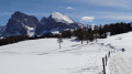
Compatsch is the gateway to the Alpe di Siusi. This mountain pasture, the largest in Europe, offers a breathtaking view of the Dolomites in South Tyrol, Italy. The panorama in the foreground stretches from the Schlern massif, including Punta Santern, to the Langkofel Group, featuring the Langkofel and the Plattkofel. In the distance lie the Sella massif with Piz Boé, and the Geisler massif with Seceda and Saas Rigais. This circular route offers magnificent views of these ‘bellissime montagne delle Dolomiti’.
Monte Bullaccia
 5.59 mi
+1,181 ft
-1,181 ft
3h 35
Average
Departure from Kastelruth - Castelrotto (South Tyrol)
5.59 mi
+1,181 ft
-1,181 ft
3h 35
Average
Departure from Kastelruth - Castelrotto (South Tyrol)
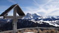
During this circular walk around Monte Bullaccia, you’ll come across several vantage points where you can admire the beauty of the Val Gardena Dolomites and the neighbouring mountain ranges. An orientation board will help you identify the best-known peaks, including the Langkofel, the Schlern, the Piz Boe and the Saas Rigais. You are in the Italian South Tyrol, where place names are given in two or even three languages: Bullaccia in Italian, Puflatsch in German and Bulacia in Ladin (the local dialect).
Walk around Schluch Lake (Schluchsee)
 11.10 mi
+659 ft
-676 ft
5h 40
Average
Departure from Schluchsee (Regierungsbezirk Freiburg)
11.10 mi
+659 ft
-676 ft
5h 40
Average
Departure from Schluchsee (Regierungsbezirk Freiburg)
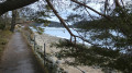
Lake Schluch is the largest lake in the Black Forest, in Germany. It is a pleasant walk around the lake at any time of year. Most of this walk follows a fairly shaded path along the lakeshore.
The Jägersteig trail starting from Schluchsee
 7.92 mi
+994 ft
-1,007 ft
4h 30
Average
Departure from Schluchsee (Regierungsbezirk Freiburg)
7.92 mi
+994 ft
-1,007 ft
4h 30
Average
Departure from Schluchsee (Regierungsbezirk Freiburg)
Schluchsee is known for its lake and attracts many tourists, especially in summer.
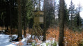
There are many hiking trails close to the lake. The Jägersteig (based on an old hunters' trail) alternates between paths along the lake and climbs into the surrounding forest overlooking the lake. There are several panoramic viewpoints along this route.
Mount Forato
 5.20 mi
+2,362 ft
-2,359 ft
4h 25
Average
Departure from Fabbriche di Vergemoli (Lucca)
5.20 mi
+2,362 ft
-2,359 ft
4h 25
Average
Departure from Fabbriche di Vergemoli (Lucca)
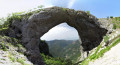
Monte Forato, or "pierced mountain" in English, is a curiosity of the Apuan Alps that attracts many hikers. Monte Forato consists of two peaks of equal height, connected by a natural arch. The circular hole is 12 metres high, and the arch itself is about 8 metres thick. This circular hike will allow you to discover the beauty of this massif in the Apuan Alps, as well as neighbouring peaks such as Procinto, Monte Nona, Piana della Croce and Omo Morto.
A circular route from the Val Maira to the Ubaye Valley
43.80 mi
+14,711 ft
-14,708 ft
5 days
Difficult
Departure from Acceglio (Cuneo)
This cross-border route consists of 5 stages. It runs partly through the Val Maira, one of the four valleys of Occitan Piedmont in Italy, and through the Ubaye Valley in France. The first stage is deliberately short. This allows you to drive to Ponte Maira and start the hike on the same day.Allow around 3 hours’ drive from the Roya Valley or the Ubaye Valley.
From Col des Planches to Grimentz via the bisses trail
 62.19 mi
+17,077 ft
-16,499 ft
6 days
Difficult
Departure from Vollèges (Valais)
62.19 mi
+17,077 ft
-16,499 ft
6 days
Difficult
Departure from Vollèges (Valais)
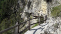
The word ‘bisse’ is used in Valais to refer to an irrigation channel carrying water from the mountains to farmland. They may be buried underground, carved into the rock or suspended from cliffs. Some bisses date back over 500 years and their channels have deteriorated or even ceased to exist following rockfalls. Water is therefore not available everywhere, despite efforts to restore this precious heritage.Over the course of six days, you will explore these trails steeped in history.
La Tzoumaz - Nendaz
 9.23 mi
+2,001 ft
-2,372 ft
6h 00
Average
Departure from Riddes (Valais)
9.23 mi
+2,001 ft
-2,372 ft
6h 00
Average
Departure from Riddes (Valais)
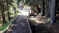
The elevation profile says it all about this day. Most of the route runs along the Grand Bisse de Saxon. This section has been beautifully restored. In Taillay, you will discover a water wheel and a hammer powered by the stream. This ingenious invention was an alarm signal. The sound of the hammer could be heard 2 km away. The absence of sound alerted the bisse guard. You will recognise the Muverans massif on the other side of the Rhône valley.
Nendaz - Veysonnaz
 8.84 mi
+1,781 ft
-1,870 ft
5h 35
Average
Departure from Nendaz (Valais)
8.84 mi
+1,781 ft
-1,870 ft
5h 35
Average
Departure from Nendaz (Valais)
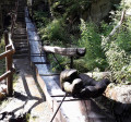
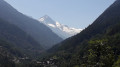
Two bisses are on the agenda for this third day. Very quickly in Nendaz, you will reach the "Bisse Vieux" against the current, then after Planchouet, you will stroll along the magnificent "Grand Bisse de Vex". Opposite, the Rhône valley is often visible, and you will clearly see the Derborance and Sanetsch valleys, Mont Gond, the Wildhorn and its glacier.
Veysonnaz - Vernamiège
 13.83 mi
+3,550 ft
-3,753 ft
9h 25
Difficult
Departure from Veysonnaz (Valais)
13.83 mi
+3,550 ft
-3,753 ft
9h 25
Difficult
Departure from Veysonnaz (Valais)
The fourth day is a long stage, using a variation on the "Chemin des Bisses" trail from La Luette.
This interesting alternative in hot weather allows you to reach Vernamiège via a new trail created in 2015, "La Luette-Ossona-Les Prixes", via the Grande Combe footbridge. The elevation gain is less than on the traditional route. You will follow the large Bisse de Vex to the Mayens de Sion. You will pass through two typical villages in the Val d'Hérens: Hérémence and Euseigne.
Vernamiège - Vercorin
 11.74 mi
+3,314 ft
-3,284 ft
8h 15
Difficult
Departure from Vernamiège (Valais)
11.74 mi
+3,314 ft
-3,284 ft
8h 15
Difficult
Departure from Vernamiège (Valais)
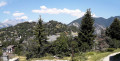
This fifth day will take you to the charming village of Vercorin. You will once again overlook the Rhône Valley as you pass through Nax, a pretty winter sports resort. Then you will gradually enter the deep valley of Réchy. You will admire the La Rèche torrent at the bottom of the valley, then begin the pleasant and peaceful route along the Bisse de Vercorin. In Vercorin, you can marvel at the many mazots (traditional houses) built on stilts.
Vercorin - Grimentz
9.96 mi
+3,251 ft
-2,349 ft
7h 25
Difficult
Departure from Chalais (Canton du Valais) (Valais)
This sixth and final stage arrives in Grimentz, a beautiful village in the Val d'Anniviers. During this day, you will walk along two more bisses. First, the Bisse des Sarrasins, marked with information panels.
This bisse is not in water. The route partially follows the old bisse trail. Finally, the Bisse de Saint Jean or Grand Bisse. It was abandoned for a long time and completely restored in 2012. As you approach Grimentz, you will enjoy the snow-capped peaks at over 4,000 metres
Col des Planches - La Tzoumaz
 8.55 mi
+3,048 ft
-2,720 ft
6h 35
Difficult
Departure from Vollèges (Valais)
8.55 mi
+3,048 ft
-2,720 ft
6h 35
Difficult
Departure from Vollèges (Valais)
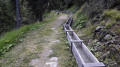
During this first stage, you will discover part of the Old Saxon Bisse (the longest of the bisse: 26 km from its water source in Siviez to La Boveresse). The bisse starts at the point (6). Built in the 1850s, the pipes no longer exist, so you will have to wait until you reach La Tzoumaz to finally see water flowing along the path. The bisse is currently being restored in sections.
Col Raiser Seceda
 11.03 mi
+3,855 ft
-3,842 ft
8h 25
Difficult
Departure from Santa Cristina Gherdëina - St. Christina in Gröden - Santa Cristina Valgardena (South Tyrol)
11.03 mi
+3,855 ft
-3,842 ft
8h 25
Difficult
Departure from Santa Cristina Gherdëina - St. Christina in Gröden - Santa Cristina Valgardena (South Tyrol)
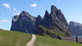
A superb hike in the Puez Geisler Odle Nature Park, a UNESCO World Heritage Site. This route offers magnificent panoramic views at the foot of the Fermeda, Sass Rigais and Furchetta peaks.
At Seceda, a promontory high above the void, you'll witness a spectacular alignment of these peaks, posing for you. At various other points on the loop, you'll enjoy marvellous panoramic views of the Langkofel, Schlern and Sella massifs.
Don Barbera Mountain Hut - Viozene
 7.81 mi
+1,319 ft
-4,091 ft
4h 45
Average
Departure from La Brigue (Alpes-Maritimes)
7.81 mi
+1,319 ft
-4,091 ft
4h 45
Average
Departure from La Brigue (Alpes-Maritimes)
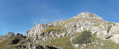
This third and final stage will, of course, take you back to the starting point of this tour in the Marguareis Park.The proposed route will take you to Passo della Croce. You will recognise Passo del Pas, just 900m away. This route is the heart of the park. You will discover Cima Pian Ballaur and Cima Saline. During the day, you will pass through the hamlets of Carnino and cross a Tibetan-style suspension bridge.
Noiraigue - Les Rochats
 8.48 mi
+2,848 ft
-1,394 ft
6h 25
Average
Departure from Noiraigue (Canton of Neuchâtel)
8.48 mi
+2,848 ft
-1,394 ft
6h 25
Average
Departure from Noiraigue (Canton of Neuchâtel)
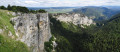
During this first stage, after the tedious climb up the 14 contours, you will be rewarded by the local geological curiosity, the Creux du Van. This Swiss version of the "Grand Canyon" is a large rocky cirque 1.5 km long and 200 m high.
At Soliat, you will enjoy a splendid panorama of Lake Neuchâtel.
The peaks of the Swiss Jura, from Noiraigue to Saint Cergue
 66.06 mi
+13,068 ft
-11,952 ft
6 days
Average
Departure from Noiraigue (Canton of Neuchâtel)
66.06 mi
+13,068 ft
-11,952 ft
6 days
Average
Departure from Noiraigue (Canton of Neuchâtel)
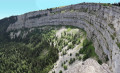
This magnificent route passes through peaceful forests, along long ridges and steep cliffs. Every day offers panoramic views of the peaks of the Alps, the lakes of Neuchâtel, Geneva and Joux, and curiosities such as the great Cirque du Creux du Van.
Les Rochats - Sainte-Croix
 11.42 mi
+2,152 ft
-2,388 ft
7h 10
Average
Departure from Provence (Vaud)
11.42 mi
+2,152 ft
-2,388 ft
7h 10
Average
Departure from Provence (Vaud)
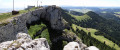
The goal for this second stage is to climb Chasseron. This rocky cliff offers breathtaking views of Lake Neuchâtel and, further south, Lake Geneva. You will also enjoy views of numerous Alpine peaks in the distance, rising up from the horizon.
Sainte-Croix - Vallorbe
 14.41 mi
+2,126 ft
-3,192 ft
8h 30
Difficult
Departure from Sainte-Croix (Canton de Vaud) (Vaud)
14.41 mi
+2,126 ft
-3,192 ft
8h 30
Difficult
Departure from Sainte-Croix (Canton de Vaud) (Vaud)
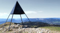
The highlight of this third stage will be the Suchet. At your feet, you will enjoy a panoramic view of Lake Neuchâtel. You will also be very close to the French-Swiss border. In Vallorbe, you will notice the presence of old railway crafts.
Vallorbe - Les Charbonnières: Lakes Joux and Brenet
 8.19 mi
+2,398 ft
-1,552 ft
5h 50
Average
Departure from Vallorbe (Vaud)
8.19 mi
+2,398 ft
-1,552 ft
5h 50
Average
Departure from Vallorbe (Vaud)
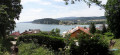
For this fourth stage, after a good hour's walk, you will reach the highest point of the day: the Dent de Vaulion. The lakes of Joux and Brenet will be at your feet. The water from these two lakes flows underground, shaping the karst cave of the Orbe, near Vallorbe. On a clear day, you can see up to eight lakes.
Les Charbonnières - Col du Machairuz
 12.99 mi
+2,703 ft
-1,266 ft
8h 20
Difficult
Departure from Le Lieu (Vaud)
12.99 mi
+2,703 ft
-1,266 ft
8h 20
Difficult
Departure from Le Lieu (Vaud)
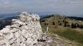
On this fifth stage, you will reach the highest point of the Swiss Jura and also of this 6-day route: Mont Tendre. This summit offers a splendid view of the canton of Vaud, Lake Geneva and the Alps.You’ll also see the numerous piles of stone gathered from fields stretching for kilometres. These are stone walls built to mark out plots of land or enclose areas for grazing livestock.
Col du Marchairuz - Saint Cergue
 10.55 mi
+840 ft
-2,159 ft
5h 35
Average
Departure from Le Chenit (Vaud)
10.55 mi
+840 ft
-2,159 ft
5h 35
Average
Departure from Le Chenit (Vaud)
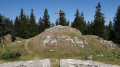
This last stage also offers a panoramic viewpoint at Crêt de la Neuve (1,493 m). At your feet, you can admire Lake Geneva, Geneva, the Alps and even Mont Blanc. On the way down, stop off at the ruins of the Oujon convent, a former Carthusian monastery.
The Madeloc Tower loop starting from Collioure
 9.52 mi
+2,343 ft
-2,333 ft
6h 25
Difficult
Departure from Collioure (Pyrénées-Orientales)
9.52 mi
+2,343 ft
-2,333 ft
6h 25
Difficult
Departure from Collioure (Pyrénées-Orientales)
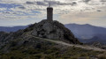
The Madeloc Tower, clearly visible from Collioure, is the main destination of this hike. Once you reach the tower, you will be rewarded with a magnificent panorama stretching from Argelès to Spain on the eastern side. The western side opens onto the first peaks of the Pyrenees, including the Pic de Neulos.Along this route, you will encounter numerous military buildings, including the Forts of Saint-Elme and Dugommier, which are clearly visible from the Madeloc Tower.
⚠️ Check whether the coastal path linking Argelès-sur-Mer to Cerbère is open or closed here before setting off on this hike.
Around Mont Clapier in 3 days
20.36 mi
+9,232 ft
-9,249 ft
3 days
Very difficult
Departure from Tende (Alpes-Maritimes)
This route, deliberately named “Around Mont Clapier”, will take you to discover this magnificent peak, rising to 3,045 m. Situated in the north of the Alpes-Maritimes, on the French-Italian border, it offers a magnificent panorama of the main peaks of the Mercantour and Argentera ranges. Over the course of these three days, you’ll be able to admire it from various angles. You’ll also have the opportunity to climb it.
Before setting off, please see the ‘Practical information’ section .
 Le Petit Croisse Baulet