Taney – Saint-Gingolph

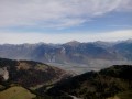
This eleventh stage will take you from Taney to Saint Gingolph. The route begins in the Loz valley at the foot of Mont Gardy and Les Jumelles, before climbing the final two passes, Lovenex and La Croix. The route continues along the River Morge, following the border with France. At Novel, the path turns towards Mont Cornin, passing through La Frîtaz and winding down towards Lake Geneva at Saint Gingolph.

Details

n°110961776
Creation:
Last update:
Last review:
–
  • Walking
    Activity: Walking
  • ↔
    Distance: 9.85 mi
  • ◔
    Average duration: 6h 35 
  • ▲
    Difficulty: Difficult

  • ⚐
    Back to start: No
  • ↗
    Ascent: + 2,352 ft
  • ↘
    Descent: - 5,768 ft

  • ▲
    Highest point: 6,099 ft
  • ▼
    Lowest point: 1,227 ft

Waypoints

  1. S : mi 0 - alt. 4,669 ft - Auberge Refuge La Vouivre - Lac de Tanay
  2. 1 : mi 1.62 - alt. 5,794 ft - Old chalets in Loz
  3. 2 : mi 2.08 - alt. 6,001 ft - Loz
  4. 3 : mi 2.64 - alt. 6,070 ft - Sign No. 6 - Pas de Lovenex
  5. 4 : mi 3.27 - alt. 5,558 ft - Chalet - Lac de Lovenex
  6. 5 : mi 3.4 - alt. 5,748 ft - Sign No. 6 - Col de la Croix (Chablais)
  7. 6 : mi 4.15 - alt. 4,551 ft - Sign No. 6
  8. 7 : mi 4.85 - alt. 3,868 ft - Chalets Au de Morge
  9. 8 : mi 5.8 - alt. 3,015 ft - Sign No. 6
  10. 9 : mi 7.51 - alt. 3,540 ft - La Fraîta
  11. 10 : mi 8.85 - alt. 1,834 ft - Sign No. 6
  12. E : mi 9.85 - alt. 1,230 ft - Saint-Gingolph – Hôtel Le Rivage - Lac Léman

Notes

This walking route follows the Chemin des cols alpins, which is marked on Swiss maps.

Signposting: at every major junction, you will find signposts:
- Sign No. 6 with a No. 6 sticker indicating this trail.
- R sign: Yellow sign with a hiker pictogram

Before setting off, it is advisable to check the Suisse Topo website for any trail closures and diversions. This information is updated in real time.

As well as the Visorando app, you can also download the swisstopo app ( free of charge), where you’ll find this information too.

Transport: Timetables

Weather: before setting off, check the Swiss Weather Service or Météo Blue

Hiking equipment, particularly good walking boots.

Accommodation:

Other walks in the area

For more walks, use our search engine .

The GPS track and description are the property of this route's author. Please do not copy them without permission.