


-
Hike completed by the author on 8 October 2026
The route for this hike follows the Waldstätterweg, which is marked on Swiss maps.
Signposting: at every major junction, you will find signposts:
- Sign No. 98 or P98 with a sticker No. 98 indicating this trail.
- R sign: Yellow sign with a hiker pictogramBefore setting off, it is advisable to check the Suisse Topo website for any trail closures and diversions. This information is updated in real time.
As well as the Visorando app, you can also download the free swisstopo app, where you’ll find this information too.
Transport: Timetables
Weather: before setting off, check the Swiss Weather Service or Météo Blue
Hiking equipment, particularly good walking boots.
Accommodation:
- Beckenried: Hotel Seerausch
Bürgenstock – Beckenried


This fifth stage will take you from Bürgenstock (NW) to Beckenried (NW). The route follows the north face of the Bürgenstock cliff to Sankt Jost Church before descending towards the lake at Ennetbürgen. The rest of the route runs alongside the lake, passing through Buochs, and ends in Beckenried.
This walk is part of a multi-day hike: Tour du Lac des Quatre Cantons
Details
Creation:
Last update:
Last review:
–
–
-
 Activity: Walking
-
 Distance: 7.73 mi
-
 Average duration: 5h 10
-
 Difficulty: Moderate
-
-
 Back to start: No
-
 Ascent: + 1,837 ft
-
 Descent: - 3,228 ft
-
-
 Highest point: 3,524 ft
-
 Lowest point: 1,414 ft
-
 Country:
Switzerland
-
 Area: Alps
-
 City:
Ennetbürgen
-
 Start: N 46.996841° / E 8.381695°
-
 End: N 46.971792° / E 8.459239°
-


 Hour-by-hour weather
Waypoints
- S : mi 0 - alt. 2,831 ft - Bürgenstock Resort (Bus Zentrum)
- 1 : mi 1.44 - alt. 3,287 ft - Känzeli
- 2 : mi 2.05 - alt. 2,602 ft - Sign No. 98
- 3 : mi 2.58 - alt. 2,526 ft - Crossroads
- 4 : mi 2.96 - alt. 2,300 ft - St Jost’s Church
- 5 : mi 3.59 - alt. 1,814 ft - Sign No. 98
- 6 : mi 3.83 - alt. 1,667 ft - Stalden
- 7 : mi 4.52 - alt. 1,427 ft - Seestrasse
- 8 : mi 4.92 - alt. 1,427 ft - Strandweg
- 9 : mi 5.61 - alt. 1,440 ft - Buochs
- 10 : mi 5.68 - alt. 1,453 ft - Beckenriederstrasse
- 11 : mi 6.01 - alt. 1,440 ft - Hinter Linden
- 12 : mi 6.87 - alt. 1,440 ft - Buochserstrasse
- 13 : mi 7.33 - alt. 1,516 ft - Bridge over the Träschlibach
- E : mi 7.73 - alt. 1,430 ft - Hotel Seerausch – Beckenried
Notes
Worth a visit
- Bürgenstock
- St Jost’s Church
- Ennetbürgen
- Buochs
- Beckenried
Other walks in the area
Renggpass - From Stansstad to Hergiswill
 Visorando Member4.82 mi
+1,772 ft
-1,709 ft
3h 45
Moderate
Departure from Hergiswil (Nidwalden)
Starting from Stansstad railway station, you go straight up above the motorway, thus tackling the steepest part.
Then, along the ridge overview of the Alpnachersee lake for a good third of the way, glimpses of views and appreciating the 400-500m ascent: Probably a good time to rest for a lunch break before the Renggpass.
The final part is downhill all the way to the village and train station of Hergiswil, passing through fields of cows, farms & green pasture.
Along Lake Lucerne
 6.32 mi
+1,644 ft
-1,696 ft
4h 20
Moderate
Departure from Beckenried (Nidwalden)
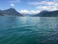
A 10 km walk (one-way) along the lake and through the forest, returning by boat.
Vitznau – Küssnacht am Rigi
11.25 mi
+2,270 ft
-2,290 ft
7h 10
 Difficult
Departure from Canton of Lucerne
This first stage will take you from Vitznau (LU) to Küssnacht am Rigi (SZ). The start of the route is a long climb up numerous steps and ladders to Oberwilen. The route passes above Weggis and gradually descends towards the Hertenstein peak before turning towards Lake Küssnacht.
A getaway to Lucerne
 4.16 mi
+157 ft
-148 ft
2h 05
 Easy
Departure from Lucerne (Canton of Lucerne)
Lucerne boasts an impressive heritage and ranks among the most beautiful cities in the world. The world-famous Chapel Bridge is an integral part of Lucerne’s image. The suggested route will take you past its two covered wooden bridges, the Chapel Bridge and the Spreuer Bridge, the city walls with their towers overlooking the town, the old town with its richly decorated houses, and St Leodegar’s Church. You’ll also enjoy a stroll along the shores of the famous Lake of the Four Cantons.
Vitznauerstock summit
 6.07 mi
+3,576 ft
-3,550 ft
5h 55
Difficult
Departure from Canton of Lucerne
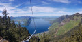
Starting in Vitznau, climb to the summit of the Vitznauerstock/Gersauerstock for a superb view of Lake Lucerne.
Rigi Kaltbad – Goldau
 6.13 mi
+479 ft
-3,609 ft
3h 15
Moderate
Departure from Weggis (Canton of Lucerne)
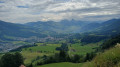
This second stage will take you from Rigi Kaltbad to Goldau. You’ll need to join Trail No. 63 at Rigi Klösterli. This route is mainly downhill. You’ll enjoy views of Lake Zug and Lake Lauerz.
Lucerne - Fräkmüntegg - Pilatus via the Alpenpanorama Weg
 6.50 mi
+3,323 ft
-177 ft
5h 55
Difficult
Departure from Lucerne (Canton of Lucerne)
Mount Pilatus, which towers over Lake Lucerne and Lucerne, quickly comes into view on the Alpenpenpanorama Weg trail. It is clearly visible from the heights as soon as you leave Lucerne. This summit is well worth a detour. You will have unforgettable memories of the panorama of the Alps and the Jura in the evening, when you can enjoy the absolute calm and a magnificent sunset over the Bernese Alps.
From Lucerne to Schwarzsee via the Alpenpanorama Weg
 97.78 mi
+19,350 ft
-17,323 ft
10 days
Difficult
Departure from Lucerne (Canton of Lucerne)
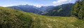
This ten-day itinerary follows the Alpenpanorama Weg from Lucerne to Schwarzsee. With Mount Pilatus within easy reach, it is well worth stopping off to enjoy the unique panorama of the Alps. You will cross the following cantons: Lucerne, Niedwalden (at Pilatus), Bern and Fribourg. This beautiful route offers numerous panoramic views of the Bernese Alps and the Jura.
For more walks, use our search engine .
The GPS track and description are the property of this route's author. Please do not copy them without permission.

