From Bettmeralp to Fiecheralp via the Bettmerhorn Bergstation

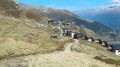
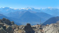
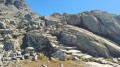
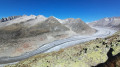
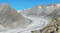
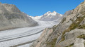
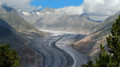
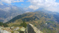
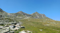
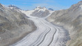
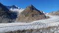
A very beautiful alpine hike that will take you from the village of Bettmeralp to the Bettmerhorn viewpoint. You’ll enjoy a magnificent view of the Aletsch Glacier. The rest of the route, which is downhill, will take you to Fiescheralp.

This walk is part of a multi-day hike: Route around Fiescheralp to see the Aletsch Glacier

Details

n°108060710
Creation:
Last update:
Last review:
–
  • Walking
    Activity: Walking
  • ↔
    Distance: 4.75 mi
  • ◔
    Average duration: 4h 10 
  • ▲
    Difficulty: Difficult

  • ⚐
    Back to start: No
  • ↗
    Ascent: + 2,313 ft
  • ↘
    Descent: - 1,483 ft

  • ▲
    Highest point: 8,704 ft
  • ▼
    Lowest point: 6,440 ft

Photos

Waypoints

  1. S : mi 0 - alt. 6,440 ft - Bettmeralp – Hotel Bettmerhof
  2. 1 : mi 0.42 - alt. 6,604 ft - Fork in the road - Bettmersee
  3. 2 : mi 0.73 - alt. 6,768 ft - Signpost: Bettmerhorn
  4. 3 : mi 1.26 - alt. 7,356 ft - Crossroads
  5. 4 : mi 1.95 - alt. 8,117 ft - Crossroads
  6. 5 : mi 2.09 - alt. 8,166 ft - Gletscher Blick Bettmerhorn sign
  7. 6 : mi 2.56 - alt. 8,645 ft - Bettmerhorn Blick
  8. 7 : mi 2.66 - alt. 8,688 ft - Crossroads
  9. 8 : mi 3.1 - alt. 8,136 ft - Crossroads
  10. 9 : mi 4.1 - alt. 7,543 ft - Signpost to Fiecheralp
  11. E : mi 4.75 - alt. 7,277 ft - Fiescheralp – Hotel Jungfrau

Notes

Hike completed by the author on 19 September 2026

Trail markings: White-Red-White

Before setting off, it is advisable to check the Suisse Topo website for any trail closures and diversions. This information is updated in real time.

As well as the Visorando app, you can also download the swisstopo app ( free of charge), where you’ll find this information too.

Transport: Timetables

Weather:Before setting off, check Météo Suisse or Météo Blue

Hiking equipment, particularly good walking shoes.

Accommodation in Bettmeralp: Hotel Bettmerhof

Worth a visit

  • Bettmeralp
  • The Bettmerhorn
  • The Aletsch Glacier
  • Fiescheralp

Other walks in the area

For more walks, use our search engine .

The GPS track and description are the property of this route's author. Please do not copy them without permission.